Outline of Wales

Last updated

Arms of Llywelyn.svg
Historic coat of arms of Llywelyn the Great
Europe location WAL2.png
Location of Wales (orange)
– in the European continent (camel & white)
– in the United Kingdom (camel)
Wales SRTM.png
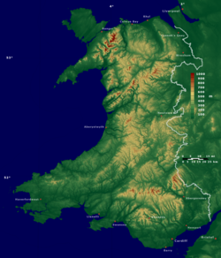
Enlargeable relief map of Wales

The following outline is provided as an overview of and topical guide to Wales:

Contents

Wales a country that is part of the United Kingdom, [1] bordered by England to its east and the Atlantic Ocean and Irish Sea to its west. It has an estimated population of three million and the Welsh and English languages are both official languages. The Welsh language is an important element of Welsh culture. Its decline has reversed over recent years, with Welsh speakers estimated to be around 20 per cent of the population of Wales. [2]

General reference

Geography

Geography

Environment

Environment of Wales

Natural geographic features

Regions

Regions of Wales; common models:

Other models exist

Administrative divisions

Administrative divisions of Wales

Local government

Local government in Wales

Preserved counties

Preserved counties of Wales

Historic counties

Historic counties of Wales

Former Districts

Districts of Wales

Cities

Cities of Wales

Demography

Demographics of Wales

Government and politics

Politics of Wales

Branches of the government

Government of Wales

Executive

Legislative

Judicial

Law and order in Wales

Military

Military of Wales within the Military of the United Kingdom

Local government in Wales

Local government in Wales

History

History of Wales

History of Wales, by period

History of Wales, by region

History of Wales, by subject

Culture

Culture of Wales

Art in Wales

Religion in Wales

Religion in Wales

Sport in Wales

Sport in Wales

Economy and infrastructure

Economy of Wales

Education in Wales

Education in Wales

See also

Wales

Related Research Articles

<span class="mw-page-title-main">History of Wales</span>

The history of what is now Wales begins with evidence of a Neanderthal presence from at least 230,000 years ago, while Homo sapiens arrived by about 31,000 BC. However, continuous habitation by modern humans dates from the period after the end of the last ice age around 9000 BC, and Wales has many remains from the Mesolithic, Neolithic, and Bronze Age. During the Iron Age the region, like all of Britain south of the Firth of Forth, the culture had become Celtic, with a common Brittonic language. The Romans, who began their conquest of Britain in AD 43, first campaigned in what is now northeast Wales in 48 against the Deceangli, and gained total control of the region with their defeat of the Ordovices in 79. The Romans departed from Britain in the 5th century, opening the door for the Anglo-Saxon settlement. Thereafter, the culture began to splinter into a number of kingdoms. The Welsh people formed with English encroachment that effectively separated them from the other surviving Brittonic-speaking peoples in the early middle ages.

<span class="mw-page-title-main">Vale of Glamorgan</span> County borough in Wales

The Vale of Glamorgan, often referred to as The Vale, is a county borough in the south-east of Wales. It borders Bridgend County Borough to the west, Cardiff to the east, Rhondda Cynon Taf to the north, and the Bristol Channel to the south. With an economy based largely on agriculture and chemicals, it is the southernmost unitary authority in Wales. Attractions include Barry Island Pleasure Park, the Barry Tourist Railway, Medieval wall paintings in St Cadoc's Church, Llancarfan, Porthkerry Park, St Donat's Castle, Cosmeston Lakes Country Park and Cosmeston Medieval Village. The largest town is Barry. Other towns include Penarth, Llantwit Major, and Cowbridge. There are many villages in the county borough.

<span class="mw-page-title-main">Wales</span> Country in north-west Europe; part of the United Kingdom

Wales is a country that is part of the United Kingdom. It is bordered by England to the east, the Irish Sea to the north and west, the Celtic Sea to the southwest and the Bristol Channel to the south. As of the 2021 census, it had a population of 3,107,494. It has a total area of 21,218 km2 (8,192 sq mi) and over 1,680 miles (2,700 km) of coastline. It is largely mountainous with its higher peaks in the north and central areas, including Snowdon, its highest summit. The country lies within the north temperate zone and has a changeable, maritime climate. The capital and largest city is Cardiff.

<span class="mw-page-title-main">Hywel Dda</span> 10th-century Welsh king

Hywel ap Cadell, commonly known as Hywel Dda, which translates to Howel the Good in English, was a Welsh king who ruled the southern Welsh kingdom of Deheubarth and eventually came to rule most of Wales. He became the sole king of Seisyllwg in 920 and shortly thereafter established Deheubarth, and proceeded to gain control over the entire country from Prestatyn to Pembroke. As a descendant of Rhodri Mawr through his father Cadell, Hywel was a member of the Dinefwr branch of the dynasty. He was recorded as King of the Britons in the Annales Cambriæ and the Annals of Ulster.

<span class="mw-page-title-main">Powys</span> County and preserved county in Wales

Powys is a county and preserved county in Wales. It borders Gwynedd, Denbighshire, and Wrexham to the north; the English ceremonial counties of Shropshire and Herefordshire to the east; Monmouthshire, Blaenau Gwent, Merthyr Tydfil, Caerphilly, Rhondda Cynon Taf, and Neath Port Talbot to the south; and Carmarthenshire and Ceredigion to the west. The largest settlement is Newtown, and the administrative centre is Llandrindod Wells.

<span class="mw-page-title-main">Local government in Wales</span> System of state administration on a local level in Wales

Since 1 April 1996, Wales has been divided into 22 single-tier principal areas, styled as counties or county boroughs for local government purposes. The elected councils of these areas are responsible for the provision of all local government services, including education, social work, environmental protection, and most highways. Below these there are also elected community councils to which responsibility for specific aspects of the application of local policy may be devolved. The last set of local elections in Wales took place in 2022, with the next due to take place in 2027.

<span class="mw-page-title-main">North Wales</span> Geographic region in Wales

North Wales is a region of Wales, encompassing its northernmost areas. It borders mid Wales to the south, England to the east, and the Irish Sea to the north and west. The area is highly mountainous and rural, with Snowdonia National Park and the Clwydian Range and Dee Valley, known for its mountains, waterfalls and trails, wholly within the region. Its population is concentrated in the north-east and northern coastal areas, with significant Welsh-speaking populations in its western and rural areas. North Wales is imprecisely defined, lacking any exact definition or administrative structure. It is commonly defined administratively as its six most northern principal areas, but other definitions exist, with Montgomeryshire historically considered to be part of the region.

<span class="mw-page-title-main">Lists of places in Wales</span>

This is a list of lists of places in Wales.

<span class="mw-page-title-main">Mid and West Wales (Senedd electoral region)</span> Electoral region of the Senedd

Mid and West Wales is an electoral region of the Senedd, consisting of eight constituencies. The region elects twelve members, eight directly elected constituency members and four additional members. The electoral region was first used in the 1999 Welsh Assembly election, when the National Assembly for Wales was created.

Girlguiding Cymru is one of the nine regions of Girlguiding UK. It serves the approximate area of Wales, although the boundaries are not exact. In 2023, there were 11,000 youth members and over 3,000 volunteers. The chief commissioner of Girlguiding Cymru is Bev Martin.

The history of local government in Wales in a recognisably modern form emerged during the late 19th century. Administrative counties and county boroughs were first established in Wales in 1889. Urban and rural districts were formed in 1894. These were replaced in 1974 by a two-tier authority system across the country comprising eight counties and, within them, thirty-seven districts. This system was itself replaced by the introduction of 22 single-tier authorities in 1996.

Archives Wales is a web resource that allows cross-searching of Welsh archive collections. It was founded in 1995 as Archives Council Wales and was renamed to Archives and Records Council Wales (ARCW) in 2004. The archives are described at collection level only, although the ultimate intention is to allow for searching at item level. In July 2009, after a major refurbishment funded by CyMAL: Museums Archives and Libraries Wales, it was relaunched as Archives Wales, or Archifau Cymru in the Welsh language. The URL is Archives.Wales or archifau.cymru

<span class="mw-page-title-main">Scouting in Wales</span>

Scouting in Wales provides an overview of Scouting activities in Wales. Scout troops have existed in the country since 1908 with the largest number of Scouts and volunteer leaders today linked to the Scout Association of the United Kingdom. This is done through ScoutsCymru, the Welsh Scout Council who split the region further into four regions and a total of 12 Scout Areas. In addition to the Scout Association, there are also traditional Scouting groups belonging to the Baden-Powell Scouts' Association and a number of Scouting clubs within Universities which are affiliated to the Student Scout and Guide Organisation.

<span class="mw-page-title-main">Trunk road agent</span> Type of road authority in Wales

In Wales, a trunk road agent,, is a partnership between two or more county and/or county borough councils for the purposes of managing, maintaining, and improving the network of trunk roads in Wales in their respective areas on behalf of the Welsh Government.

<span class="mw-page-title-main">2015 United Kingdom general election in Wales</span>

The 2015 United Kingdom general election in Wales was held on 7 May 2015 and all 40 seats in Wales were contested. The election for each seat was conducted on the basis of first-past-the-post.

<span class="mw-page-title-main">2017 Welsh local elections</span>

The 2017 Welsh local elections were held on 4 May 2017 to elect members of all 22 local authorities in Wales. This included the Isle of Anglesey, which was previously up for election in 2013 due to having its elections delayed for a year. Community council elections also took place on the same day. These local elections were held as part of the 2017 local elections in the United Kingdom. Apart from Anglesey, the last elections were held in 2012. Normally these elections take place every four years, but the 2017 elections were postponed for a year in order to avoid clashing with the 2016 Welsh Assembly election, which itself had been postponed by a year to avoid clashing with the 2015 general election.

<span class="mw-page-title-main">Regions of Wales</span> Undefined class of subdivision in Wales

Wales has traditionally been divided into a number of ambiguous and ill-defined areas described as "regions", reflecting historical, geographical, administrative, cultural and electoral boundaries within the country. Presently, the most common form of division of Wales into "regions" has been using cardinal and intercardinal references: north or south-west for example. None of the variously described "regions" have official status or defined boundaries; neither is there a fixed number of regions. Various organisations use different regions and combinations of regions for their individual purposes. This includes devolved institutions, such as Visit Wales, Natural Resources Wales, and the Welsh Government itself, using different sets of Wales' regions. Wales is most commonly sub-divided into between two and four regions, with a North–South divide, and North, Mid, South East and South West division being common. This article lists the various terms applied to be the "regions of Wales" and the regions used by various organisations.

The Register of Landscapes of Historic Interest in Wales is a non-statutory heritage register of 58 landscapes of outstanding or special historic interest published in two volumes. It was produced by a partnership between Cadw, the Countryside Council for Wales, and the International Council on Monuments and Sites working in collaboration with the Welsh Archaeological Trusts and several other organisations with the intention of aiding in the protection and conservation of the most important and significant historic landscape areas in Wales.

References

  1. "The Countries of the UK". statistics.gov.uk. Retrieved 10 October 2008.
  2. "Welsh Language Board - Number of speakers". Byig-wlb.org.uk. Archived from the original on 24 May 2010. Retrieved 19 June 2010.

Gnome-globe.svg Wikimedia Atlas of Wales