Regions of Wales

Last updated

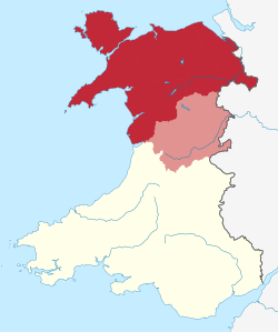
Wales has traditionally been divided into a number of ambiguous and ill-defined areas described as regions , reflecting historical, geographical, administrative, cultural and electoral boundaries within the country. Presently, the most common form of division of Wales into "regions" has been using cardinal and intercardinal references: north or south-west for example. [1] None of the variously described "regions" have official status or defined boundaries; neither is there a fixed number of regions. Various organisations use different regions and combinations of regions for their individual purposes. This includes devolved institutions, such as Visit Wales, [2] Natural Resources Wales, [3] and the Welsh Government itself, [4] [5] [6] using different sets of Wales' regions. Wales is most commonly sub-divided into between two and four regions, with a North–South divide, and North, Mid, South East and South West division being common. This article lists the various terms applied to be the "regions of Wales" and the regions used by various organisations.

Contents

19th Century Map using the term "North and South Wales" LEWIS(1833) p1.028 MAP OF NORTH AND SOUTH WALES.jpg
19th Century Map using the term "North and South Wales"

Status

The regions of Wales have little administrative status, as of 2022, nor are they officially defined. Local government is primarily managed by the twenty-two principal areas.

Some argue that Wales should stop using terms to describe regions of Wales, as they lack both strict definitions and boundaries, and instead consider Wales as a single entity. However, others campaign for more recognition of Wales' various regions, such as the north and west. [1] [7]

Historical usage

North-South divide

Map of North Wales; common modern day definition in dark red, historical definition in dark red and light red (Montgomeryshire). North Wales Map.svg
Map of North Wales; common modern day definition in dark red, historical definition in dark red and light red (Montgomeryshire).
Map of South Wales, defined either by combining South East and South West Wales (dark red); or the historic definition (dark red and light red); there are other definitions. South Wales Map.svg
Map of South Wales, defined either by combining South East and South West Wales (dark red); or the historic definition (dark red and light red); there are other definitions.

There may be a north-south divide, between North Wales and South Wales. [8] The Cambrian Mountains form a mountainous interior of Wales, limiting the connection between North and South with few transport links between them. [9] Most of the population of Wales is concentrated on opposing sides of Wales. Transport links between North and South Wales are significantly weak, [10] with major north–south links passing through England, and both the North and South, having closer transport links with North West England, and South West England respectively. [11] [12] Liverpool is sometimes described as the "Capital of North Wales", as its the largest city closest to North Wales. [13] Historical maps divide North and South Wales using the boundaries between Montgomeryshire and Radnorshire, and between Cardiganshire and Merionethshire, but the modern-day divide is described as ambiguous or arbitrary. [14]

Modern usage

Since devolution, the Welsh Government is making efforts to increase connection between north and south. [8] [15] However in 2013 there were reports that the Welsh Government may have short-changed the north by £131.53 million, which critics describe as proof of a modern north–south divide. The government responded that the figures are "highly misleading", as they ignore funding through Wales-wide programmes, and that the government has spent more on health and transport in the north than in the south-east, and more on education than the national average. The then First Minister of Wales, Carwyn Jones, disagreed that there was a north–south divide in Wales, but stated that there would "never be a time" that people will no longer see a north–south divide. [16]

There is a part-ministerial post in the Welsh Cabinet for "North Wales", [17] and a North Wales office of the Senedd. [18] Plaid Cymru has called for a trans-Wales railway as a solution to bridge the cultural divide between north and south. [19]

There is a north–south divide in language, not only between more and less Welsh-speaking areas, but also in terms of accents (both relating to English and Welsh) and dialects of Welsh. [20] There is also a cultural divide between "gogs" in the north and "hwntws" in the south.

There may be a tourism divide between north and south Wales due to geographic and existing transport capabilities, with tourism in the north aimed at nearby tourists from the rest of the UK and closer airports in Liverpool and Manchester, for day trips and staycations; whereas strategies for the south by the devolved administrations aim for more international and longer-term tourism through Cardiff Airport in the south. Strategies based on drawing tourists through Cardiff Airport may not have a big impact on the north due to a lack of connectivity with Cardiff Airport and the north of Wales. [21]

Capitalisation

There is a debate whether to spell the regions of Wales with a capitalised letter or a lowercase letter, for example either a lower case 'n' for north Wales or a capitalised 'N' for North Wales (see North Wales#Capitalisation). The debate has been coined as the "to cap or not to cap" debate in media. [22] Usage varies, BBC News [23] and the Welsh Government [24] for example use lowercase, whereas Visit Wales uses capitalised, with the latter having their own version of Wales' regions. [25] David Williams, chairman of the North Wales Business Club, announced his support for capping the term "North" in "North Wales" stating that the region should be "very recognisable [...] in our own right". [22]

List of regions

Geographical regions and sub-regions

Regions using the cardinal and intercardinal points of a compass, e.g. north and south-west for nomenclature, and are based mainly on physical and environmental geographic factors due to their lack of definition.

For many administrative purposes, most of the regions follow the boundaries of the twenty-two principal areas of Wales. Those listed below are based on the usage by organisations further down.

Map of a definition of North Wales, Mid Wales and South Wales Wales map.png
Map of a definition of North Wales, Mid Wales and South Wales
17-18th Century Map of North Wales Principatus Walliae pars borealis vulgo North Wales - CBT 6599369.jpg
17-18th Century Map of North Wales

By organisation

17-18th Century Map of South Wales Principatus Walliae pars australis vulgo South-Wales - CBT 6599377.jpg
17-18th Century Map of South Wales

Note: names in-between inverted commas ("), implies there are other definitions of the region that may be more common.

Visit Wales

Visit Wales uses four regions: [2] [26]

Business Wales

Business Wales uses four regions: [4]

  • North Wales — northern six principal areas (i.e. excluding Powys)
  • "Mid Wales" — Carmarthenshire, Ceredigion, Pembrokeshire and Powys
  • "South East Wales" — Blaenau Gwent, Caerphilly, Cardiff, Monmouthshire, Newport, Torfaen, Vale of Glamorgan
  • "South West Wales" — Bridgend, Merthyr Tydfil, Neath Port Talbot, Rhondda Cynon Taf, Swansea

Welsh Government Economic Action Plan

Either a three economic region model or a four economic region model: [5] [27]

Three region model
Four region model

Future Wales: The National Plan 2040 (Welsh Government)

Natural Resources Wales

Described as the six "areas" (with an additional "marine area") by Natural Resources Wales [3]

Wales Spatial Plan

Note: no clear boundaries shown, merely labels on a blank map.

  • North West Wales [34]
  • North East Wales — Border and Coast
  • Central Wales
  • South East — the Capital Network
  • Swansea Bay — Waterfront & Western Valleys
  • Pembrokeshire — The Haven

Former organisations

Welsh Development Agency and the Development Board for Rural Wales
Pre-mid-1990s regions
  • "North East Wales" — Clwyd with boundaries between 1974 and 1996 [35]
  • "North West Wales" — Gwynedd with boundaries between 1974 and 1996 (excluding Meirionnydd); (Modern Isle of Anglesey, half of Gwynedd and half of Conwy County Borough)
  • Development Board for Rural Wales — Mid Wales (Powys and Ceredigion) and Meirionnydd of Gwynedd.
  • "West Wales" — Pembrokeshire and Carmarthenshire (excluding Llanelli).
  • South Wales (West) — Llanelli, Swansea, Neath Port Talbot and parts of Bridgend County Borough
  • South Wales (Valleys) — Blaenau Gwent, Caerphilly County Borough, Merthyr Tydfil County Borough, Rhondda Cynon Taf, Torfaen, and parts of Bridgend County Borough.
  • South Wales (East) — City and County of Cardiff, Newport, Monmouthshire, and the Vale of Glamorgan.
Post-mid-1990s regions
  • "North Wales" — Clwyd and Gwynedd with boundaries between 1974 and 1996 (excluding Meirionnydd) [35]
  • Development Board for Rural Wales — Mid Wales (Powys and Ceredigion) and Meirionnydd of Gwynedd.
  • "West Wales" — Pembrokeshire, Carmarthenshire, City and County of Swansea, Neath Port Talbot and Bridgend County Borough
  • "South Wales" — Blaenau Gwent, Caerphilly County Borough, City and County of Cardiff, Merthyr Tydfil County Borough, Monmouthshire, Newport, Rhondda Cynon Taf, Torfaen, and Vale of Glamorgan

Other organisations

Statistical regions

StatsWales

StatsWales divides Wales into "Economic regions", of either a three economic region model or a four economic region model:

Three region model
Four region model

International Territorial Level 2 regions

ITL (formerly NUTS) 2 and 3 regions; East Wales (orange) and West Wales and the Valleys (green) NUTS 3 regions of Wales map.svg
ITL (formerly NUTS) 2 and 3 regions; East Wales (orange) and West Wales and the Valleys (green)

Cultural regions

Denis Balsom's three-Wales model (1985)

Linguistic regions

Welsh speakers

  • Carmarthenshire, Ceredigion, Gwynedd and Isle of Anglesey — Majority Welsh-speaking region (>40%) [37]
  • Conwy, Denbighshire, Pembrokeshire and Powys — Significant Welsh-speaking region (20-39%) [37]
  • Rest of Wales — Minority Welsh-speaking region (<19%) [37]

Dialect regions

Two dialect model: [20]

Four dialect model: [38]

  • Gwyndodeg — North West Wales
  • Powyseg — Northern Mid Wales and North East Wales
  • Dyfedseg — South West Wales (includes subdialect Iaith Sir Benfro — "Pembrokeshire language")
  • Gwenhwyseg — South East Wales

City regions

Map of the four city regions; North (pink); Mid (yellow); Swansea Bay (purple); and Cardiff (orange) Wales City Regions map.svg
Map of the four city regions; North (pink); Mid (yellow); Swansea Bay (purple); and Cardiff (orange)

Regional Tourism Partnerships

Regional Corporate Joint Committees

Regional Skills Partnerships

Cross-border regions

Electoral regions

Historic regions

Map of the various historical regions of Wales A Short History of Wales - Map - The Wales of the Princes.jpg
Map of the various historical regions of Wales

Natural regions

Tourism names

Coal mining regions

Fire and Rescue

Rugby league

Rugby union

Others

See also

Related Research Articles

<span class="mw-page-title-main">Powys</span> County and preserved county in Wales

Powys is a county and preserved county in Wales. It borders Gwynedd, Denbighshire, and Wrexham to the north; the English ceremonial counties of Shropshire and Herefordshire to the east; Monmouthshire, Blaenau Gwent, Merthyr Tydfil, Caerphilly, Rhondda Cynon Taf, and Neath Port Talbot to the south; and Carmarthenshire and Ceredigion to the west. The largest settlement is Newtown, and the administrative centre is Llandrindod Wells.

Local government in Wales is primarily undertaken by the twenty-two principal councils. The councils are unitary authorities, meaning they are responsible for providing local government services within their principal area, including education, social work, environmental protection, and most highway maintenance. The principal areas are divided into communities, most of which have an elected community council. The services provided by community councils vary, but they will typically maintain public spaces and facilities. Local councils in Wales are elected; the most recent local elections in Wales took place in 2022, and the next are due to take place in 2027.

<span class="mw-page-title-main">North Wales</span> Geographic region in Wales

North Wales is a region of Wales, encompassing its northernmost areas. It borders mid Wales to the south, England to the east, and the Irish Sea to the north and west. The area is highly mountainous and rural, with Snowdonia National Park and the Clwydian Range and Dee Valley, known for its mountains, waterfalls and trails, wholly within the region. Its population is concentrated in the north-east and northern coastal areas, with significant Welsh-speaking populations in its western and rural areas. North Wales is imprecisely defined, lacking any exact definition or administrative structure. It is commonly defined administratively as its six most northern principal areas, but other definitions exist, with Montgomeryshire historically considered to be part of the region.

<span class="mw-page-title-main">Mid Wales</span> Geographic region of Wales

Mid Wales or Central Wales is a region of Wales, encompassing its midlands, in-between North Wales and South Wales. The Mid Wales Regional Committee of the Senedd covered the unitary authority areas of Ceredigion and Powys and the area of Gwynedd that had previously been the district of Meirionnydd. A similar definition is used by the BBC. The Wales Spatial Plan defines a region known as "Central Wales" which covers Ceredigion and Powys.

<span class="mw-page-title-main">Lists of places in Wales</span>

These are lists of places in Wales.

The subdivisions of Wales constitute a hierarchy of administrative divisions and non-administrative ceremonial areas.

<span class="mw-page-title-main">Brecon and Radnorshire (Senedd constituency)</span> Constituency of the Senedd

Brecon and Radnorshire is a constituency of the Senedd. It elects one Member of the Senedd by the first past the post method of election. Also, however, it is one of eight constituencies in the Mid and West Wales electoral region, which elects four additional members, in addition to eight constituency members, to produce a degree of proportional representation for the region as a whole. It is currently represented by James Evans MS, of the Conservatives who has been the MS since May 2021.

<span class="mw-page-title-main">Carmarthen East and Dinefwr (Senedd constituency)</span> Constituency of the Senedd

Carmarthen East and Dinefwr is a constituency of the Senedd. It elects one Member of the Senedd by the first past the post method of election. Also, however, it is one of eight constituencies in the Mid and West Wales electoral region, which elects four additional members, in addition to eight constituency members, to produce a degree of proportional representation for the region as a whole.

<span class="mw-page-title-main">Dwyfor Meirionnydd (Senedd constituency)</span> Constituency of the Senedd

Dwyfor Meirionnydd is a constituency of the Senedd, first created for the former Assembly's 2007 election. It elects one Member of the Senedd by the first past the post method of election. Also, however, it is one of eight constituencies in the Mid and West Wales electoral region, which elects four additional members, in addition to nine constituency members, to produce a degree of proportional representation for the region as a whole.

The history of local government in Wales in a recognisably modern form emerged during the late 19th century. Administrative counties and county boroughs were first established in Wales in 1889. Urban and rural districts were formed in 1894. These were replaced in 1974 by a two-tier authority system across the country comprising eight counties and, within them, thirty-seven districts. This system was itself replaced by the introduction of 22 single-tier authorities in 1996.

<span class="mw-page-title-main">Scouting in Wales</span>

Scouting in Wales provides an overview of Scouting activities in Wales. Scout troops have existed in the country since 1908 with the largest number of Scouts and volunteer leaders today linked to the Scout Association of the United Kingdom. This is done through ScoutsCymru, the Welsh Scout Council who split the region further into four regions and a total of 12 Scout Areas. In addition to the Scout Association, there are also traditional Scouting groups belonging to the Baden-Powell Scouts' Association and a number of Scouting clubs within Universities which are affiliated to the Student Scout and Guide Organisation.

<span class="mw-page-title-main">Outline of Wales</span> Overview of and topical guide to Wales

The following outline is provided as an overview of and topical guide to Wales:

<span class="mw-page-title-main">Trunk road agent</span> Type of road authority in Wales

In Wales, a trunk road agent,, is a partnership between two or more county and/or county borough councils for the purposes of managing, maintaining, and improving the network of trunk roads in Wales in their respective areas on behalf of the Welsh Government.

Scheduled monuments are sites of archaeological importance with specific legal protection against damage or development.

<span class="mw-page-title-main">2015 United Kingdom general election in Wales</span>

The 2015 United Kingdom general election in Wales was held on 7 May 2015 and all 40 seats in Wales were contested. The election for each seat was conducted on the basis of first-past-the-post.

<span class="mw-page-title-main">North West Wales</span> Area of Wales

North West Wales is an area or region of Wales, commonly defined as a grouping of the principal areas of Conwy County Borough, Gwynedd and the Isle of Anglesey in the north-west of the country. These principal areas make up the entire preserved county of Gwynedd, and parts of Clwyd. It is bordered by Denbighshire, in North East Wales to the east, Powys, and Ceredigion in Mid Wales to the south, and the Irish sea to the north and west. It is the more mountainous, rural, and sparsely populated part of the north Wales geographic region.

<span class="mw-page-title-main">2021 Senedd election</span> General election held in Wales on 6 May 2021

The 2021 Senedd election took place on Thursday 6 May 2021 to elect 60 members to the Senedd. It was the sixth devolved general election since the Senedd was established in 1999. The election was held alongside the Scottish Parliament election, English local elections, London Assembly and mayoral election and the Hartlepool by-election.

<span class="mw-page-title-main">Regional economy in Wales</span> Four regional economic boards in Wales

Regional economy in Wales is centred on four regional economic boards in Wales. Each board oversees a city or growth deal, signed between 2016 and 2022, lasting 10–15 years. Two of the deals are city deals signed and proposed by their respective economic boards, and their areas are described as "city regions"; the Cardiff Capital Region and Swansea Bay City Region. Whereas in North Wales, the North Wales Economic Ambition Board negotiated a North Wales growth deal signed in 2020, and in Mid Wales, the Growing Mid Wales Partnership, led negotiations for a Mid Wales growth deal signed in 2022. The programmes are based on the City deal and Growth deal initiatives set up by the Coalition UK Government in 2012, to promote the decentralisation of the UK economy, by stimulating local economic growth.

<span class="mw-page-title-main">Bus transport in Wales</span> Overview of buses in Wales

Bus transport in Wales is a significant form of public transport in Wales. In 2021–22 52.3 million journeys were travelled in Wales on local buses.

References

  1. 1 2 "Why it's time to dump North Wales and South Wales and come together as a nation". Nation.Cymru. 2017-11-09. Retrieved 2021-12-11.
  2. 1 2 "Introduction to Wales". VisitWales. Retrieved 2021-12-06.
  3. 1 2 "Natural Resources Wales / Area Statements". naturalresources.wales. Retrieved 2021-12-05.
  4. 1 2 "Regions of Wales". Business Wales - Wales Screen. Retrieved 2021-12-05.
  5. 1 2 "Prosperity for All: economic action plan" (PDF). gov.wales. Welsh Government. 13 December 2017.
  6. 1 2 Future Wales - The National Plan 2040 (PDF). gov.wales: Welsh Government. p. 100.
  7. "Give us back our real places: why north Wales shouldn't be North". The National Wales. Retrieved 2021-12-11.
  8. 1 2 "20 years of Welsh Devolution: Is there still a North / South divide in Wales?". The Leader. Retrieved 2021-12-16.
  9. Minnis, Andrew (2013). East-west or north-south? Strategic priorities for a Welsh transport infrastructure (PDF). senedd.wales: National Assembly for Wales.
  10. "Driving in Wales: Why the north-south road is so slow". BBC News. 2019-10-18. Retrieved 2021-12-11.
  11. "20 years of Welsh Devolution: Is there still a North / South divide in Wales?". The Leader. Retrieved 2021-12-11.
  12. "Connecting North and South Wales". Transport For Wales News. Retrieved 2021-12-16.
  13. Weston, Alan (2021-03-01). "Liverpool's deep rooted connection with 'North Wales'". Liverpool Echo. Retrieved 2021-12-11.
  14. Pyke, Chris (2016-06-17). "Where is the dividing line between North and South Wales?". WalesOnline. Retrieved 2021-12-11.
  15. "Connecting North and South Wales". Transport For Wales News. Retrieved 2021-12-11.
  16. Flint-NW, Rachel (2015-11-24). "Has North Wales been shortchanged by millions due to the north-south divide?". North Wales Live. Retrieved 2021-12-16.
  17. "Cabinet members and ministers". GOV.WALES. Retrieved 2022-11-13.
  18. "Senedd North Wales Office". senedd.wales. Retrieved 2022-11-13.
  19. "Plaid Cymru calls for trans-Wales railway to boost economy". the Guardian. 2019-12-07. Retrieved 2021-12-16.
  20. 1 2 Robinson, Jonnie (24 April 2019). "Accents and dialects of Wales". www.bl.uk. British Library . Retrieved 2021-12-16.
  21. Russell, Matt (2018-08-20). "The north-south divide of Welsh tourism". Coinslot International. Retrieved 2021-12-16.
  22. 1 2 Hughes, Owen (2017-09-24). "Why North Wales should ALWAYS be in capital letters...business leader makes case for 'capping up'". North Wales Live. Retrieved 2021-12-11.
  23. "A-Z complete guide". www.bbc.co.uk. Retrieved 2022-11-13. Also lower case for south Wales, north Wales, mid-Wales etc.
  24. "GOV.WALES style guide". GOV.WALES. Retrieved 2021-12-11.
  25. "Guidance on house style and use of language mechanics". Wales. 2019-11-13. Retrieved 2021-12-11.
  26. "Destinations". VisitWales. Retrieved 2021-12-05.
  27. "OECD case study: Considerations for economic regions in Mid Wales and South West Wales". www.oecd-ilibrary.org. Retrieved 2021-12-05.
  28. "Natural Resources Wales / North East Wales Area Statement". naturalresources.wales. Retrieved 2021-12-05.
  29. "Natural Resources Wales / North West Wales Area Statement". naturalresources.wales. Retrieved 2021-12-05.
  30. "Natural Resources Wales / Mid Wales Area Statement". naturalresources.wales. Retrieved 2021-12-05.
  31. "Natural Resources Wales / South Central Wales Area Statement". naturalresources.wales. Retrieved 2021-12-05.
  32. "Natural Resources Wales / South East Wales Area Statement". naturalresources.wales. Retrieved 2021-12-05.
  33. "Natural Resources Wales / South West Wales Area Statement". naturalresources.wales. Retrieved 2021-12-05.
  34. Winter, Graham (September 2008). Members' Research Service: Topic Brief ⁠— Wales Spatial Plan (PDF). National Assembly for Wales.{{cite book}}: CS1 maint: date and year (link)
  35. 1 2 Phelps, Nick; Morgan, Kevin; Fuller, Crispian (2000), Hood, Neil; Young, Stephen (eds.), "Regions, Governance and FDI: The Case of Wales", The Globalization of Multinational Enterprise Activity and Economic Development, London: Palgrave Macmillan UK, pp. 366–389, doi:10.1057/9780230599161_15, ISBN   978-0-230-59916-1 , retrieved 2021-12-17
  36. "National Forest for Wales: woodland sites". GOV.WALES. Retrieved 2022-11-13.
  37. 1 2 3 Irvine, Fiona E.; Roberts, Gwerfyl W.; Jones, Peter; Spencer, Llinos H.; Baker, Colin R.; Williams, Cen (March 2006). "Communicative sensitivity in the bilingual healthcare setting: A qualitative study of language awareness". Journal of Advanced Nursing. 53 (4): 422–434. doi:10.1111/j.1365-2648.2006.03733.x. ISSN   0309-2402. PMID   16448485.
  38. Harries, Robert (2018-09-30). "Why we use different words for the same thing based on where in Wales we live". WalesOnline. Retrieved 2021-12-05.
  39. 1 2 3 4 "Consultation on the Corporate Joint Committees (General) (No.2) (Wales) Regulations 2021 [HTML]". GOV.WALES. Retrieved 2022-01-08.
  40. 1 2 3 George, Russell; Asghar, Mohammad; David, Hefin; Howells, Vikki; Sayed, Bethan; Watson, Joyce; Reckless, Mark; Rowlands, David J; Sargeant, Jack (October 2019). "Regional Skills Partnerships" (PDF). Senedd.wales . National Assembly for Wales Economy, Infrastructure and Skills Committee. p. 12. Retrieved 13 January 2022.
  41. "Mersey Dee Alliance – Connecting people" . Retrieved 2022-11-13.
  42. "World-class sectors driving growth across North Wales & Mersey Dee region | TheBusinessDesk.com". North West. 2018-10-29. Retrieved 2022-11-13.
  43. "About the Western Gateway". Western Gateway. Retrieved 2022-11-13.