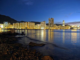
The Eastern District located on northeastern part of Hong Kong Island,being one of the 18 administrative districts of Hong Kong. It had a population of 529,603 in 2021 The district has the second highest population while its residents have the third highest median household income among the 18 districts.

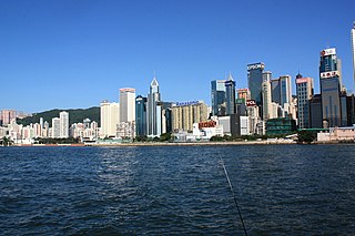
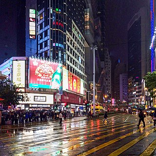
Wan Chai District is one of the 18 districts of Hong Kong. Of the four on Hong Kong Island,it is north-central,and had 166,695 residents in 2021,an increase from 152,608 residents in 2011. The district has the second-highest educationally qualified residents with the highest-bracket incomes,the second-lowest population and the third-oldest quotient. It is a relatively affluent district,with one in five persons having liquid assets of more than HKD 1 million.

Hong Kong Island is an island in the southern part of Hong Kong. The island,known originally and on road signs simply as "Hong Kong",had a population of 1,289,500 and a population density of 16,390 per square kilometre (42,400/sq mi),as of 2023. It is the second largest island in Hong Kong,with the largest being Lantau Island. Hong Kong Island forms one of the three areas of Hong Kong,with the other two being Kowloon and the New Territories.

Hong Kong Tramways (HKT) is a 3 ft 6 in narrow-gauge tram system in Hong Kong. Owned and operated by RATP Dev,the tramway runs on Hong Kong Island between Kennedy Town and Shau Kei Wan,with a branch circulating through Happy Valley.

Shau Kei Wan or Shaukiwan is a neighborhood in the Eastern District of Hong Kong Island. The area is bordered by Chai Wan to the east,Mount Parker to the south,Sai Wan Ho to the west,and Victoria Harbour to the north.

Happy Valley is an upper-income residential area in Hong Kong,located on Hong Kong Island. The area is bordered by Caroline Hill to the east,Jardine's Lookout to the south,Morrison Hill to the west,and Causeway Bay to the north. Administratively,it is part of Wan Chai District.

Quarry Bay is an area beneath Mount Parker in the Eastern District of Hong Kong Island,in Hong Kong. Quarry Bay is bordered by Sai Wan Ho to the east,Mount Parker to the south,North Point to the west,and Victoria Harbour to the north.

Tuen Mun Road is a major expressway in Hong Kong which connects Tuen Mun with Tsuen Wan,within the New Territories. It is part of Hong Kong's Route 9,which circumnavigates the New Territories. Opened in 1978,it was once the major trunk route linking the northwest New Territories to urban Kowloon and is known for its frequent traffic jams and road accidents owing to its early design and heavy usage. As a result,speed limits have been enforced to 70–80 km/h (45–50 mph) due to geometric constraints.

Chai Wan Road located in Hong Kong,is one of the major roads in Chai Wan on Hong Kong Island. It runs from Shau Kei Wan to Chai Wan through Chai Wan Gap;with one of the steepest inclines in Hong Kong on either side,with signs posted 1 in 10 gradient. It is therefore popularly referred to as Cheung Meng Che (長命斜),or long-lived incline.
Route 1 is a major artery in Hong Kong that runs in a generally north-south direction,connecting Aberdeen with Sha Tin.

The Wan Chai Pier,or Wan Chai Ferry Pier,is a pier at the coast of Wan Chai North on the Hong Kong Island of Hong Kong. The pier is operated by Star Ferry,and provides ferry services to Tsim Sha Tsui. The pier is near the Hong Kong Convention and Exhibition Centre.

Queen's Road East is a street in Wan Chai,in the north of Hong Kong Island,Hong Kong,connecting Admiralty in the west to Happy Valley in the east. Queen's Road East is one of the four sections of Queen's Road,and historically included Queensway.

Hennessy Road is a thoroughfare on Hong Kong Island,Hong Kong.

Kwai Chung Road is a throughway in Kwai Chung of the New Territories in Hong Kong. It is one of the busiest roads in Hong Kong. The Transport Department has classified it as a trunk road.

The Hong Kong Strategic Route and Exit Number System is a system adopted by the Transport Department of the Hong Kong Government to organise the major roads in the territory into routes 1 to 10 for the convenience of drivers. When the system was implemented in 2004,the government promoted it with a major public campaign,including the slogan "Remember the Numbers;Make Driving Easier".

Bowen Road is a road from the Mid-Levels to Wong Nai Chung Gap of Hong Kong Island,on the slope above Central,Wan Chai and Happy Valley in Hong Kong. Bowen Road starts from Magazine Gap Road near the rail of Peak Tram and ends at the junction with Stubbs Road,Tai Hang Road and Wong Nai Chung Gap Road.

Magazine Gap Road is a winding road on the affluent and ultra-expensive Mid-Levels and the Peak on the Hong Kong Island in Hong Kong. It is one of the main access leading to the Peak area.

Shau Kei Wan Government Secondary School is a co-educational grammar school operated by the Government of Hong Kong in Hong Kong. Located in Chai Wan Gap,the school was founded in 1961 and its medium of instruction is English.

Old Peak Road is a road in the Mid-Levels on Hong Kong Island,Hong Kong. It is the most direct path from Victoria Gap and Victoria Peak to Central on Hong Kong Island. The highest altitude is about 350 meters,the highest altitude of the driving road is about 200 meters,which is the Dynasty Court,and the mountain road is 350 meters.


