Plainwell, Michigan

Last updated
Plainwell, Michigan
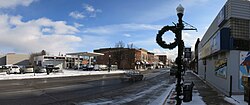
Plainwell.jpg
Nickname: 
The Island City
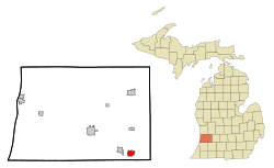
Allegan County Michigan Incorporated and Unincorporated areas Plainwell Highlighted.svg
Location of Plainwell, Michigan
Coordinates: 42°26′36″N85°38′34″W / 42.44333°N 85.64278°W / 42.44333; -85.64278
Country United States
State Michigan
County Allegan
Incorporated (village)March 26, 1869
Government
  MayorBrad Keeler
Area
[1]
  Total2.07 sq mi (5.37 km2)
  Land1.99 sq mi (5.16 km2)
  Water0.08 sq mi (0.21 km2)
Elevation
728 ft (222 m)
Population
 (2020)
  Total3,788
  Density1,901.61/sq mi (734.19/km2)
Time zone UTC-5 (Eastern (EST))
  Summer (DST) UTC-4 (EDT)
ZIP code
49080
Area code 269
FIPS code 26-64740 [2]
GNIS feature ID0635077 [3]
Website www.plainwell.org

Plainwell is a city in Allegan County in the U.S. state of Michigan. The population was 3,804 at the 2010 census.

Contents

Plainwell is located on M-89 just east of its junction with US 131. The city of Otsego is about three miles (4.8 km) to the west. The city of Kalamazoo is about ten miles (16 km) to the south, and the city of Grand Rapids is about thirty-five miles (56 km) to the north. The Kalamazoo River flows through the center of the city and it is known as "The Island City". [4]

History

This part of Michigan was settled in the 1830s, after the removal of native people. Allegan County was organized in 1835, and the Plainwell area was settled soon after. It was on a stagecoach route from Kalamazoo to Grand Rapids, and later the Grand Rapids and Indiana Railroad was constructed along the same route. After the advent of the automobile, U.S. Route 131 was created and run through the town. In the 1960s, an improved 4-lane US-131 was built west of town to connect Kalamazoo and Grand Rapids, with an interchange on M-89 between Plainwell and Otsego. This allowed the town to become a kind of "bedroom community" for Kalamazoo or the southern part of Grand Rapids.

The city is home to a local JBS meat processing plant that employs 1,300 workers, On April 20, 2020, the plant reported 60 cases and 1 death from COVID-19 during the 2019–20 coronavirus pandemic. [5] On April 27, 2020, 86 employees were reported to have been infected with COVID-19. The plant remains open with safety precautions established such as others wearing face masks and installed plexiglas between people who work shoulder to shoulder. [6]

Geography

According to the United States Census Bureau, the city has a total area of 2.06 square miles (5.34 km2), of which 1.98 square miles (5.13 km2) is land and 0.08 square miles (0.21 km2) is water. [7] The nickname Island City has to do with a power canal which diverts a portion of the Kalamazoo River around the downtown area, causing it to be an island.

Major highways

Demographics

Historical population
CensusPop.Note
1870 1,035
1880 1,35631.0%
1890 1,4144.3%
1900 1,318−6.8%
1910 1,49313.3%
1920 2,04937.2%
1930 2,27911.2%
1940 2,4246.4%
1950 2,76714.2%
1960 3,12512.9%
1970 3,1952.2%
1980 3,75117.4%
1990 4,0578.2%
2000 3,933−3.1%
2010 3,804−3.3%
2020 3,788−0.4%
U.S. Decennial Census [8]

2010 census

As of the census [9] of 2010, there were 3,804 people, 1,561 households, and 966 families living in the city. The population density was 1,921.2 inhabitants per square mile (741.8/km2). There were 1,674 housing units at an average density of 845.5 per square mile (326.4/km2). The racial makeup of the city was 96.0% White, 1.0% African American, 0.5% Native American, 0.4% Asian, 0.1% Pacific Islander, 0.6% from other races, and 1.5% from two or more races. Hispanic or Latino of any race were 2.3% of the population.

There were 1,561 households, of which 32.4% had children under the age of 18 living with them, 44.3% were married couples living together, 13.6% had a female householder with no husband present, 4.0% had a male householder with no wife present, and 38.1% were non-families. 33.1% of all households were made up of individuals, and 12.1% had someone living alone who was 65 years of age or older. The average household size was 2.33 and the average family size was 2.97.

The median age in the city was 38.7 years. 23.8% of residents were under the age of 18; 9.4% were between the ages of 18 and 24; 24.2% were from 25 to 44; 26.6% were from 45 to 64; and 15.9% were 65 years of age or older. The gender makeup of the city was 46.7% male and 53.3% female.

2000 census

As of the census [2] of 2000, there were 3,933 people, 1,506 households, and 1,018 families living in the city. The population density was 1,897.9 inhabitants per square mile (732.8/km2). There were 1,593 housing units at an average density of 768.7 per square mile (296.8/km2). The racial makeup of the city was 96.77% White, 0.46% African American, 0.48% Native American, 0.36% Asian, 0.66% from other races, and 1.27% from two or more races. Hispanic or Latino of any race were 1.65% of the population.

There were 1,506 households, out of which 35.7% had children under the age of 18 living with them, 50.7% were married couples living together, 13.1% had a female householder with no husband present, and 32.4% were non-families. 26.8% of all households were made up of individuals, and 10.0% had someone living alone who was 65 years of age or older. The average household size was 2.48 and the average family size was 3.01.

In the city, the population was spread out, with 26.5% under the age of 18, 7.9% from 18 to 24, 30.2% from 25 to 44, 19.8% from 45 to 64, and 15.7% who were 65 years of age or older. The median age was 36 years. For every 100 females, there were 91.3 males. For every 100 females age 18 and over, there were 87.5 males.

The median income for a household in the city was $39,590, and the median income for a family was $44,519. Males had a median income of $35,785 versus $26,397 for females. The per capita income for the city was $16,982. About 1.4% of families and 6.1% of the population were below the poverty line, including 2.6% of those under age 18 and 18.8% of those age 65 or over.
Education

K-12 Students are served by the Plainwell School District. There are two high schools, Plainwell High School, and Renaissance High School. Renaissance is the alternative education high school. There is only one middle school, Plainwell Middle School. The school district has three elementary schools. They are Cooper Elementary, Gilkey Elementary, and Starr Elementary.

Michigan Career and Technical Institute is also located nearby.

Notable people

See also

Related Research Articles

<span class="mw-page-title-main">Allegan County, Michigan</span> County in Michigan, United States

Allegan County is a county in the U.S. state of Michigan. As of the 2020 United States Census, the population was 120,502. The county seat is Allegan. The name was coined by Henry Rowe Schoolcraft to sound like a Native American word.

<span class="mw-page-title-main">Douglas, Michigan</span> City in Michigan, United States

Douglas is a city in Allegan County in the U.S. state of Michigan. The population was 1,378 at the 2020 census. The city is surrounded by Saugatuck Township and the city of Saugatuck is adjacent on the north.

Gun Plain Charter Township is a charter township of Allegan County in the U.S. state of Michigan. As of the 2010 census, the township population was 5,895.

<span class="mw-page-title-main">Otsego, Michigan</span> City in Michigan, United States

Otsego is a city in Allegan County in the U.S. state of Michigan. The population was 3,956 at the 2010 census. The city is within Otsego Township, but is administratively autonomous.

Otsego Township is a civil township of Allegan County in the U.S. state of Michigan. The population was 5,594 at the 2010 census. The city of Otsego is located within the township, but is administratively autonomous.

<span class="mw-page-title-main">Wayland, Michigan</span> City in Michigan, United States

Wayland is a city in Allegan County in the U.S. state of Michigan. The population was 4,079 at the 2010 census.

<span class="mw-page-title-main">Mancelona, Michigan</span> Village in Michigan, United States

Mancelona is a village in the Northern Lower Peninsula of the U.S. state of Michigan. Part of Mancelona Township, the village is located within Antrim County. Its population was 1,344 at the 2020 census.

<span class="mw-page-title-main">Level Park–Oak Park, Michigan</span> Census-designated place & unincorporated community in Michigan, United States

Level Park–Oak Park is a census-designated place for statistical purposes in Calhoun County in the U.S. state of Michigan. The CDP population was 3,409 at the 2010 census. The CDP is immediately northwest of the city of Battle Creek and is part of the Battle Creek Metropolitan Statistical Area.

Marengo Township is a civil township of Calhoun County in the U.S. state of Michigan. It is part of the Battle Creek, Michigan Metropolitan Statistical Area. As of the 2010 census, the township population was 2,213.

Alamo Township is a civil township of Kalamazoo County in the U.S. state of Michigan. As of the 2020 census, the township population was 3,805.

Charleston Township is a civil township of Kalamazoo County in the U.S. state of Michigan. The 2010 census recorded a population of 1,975, up from 1,813 at the 2000 census.

<span class="mw-page-title-main">Portage, Michigan</span> City in Michigan, United States

Portage is a city in Kalamazoo County in the U.S. state of Michigan. The population was 46,292 in the 2010 census. It is the smaller of the two main cities included in the Kalamazoo-Portage Metropolitan Statistical Area, which has a population of 326,589 as of 2010. Portage is known for its Pharmaceutical manufacturing and celery agriculture. On February 19, 2021, the president of the United States, Joe Biden, visited Portage to commemorate the production of the Pfizer Vaccine.

<span class="mw-page-title-main">Kalkaska Township, Michigan</span> Civil township in Michigan, United States

Kalkaska Township is a civil township of Kalkaska County in the U.S. state of Michigan. The population was 2,895 at the 2020 census. The township contains the village of Kalkaska, which serves as the county seat. The western half of the township was formerly a separate township, known as Wilson Township.

<span class="mw-page-title-main">Byron Township, Michigan</span> Civil township in Michigan, United States

Byron Township is a civil township of Kent County in the U.S. state of Michigan. The population was 20,317 at the 2010 census, an increase from 17,553 at the 2000 census.

<span class="mw-page-title-main">Comstock Park, Michigan</span> Census-designated place & unincorporated community in Michigan, United States

Comstock Park is an unincorporated community and census-designated place (CDP) in Kent County in the U.S. state of Michigan. The population was 10,088 at the 2010 census. The community is located within Alpine Township to the west and Plainfield Township to the east.

<span class="mw-page-title-main">Kentwood, Michigan</span> City in Michigan, United States

Kentwood is a city in Kent County in the U.S. state of Michigan. The population was 54,304 as of the 2020 census. The city is bordered on the northwest by Grand Rapids and is the third most-populated municipality in the Grand Rapids metropolitan area.

<span class="mw-page-title-main">Big Rapids, Michigan</span> City in Michigan, United States

Big Rapids is a city in the U.S. state of Michigan. The population was 10,601 at the 2010 census. It is the county seat of Mecosta County. The city is located within Big Rapids Township, but it is politically independent. Big Rapids is home of the main campus of Ferris State University, a four-year public university, well known for its College of Pharmacy and the Michigan College of Optometry, as well as its NCAA Division I hockey team, the Bulldogs, and their Division II football and basketball teams.

Colfax Township is a civil township of Mecosta County in the U.S. state of Michigan. The population was 1,975 at the 2000 census.

<span class="mw-page-title-main">Manton, Michigan</span> City in Michigan, United States

Manton is a city in Wexford County in the U.S. state of Michigan. The population was 1,258 at the 2020 census.

<span class="mw-page-title-main">Plainfield Township, Kent County, Michigan</span> Charter township in Michigan, United States

Plainfield Charter Township is a charter township of Kent County in the U.S. state of Michigan. The population was 30,952 at the 2010 census.

References

  1. "2020 U.S. Gazetteer Files". United States Census Bureau. Retrieved May 21, 2022.
  2. 1 2 "U.S. Census website". United States Census Bureau . Retrieved 2008-01-31.
  3. U.S. Geological Survey Geographic Names Information System: Plainwell, Michigan
  4. "City of Plainwell official website" . Retrieved 17 April 2012.
  5. Moore, Lindsay (April 21, 2020). "60 coronavirus cases, 1 death at Plainwell meat plant". Mlive .
  6. Boldrey, Ryan (April 27, 2020). "Plainwell meat plant's coronavirus case count rises to 86". Mlive .
  7. "US Gazetteer files 2010". United States Census Bureau. Archived from the original on 2012-01-25. Retrieved 2012-11-25.
  8. "Census of Population and Housing". Census.gov. Retrieved June 4, 2015.
  9. "U.S. Census website". United States Census Bureau . Retrieved 2012-11-25.

Coordinates: 42°26′24″N85°38′56″W / 42.44000°N 85.64889°W / 42.44000; -85.64889