
Plemstall (formerly Plemonstall) is a hamlet in the civil parish of Mickle Trafford and District, in Cheshire West and Chester, Cheshire, England. It lies north-east of the village of Mickle Trafford.

Plemstall (formerly Plemonstall) is a hamlet in the civil parish of Mickle Trafford and District, in Cheshire West and Chester, Cheshire, England. It lies north-east of the village of Mickle Trafford.
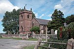
The hamlet contains only a couple of houses, being a farm and former level crossing keeper's house, in addition to the Grade I listed St Peter's Church. [1] The church stands on a slightly elevated area which was known as "The Isle of Chester", the surrounding area formerly being marsh. The church is believed to have been built on the site of Plegmund's hermitage, who is believed to have lived in there before he became Archbishop of Canterbury in AD 890.

St Plegmund's well is also situated within the hamlet, on the edge of a low cliff about 220 yards (201 m) to the west of the church and to the east of one of the channels of the River Gowy. [2] [3] It is one of two holy wells in west Cheshire.
There are two tiers of local government covering Plemstall, at parish and unitary authority level: Mickle Trafford and District Parish Council, and Cheshire West and Chester Council. The parish council generally meets at the village hall in Mickle Trafford. [4]
Plemstall was an ancient parish, and formed part of the Broxton Hundred of Cheshire. The parish was subdivided into the four townships of Bridge Trafford, Hoole, Mickle Trafford, and Picton. Plemstall's parish church of St Peter was in the Mickle Trafford township. [5] From the 17th century onwards, parishes were gradually given various civil functions under the poor laws, in addition to their original ecclesiastical functions. In some cases, including Plemstall, the civil functions were exercised by each township separately rather than the parish as a whole. In 1866, the legal definition of 'parish' was changed to be the areas used for administering the poor laws, and so the four townships each became a separate civil parish, whilst remaining part of the ecclesiastical parish of Plemstall. [6] The ecclesiastical parish retains the name Plemstall. [7] [8]

Altrincham is a market town in Trafford, Greater Manchester, England, south of the River Mersey. It is 8 miles (13 km) southwest of Manchester, 3 miles (5 km) southwest of Sale and 10 miles (16 km) east of Warrington. At the 2021 census, the built up area had a population of 49,680.
Tattenhall is a village and former civil parish, now in the parish of Tattenhall and District, 8 miles (13 km) south-east of Chester, in the unitary authority area of Cheshire West and Chester and the ceremonial county of Cheshire, England. In the 2001 census, the population was recorded as 1,986, increasing to 2,079 by the 2011 census.

Alderley Edge is a village and civil parish in Cheshire, England. It is 6 miles (10 km) north-west of Macclesfield and 12 miles (19 km) south of Manchester, at the base of a steep wooded sandstone escarpment, The Edge, which overlooks the Cheshire Plain. At the 2021 census the parish had a population of 4,777.

Wilmslow is a market town and civil parish in the borough of Cheshire East in Cheshire, England. It is 11 miles (18 km) south of Manchester. At the 2021 census the parish had a population of 26,213 and the built up area had a population of 25,725.
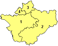
A civil parish is a country subdivision, forming the lowest unit of local government in England. There are 333 civil parishes in the ceremonial county of Cheshire, most of the county being parished. Cheshire East unitary authority is entirely parished. At the 2001 census, there were 565,259 people living in 332 parishes, accounting for 57.5 per cent of the county's population.

Cheadle is a village in the Metropolitan Borough of Stockport, in the county of Greater Manchester, England. Within the boundaries of the historic county of Cheshire, it borders Cheadle Hulme, Gatley, Heald Green and Cheadle Heath in Stockport, and East Didsbury in Manchester. In 2011, it had a population of 14,698.

Guilden Sutton is a civil parish and village in the unitary authority of Cheshire West and Chester and the ceremonial county of Cheshire, England. The village lies approximately 3 miles (5 km) to the east of Chester and is south of the village of Mickle Trafford. The community consists of a church, a primary school, a post office, a pub, a village hall and several local businesses.

Ashton upon Mersey is an area in Trafford, in Greater Manchester, England. It lies on the south bank of the River Mersey, 5 miles (8.0 km) south of Manchester city centre and immediately adjoins Sale to the east. It gives its name to the Ashton upon Mersey ward, which covers the main part of the former village. Ashton upon Mersey lies within the historic county boundaries of Cheshire, and became part of Greater Manchester in 1974.

Picton is a hamlet in the civil parish of Mickle Trafford and District, in Cheshire West and Chester, Cheshire, England. It lies 4 miles (6.4 km) north-east of Chester. Picton was formerly a separate civil parish until 2015.

Handforth is a town and civil parish in Cheshire, England, 9 miles (14 km) south of Manchester city centre. The population of the parish was 6,715 at the 2021 census. In the 1960s and 1970s, two overspill housing estates, Spath Lane in Handforth, and Colshaw Farm nearby in Wilmslow, were built to re-house people from inner city Manchester. It lies between Wilmslow, Heald Green, and Styal, and forms part of the Greater Manchester Built-up Area.

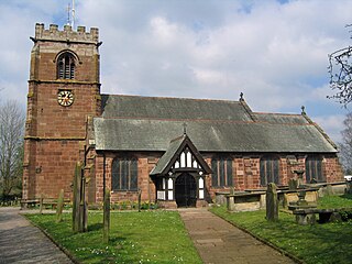
St Peter's Church, Plemstall stands in an isolated position at the end of a country lane near the village of Mickle Trafford, Cheshire, England. It is recorded in the National Heritage List for England as a designated Grade I listed building. It is an active Anglican parish church in the diocese of Chester, the archdeaconry of Chester and the deanery of Chester. Its benefice is combined with that of St John the Baptist's Church, Guilden Sutton.
Chorley is a civil parish in the borough of Cheshire East in Cheshire, England. The parish is named after the village of Chorley, which was renamed Alderley Edge during the 19th century. Alderley Edge was removed from the parish in 1894, since when the parish of Chorley has just covered the more rural western parts of the old parish. The largest settlement in the parish today is a hamlet called Row-of-Trees in the north of the parish. At the 2021 census, the parish had a population of 490.

St. Plegmund's well is about 220 yards (201 m) west of St Peter's Church, Plemstall, near the village of Mickle Trafford, Cheshire, England. It is named after Plegmund, who later became Archbishop of Canterbury and is believed to have lived as a hermit nearby. The earliest documentary evidence of the well is in a quitclaim dated 1301. The well is on the edge of a low rise, to the east of which is one of the channels of the River Gowy. It is one of two holy wells in west Cheshire.
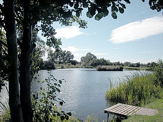
Mickle Trafford is a village in Cheshire West and Chester, Cheshire, England. It is the main village in the civil parish of Mickle Trafford and District. The A56 road from Chester to Warrington passes through the village and the Chester-Warrington railway line passes immediately to its east.
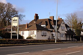
Bridge Trafford is a hamlet in the civil parish of Mickle Trafford and District, in Cheshire West and Chester, Cheshire, England. It lies 2 miles (3 km) to the north of Mickle Trafford on the A56 road, and is 4 miles (6 km) north-east of Chester. Bridge Trafford was formerly a separate civil parish until 2015.
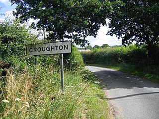
Croughton is a hamlet and civil parish on the outskirts and 3.5 miles (5.7 km) north of the city of Chester, and part of the unitary authority of Cheshire West and Chester and the ceremonial county of Cheshire. The Shropshire Union Canal runs through Croughton.

Wimbolds Trafford is a hamlet in the civil parish of Mickle Trafford and District, in Cheshire West and Chester, Cheshire, England. The hamlet lies on the B5132 road, approximately 5 miles (8 km) to the north east of Chester and north of the village of Mickle Trafford.

Northen Etchells was a civil parish in Cheshire, England. It was abolished in 1931 when the area was absorbed into the County Borough of Manchester.
Guilden Sutton is a civil parish and village in Cheshire West and Chester, England. It contains three buildings that are recorded in the National Heritage List for England as designated listed buildings, all of which are at Grade II. This is the lowest of the three grades, which contains "buildings of national importance and special interest".
Mickle Trafford is a former civil parish, now in the parish of Mickle Trafford and District, in Cheshire West and Chester, England. It contains eleven buildings that are recorded in the National Heritage List for England as designated listed buildings. Of these, one is listed at Grade I, the highest grade, one is listed at Grade II*, the middle grade, and the others are at Grade II. Apart from the village of Mickle Trafford, the parish is rural. In addition to houses and buildings related to farming, the listed buildings include a medieval church and associated structures, an inscribed stone, and a corn mill.
![]() Media related to Plemstall at Wikimedia Commons
Media related to Plemstall at Wikimedia Commons