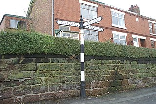
Barnton is a civil parish and village, just outside the town of Northwich, in the unitary authority of Cheshire West and Chester and the ceremonial county of Cheshire, England. It lies north and east of the Trent & Mersey Canal which goes through two tunnels (Barnton and Saltersford) to the west of the village.
The village can roughly be divided into four parts: the old village which grew northeastwards from the southwest corner; the more up-market properties northwest-wards along and to the west of the main Runcorn Road (A533); the council-built estate to the north west, largely between Townfield Lane and Runcorn Road; and the more modern estates (the largest known as the Locke estate after the builders) to the north and east. The village has no easily identifiable centre with some shops along the Runcorn Road and others by the new Health Centre in Lydyett Lane.
There is currently only one pub, a small number for such a large village and greatly fewer than there were 100 years ago. The parish church is Christ Church in Church Road in the old part of the village; there are also Catholic, Methodist and Pentecostal churches.
Barnton F.C. were founder members of the Mid Cheshire Football League and now compete in the North-West counties league division one south. The new village hall (the Memorial Hall) is located next to the Barnton F.C. ground off Townfield Lane. The village also has a cricket club which is located close to Barnton School which is also on Townfield Lane.
Below the village where the main A533 crosses the River Weaver, on 19 August 1659, at the Battle of Winnington Bridge, a Parliamentary army of 5,000 men under the command of General John Lambert defeated a rebel Royalist army of 4,000 men under the command of Sir George Booth.[2][3] A plaque marking this was erected on the bridge in August 2009 by the Northwich & District Heritage Society, 350 years after the battle commenced.[4]
The Parish Church, Christ Church, Barnton was completed in 1842 and the Vicarage stands proudly on Church Road overlooking the Winnington Village housing estate. Further along at Church Road junction stands the old Police Station, which was built in 1902 for the sergeant who lived on Bells Brow. It contained an office, an interview room and three cells. There is still has a row of back-to-back houses on Bell's Brow at the top of Barnton Hill built in 1810 to accommodate Brunner Mond labourers.
Barnton became known as "Jam Town" in the late 1800s due to so many people owning and not renting their homes. "People in Barnton eat Jam butties so that they can own not only their own houses, but buy their neighbours too!".[5] In December 2018, a wooden carving of a young boy eating a Jam Sandwich was unveiled in honour of the sacrifices for home ownership in the village.[6] The statue was named the 'Jam Butty Boy', and is located on the A533 (Runcorn Road) that runs through the village.
Runcorn is an industrial town and cargo port in the Borough of Halton, Cheshire, England. Its population in 2021 was 62,100. Runcorn is on the southern bank of the River Mersey, where the estuary narrows to form the Runcorn Gap. It lies on the southern shore of the River Mersey 15 miles upstream from the port of Liverpool.
Northwich is a market and port town and civil parish in the unitary authority of Cheshire West and Chester in the ceremonial county of Cheshire, England. It lies in the heart of the Cheshire Plain, at the confluence of the rivers Weaver and Dane. The town is about 18 miles (29 km) east of Chester, 15 miles (24 km) south of Warrington, and 19 miles (31 km) south of Manchester.
Winnington is a ward and northwestern suburb of the town of Northwich, in the Cheshire West and Chester borough of Cheshire, England.
Antrobus is a civil parish and village in Cheshire, England, about 7 mi (11 km) south of Warrington. It lies within the unitary authority of Cheshire West and Chester, and had a population of 832, reducing to 791 at the 2011 Census, and to 767 in the 2021 Census. The parish is the most northeasterly point of Cheshire West and Chester, and as such borders both Warrington and Cheshire East. As well as Antrobus village centre itself, the parish includes other large hamlets at Frandley, about 1 mi (1.6 km) south-west from the main village, and Crowley, about 2 mi (3.2 km) to the north-east.
Whitley is a civil parish in the unitary authority of Cheshire West and Chester and the ceremonial county of Cheshire, England. It is surrounded by the parishes of Antrobus, Comberbach, Little Leigh and Dutton. It also borders Daresbury in Halton borough as well as Hatton and Stretton in Warrington borough. It is a small village located next to Antrobus.
Hartford is a village and civil parish in the unitary authority of Cheshire West and Chester and the ceremonial county of Cheshire, England. It lies at the intersection of the A559 road and the West Coast Main Line and is less than 2 miles (3.2 km) south west of the town of Northwich. It forms part of the Mid Cheshire parliamentary constituency. According to the 2011 Census, the population of the parish was 5,558.
The A556 is a road in England which extends from the village of Delamere in Cheshire West and Chester to the Bowdon Interchange in Cheshire East, bordering Greater Manchester. The road contains a mixture of single and dual carriageway sections and forms a large part of the route between Manchester and Chester. It also acts as a major access route to Chester/North Wales to the west and to Manchester to the east for the conurbation of towns and villages around the Dane Valley centering on Winsford and Northwich. The central part, which forms the Northwich Bypass between Davenham and Lostock Gralam, suffers because of the amount of commuter traffic from this area. The part of the route between the M6 motorway Junction 19 and the M56 motorway Junction 7 is a major route into Manchester and has been recently upgraded to a four-lane dual carriageway.
Little Leigh is a civil parish and village within the unitary authority of Cheshire West and Chester and the ceremonial county of Cheshire, England. It is situated on high ground on the north bank of the River Weaver; it is approximately 2 miles north of Weaverham on the A533 road and about three miles north-west of Northwich. The population of the civil parish taken at the 2011 census was 567.
Hartford Church of England High School is a voluntary aided Church of England secondary school on Neot Road in Hartford, Cheshire. The school has dual specialist college status in both languages and sports. It has been rated as 'Good' by Ofsted.
Cheshire West and Chester is a local government district with borough status in Cheshire, England. It was established on 1 April 2009 as part of the 2009 local government changes, by virtue of an order under the Local Government and Public Involvement in Health Act 2007. It superseded the boroughs of Ellesmere Port and Neston, Vale Royal and the City of Chester; its council is a unitary authority, having also assumed the functions and responsibilities of the former Cheshire County Council within its area. The remainder of ceremonial Cheshire is composed of Cheshire East, Halton and Warrington. Cheshire West and Chester has three key urban areas: Chester, Ellesmere Port and Northwich/Winsford.
Preston on the Hill is a village and former civil parish, now in the parish of Preston Brook and the unitary authority area of Halton, in Cheshire, England. It is between the villages of Daresbury 1.5 miles (2.4 km) to the north and Dutton 1.1 miles (1.8 km) to the south. The village comprises the hamlets of Windmill Lane, Waterfront, Cotton's Bridge, Tunnel End North, Tunnel Top and Barker's Hollow as well as several farms including White House, Little Manor, New Manor, Windmill Farm and Humble Bee House.
Northwich Rural District was a rural district surrounding, but not including the towns of Northwich and Winsford in Cheshire, which were separate urban districts. It was created in 1894 from the Northwich Rural Sanitary District.
Holy Trinity Church, Northwich, is in the Castle district of Northwich, Cheshire, England. It is an active Anglican parish church in the deanery of Middlewich, the archdeaconry of Chester, and the diocese of Chester. Its benefice was united with that of St Luke, Winnington, Northwich until 2018 when the benefice was dissolved and Holy Trinity became a single parish again. The church is recorded in the National Heritage List for England as a designated Grade II listed building.
Christ Church is in the village of Barnton, Cheshire, England. It is an active Anglican parish church in the deanery of Great Budworth, the archdeaconry of Chester, and the diocese of Chester. The church is recorded in the National Heritage List for England as a designated Grade II listed building.
1874 Northwich Football Club is a football club based in Northwich, Cheshire, England. Established in 2012 by supporters of Northwich Victoria, they are currently members of the Midland League Premier Division. Home matches are played at Barnton's Townfield ground. The club is fully owned by its supporters, and is run by a democratically elected board.
Northwich is a civil parish and a town in Cheshire West and Chester, England. It contains 35 buildings that are recorded in the National Heritage List for England as designated listed buildings. Two of these are listed at Grade I, the highest grade, and the rest at the lowest grade, Grade II; none are listed at the middle grade, Grade II*. The River Dane joins the River Weaver and the Weaver Navigation within the parish. Also passing through the parish are the A533 road, the Trent and Mersey Canal, and a railway built by the Cheshire Lines Committee. Many of the listed buildings are associated with these features.
Barnton is a village and a civil parish in Cheshire West and Chester, England. It contains 11 buildings that are recorded in the National Heritage List for England as designated listed buildings, all of which are at Grade II. This grade is the lowest of the three gradings given to listed buildings and is applied to "buildings of national importance and special interest". Running through the parish are the Trent and Mersey Canal, which passes through two tunnels, and the River Weaver together with the Weaver Navigation. The majority of the listed buildings in the parish are associated with these transport links. Associated with the canal are four tunnel entrances, an airshaft, two mileposts, and a terrace of cottages. The Weaver Navigation contains Saltersford Locks, and its toll house. The other listed building is the village church, Christ Church.
This page is based on this Wikipedia article Text is available under the CC BY-SA 4.0 license; additional terms may apply. Images, videos and audio are available under their respective licenses.