| Duddon and Burton | |
|---|---|
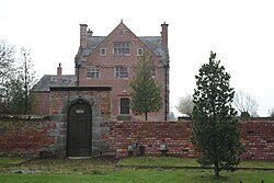 Burton Hall | |
 Duddon and Burton Location within Cheshire | |
| Civil parish |
|
| Unitary authority | |
| Ceremonial county | |
| Region | |
| Country | England |
| Sovereign state | United Kingdom |
| Post town | Tarporley |
| Postcode district | CW6 |
| Dialling code | 01829 |
| Police | Cheshire |
| Fire | Cheshire |
| Ambulance | North West |
| UK Parliament | |
Duddon and Burton is a civil parish in the unitary authority of Cheshire West and Chester and the ceremonial county of Cheshire, England. The parish is formed of the villages of Duddon and Burton.