Oxisols are a soil order in USDA soil taxonomy, best known for their occurrence in tropical rain forest within 25 degrees north and south of the Equator. In the World Reference Base for Soil Resources (WRB), they belong mainly to the ferralsols, but some are plinthosols or nitisols. Some oxisols have been previously classified as laterite soils.

In both the World Reference Base for Soil Resources (WRB) and the USDA soil taxonomy, a Histosol is a soil consisting primarily of organic materials. They are defined as having 40 centimetres (16 in) or more of organic soil material in the upper 80 centimetres (31 in). Organic soil material has an organic carbon content of 12 to 18 percent, or more, depending on the clay content of the soil. These materials include muck, mucky peat, or peat. Aquic conditions or artificial drainage are required. Typically, Histosols have very low bulk density and are poorly drained because the organic matter holds water very well. Most are acidic and many are very deficient in major plant nutrients which are washed away in the consistently moist soil.
The World Reference Base for Soil Resources (WRB) is an international soil classification system for naming soils and creating legends for soil maps. The currently valid version is the fourth edition 2022. It is edited by a working group of the International Union of Soil Sciences (IUSS).

In soil classification, an Umbrisol is a soil with a dark topsoil and in which organic matter has accumulated within the mineral surface soil—in most cases with low base saturation—to the extent that it significantly affects the behaviour and utilization of the soil. Umbrisols are the counterpart of comparable soils with a high base saturation.

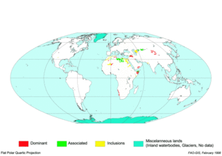
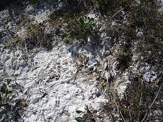
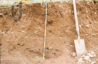
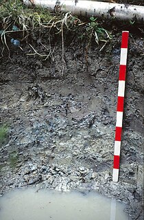
Gypsisols in the World Reference Base for Soil Resources (WRB) are soils with substantial secondary accumulation of gypsum (CaSO4.2H2O). They are found in the driest parts of the arid climate zone. In the USDA soil taxonomy they are classified as Gypsids (USDA Soil Taxonomy), in the Russian soil classification they are called Desert soils (USSR).

An Acrisol is a Reference Soil Group of the World Reference Base for Soil Resources (WRB). It has a clay-rich subsoil and is associated with humid, tropical climates, such as those found in Brazil, and often supports forested areas. In the USDA soil taxonomy, Acrisols correspond to the Humult, Udult and Ustult suborders of the Ultisols and also to Oxisols with a kandic horizon and to some Alfisols. The Acrisols low fertility and toxic amounts of aluminium pose limitations to its agricultural use, favouring in many places its use for silviculture, low intensity pasture and protected areas. Crops that can be successfully cultivated, if climate allows, include tea, rubber tree, oil palm, coffee and sugar cane.
Solonetz is a Reference Soil Group of the World Reference Base for Soil Resources (WRB). They have, within the upper 100 cm of the soil profile, a so-called "natric horizon". There is a subsurface horizon (subsoil), higher in clay content than the upper horizon, that has more than 15% exchangeable sodium. The name is based on the Russian соль. Ukrainian folk word "solontsi" means salty soil. In Ukraine there are many villages that are called Solontsі.

A gley is a wetland soil that, unless drained, is saturated with groundwater for long enough to develop a characteristic gleyic colour pattern. The pattern is essentially made up of reddish, brownish, or yellowish colours at surfaces of soil particles and/or in the upper soil horizons mixed with greyish/blueish colours inside the peds and/or deeper in the soil. Gleysols are also known as Gleyzems, meadow soils, Aqu-suborders of Entisols, Inceptisols and Mollisols, or as groundwater soils and hydro-morphic soils.

Solonchak is a Reference Soil Group of the World Reference Base for Soil Resources (WRB). It is a pale or grey soil type found in arid to subhumid, poorly drained conditions. The word is Russian for "salt marsh" in turn from Russian sol (соль), "salt". Ukrainian folk word "солончак" in turn from Ukrainian "salty" (солоний) + "чак"—suffix; designation of an object that has the property. In Ukraine there is a village Solonchaky.

A Leptosol in the World Reference Base for Soil Resources (WRB) is a very shallow soil over hard rock or a deeper soil that is extremely gravelly and/or stony. Leptosols cover approximately 1.7 billion hectares of the Earth's surface. They are found from the tropics to the cold polar regions and from sea level to the highest peaks. Leptosols are particularly widespread in mountain areas, notably in Asia, South America, northern Canada and Alaska; and in the Saharan and Arabian deserts. Elsewhere, Leptosols can be found on hard rocks or where erosion has kept pace with soil formation or removed the top of the soil. In the FAO soil classification for the UNESCO Soil Map of the World (1974) the Leptosols on calcareous rock were called Rendzinas, those on acid rock were Rankers. The very shallow, less than 10 cm deep, Lithic Leptosols in mountain regions are the most extensive Leptosols on Earth.

A Regosol in the World Reference Base for Soil Resources (WRB) is very weakly developed mineral soil in unconsolidated materials. Regosols are extensive in eroding lands, in particular in arid and semi-arid areas and in mountain regions. Internationally, Regosols correlate with soil taxa that are marked by incipient soil formation such as Entisols in the USDA soil taxonomy or Rudosols and possibly some Tenosols in the Australian Soil Classification.

A Planosol in the World Reference Base for Soil Resources is a soil with a light-coloured, coarse-textured, surface horizon that shows signs of periodic water stagnation and abruptly overlies a dense, slowly permeable subsoil with significantly more clay than the surface horizon. In the US Soil Classification of 1938 used the name Planosols, whereas its successor, the USDA soil taxonomy, includes most Planosols in the Great Groups Albaqualfs, Albaquults and Argialbolls.

A Stagnosol in the World Reference Base for Soil Resources (WRB) is soil with strong mottling of the soil profile due to redox processes caused by stagnating surface water.

Andosols are soils found in volcanic areas formed in volcanic tephra. In some cases Andosols can also be found outside active volcanic areas. Andosols cover an estimated 1–2% of earth's ice-free land surface. Andosols are a Reference Soil Group of the World Reference Base for Soil Resources (WRB). They are closely related to other types of soils such as Vitrosols, Vitrandosols, Vitrons and Pumice Soils that are used in different soil classification systems. Poorly developed Andosols are often rich in vitreous materials and are therefore also called Vitric Andosols. The name comes from Japanese an and do, synonymous with kuroboku. In the USDA soil taxonomy, Andosols are known as Andisols.
An anthrosol in the World Reference Base for Soil Resources (WRB) is a type of soil that has been formed or heavily modified due to long-term human activity, such as from irrigation, addition of organic waste or wet-field cultivation used to create paddy fields.

A fluvisol in the World Reference Base for Soil Resources (WRB) is a genetically young soil in alluvial deposits. Apart from river sediments, they also occur in lacustrine and marine deposits. Fluvisols correlate with fluvents and fluvaquents of the USDA soil taxonomy. The good natural fertility of most fluvisols and their attractive dwelling sites on river levees and higher parts in marine landscapes were recognized in prehistoric times.
Kastanozem is one of the 32 Reference Soil Groups of the World Reference Base for Soil Resources (WRB). These soils are brighter than Chernozems, and are related to the Mollisols in the USDA soil taxonomy. They are rich in humus, and originally covered with early maturing native grasslands vegetation, which produces a characteristic brown surface layer in the first meter in depth. They have a relative high level of available calcium ions bound to soil particles and can have a petrocalcic horizon between 25 and 100 cm thick.

A nitisol in the World Reference Base for Soil Resources (WRB) is a deep, red, well-drained soil with a clay content of more than 30% and a blocky structure. Nitisols correlate with the kandic alfisols, ultisols and inceptisols of the USDA soil taxonomy.

A Phaeozem in the World Reference Base for Soil Resources (WRB) is a dark soil with a high base status, but without a secondary carbonates within one metre of the soil surface. Phaeozems correlate with the Udolls and Aquolls (Mollisols) of the USDA soil taxonomy.
A Retisol is a Reference Soil Group of the World Reference Base for Soil Resources (WRB). Retisols are characterized by clay migration and an additional specific feature: The clay-poorer and lighter coloured eluvial horizon intercalates netlike into the clay-richer more intensely coloured illuvial horizon. The illuvial horizon is the diagnostic argic horizon, and the intercalation is called retic properties.


