Related Research Articles
The Food and Agriculture Organization of the United Nations (FAO) developed a supra-national classification, which offers useful generalizations about pedogenesis in relation to the interactions between the main soil-forming factors. It was first published in form of the UNESCO Soil Map of the World (1974). Many of the names offered in that classification are known in many countries and do have similar meanings.

Chalacot or Chelekot is a village in the Tigray Region of Ethiopia. Located in the Enderta woreda (district) of the Debub Misraqawi (Southeastern) Zone, 10 kilometers north of Antalo and 17 kilometers south of Mek'ele, the village has an approximate elevation of 2100 meters above sea level. The Central Statistical Agency has not published an estimate for this village's 2005 population.
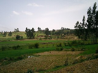
Atsbi is a town in Tigray, Ethiopia. Located in the Misraqawi (Eastern) Zone of the Tigray Region, about 50 kilometers northeast of Qwiha, this town has a latitude and longitude of 13°52′N39°44′E with an elevation of 2630 meters above sea level. It is the administrative center of Atsbi Wenberta woreda.
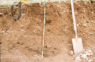
A Regosol in the World Reference Base for Soil Resources (WRB) is very weakly developed mineral soil in unconsolidated materials. Regosols are extensive in eroding lands, in particular in arid and semi-arid areas and in mountain regions. Internationally, Regosols correlate with soil taxa that are marked by incipient soil formation such as Entisols in the USDA soil taxonomy or Rudosols and possibly some Tenosols in the Australian Soil Classification.
An English translation of soil types defined in "référentiel pedologique français" can be done this way. it is relevant for European soils:

Aqushela is a typical over-dimensioned reservoir located in the Tanqwa-Abergele woreda of the Tigray Region in Ethiopia. The earthen dam that holds the reservoir was built in 1999 by the Relief Society of Tigray.

Mika’el Abiy is a tabia or municipality in the Dogu’a Tembien district of the Tigray Region of Ethiopia. The tabia centre is in Megesta village, located approximately 7 km to the southeast of the woreda town Hagere Selam.
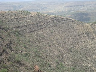
Amanit is a tabia or municipality in the Dogu'a Tembien district of the Tigray Region of Ethiopia. The tabia centre is Addi Qeshofo village, located approximately 15 km to the southeast of the woreda town Hagere Selam.
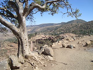
Aregen is a tabia or municipality in the Dogu'a Tembien district of the Tigray Region of Ethiopia. The tabia centre is in Addi Gotet village, located approximately 11 km (6.8 mi) to the west-southwest of the woreda town Hagere Selam.

Menachek is a tabia or municipality in the Tanqua Millash district of the Tigray Region of Ethiopia. The tabia centre is in Addi Bayro village. Until January 2020 it belonged to the Dogu'a Tembien district.

Walta is a municipality in the Dogu'a Tembien district of the Tigray Region of Ethiopia. The tabia centre is in Da’erere village, located approximately 7 km to the south of the woreda town Hagere Selam.

Selam is a tabia or municipality in the Dogu'a Tembien district of the Tigray Region of Ethiopia. The tabia centre is in Addi Werho village, located approximately 3 km to the northeast of the woreda town Hagere Selam.
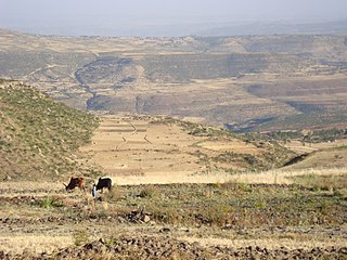
Ayninbirkekin is a tabia or municipality in the Dogu'a Tembien district of the Tigray Region of Ethiopia. Literal meaning of Ayninbirkekin in Tigrinya is "We will not bend". The tabia centre is in Halah village, located approximately 8 km to the east of the woreda town Hagere Selam. Main town is Ala'isa, situated on the ridge overseeing the Giba valley.

The soils of the Kilte Awula’ilo woreda (district) in Tigray, Ethiopia reflect its longstanding agricultural history, highly seasonal rainfall regime, relatively low temperatures, the presence of a wide depression at the foot of the Atsbi horst and steep slopes. Outstanding features in the soilscape are the wide ancient fluvial deposits, the soils of the granite batholith, cuestas and fertile lands behind tufa dams.
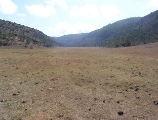
The soils of the Atsbi Wenberta woreda (district) in Tigray (Ethiopia) reflect its longstanding agricultural history, highly seasonal rainfall regime and relatively low temperatures. The northern part of the district is on the high uplifted Atsbi Horst, whereas the southern part is dominated by the Des’a forest on Antalo Limestone. In between there is the fluvial landscape of Hayqi Meshal. Particularities in the southern part of the district are soil catenas on intervening plains behind tufa dams and in a polje.

The soils of the Sa'isi Tsa'ida Imba woreda (district) in Tigray (Ethiopia) reflect its longstanding agricultural history, highly seasonal rainfall regime, relatively low temperatures, overall dominance of metamorphic and sandstone lithology and steep slopes.
The soils of the Inderta woreda (district) in Tigray (Ethiopia) reflect its longstanding agricultural history, highly seasonal rainfall regime, relatively low temperatures, overall dominance of limestone and dolerite lithologies and steep slopes. Outstanding features in the soilscape are wide plains with Vertisols.
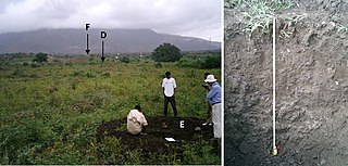
The soils of the Tanqwa Abergele woreda (district) in Tigray (Ethiopia) reflect its longstanding agricultural history, highly seasonal rainfall regime, relatively high temperatures, overall dominance of Precambrian metamorphic rocks and steep slopes.

The soils of the Kola Tembien woreda (district) in Tigray (Ethiopia) reflect its longstanding agricultural history, highly seasonal rainfall regime, relatively high temperatures, overall dominance of sandstone and metamorphic lithology and steep slopes.

The soils of the Dogu’a Tembien woreda (district) in Tigray (Ethiopia) reflect its longstanding agricultural history, highly seasonal rainfall regime, relatively low temperatures, an extremely great variety in lithology and steep slopes. Outstanding features in the soilscape are the fertile highland Vertisols and Phaeozems in forests.
References
- 1 2 3 4 Marcinek, Jerzy; Komisarek, Jolanta (2011). "Systematyka gleb Polski. Wydanie 5" [Polish Soil Classification. 5th edition]. Roczniki Gleboznawcze - Soil Science Annual (in Polish). 62/3. Polskie Towarzystwo Gleboznawcze. ISSN 2300-4975.
- ↑ Strzemski, Michał (1976). "Sławomir Miklaszewski jako twórca polskiej szkoły gleboznawczej" [Sławomir Miklaszewski as a founder of the Polish pedologie school]. Roczniki Gleboznawcze (in Polish). 27 (2): 11–18.
- ↑ "Klasyfikacja uziarnienia gleb i utworów mineralnych" [Soils and Mineral Sediments Texture Classification](PDF) (in Polish). Polskie Towarzystwo Gleboznawcze. 2008. Archived from the original (PDF) on 2018-02-04. Retrieved 2017-02-11.
