
The West Point Light, also known as the Discovery Park Lighthouse, is an active aid to navigation on Seattle, Washington's West Point, which juts into Puget Sound and marks the northern extent of Elliott Bay. The lighthouse is similar in design to the Point No Point Light and was added to the National Register of Historic Places in 1977. It is a main feature of Seattle's Discovery Park.
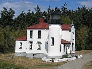
The Admiralty Head Light is a deactivated aid to navigation located on Whidbey Island near Coupeville, Island County, Washington, on the grounds of Fort Casey State Park. The restored lighthouse overlooks Admiralty Inlet. It was the companion to the Point Wilson Light, which sits four miles away on Admiralty Inlet's western shore.

Marblehead Lighthouse in Marblehead, Ohio, United States, is the oldest lighthouse in continuous operation on the American side of the Great Lakes. It has guided sailors safely along the rocky shores of Marblehead Peninsula since 1822, and is an active aid to navigation.
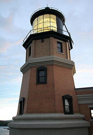
Split Rock Lighthouse is a lighthouse located southwest of Silver Bay, Minnesota, US on the North Shore of Lake Superior. The structure was designed by lighthouse engineer Ralph Russell Tinkham and was completed in 1910 by the United States Lighthouse Service for $75,000, including the buildings and the land. It is considered one of the most picturesque lighthouses in the United States.
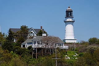
Cape Elizabeth Light is a lighthouse in Cape Elizabeth, at the southwestern entrance to Casco Bay in Maine.

The Point Wilson Light is an active aid to navigation located in Fort Worden State Park near Port Townsend, Jefferson County, Washington. It is one of the most important navigational aids in the state, overlooking the entrance to Admiralty Inlet, the waterway connecting the Strait of Juan de Fuca and Puget Sound. The lighthouse was listed on the Washington State Heritage Register and the National Register of Historic Places in 1971.

The Mukilteo Light is an operational navigation aid located on the east side of Possession Sound at Mukilteo, Snohomish County, Washington, in the United States. It is owned and operated by the City of Mukilteo as part of Mukilteo Lighthouse Park. The lighthouse is listed on the Washington State Heritage Register and was placed on the National Register of Historic Places in 1977.

The Alki Point Light is an active aid to navigation located on Puget Sound's Alki Point, the southern entrance to Seattle's Elliott Bay, King County, Washington. It is listed as Alki Point Light number 16915 in the USCG light lists.

The Burrows Island Light is a lighthouse on the western tip of Burrows Island, facing Rosario Strait, near Anacortes, in Skagit County, Washington.

The Dofflemyer Point Lighthouse is a U.S. lighthouse in Boston Harbor, Washington, and was one of the first in the state of Washington to be automated. It sits at the northeastern entrance to Budd Inlet north of Olympia. It is the southernmost light in Puget Sound and is listed on the National Register of Historic Places.

The Lime Kiln Light is a functioning navigational aid located on Lime Kiln Point overlooking Dead Man's Bay on the western side of San Juan Island, San Juan County, Washington, in the United States. It guides ships through the Haro Straits and is part of Lime Kiln Point State Park, which offers tours during summer months.
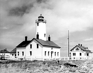
The New Dungeness Lighthouse is a functioning aid to navigation on the Strait of Juan de Fuca, located on the Dungeness Spit in the Dungeness National Wildlife Refuge near Sequim, Clallam County, in the U.S. state of Washington. It has been in continuous operation since 1857, although the current lighthouse tower is 26 feet (7.9 m) shorter than when first constructed.

Patos Island Lighthouse is an active aid to navigation overlooking the Strait of Georgia at Alden Point on the western tip of Patos Island in the San Juan Islands, San Juan County, Washington, in the United States. The station is the northernmost in the San Juan Islands and marks the division point between the eastern and western passages into the Strait of Juan de Fuca.
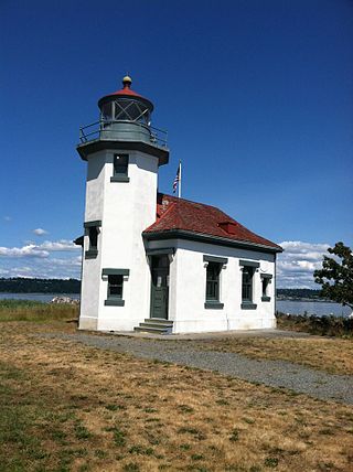
The Point Robinson Light is an operational aid to navigation and historic lighthouse on Puget Sound, located at Point Robinson, the easternmost point of Maury Island, King County, in the U.S. state of Washington. The site was listed on the National Register of Historic Places in 2004.

The Lynde Point Light or Lynde Point Lighthouse, also known as Saybrook Inner Lighthouse, is a lighthouse in Connecticut, United States, on the west side of the mouth of the Connecticut River on the Long Island Sound, Old Saybrook, Connecticut. The first light was a 35 feet (11 m) wooden tower constructed by Abisha Woodward for $2,200 and it was completed in 1803. A new lighthouse was eventually needed and a total of $7,500 was appropriated on July 7, 1838. Jonathan Scranton, Volney Pierce, and John Wilcox were contracted to build the new 65-foot (20 m) octagonal brownstone tower. It was constructed in 1838 and lit in 1839. The lighthouse was renovated in 1867 and had its keeper's house from 1833 replaced in 1858 with a Gothic Revival gambrel-roofed wood-frame house. In 1966, the house was torn down and replaced by a duplex house. The original ten lamps were replaced in 1852 with a fourth-order Fresnel lens, and with a fifth-order Fresnel lens in 1890. Lynde Point Lighthouse used whale oil until 1879 when it switched to kerosene. It was electrified in 1955 and fully automated by the United States Coast Guard in 1978. In 1990, it was added to the National Register of Historic Places and is significant for its "superior stone work in the tapering brownstone walls".

The Highland Light is an active lighthouse on the Cape Cod National Seashore in North Truro, Massachusetts. The current tower was erected in 1857, replacing two earlier towers that had been built in 1797 and 1831. It is the oldest and tallest lighthouse on Cape Cod.

Point Sur Lighthouse is a lightstation at Point Sur 24.6 miles (39.6 km) south of Monterey, California at the peak of the 361-foot (110 m) rock at the head of the point. It was established in 1889 and is part of Point Sur State Historic Park. The light house is 40 feet (12 m) tall and 270 feet (82 m) above sea level. As of 2016, and for the foreseeable future the light is still in operation as an essential aid to navigation.
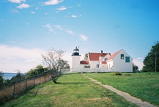
The Fort Point Light, or Fort Point Light Station, is located in Fort Point State Park, in Stockton Springs, Maine. A lighthouse at this point has served as an active aid to navigation since 1835; the present lighthouse dates to 1857, and is listed on the National Register of Historic Places.

Marshall Point Light Station is a lighthouse at the entrance of Port Clyde Harbor in Port Clyde, Maine. The light station was established in 1832.
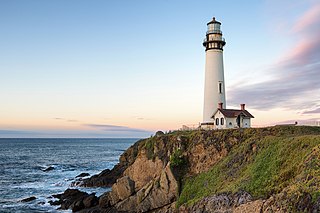
Pigeon Point Light Station or Pigeon Point Lighthouse is a lighthouse built in 1871 to guide ships on the Pacific coast of California. It is the tallest lighthouse on the West Coast of the United States. It is still an active Coast Guard aid to navigation. Pigeon Point Light Station is located on the coastal highway, 5 miles (8 km) south of Pescadero, California, between Santa Cruz and San Francisco. The 115-foot (35 m), white masonry tower, resembles the typical New England structure.


