National Register of Historic Places listings in Wahkiakum County, Washington

Last updated

Location of Wahkiakum County in Washington Map of Washington highlighting Wahkiakum County.svg
Location of Wahkiakum County in Washington

This list presents the full set of buildings, structures, objects, sites, or districts designated on the National Register of Historic Places in Wahkiakum County, Washington, and offers brief descriptive information about each of them. The National Register recognizes places of national, state, or local historic significance across the United States. [1] Out of over 90,000 National Register sites nationwide, [2] Washington is home to approximately 1,500, [3] and 5 of those are found in Wahkiakum County.

Contents


    This National Park Service list is complete through NPS recent listings posted March 4, 2022. [4]

Current listings

[5] Name on the RegisterImageDate listed [6] Location City or townDescription
1 Columbia River Gillnet Boat
Columbia River Gillnet Boat Columbia R Gillnet Boat NRHP 78002783 Wahkiakum County, WA.jpg
Columbia River Gillnet Boat
February 14, 1978
(#78002783)
Altoona Cannery
46°15′58″N123°39′15″W / 46.266111°N 123.654167°W / 46.266111; -123.654167 (Columbia River Gillnet Boat)
Altoona
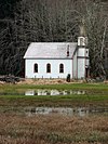
2 Deep River Pioneer Lutheran Church
Deep River Pioneer Lutheran Church Deep River Pioneer Lutheran Church 1 - Deep River Washington.jpg
Deep River Pioneer Lutheran Church
August 7, 1974
(#74001983)
N of Deep River
46°21′35″N123°40′55″W / 46.359722°N 123.681944°W / 46.359722; -123.681944 (Deep River Pioneer Lutheran Church)
Deep River
3 Grays River Covered Bridge
Grays River Covered Bridge Grays River Covered Bridge.jpg
Grays River Covered Bridge
November 23, 1971
(#71000880)
WA 4, 1.5 mi (2.4 km). E of Grays River
46°21′17″N123°34′47″W / 46.354722°N 123.579722°W / 46.354722; -123.579722 (Grays River Covered Bridge)
Grays River Historic Bridges and Tunnels in Washington TR
4 Pioneer Church
Pioneer Church Cathlamet Pioneer Church - Cathlamet Washington.jpg
Pioneer Church
April 11, 1973
(#73001893)
Alley St.
46°12′05″N123°23′01″W / 46.201422°N 123.383718°W / 46.201422; -123.383718 (Pioneer Church)
Cathlamet
5 Skamokawa Historic District
Skamokawa Historic District Over the slough in Skamokawa, Washington.jpg
Skamokawa Historic District
April 21, 1976
(#76001923)
WA 4
46°16′55″N123°26′47″W / 46.281944°N 123.446389°W / 46.281944; -123.446389 (Skamokawa Historic District)
Skamokawa

See also

References

  1. Andrus, Patrick W.; Shrimpton, Rebecca H.; et al. (2002), How to Apply the National Register Criteria for Evaluation, National Register Bulletin, National Park Service, U.S. Department of the Interior , retrieved June 20, 2014.
  2. National Park Service, National Register of Historic Places Program: Research , retrieved January 28, 2015.
  3. Department of Archaeology and Historic Preservation, Washington Information System for Architectural and Archaeological Records Data (WISAARD) , retrieved February 14, 2015.
  4. National Park Service, United States Department of the Interior, "National Register of Historic Places: Weekly List Actions", retrieved March 4, 2022.
  5. Numbers represent an alphabetical ordering by significant words. Various colorings, defined here, differentiate National Historic Landmarks and historic districts from other NRHP buildings, structures, sites or objects.
  6. The eight-digit number below each date is the number assigned to each location in the National Register Information System database, which can be viewed by clicking the number.
Map all coordinates using: OpenStreetMap  
Download coordinates as: KML