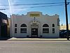
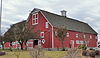
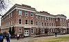
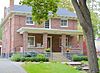
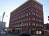
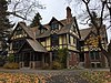
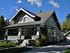
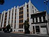
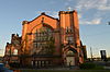
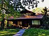
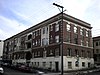
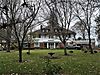
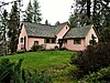
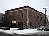
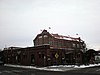
[3] Name on the Register Image Date listed [4] Location Description 1 Amman Amman February 12, 1987 (# 87000086 W. 1516 Riverside 47°39′25″N 117°26′01″W / 47.656944°N 117.433611°W / 47.656944; -117.433611 (Amman ) Built in 1904. 2 Louise Chandler Anderson House Louise Chandler Anderson House December 30, 2013 (# 13001030 3003 S. Manito Blvd. 47°37′37″N 117°24′25″W / 47.627058°N 117.406983°W / 47.627058; -117.406983 (Louise Chandler Anderson House ) 3 Alonzo and Louise Barnett House Alonzo and Louise Barnett House August 21, 2003 (# 03000809 902 W. Augusta Ave. 47°40′24″N 117°25′41″W / 47.6733175°N 117.4280022°W / 47.6733175; -117.4280022 (Alonzo and Louise Barnett House ) Built in 1903. 4 Harvey and Mary Bauer House Harvey and Mary Bauer House December 31, 2013 (# 13001031 420 W. 22nd St. 47°38′05″N 117°25′03″W / 47.634732°N 117.417632°W / 47.634732; -117.417632 (Harvey and Mary Bauer House ) 5 Dr. Robert and Jessie Bell House Dr. Robert and Jessie Bell House August 24, 2005 (# 05000921 917 S. Lincoln St. 47°38′57″N 117°25′27″W / 47.649167°N 117.424167°W / 47.649167; -117.424167 (Dr. Robert and Jessie Bell House ) Built in 1908. 6 Benewah Milk Bottle Benewah Milk Bottle August 13, 1986 (# 86001521 S. 321 Cedar 47°39′11″N 117°25′53″W / 47.653056°N 117.431389°W / 47.653056; -117.431389 (Benewah Milk Bottle ) Built in 1935. 7 J. W. Binkley House J. W. Binkley House March 31, 1989 (# 89000211 628 S. Maple 47°39′01″N 117°26′06″W / 47.650278°N 117.435°W / 47.650278; -117.435 (J. W. Binkley House ) 8 Harry and Catherine Bleeker House Harry and Catherine Bleeker House December 23, 2019 (# 100004787 1707 North West Point Rd. 47°40′22″N 117°26′45″W / 47.6729°N 117.4458°W / 47.6729; -117.4458 (Harry and Catherine Bleeker House ) 9 Breslin Breslin February 12, 1987 (# 87000095 S. 729 Bernard 47°38′56″N 117°24′54″W / 47.648889°N 117.415°W / 47.648889; -117.415 (Breslin ) Built in 1910. 10 Kenneth and Edna Brooks House Kenneth and Edna Brooks House September 15, 2004 (# 04001006 723 W. Sumner Ave. 47°38′48″N 117°25′15″W / 47.646667°N 117.420833°W / 47.646667; -117.420833 (Kenneth and Edna Brooks House ) Built in 1956. 11 Browne's Addition Historic District Browne's Addition Historic District July 30, 1976 (# 76001916 Roughly bounded by Sunset Blvd., Maple, Latah Creek, and Spokane River 47°39′19″N 117°26′30″W / 47.655278°N 117.441667°W / 47.655278; -117.441667 (Browne's Addition Historic District ) Roughly bounded by Sunset Blvd., Maple, Latah Creek, and Spokane River 12 Bump Block-Bellevue House-Hawthorne Hotel Bump Block-Bellevue House-Hawthorne Hotel August 10, 2000 (# 00000977 S 206 Post St. 47°39′16″N 117°25′22″W / 47.654444°N 117.422778°W / 47.654444; -117.422778 (Bump Block-Bellevue House-Hawthorne Hotel ) Built in 1890. 13 Cambern Dutch Shop Windmill Cambern Dutch Shop Windmill March 16, 1989 (# 89000213 S. 1102 Perry 47°38′43″N 117°23′20″W / 47.645278°N 117.388889°W / 47.645278; -117.388889 (Cambern Dutch Shop Windmill ) Built circa 1929. 14 Campbell House Campbell House May 31, 1974 (# 74001979 W. 2316 1st Ave. 47°39′25″N 117°26′45″W / 47.656944°N 117.445833°W / 47.656944; -117.445833 (Campbell House ) Built in 1898, this house is now part of the Northwest Museum of Arts and Culture . 15 George and Nellie Canfield House George and Nellie Canfield House December 29, 2014 (# 14001109 1301 N. Sherwood St. 47°40′08″N 117°27′23″W / 47.6690°N 117.4565°W / 47.6690; -117.4565 (George and Nellie Canfield House ) 16 Central Steam Heat Plant Central Steam Heat Plant December 13, 1996 (# 96001492 152 S. Post St. and 815 W. Railroad Ave. 47°39′20″N 117°25′23″W / 47.655556°N 117.423056°W / 47.655556; -117.423056 (Central Steam Heat Plant ) Built in 1916. 17 George and Blanche Christiansen House George and Blanche Christiansen House December 8, 2015 (# 15000881 1329 E. Overbluff Rd. 47°38′09″N 117°23′25″W / 47.635796°N 117.390333°W / 47.635796; -117.390333 (George and Blanche Christiansen House ) 18 City Ramp Garage City Ramp Garage December 26, 2012 (# 12001099 430 W. 1st Ave. 47°39′24″N 117°25′10″W / 47.656716°N 117.419325°W / 47.656716; -117.419325 (City Ramp Garage ) 19 Patsy Clark Mansion Patsy Clark Mansion October 31, 1975 (# 75001873 W. 2208 2nd Ave. 47°39′19″N 117°26′39″W / 47.655278°N 117.444167°W / 47.655278; -117.444167 (Patsy Clark Mansion ) 20 Coeur d'Alene Park Coeur d'Alene Park December 12, 2018 (# 100003228 2111 W 2nd Ave. 47°39′13″N 117°26′41″W / 47.6536°N 117.4447°W / 47.6536; -117.4447 (Coeur d'Alene Park ) 21 Columbia Building Columbia Building February 3, 2020 (# 100004960 107 South Howard St. 47°39′23″N 117°25′16″W / 47.6564°N 117.4211°W / 47.6564; -117.4211 (Columbia Building ) 22 Clemmer Theater Clemmer Theater December 1, 1988 (# 88002758 W. 901 Sprague Ave. 47°39′26″N 117°25′26″W / 47.6572°N 117.4239°W / 47.6572; -117.4239 (Clemmer Theater ) Built circa 1915; also known as the Bing Crosby Theater 23 Commercial Block Commercial Block October 15, 1993 (# 93001103 1111-1119 First Ave. W. 47°39′24″N 117°25′39″W / 47.6567°N 117.4275°W / 47.6567; -117.4275 (Commercial Block ) Built in 1906. 24 Coolidge-Rising House Coolidge-Rising House May 19, 1988 (# 88000598 W. 1405 Ninth Ave. 47°38′50″N 117°25′54″W / 47.6472°N 117.4317°W / 47.6472; -117.4317 (Coolidge-Rising House ) Built circa 1906. 25 Corbet-Aspray House Corbet-Aspray House November 30, 1999 (# 99001454 820 W. 7th Ave. 47°38′59″N 117°25′22″W / 47.6497°N 117.4228°W / 47.6497; -117.4228 (Corbet-Aspray House ) Built in 1908. 26 Corbin Park Historic District Corbin Park Historic District November 12, 1992 (# 92001584 Waverly Pl. (W205-733), Park Pl. (W203-738), W. Oval and E. Oval 47°41′06″N 117°25′03″W / 47.685°N 117.4175°W / 47.685; -117.4175 (Corbin Park Historic District ) 27 Daniel C. and Anna Corbin House Daniel C. and Anna Corbin House May 10, 2004 (# 04000157 507 W. Seventh Ave. 47°39′02″N 117°25′11″W / 47.6506°N 117.4197°W / 47.6506; -117.4197 (Daniel C. and Anna Corbin House ) Built in 1898. 28 Cowley Park Cowley Park February 6, 1973 (# 73001891 S. Division St. between 6th and 7th Aves. 47°38′58″N 117°24′39″W / 47.6494°N 117.4108°W / 47.6494; -117.4108 (Cowley Park ) Built in 1917 29 The Davenport Hotel The Davenport Hotel September 5, 1975 (# 75001874 807 W. Sprague 47°39′26″N 117°25′23″W / 47.6572°N 117.4231°W / 47.6572; -117.4231 (The Davenport Hotel ) Built in 1914. 30 Desmet Avenue Warehouse Historic District Desmet Avenue Warehouse Historic District May 27, 1997 (# 97000450 Roughly, N side of Desmet Ave., from Pearl St. to US 395-2 47°40′04″N 117°24′30″W / 47.6678°N 117.4083°W / 47.6678; -117.4083 (Desmet Avenue Warehouse Historic District ) 31 Dodd House Dodd House July 3, 2010 (# 10000417 603 S. Arthur St. 47°39′03″N 117°23′41″W / 47.6508°N 117.3947°W / 47.6508; -117.3947 (Dodd House ) 32 Dodson Building Dodson Building January 29, 2021 (# 100006068 218-220 North Bernard St. 47°39′35″N 117°24′58″W / 47.6597°N 117.4160°W / 47.6597; -117.4160 (Dodson Building ) 33 East Downtown Historic District East Downtown Historic District August 29, 2003 (# 03000860 Roughly bounded by Main Ave., Second Ave., Division St., and Post St. 47°39′24″N 117°25′05″W / 47.6567°N 117.4181°W / 47.6567; -117.4181 (East Downtown Historic District ) 34 Gus and Florence Ehrenberg House Gus and Florence Ehrenberg House August 16, 2007 (# 07000832 1304 S. Cook St. 47°38′43″N 117°22′25″W / 47.6453°N 117.3736°W / 47.6453; -117.3736 (Gus and Florence Ehrenberg House ) Built in 1911. 35 Eldridge Building Eldridge Building November 12, 1992 (# 92001588 1319-1325 W. First Ave. 47°39′24″N 117°25′51″W / 47.6567°N 117.4308°W / 47.6567; -117.4308 (Eldridge Building ) Built circa 1925. 36 Empire State Building Empire State Building August 18, 1977 (# 77001361 W. 901 Riverside St. 47°39′28″N 117°25′27″W / 47.6578°N 117.4242°W / 47.6578; -117.4242 (Empire State Building ) Built circa 1900, this is also known as the Great Western Building. 37 Fairmont Hotel Fairmont Hotel September 18, 2001 (# 01001204 315 W. Riverside Ave., 314 W. Sprague Ave. 47°39′27″N 117°25′00″W / 47.6575°N 117.4167°W / 47.6575; -117.4167 (Fairmont Hotel ) 38 Felts Field Historic District Felts Field Historic District September 24, 1991 (# 91001442 Roughly, Rutter Ave. between Fancher and Dollar Rds. 47°40′50″N 117°19′15″W / 47.6806°N 117.3208°W / 47.6806; -117.3208 (Felts Field Historic District ) 39 Finch House Finch House July 12, 1976 (# 76001917 W. 2340 1st Ave., S. 104 Poplar 47°39′27″N 117°26′48″W / 47.6575°N 117.4467°W / 47.6575; -117.4467 (Finch House ) Built circa 1897, this home was designed by Kirtland Cutter & Karl G. Malmgren of Cutter & Malmgren . 40 John A. Finch Memorial Nurses Home John A. Finch Memorial Nurses Home May 28, 1991 (# 91000631 N. 852 Summit Blvd. 47°39′57″N 117°27′16″W / 47.6658°N 117.4544°W / 47.6658; -117.4544 (John A. Finch Memorial Nurses Home ) Built in 1929. 41 John A. Finch School John A. Finch School January 8, 2014 (# 13001061 3717 N. Milton St. 47°41′32″N 117°27′10″W / 47.6922°N 117.4528°W / 47.6922; -117.4528 (John A. Finch School ) 42 First Congregational Church of Spokane First Congregational Church of Spokane April 26, 1978 (# 78002775 W. 311-329 4th Ave. 47°39′08″N 117°24′59″W / 47.652222°N 117.416389°W / 47.652222; -117.416389 (First Congregational Church of Spokane ) Built in 1890. 43 Five Mile Prairie School Five Mile Prairie School September 9, 2004 (# 04000952 8621 N. Five Mile Rd. 47°44′19″N 117°27′16″W / 47.738611°N 117.454444°W / 47.738611; -117.454444 (Five Mile Prairie School ) Built in 1939. 44 Fort George Wright Historic District Fort George Wright Historic District May 17, 1976 (# 76001918 W. 4000 Randolph Rd. 47°40′42″N 117°28′27″W / 47.678333°N 117.474167°W / 47.678333; -117.474167 (Fort George Wright Historic District ) Founded in 1897. 45 Fox Theater Fox Theater November 30, 2001 (# 01001287 1005 W. Sprague Ave. 47°39′25″N 117°25′34″W / 47.656944°N 117.426111°W / 47.656944; -117.426111 (Fox Theater ) Built in 1931, this theater was remodeled and renamed the Martin Woldson Theater at the Fox in 2007. 46 Franklin Elementary School Franklin Elementary School May 1, 2017 (# 100000946 2627 E. 17th Ave. 47°38′26″N 117°22′17″W / 47.640535°N 117.371277°W / 47.640535; -117.371277 (Franklin Elementary School ) 47 Frequency Changing Station Frequency Changing Station June 19, 1979 (# 79002556 E. 1420 Celesta Ave. 47°39′06″N 117°23′14″W / 47.651667°N 117.387222°W / 47.651667; -117.387222 (Frequency Changing Station ) Built in 1908. 48 W. P. Fuller and Company Warehouse W. P. Fuller and Company Warehouse January 11, 1996 (# 95001529 E. 111 and E. 115 Desmet 47°40′03″N 117°24′27″W / 47.6675°N 117.4075°W / 47.6675; -117.4075 (W. P. Fuller and Company Warehouse ) Built circa 1915. 49 Garland Theater Garland Theater December 24, 2013 (# 13000999 924 W. Garland Ave. 47°41′38″N 117°25′32″W / 47.693898°N 117.425587°W / 47.693898; -117.425587 (Garland Theater ) Part of the Movie Theaters in Washington State MPS 50 Germond Block Germond Block January 8, 2014 (# 13001062 830 W. Sprague Ave. 47°39′27″N 117°25′29″W / 47.657386°N 117.424723°W / 47.657386; -117.424723 (Germond Block ) 51 The Globe Hotel The Globe Hotel December 17, 1998 (# 97001080 204 N. Division St. 47°39′34″N 117°24′35″W / 47.659444°N 117.409722°W / 47.659444; -117.409722 (The Globe Hotel ) Built in 1908. 52 Glover House Glover House August 14, 1973 (# 73001892 W. 321 8th Ave. 47°38′54″N 117°24′57″W / 47.648333°N 117.415833°W / 47.648333; -117.415833 (Glover House ) Built circa 1888, this home was designed by Kirtland Cutter. 53 Grace Baptist Church Grace Baptist Church October 2, 1992 (# 92001289 1527 W. Mallon St. 47°39′55″N 117°26′03″W / 47.665278°N 117.434167°W / 47.665278; -117.434167 (Grace Baptist Church ) Built in 1908. 54 Hill–Hilscher House Hill–Hilscher House January 8, 2014 (# 13001063 1638 S. Cedar St. 47°38′22″N 117°25′58″W / 47.639576°N 117.432784°W / 47.639576; -117.432784 (Hill–Hilscher House ) 55 Hillyard High School Hillyard High School August 24, 2005 (# 05000920 5313 N. Regal St. 47°42′23″N 117°22′04″W / 47.706389°N 117.367778°W / 47.706389; -117.367778 (Hillyard High School ) Built in 1912, the building was converted to apartments in the 1940s. 56 Hillyard Historic Business District Hillyard Historic Business District August 9, 2002 (# 02000860 N. 4912-5220 Market St., E. 3108-3117 Olympic Ave. 47°42′15″N 117°21′49″W / 47.704167°N 117.363611°W / 47.704167; -117.363611 (Hillyard Historic Business District ) 57 Holley-Mason Building Holley-Mason Building October 13, 1983 (# 83004262 S. 157 Howard 47°39′19″N 117°25′12″W / 47.655278°N 117.42°W / 47.655278; -117.42 (Holley-Mason Building ) Built circa 1905. 58 Holy Names Academy Building Holy Names Academy Building May 2, 1986 (# 86000959 1216 N. Superior St. 47°40′08″N 117°23′28″W / 47.668889°N 117.391111°W / 47.668889; -117.391111 (Holy Names Academy Building ) Built in 1891. 59 Hotel Upton Hotel Upton July 29, 1994 (# 94000798 S. 106 Cedar St. 47°38′52″N 117°25′54″W / 47.647778°N 117.431667°W / 47.647778; -117.431667 (Hotel Upton ) Built in 1910, this is also known as the Grand Coulee Building. 60 Hutton Building Hutton Building January 27, 1983 (# 83004037 9 S. Washington St. 47°39′25″N 117°25′00″W / 47.656944°N 117.416667°W / 47.656944; -117.416667 (Hutton Building ) Built circa 1907. 61 Hutton Settlement Hutton Settlement January 1, 1976 (# 76001919 9907 Wellesley 47°42′00″N 117°15′53″W / 47.7°N 117.264722°W / 47.7; -117.264722 (Hutton Settlement ) 62 Levi and May Arkwright Hutton House Levi and May Arkwright Hutton House February 21, 2002 (# 02000088 2206 W. 17th Ave. 47°38′24″N 117°22′40″W / 47.64°N 117.377778°W / 47.64; -117.377778 (Levi and May Arkwright Hutton House ) Built in 1914, this was the home of May Arkwright . 63 Kemp & Hebert Building Kemp & Hebert Building July 1, 1994 (# 94000660 404 W. Main Ave. 47°39′35″N 117°25′03″W / 47.659722°N 117.4175°W / 47.659722; -117.4175 (Kemp & Hebert Building ) Built in 1908. 64 Kiesow-Gentsch House Kiesow-Gentsch House January 7, 2015 (# 14001144 618 W. 23rd Ave. 47°38′02″N 117°25′17″W / 47.6338°N 117.4215°W / 47.6338; -117.4215 (Kiesow-Gentsch House ) 65 Knickerbocker Knickerbocker February 12, 1987 (# 87000096 S. 501-507 Howard 47°39′05″N 117°25′10″W / 47.651389°N 117.419444°W / 47.651389; -117.419444 (Knickerbocker ) Built in 1912. 66 Knight House Knight House November 30, 1999 (# 99001459 1715 N. West Point Rd. 47°40′28″N 117°26′41″W / 47.674444°N 117.444722°W / 47.674444; -117.444722 (Knight House ) Built in 1910. 67 Koerner House Koerner House July 28, 1999 (# 99000915 1824 S. Mount Vernon St. 47°38′20″N 117°22′11″W / 47.638889°N 117.369722°W / 47.638889; -117.369722 (Koerner House ) Built in 1912. 68 Levesque-Majer House Levesque-Majer House January 14, 2015 (# 14001162 1708 S. Maple Blvd. 47°38′20″N 117°26′03″W / 47.6389°N 117.4342°W / 47.6389; -117.4342 (Levesque-Majer House ) 69 Lewis and Clark High School Lewis and Clark High School December 6, 1990 (# 90001860 W. 521 4th Ave. 47°39′08″N 117°25′09″W / 47.652222°N 117.419167°W / 47.652222; -117.419167 (Lewis and Clark High School ) 70 Littlebrook Littlebrook July 26, 1996 (# 96000840 16704 N. Dartford Dr. 47°48′36″N 117°24′29″W / 47.81°N 117.408056°W / 47.81; -117.408056 (Littlebrook ) Built in 1905. 71 Manito Park and Boulevard Manito Park and Boulevard December 15, 2015 (# 15000909 1702 S. Grand Blvd. 47°38′07″N 117°24′30″W / 47.635316°N 117.408342°W / 47.635316; -117.408342 (Manito Park and Boulevard ) 72 Marycliff-Cliff Park Historic District Marycliff-Cliff Park Historic District December 21, 1979 (# 79002557 Roughly bounded by Lincoln St., 7th, 12th, and 14th Aves. 47°38′46″N 117°25′06″W / 47.646111°N 117.418333°W / 47.646111; -117.418333 (Marycliff-Cliff Park Historic District ) 73 McKinley School McKinley School December 7, 2018 (# 100003257 117 N Napa St. 47°39′31″N 117°22′53″W / 47.6587°N 117.3813°W / 47.6587; -117.3813 (McKinley School ) 74 McMillen-Dyar House McMillen-Dyar House August 26, 2019 (# 100004330 526 E 12th Ave. 47°38′39″N 117°24′11″W / 47.6442°N 117.4031°W / 47.6442; -117.4031 (McMillen-Dyar House ) 75 Gustav Meese Building Gustav Meese Building February 16, 1996 (# 96000049 1727 Sinto Ave. 47°40′11″N 117°26′13″W / 47.669722°N 117.436944°W / 47.669722; -117.436944 (Gustav Meese Building ) 76 Miller Block Miller Block May 4, 1998 (# 98000370 808 W. Sprague Ave. 47°39′28″N 117°25′22″W / 47.657778°N 117.422778°W / 47.657778; -117.422778 (Miller Block ) Built circa 1890. 77 Mission Avenue Historic District Mission Avenue Historic District August 14, 1986 (# 86002644 E. 220-824 Mission Ave. 47°40′19″N 117°24′04″W / 47.671944°N 117.401111°W / 47.671944; -117.401111 (Mission Avenue Historic District ) 78 Dr. Hans & Rosaleen Moldenhauer House Dr. Hans & Rosaleen Moldenhauer House June 4, 2024 (# 100010388 808 S. Lincoln St. 47°38′53″N 117°25′29″W / 47.6481°N 117.4247°W / 47.6481; -117.4247 (Dr. Hans & Rosaleen Moldenhauer House ) 78 Monroe Street Bridge Monroe Street Bridge May 13, 1976 (# 76001920 Monroe St. between Ide Ave. and Riverfalls Blvd. 47°39′40″N 117°25′32″W / 47.661111°N 117.425556°W / 47.661111; -117.425556 (Monroe Street Bridge ) Built in 1911, this bridge had the longest concrete span in the US when it was built. 79 Montvale Block Montvale Block April 13, 1998 (# 98000369 1001-1009 W. First Ave. 47°39′24″N 117°25′31″W / 47.656667°N 117.425278°W / 47.656667; -117.425278 (Montvale Block ) Built in 1899 and also known as the Montvale Hotel, the building was renovated and reopened in 2005, after 25 years of vacancy. 80 Mount Saint Michael Mount Saint Michael May 5, 2000 (# 00000456 8500 N. Saint Michael Rd. 47°43′55″N 117°20′21″W / 47.731944°N 117.339167°W / 47.731944; -117.339167 (Mount Saint Michael ) Built in 1916. 81 Muzzy-Shine House Muzzy-Shine House December 20, 2010 (# 10001045 1506 W. Mission Ave. 47°40′18″N 117°24′51″W / 47.671667°N 117.414167°W / 47.671667; -117.414167 (Muzzy-Shine House ) 82 Natatorium Carousel Natatorium Carousel September 19, 1977 (# 77001362 Spokane Falls Blvd. 47°39′39″N 117°25′10″W / 47.660833°N 117.419444°W / 47.660833; -117.419444 (Natatorium Carousel ) Built circa 1909 and also known as the Natatorium Carousel, this carousel was designed by Charles I. D. Looff and moved from Natatorium Park to its current site at Riverfront Park in 1975. 83 Nettleton's Addition Historic District Nettleton's Addition Historic District March 22, 2006 (# 06000176 Area bounded by W. Summit, Mission, N Summit, A St. Bridge, and Chestnut 47°40′08″N 117°26′34″W / 47.668889°N 117.442778°W / 47.668889; -117.442778 (Nettleton's Addition Historic District ) Established in 1887. 84 Ninth Avenue Historic District Ninth Avenue Historic District July 21, 1994 (# 94000679 Roughly bounded by 7th Ave., Monroe St., 12th Ave. and the Burlington Northern RR tracks 47°38′51″N 117°26′02″W / 47.6475°N 117.433889°W / 47.6475; -117.433889 (Ninth Avenue Historic District ) 85 Otis Hotel Otis Hotel October 2, 1998 (# 98001227 1101-1109 W. First 47°39′24″N 117°25′38″W / 47.656667°N 117.427222°W / 47.656667; -117.427222 (Otis Hotel ) Built in 1911. 86 Eben and Cynthia Palmer Farmstead Eben and Cynthia Palmer Farmstead January 14, 2015 (# 14001163 6616 E. Orchard Rd. 47°44′18″N 117°18′55″W / 47.7383°N 117.3152°W / 47.7383; -117.3152 (Eben and Cynthia Palmer Farmstead ) 87 Peaceful Valley Historic District Peaceful Valley Historic District April 19, 1984 (# 84003617 Roughly bounded by the Spokane River, Wilson Ave., Elm, and Cedar Sts. 47°39′32″N 117°26′03″W / 47.658889°N 117.434167°W / 47.658889; -117.434167 (Peaceful Valley Historic District ) 88 Peyton Building and Peyton Annex Peyton Building and Peyton Annex March 15, 2005 (# 05000191 722 W. Sprague Ave./10 N. Post St. 47°39′34″N 117°25′24″W / 47.659444°N 117.423333°W / 47.659444; -117.423333 (Peyton Building and Peyton Annex ) Built in 1898 and 1908. 89 Victor & Jean Piollet House Victor & Jean Piollet House December 13, 2010 (# 10001019 606 W. 16th Ave. 47°38′28″N 117°25′15″W / 47.641111°N 117.420833°W / 47.641111; -117.420833 (Victor & Jean Piollet House ) 90 John and Mary Ralston House John and Mary Ralston House December 3, 2002 (# 02001488 2421 W. Mission Ave. 47°40′17″N 117°26′53″W / 47.671389°N 117.448056°W / 47.671389; -117.448056 (John and Mary Ralston House ) Built in 1900. 91 Review Building Review Building February 24, 1975 (# 75001875 SE corner, Riverside Ave. and Monroe St. 47°39′28″N 117°25′31″W / 47.657778°N 117.425278°W / 47.657778; -117.425278 (Review Building ) Built in 1890. 92 Royal Riblet House Royal Riblet House March 26, 1979 (# 79002558 East of Spokane on Fruit Hill Rd. 47°41′52″N 117°14′57″W / 47.697778°N 117.249167°W / 47.697778; -117.249167 (Royal Riblet House ) Built in 1925. 93 Richardson-Jackson House Richardson-Jackson House March 22, 2006 (# 06000178 1226 N. Summit Blvd. 47°40′13″N 117°27′29″W / 47.670278°N 117.458056°W / 47.670278; -117.458056 (Richardson-Jackson House ) Built in 1906. 94 Ridpath Hotel Ridpath Hotel December 24, 2013 (# 13001000 515 W. Sprague Ave. 47°39′25″N 117°25′13″W / 47.656861°N 117.420388°W / 47.656861; -117.420388 (Ridpath Hotel ) 95 Riverside Avenue Historic District Riverside Avenue Historic District July 30, 1976 (# 76001921 Riverside Ave. 47°39′27″N 117°25′44″W / 47.6575°N 117.428889°W / 47.6575; -117.428889 (Riverside Avenue Historic District ) 96 Robinwood Apartments Robinwood Apartments March 30, 2005 (# 05000248 209-223 West Ninth Ave. 47°38′57″N 117°24′54″W / 47.649167°N 117.415°W / 47.649167; -117.415 (Robinwood Apartments ) Built in 1939. 97 Rockwood Historic District Rockwood Historic District April 14, 1997 (# 97000320 Roughly, Rockwood Blvd. from 11th to 29th Aves. 47°38′12″N 117°23′56″W / 47.636667°N 117.398889°W / 47.636667; -117.398889 (Rockwood Historic District ) 98 John R. Rogers High School John R. Rogers High School December 29, 2010 (# 10001104 1622 E. Wellesley Ave. 47°47′58″N 117°23′09″W / 47.799444°N 117.385833°W / 47.799444; -117.385833 (John R. Rogers High School ) 99 Roosevelt Apartments Roosevelt Apartments August 10, 2000 (# 00000969 524 W. Seventh Ave. 47°38′59″N 117°24′59″W / 47.649722°N 117.416389°W / 47.649722; -117.416389 (Roosevelt Apartments ) Built in 1929. 100 Rosebush House Rosebush House November 22, 2000 (# 00001446 3318 N. Marguerite Rd. 47°41′15″N 117°17′02″W / 47.6875°N 117.283889°W / 47.6875; -117.283889 (Rosebush House ) 101 Salvation Army Building Salvation Army Building November 22, 2000 (# 00001445 245 W. Main Ave. 47°39′32″N 117°24′53″W / 47.658889°N 117.414722°W / 47.658889; -117.414722 (Salvation Army Building ) Built in 1921. 102 San Marco San Marco February 12, 1987 (# 87000090 W. 1229 Riverside 47°39′27″N 117°25′48″W / 47.6575°N 117.43°W / 47.6575; -117.43 (San Marco ) Built in 1904. 103 Schade Brewery Schade Brewery December 8, 1994 (# 94001441 E. 528 Trent Ave. 47°39′40″N 117°24′05″W / 47.661111°N 117.401389°W / 47.661111; -117.401389 (Schade Brewery ) Originally built 1902-03, additional construction was in 1907 and 1934–1937. 104 Sears, Roebuck Department Store Sears, Roebuck Department Store June 4, 1991 (# 91000629 W. 902 Main Ave. 47°39′34″N 117°25′28″W / 47.659444°N 117.424444°W / 47.659444; -117.424444 (Sears, Roebuck Department Store ) Built in 1929 and also known as the Comstock Library, this art deco building was demolished in 1992. 105 Seehorn-Lang Building Seehorn-Lang Building January 23, 1998 (# 97001674 151-165 S. Lincoln St. 47°39′20″N 117°25′25″W / 47.655556°N 117.423611°W / 47.655556; -117.423611 (Seehorn-Lang Building ) 106 William O. and Stella M. Seligman House William O. and Stella M. Seligman House December 16, 2014 (# 14001054 2203 S. Manito Blvd. 47°38′03″N 117°24′27″W / 47.6343°N 117.4074°W / 47.6343; -117.4074 (William O. and Stella M. Seligman House ) 107 Edwin A. Smith House Edwin A. Smith House August 23, 1985 (# 85001808 N. 1414 Summit Blvd. 47°40′14″N 117°27′19″W / 47.670556°N 117.455278°W / 47.670556; -117.455278 (Edwin A. Smith House ) Built circa 1912. 108 William and Margaret Solby House William and Margaret Solby House August 16, 2007 (# 07000831 1325 E. 20th Ave. 47°38′20″N 117°23′25″W / 47.638889°N 117.390278°W / 47.638889; -117.390278 (William and Margaret Solby House ) Built in 1926. 109 Spokane City Hall Building Spokane City Hall Building February 21, 1985 (# 85000350 N. 221 Wall St. and W. 711 Spokane Falls Blvd. 47°39′35″N 117°25′18″W / 47.659722°N 117.421667°W / 47.659722; -117.421667 (Spokane City Hall Building ) Built 1912-13, this was planned to be a "temporary" city hall, but functioned in this capacity for 70 years. 110 Spokane Club Building-Legion Building Spokane Club Building-Legion Building August 8, 1994 (# 94000800 108 N. Washington St. 47°39′30″N 117°25′00″W / 47.658333°N 117.416667°W / 47.658333; -117.416667 (Spokane Club Building-Legion Building ) Built in 1901 and designed by John K. Dow. 111 Spokane County Courthouse Spokane County Courthouse January 21, 1974 (# 74001980 W. 1116 Broadway 47°39′54″N 117°25′40″W / 47.665°N 117.427778°W / 47.665; -117.427778 (Spokane County Courthouse ) Built 1894-95 and designed by Willis Ritchie . 112 Spokane Fire Station No. 3 Spokane Fire Station No. 3 December 9, 1994 (# 94001439 1229 N. Monroe St. 47°40′09″N 117°25′33″W / 47.669167°N 117.425833°W / 47.669167; -117.425833 (Spokane Fire Station No. 3 ) 113 Spokane Flour Mill Spokane Flour Mill February 8, 1978 (# 78002778 W. 621 Mallon Ave. 47°39′45″N 117°25′13″W / 47.6625°N 117.420278°W / 47.6625; -117.420278 (Spokane Flour Mill ) Built in 1895, but did not begin operation until 1900 due to legal issues. 114 Spokane & Inland Empire Railroad Car Facility Spokane & Inland Empire Railroad Car Facility September 10, 2010 (# 10000749 800 E. Spokane Falls Blvd. 47°39′42″N 117°23′52″W / 47.661667°N 117.397778°W / 47.661667; -117.397778 (Spokane & Inland Empire Railroad Car Facility ) 115 Spokane Public Library Spokane Public Library August 3, 1982 (# 82004292 925 W. Montgomery St. 47°40′42″N 117°25′31″W / 47.678333°N 117.425278°W / 47.678333; -117.425278 (Spokane Public Library ) Carnegie Libraries of Washington TR 116 Spokane Public Library Spokane Public Library August 3, 1982 (# 82004291 525 Mission St. 47°40′20″N 117°24′02″W / 47.672222°N 117.400556°W / 47.672222; -117.400556 (Spokane Public Library ) Built circa 1913. 117 Spokane Public Library Spokane Public Library August 3, 1982 (# 82004290 25 Altamont St. 47°39′24″N 117°22′26″W / 47.656667°N 117.373889°W / 47.656667; -117.373889 (Spokane Public Library ) Carnegie Libraries of Washington TR 118 Spokane Public Library Spokane Public Library August 3, 1982 (# 82004910 10 S. Cedar 47°39′25″N 117°25′54″W / 47.656944°N 117.431667°W / 47.656944; -117.431667 (Spokane Public Library ) Carnegie Libraries of Washington TR 119 Spokane Sash and Door Company Flats Spokane Sash and Door Company Flats August 24, 2005 (# 05000924 1302-1312 W Broadway Ave. 47°40′00″N 117°25′52″W / 47.666667°N 117.431111°W / 47.666667; -117.431111 (Spokane Sash and Door Company Flats ) Built in 1909 and designed by Kirtland Cutter. 120 Sunset Boulevard Bridge Sunset Boulevard Bridge July 16, 1982 (# 82004293 Spans Latah Creek 47°39′00″N 117°26′48″W / 47.65°N 117.446667°W / 47.65; -117.446667 (Sunset Boulevard Bridge ) Built 1911-14. 121 Dr. Charles and Elsie Thomas House Dr. Charles and Elsie Thomas House August 15, 2007 (# 07000834 1212 N. Summit Blvd. 47°40′12″N 117°27′28″W / 47.67°N 117.457778°W / 47.67; -117.457778 (Dr. Charles and Elsie Thomas House ) Built in 1907. 122 Frank and Maude Tuell House Frank and Maude Tuell House August 9, 2006 (# 06000702 416 W. 22nd Ave. 47°38′12″N 117°25′03″W / 47.636667°N 117.4175°W / 47.636667; -117.4175 (Frank and Maude Tuell House ) 123 Luther P. and Jane Marie Turner House Luther P. and Jane Marie Turner House December 23, 2003 (# 03001343 E. 1521 Illinois Ave 47°40′47″N 117°22′20″W / 47.679722°N 117.372222°W / 47.679722; -117.372222 (Luther P. and Jane Marie Turner House ) Built in 1916. 124 US Post Office, Courthouse, and Custom House US Post Office, Courthouse, and Custom House December 8, 1983 (# 83004269 904 W. Riverside Ave. 47°39′30″N 117°25′31″W / 47.6582°N 117.4254°W / 47.6582; -117.4254 (US Post Office, Courthouse, and Custom House ) 125 William and Ella Warner House William and Ella Warner House December 23, 2019 (# 100004788 2627 South Manito Blvd. 47°37′48″N 117°24′26″W / 47.6301°N 117.4073°W / 47.6301; -117.4073 (William and Ella Warner House ) 126 Washington Street Bridge Washington Street Bridge July 16, 1982 (# 82004294 Spanned Spokane River 47°39′48″N 117°25′01″W / 47.663333°N 117.416944°W / 47.663333; -117.416944 (Washington Street Bridge ) Built in 1908, this bridge was the oldest of its type in Washington when it was demolished in 1983. 127 Lawrence and Lydia Weaver House Lawrence and Lydia Weaver House March 13, 2002 (# 02000186 520 W. 16th Ave. 47°38′29″N 117°25′07″W / 47.641389°N 117.418611°W / 47.641389; -117.418611 (Lawrence and Lydia Weaver House ) Built in 1910. 128 West Downtown Historic Transportation Corridor West Downtown Historic Transportation Corridor December 30, 1999 (# 99001631 Roughly bounded 2nd Ave., Maple St., Sprague Ave., and Howard St. 47°39′22″N 117°25′40″W / 47.656111°N 117.427778°W / 47.656111; -117.427778 (West Downtown Historic Transportation Corridor ) 129 Whitten Block Whitten Block May 14, 1993 (# 93000362 N. 1 Post St. 47°39′28″N 117°25′22″W / 47.657778°N 117.422778°W / 47.657778; -117.422778 (Whitten Block ) Built 1889-90, it is also known as Hamer's, currently houses the Hotel Lusso. 130 Ralston and Sarah Wilbur House Ralston and Sarah Wilbur House March 15, 2006 (# 06000136 2525 E. 19th Ave. 47°38′26″N 117°22′18″W / 47.640556°N 117.371667°W / 47.640556; -117.371667 (Ralston and Sarah Wilbur House ) Built in 1916. 131 James and Corinne Williams House James and Corinne Williams House December 23, 2003 (# 03001344 1225 W. 19th Ave. 47°38′16″N 117°25′44″W / 47.637778°N 117.428889°W / 47.637778; -117.428889 (James and Corinne Williams House ) Built in 1911.