Muttippalam is a small town near Manjeri in the Malappuram District of Kerala in India. It is on the Manjeri–Malappuram road, about 3 km away from Manjeri.
Melangadi is a small town near to Calicut Airport and Kondotty town in Malappuram district, Kerala state, India. The name came since it is located on a small hill half a kilometer from Kondotty. In the Malayalam language the "mele" means "up" and "angadi" means "town", and hence the name Melangadi.
Ananthavoor is a village in the Malappuram District of the state of Kerala, India.
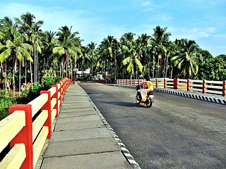
Valapuram is a small village which exists as a part of Kuruvambalam village. It is in Pulamanthole grama panchayath of Malappuram District, Kerala. It is situated on the banks of the Kunthipuzha River. The river separates Malappuram and Palakkad districts, a new bridge has been built across it at Valapuram. The nearest towns are Perinthalmanna(18 km), Valanchery (16 km), Pattambi (17 km), Pulamanthol (6 km), and Kulathur (5 km).
Theyyala is a small town in Malappuram district in Kerala, India. Theyyala is near the sea with the beach being only 5 km away. The nearest Railway station is at Tanur which is 4 km away. The nearest airport is Calicut International Airport, at a distance of 25 km, approximately. The nearest city is Tirur which is only 9 km away and so is Kottakkal which is famous worldwide for Ayurvedic Treatments.

Alathiyur is a village in the Tirur taluk of Malappuram district, and it is a growing suburban area of Tirur Town Kerala, India. Alathiyur is located 6 km south of Tirur on the road towards Ponnani. Govinda Bhattathiri, a legendary figure in the Kerala astrological traditions, was born in this village in 1237 CE.
Pacheeripara is a village situated in Malappuram District, Kerala, India. Pacheeripara is a place with many rocks.
Vellarangal is a location in Manjeri Municipality in Malappuram district of Kerala State of south India.
Santhigram is a location in Manjeri municipality in Malappuram district of Kerala State of south India.
Chelamala is a hilly village in Malappuram district in Kerala. It is located about 20 kilometres (12 mi) east of the city of Malappuram.
Paravakkal is a town in the Kadungapuram village of the Puzhakkattiri panchayath, located in the Malappuram district, in the state of Kerala, southeast India. It was the homeland of Valluvanad, an erstwhile kingdom in Malabar. Perinthalmanna, Malappuram, and Kottakkal are some of the major towns nearby.
Pariyangadu is a village near Anchachavadi in Kalikavu Panchayat, Nilambur taluk in Malappuram district in the state of Kerala. The total population is 26,795.
Pang is a village in Malappuram district in the state of Kerala, India.
Kozhichena is a village in Malappuram district, Kerala, India.
Payyanad is a place located in Manjeri municipality of Malappuram district of Kerala. Payyanad football stadium located in Payyanad
Karinkallathani is a village in Perinthalmanna taluk of the Malappuram district of the Indian state of Kerala.

Thiruthiyad is a scenic village near Vazhayur in Malappuram district. It is also accessible from Mavoor town through the Oorkkadavu bridge.
Kottupadam is a village situated in the malappuram district in Kerala. Kottupadam is situated near to the village Peringave. Kakkov is another village near to Kottupadam.
Venniyour is a town situated in Malappuram district, Kerala, India.
Kakkidippuram is a small village in Kerala, composed of WARD 2 & 3 of Alankode panchayath of Malappuram District.

