Related Research Articles

Murfreesboro is a town in Hertford County, North Carolina, United States. The population was 2,835 at the 2010 census. The town is home to Chowan University.

Cullowhee is a census-designated place (CDP) in Jackson County, North Carolina, United States. It is located on the Tuckasegee River, and the permanent population was 7,682 at the 2020 census up from 6,228 at the 2010 census.

Princeton is a town in Johnston County, North Carolina, United States. As of the 2010 census it had a population of 1,194. Each May the town celebrates Princeton Community Day, a festival dedicated to promoting community involvement and town pride. The town holds municipal elections in November in odd-number years to elect its mayor and town council.

Asheboro is a city in and the county seat of Randolph County, North Carolina, United States. The population was 25,012 at the 2010 census. It is part of the Greensboro–High Point Metropolitan Area of the Piedmont Triad and is home of the state-owned North Carolina Zoo.
The Cherokee Path was the primary route of English and Scots traders from Charleston to Columbia, South Carolina in Colonial America. It was the way they reached Cherokee towns and territories along the upper Keowee River and its tributaries. In its lower section it was known as the Savannah River. They referred to these towns along the Keowee and Tugaloo rivers as the Lower Towns, in contrast to the Middle Towns in Western North Carolina and the Overhill Towns in present-day southeastern Tennessee west of the Appalachian Mountains.

This is a list of structures, sites, districts, and objects on the National Register of Historic Places in North Carolina:

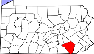
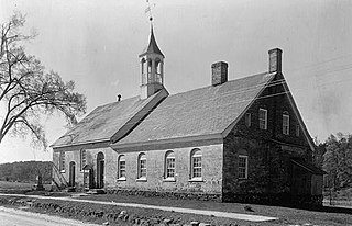
This is a list of the National Register of Historic Places listings in Lancaster County, Pennsylvania.
Ninety Six National Historic Site, also known as Old Ninety Six and Star Fort, is a United States National Historic Site located about 60 miles south of Greenville, South Carolina. The historic site was listed on the National Register in 1969, declared to be a National Historic Landmark in 1973, and established as a National Historic Site in 1976 to preserve the original site of Ninety Six, South Carolina, a small town established in the early 18th century. It encompasses 1,022 acres of property.

Nikwasi comes from the Cherokee word for "star", Noquisi (No-kwee-shee), and is the site of the Cherokee town which is first found in colonial records in the early 18th century, but is much older. The town covered about 100 acres (40 ha) on the floodplain of the Little Tennessee River. Franklin, North Carolina, was later developed by European Americans around this site.

Long Island, also known as Long Island of the Holston, is an island in the Holston River at Kingsport in East Tennessee. Important in regional history since pre-colonial times, the island is listed on the National Register of Historic Places and is designated as a U.S. National Historic Landmark District.

Town Creek Indian Mound is a prehistoric Native American archaeological site located near present-day Mount Gilead, Montgomery County, North Carolina, in the United States. The site, whose main features are a platform mound with a surrounding village and wooden defensive palisade, was built by the Pee Dee, a South Appalachian Mississippian culture people that developed in the region as early as 980 CE. They thrived in the Pee Dee River region of North and South Carolina during the Pre-Columbian era. The Town Creek site was an important ceremonial site occupied from about 1150—1400 CE. It was abandoned for unknown reasons. It is the only ceremonial mound and village center of the Pee Dee located within North Carolina.
This is an incomplete list of historic properties and districts at United States colleges and universities that are listed on the National Register of Historic Places (NRHP). This includes National Historic Landmarks (NHLs) and other National Register of Historic Places listings. It includes listings at current and former educational institutions.

Bethabara Historic District encompasses the surviving buildings and archaeological remains of a small Moravian community, that was first settled in 1753. Located in present-day Forsyth County, North Carolina, it is now a public park of the city of Winston-Salem. It was designated National Historic Landmark in 1999.

The Princeton Battlefield in Princeton, Mercer County, New Jersey, United States, is where American and British troops fought each other on January 3, 1777, in the Battle of Princeton during the American Revolutionary War. The battle ended when the British soldiers in Nassau Hall surrendered. This success, following those at the Battle of Trenton on December 26, 1776, and the Battle of the Assunpink Creek the day before, helped improve American morale.

The Middle Haddam Historic District is a historic district in the town of East Hampton, Connecticut. It encompasses the village center of Middle Haddam, a riverfront community founded in the 17th century on the east bank of the Connecticut River. It was an important port on the river between about 1730 and 1880. Its layout and architecture are reflective of this history, and by the geographic constraints of the local terrain. The district was listed on the National Register of Historic Places in 1984.

Halifax Historic District is a national historic district located at Halifax, Halifax County, North Carolina, US that was listed on the National Register of Historic Places in 1970. It includes several buildings that are individually listed on the National Register. Halifax was the site of the signing of the Halifax Resolves on April 12, 1776, a set of resolutions of the North Carolina Provincial Congress which led to the United States Declaration of Independence gaining the support of North Carolina's delegates to the Second Continental Congress in that year.

The Princeton Historic District is a 370-acre (150 ha) historic district located in Princeton, New Jersey that was listed on the U.S. National Register of Historic Places in 1975. It stretches from Marquand Park in the west to the Eating Clubs in the East, from the Princeton Cemetery in the north to the Graduate College in the south. The district encompasses the core parts of the campuses of the Princeton Theological Seminary and Princeton University. It also includes the business district centered on Nassau Street and many historic homes, both mansions in the western section and more humble dwellings in the Witherspoon/Jackson neighborhood. Notable churches within the district include Nassau Presbyterian Church, Trinity Episcopal, Nassau Christian Center, and the Princeton University Chapel. The district is home to seven of Princeton's nine, and New Jersey's fifty-eight, National Historic Landmarks, the largest concentration of such sites in the state.

The Spikebuck Town Mound and Village Site is a prehistoric and historic archaeological site on Town Creek near its confluence with the Hiwassee River within the boundaries of present-day Hayesville, North Carolina. The site encompasses the former area of the Cherokee village of Quanassee and associated farmsteads. The village was centered on what is known as Spikebuck Mound, an earthwork platform mound, likely built about 1,000 CE by ancestral indigenous peoples during the South Appalachian Mississippian culture period.

Too-Cowee, was an important historic Cherokee town located near the Little Tennessee River north of present-day Franklin, North Carolina. It also had a prehistoric platform mound and earlier village built by ancestral peoples. As their expression of public architecture, the Cherokee built a townhouse on top of the mound. It was the place for their community gatherings in their highly decentralized society. The name translates to "pig fat" in English. British traders and colonists referred to Cowee as one of the Cherokee Middle Towns along this river; they defined geographic groupings based in relation to their coastal settlements, such as Charlestown, South Carolina.
Nununyi was a historic village of the Cherokee people in western North Carolina, located on the eastern side of the Oconaluftee River. Today it is within the boundaries of the present-day city of Cherokee in Swain County. It was classified by English traders and colonists as among the "Out Towns" of the Cherokee in this area east of the Appalachian Mountains.
References
- 1 2 "National Register Information System". National Register of Historic Places . National Park Service. July 9, 2010.
- ↑ "Current Research". American Antiquity (Volume 49, No. 4). October 1984. JSTOR 279753.