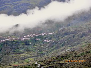
Sandia Province is a province of the Puno Region in Peru. The capital of the province is the city of Sandia.

Patambuco District is one of ten districts of the Sandia Province in Peru.

Lake Jochajucho is a lake in Peru located in the Puno Region, Sandia Province, Patambuco District. Lake Jochajucho lies west of Patambuco, north-west of the village of Punayllu and north-east of the mountain Pacchapata.
A pukara is a pre-Hispanic central Andean fortress.
Mawk'allaqta, also Mawk'a Llaqta, is an archaeological site in Peru. It is located in the Puno Region, Sandia Province, Sandia District. The site was declared a National Cultural Heritage (Patrimonio Cultural) of Peru by the National Institute of Culture.

Qulu Qulu is an archaeological site in Peru. It is located in the Puno Region, Sandia Province, Patambuco District. The site was declared a National Cultural Heritage (Patrimonio Cultural) of Peru by the National Institute of Culture.

Pucará, Puno is a town in the Puno Region, Lampa Province, Pucará District, Peru. It is located to the north-west of Lake Titicaca.
Yuraq Apachita is a mountain in the Andes of Peru, about 4,423.9 metres (14,514 ft) high. It is situated in the Puno Region, Lampa Province, Pucará District, southwest of Pucará.
Ancayoc Cucho is a mountain in the Andes of Peru, about 5,000 metres (16,404 ft) high. It is located in the Puno Region, Sandia Province, Limbani District.
Utkhuqaqa or Utkhu Qaqa is a 5,049-metre-high (16,565 ft) mountain in the Apolobamba mountain range in the Andes of Peru. It is located in the Puno Region, Sandia Province, Cuyocuyo District. It lies northwest of the mountain Wilaquta and northeast of Qurwari and Janq'u Uma. Little streams named Qullqipirwa (Jolljepirhua), Janq'u Uma (Janjouma) and Utkhuqaqa (Utjujaja) flow along its slopes. They are the origin of the river Lawa Lawani which runs to the north. It belongs to the watershed of the Inambari River.
Qachini or Tara Paka is a mountain in the north of the Apolobamba mountain range in the Andes of Peru, about 5,200 metres (17,060 ft) high. It is located in the Puno Region, Putina Province, Ananea District, northwest of La Rinconada. Qachini lies southwest of the mountain named Wilaquta, northeast of Qala K'umu and southeast of Qurwari.
Riticunca is a mountain in the Andes of Peru, about 5,000 metres (16,404 ft) high. It is located in the Puno Region, Carabaya Province, Crucero District, and in the Sandia Province, Patambuco District, northwest of the mountain Laramani. East of Riticunca there is a group of small lakes, among them Riticocha and Yanacocha. The lake Jochajucho is situated in the Ritipata valley southeast of the mountain.
Hatun Pinkilluni is a mountain in the Andes of Peru, about 5,000 metres (16,404 ft) high. It is located in the Puno Region, Sandia Province, Patambuco District. It lies southwest of the mountain Pinkilluni and northeast of Rit'ikunka and Q'alawaña. The ridge northeast of the mountain is named Huch'uy Pinkilluni.
Jalahuana or Jalahuaña is a 5,325-metre-high (17,470 ft) mountain in the Andes of Peru. It is located in the Puno Region, Carabaya Province, Crucero District, and in the Sandia Province, on the border of the Limbani District and the Patambuco District. Jalahuana lies east of Aricoma Lake between the mountain Aricoma in the northwest and Riticunca in the southeast to south.

Apacheta is a 5,168-metre-high (16,955 ft) mountain in the Andes of Peru. It is located in the Puno Region, Carabaya Province, Crucero District. Apachita lies west of the peaks of Ariquma, north of Ariquma Lake and northeast of Wiluyuq Qucha and the peak of Wiluyuq Urqu.
Qaqa Wasi or Qaqawasi is a mountain in the Andes of Peru, about 4,800 metres (15,748 ft) high. It is located in the Puno Region, Sandia Province, Patambuco District. It lies northeast of the mountain Rit'ikunka. South of Qaqa Wasi there is a group of small lakes, among them Rit'iqucha and Yanaqucha. The lake Quchak'uchu is situated in the Rit'ipata valley southeast of the mountain.
Puka Pukayuq is a mountain in the Andes of Peru, about 4,800 metres (15,748 ft) high. It is located in the Puno Region, Sandia Province, Limbani District It lies northeast of the peaks of Ariquma, Ankayuq K'uchu and Wirta Pata, and north of a lake named Ch'uxñaquta.
Warachani is a mountain in the Andes of Peru, about 4,800 metres (15,748 ft) high. It is located in the Puno Region, Sandia Province, on the border of the districts Limbani and Patambuco. It lies at the Ariquma valley northeast of the peaks of Ariquma.
Pinkilluni is a mountain in the Andes of Peru, about 4,800 metres (15,748 ft) high. It is located in the Puno Region, Sandia Province, Patambuco District. It lies north of the mountain Huch'uy Pinkilluni and northeast of Hatun Pinkilluni.
Yana Urqu is a mountain in the Andes of Peru, about 5,000-metre (16,000 ft) high. It is located in the Puno Region, Sandia Province, Limbani District. It lies near Ariquma.


