Q'arachupa

Last updated
Q'arachupa

Petroglifos de Carachupa1.jpg

Rock art of Q'arachupa
Location Peru
Region Amazonas Region, Utcubamba Province, Lonya Grande District

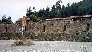
Q'arachupa (Quechua for opossum, [1] [2] Hispanicized spelling Carachupa) is an archaeological site with rock art in Peru. It is located in the Amazonas Region, Utcubamba Province, Lonya Grande District, in the hamlet of Q'arachupa (Carachupa) southwest of Lonya Grande. [3]

Opossum family of mammals

The opossum is a marsupial of the order Didelphimorphia endemic to the Americas. The largest order of marsupials in the Western Hemisphere, it comprises 103 or more species in 19 genera. Opossums originated in South America and entered North America in the Great American Interchange following the connection of the two continents. Their unspecialized biology, flexible diet, and reproductive habits make them successful colonizers and survivors in diverse locations and conditions.

Rock art human-made markings on natural stone

In archaeology, rock art is human-made markings placed on natural stone; it is largely synonymous with parietal art. A global phenomenon, rock art is found in many culturally diverse regions of the world. It has been produced in many contexts throughout human history, although the majority of rock art that has been ethnographically recorded has been produced as a part of ritual. Such artworks are often divided into three forms: petroglyphs, which are carved into the rock surface, pictographs, which are painted onto the surface, and earth figures, formed on the ground. The oldest known rock art dates from the Upper Palaeolithic period, having been found in Europe, Australia, Asia and Africa. Archaeologists studying these artworks believe that they likely had magico-religious significance.

Peru republic in South America

Peru, officially the Republic of Peru, is a country in western South America. It is bordered in the north by Ecuador and Colombia, in the east by Brazil, in the southeast by Bolivia, in the south by Chile, and in the west by the Pacific Ocean. Peru is a megadiverse country with habitats ranging from the arid plains of the Pacific coastal region in the west to the peaks of the Andes mountains vertically extending from the north to the southeast of the country to the tropical Amazon Basin rainforest in the east with the Amazon river.

See also

Related Research Articles

Utcubamba Province Province in Amazonas, Peru

Utcubamba, in Quechua Utkhupampa, is one of seven provinces of the Amazonas Region, Peru. It was created by Law#-23843 on May 30, 1984. Its capital is Bagua Grande and its principal attraction is the Tourist Corridor of Utcubamba where the valley becomes notably closer forming "the canyon of Utcubamba". These conditions modify the climate in a substantial way and create a radical ecological shift. The area is fresh and fragrant and the orchids that are bountiful are unique in the world. Notably picturesque cascades are observed in the rocky vertical walls that the river has created. There are hot springs a few meters from El Ingenio bridge.

Utcubamba (river) river in Peru

Utcubamba or Utkhupampa is a river in the Amazonas Region of Peru, located at 5°32′6″S78°33′9″W. The name is a historical reference to the past agricultural practice of growing cotton in the Utcubamba Valley.

Tambomachay cultural heritage site in Peru

Tambomachay is an archaeological site associated with the Inca Empire, located near Cusco, Peru. An alternate Spanish name is El Baño del Inca.

Incahuasi District District in Lambayeque, Peru

Incahuasi District or Inkawasi is one of six districts of the Ferreñafe Province in the Department of Lambayeque in Peru.

Sauce District District in San Martín, Peru

Sauce is one of fourteen districts of the province San Martín in Peru.

Tarahuasi

Tarahuasi is an archaeological site in Peru. It is located in the Cusco Region, Anta Province, Limatambo District.

Incahuasi, Lima archaeological site

Incahuasi or Incawasi is an archaeological site in Peru. It is located in the Lima Region, Cañete Province, Lunahuaná District.

Inka Wasi, Ayacucho

Inka Wasi or Inkawasi is an archaeological site in Peru. It is located in the Ayacucho Region, Parinacochas Province, Pullo District.

Titiqaqa is an archaeological site in Peru. It is located in the Cusco Region, Cusco Province, Cusco District, in the northeast of Cusco.

Tupu Inka is an archaeological site in Peru. It is located in the Puno Region, Yunguyo Province, Unicachi District.

Taqrachullu, Pukara Taqrachullu, T'akrachullu, Pukara T'akrachullu or María Fortaleza is an archaeological site in Peru. It is located in the Cusco Region, Espinar Province, Suykutambo District.

Inka Mach'ay is an archaeological site in Peru. It is situated in the Huancavelica Region, Tayacaja Province, Ñahuimpuquio District.

Qurimarka is an archaeological site in Peru. It is located in the Cusco Region, Urubamba Province, Ollantaytambo District. It is situated at the river Rayanniyuq (Rayanniyoc) and it belongs to the community Rayanniyuq.

Colcampata

Colcampata is an archaeological site in Peru. It is situated in the Cusco Region, Cusco Province, Cusco District.

Choquequirao Puquio

Choquequirao Puquio is an archaeological site in Peru. It is situated in the Cusco Region, Cusco Province, San Sebastián District, north of San Sebastián.

Markapukyu is an archaeological site in Peru. It is situated in the Pasco Region, Pasco Province, Yarusyacán District, at a height of 3,787 metres (12,425 ft).

Wilca

Wilca is an archaeological site in Peru. It is situated in the Amazonas Region, Utcubamba Province, in the east of the Cajaruro District, near the border with the Bongara Province.

Purunllacta, Soloco

Purunllacta or Purum Llacta (possibly from Quechua purum, purun savage, wild / wasteland, llaqta place is an archaeological site in Peru. It is situated in the Amazonas Region, Chachapoyas Province, Soloco District, southwest and near the archaeological site of Purum Llaqta of the Cheto District.

Inti Watana, Calca

Inti Watana or Intiwatana (Quechua) is an archaeological site in Peru. It lies in the Cusco Region, Calca Province, Pisac District.

Qosqoccahuarina is a private area of conservation in the Urubamba mountain range in the Andes of Peru. It is located in the Cusco Region, Urubamba Province, Ollantaytambo District. It lies in the community of Rumira Sondormayo at the Patacancha valley near Patacancha. The area of conservation of Qosqoccahuarina is recognized by Resolución Ministerial No. 089-2011-MINAM. The aim is to protect the Polylepis forest and its avifauna, the hydrographical basins of the community and the wild flora and fauna of the Andean highlands.

References

  1. Diccionario Quechua - Español - Quechua, Academía Mayor de la Lengua Quechua, Gobierno Regional Cusco, Cusco 2005 (Quechua-Spanish dictionary)
  2. Teofilo Laime Ajacopa, Diccionario Bilingüe Iskay simipi yuyayk'ancha, La Paz, 2007 (Quechua-Spanish dictionary)
  3. "Petroglifos de Carachupa". mincetur. Retrieved March 29, 2014.

Coordinates: 6°07′17″S78°26′17″W / 6.1213°S 78.4380°W / -6.1213; -78.4380

Geographic coordinate system Coordinate system

A geographic coordinate system is a coordinate system that enables every location on Earth to be specified by a set of numbers, letters or symbols. The coordinates are often chosen such that one of the numbers represents a vertical position and two or three of the numbers represent a horizontal position; alternatively, a geographic position may be expressed in a combined three-dimensional Cartesian vector. A common choice of coordinates is latitude, longitude and elevation. To specify a location on a plane requires a map projection.