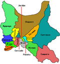
Q'illu Q'illu | |
---|---|
Highest point | |
Elevation | 4,560 m (14,960 ft) [1] |
Coordinates | 17°03′50″S66°29′22″W / 17.06389°S 66.48944°W |
Geography | |
Location | Bolivia, Cochabamba Department |
Parent range | Andes |
Q'illu Q'illu (Aymara and Quechua q'illu yellow, [2] [3] the reduplication indicates that there is a group or a complex of something, "a complex of yellow", or q'illu q'illu a plant (Berberis bumaelifolia), [4] also spelled Khellu Khellu) is a mountain in the Bolivian Andes which reaches a height of approximately 4,560 m (14,960 ft). It is located in the Cochabamba Department, Ayopaya Province, Morochata Municipality, northwest of the village of Qullqi Chaka (meaning "silver bridge", also spelled Colquechaca). It lies northeast of the lakes named Q'umir Qucha ("green lake", Khomer Khocha), Yana Qucha ("black lake", Yana Khocha), Parinani ("the one with flamingos") and Wallatani ("the one with Andean geese", Huallatani). [1] [5]
Jello Jello (possibly from Aymara and Quechua q'illu yellow, the reduplication indicates that there is a group or a complex of something, "a complex of yellow", q'illu q'illu a plant , is a mountain in the Andes of Peru, about 5,220 metres high. It is situated in the Arequipa Region, Caylloma Province, in the districts Callalli and Chivay. Jello Jello lies northeast of a higher mountain named Huarancante. There is a small lake northwest of the mountain named Jello Jello.
Kunka is a mountain in the La Raya mountain range in the Andes of Peru. It is situated at the La Raya Pass and the road and rail which connect Cusco with Lake Titicaca. It is located in the Cusco Region, Canas Province, Layo District, and in the Puno Region, Melgar Province, Santa Rosa District, and about 5,200 metres (17,060 ft) high. Kunka lies southwest of the mountains Yana Khuchilla and Chimpulla. Other neighboring mountains are Huch'uy K'uchu north of it and Hatun Ichhuna Kunka in the south. Between the road and the mountain is a small lake, Q'umirqucha.
Puma Apachita is a mountain in the Tunari mountain range of the Bolivian Andes, about 4,920 m (16,142 ft) high. It is situated in the Cochabamba Department, Quillacollo Province, Quillacollo Municipality, northwest of Cochabamba. Puma Apachita lies southeast of Jatun Q'asa.
Wayna Tunari is a mountain in the Tunari mountain range of the Bolivian Andes which reaches a height of approximately 4,800 m (15,748 ft). It is situated in the Cochabamba Department, Ayopaya Province, Morochata Municipality, and in the Quillacollo Province, Vinto Municipality. It lies northwest of Tunari.
Punta Yavre or Punta Yayre is a mountain in the northeast of the Apolobamba mountain range on the border of Bolivia and Peru. It is about 4,600 metres (15,092 ft) high. On the Bolivian side it is located in the La Paz Department, Franz Tamayo Province, Pelechuco Municipality, and on the Peruvian side it lies in the Puno Region, Putina Province, Sina District. Punta Yavre is situated northwest and northeast of the mountains Chawpi Urqu and Kulli Pata.
Wila Apachita is a 4,595-metre-high (15,075 ft) mountain in the Bolivian Andes. It is located in the Cochabamba Department, Tapacari Province. Wila Apachita lies southeast of Ñuñu Qullu.
Q'ara Apachita is a 4,046-metre-high (13,274 ft) mountain in the Bolivian Andes. It is located in the Cochabamba Department, Quillacollo Province, Sipe Sipe Municipality.
Inka Pukara is a 4,422-metre-high (14,508 ft) mountain in the Bolivian Andes. It is located in the Cochabamba Department, Arque Province, Tacopaya Municipality, southeast of Tacopaya.
Salla Willk'i Punta is a mountain in the Bolivian Andes which reaches a height of approximately 4,560 m (14,960 ft). It is located in the Cochabamba Department, Ayopaya Province, Morochata Municipality. It lies north of the lakes named Q'umir Qucha, Yana Qucha, Parinani and Wallatani.
Silla Q'asa is a mountain in the Bolivian Andes which reaches a height of approximately 4,480 m (14,700 ft). It is located in the Cochabamba Department, Ayopaya Province, Morochata Municipality. It lies southeast and east of the lakes named Q'umir Qucha, Yana Qucha, Parinani and Wallatani.
Q'illu Suchusqa is a mountain in the Bolivian Andes which reaches a height of approximately 4,480 m (14,700 ft). It is located in the Cochabamba Department, Quillacollo Province, Quillacollo Municipality. Q'illu Suchusqa lies southwest of Wila Qullu Punta.
Pukara is a mountain in the Bolivian Andes which reaches a height of approximately 3,760 m (12,340 ft). It is located in the Cochabamba Department, Esteban Arce Province, Sacabamba Municipality. Pukara lies southwest of Atuq Wachana and northwest of Jatun Urqu, southwest of the village of Yana Rumi.
Qutani is a 3,482-metre-high (11,424 ft) mountain in the Bolivian Andes. It is located in the Cochabamba Department, Carrasco Province, Pocona Municipality. Qutani lies south of the UNESCO World Heritage Site of Inkallaqta, north of the village of Pocona. The next peak to the southeast is Qucha Qucha.
Qucha Qucha is a mountain in the Bolivian Andes which reaches a height of approximately 3,360 m (11,020 ft). It is located in the Cochabamba Department, Carrasco Province, Pocona Municipality. Qucha Qucha lies southeast of the UNESCO World Heritage Site of Inkallaqta, north of the village of Pocona. The next peak to the northwest is Qutani.
P'isaqa is a mountain in the Bolivian Andes which reaches a height of approximately 3,200 m (10,500 ft). It is located in the Cochabamba Department, Carrasco Province, Pocona Municipality. It lies at the Wanaku Mayu.
Misk'i is a mountain in the Bolivian Andes which reaches a height of approximately 2,880 m (9,450 ft). It is located in the Cochabamba Department, Carrasco Province, Pocona Municipality. It lies at the Wanaku Mayu.
Waka P'iqi is a 4,578-metre-high (15,020 ft) mountain in the Bolivian Andes. It is located in the Cochabamba Department, Ayopaya Province, Cocapata Municipality, west of the village of Chorito. Wak'a P'iqi lies at the left bank of the Jatun Mayu.
Ch'uñu Pata is a mountain in the Bolivian Andes which reaches a height of approximately 4,560 m (14,960 ft). It is located in the Cochabamba Department, Ayopaya Province, Cocapata Municipality. Ch'uñu Pata lies east of the Sinturani Lake.
P'iq'iñ Q'ara is a mountain in the Bolivian Andes which reaches a height of approximately 4,480 m (14,700 ft). It is located in the Cochabamba Department, Ayopaya Province, Cocapata Municipality. It lies northeast of the two lakes named Iskay Qucha.
Q'illu Apachita is a mountain in the Bolivian Andes which reaches a height of approximately 4,440 m (14,570 ft). It is located in the Chuquisaca Department, Nor Cinti Province, San Lucas Municipality. It lies northeast of Llaqta Pampa.