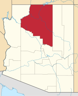
Red Lake, Arizona

Last updated

Red Lake, Arizona
USA Arizona location map.svg
Red pog.svg
Red Lake
Usa edcp location map.svg
Red pog.svg
Red Lake
Coordinates: 35°22′3″N112°09′23″W / 35.36750°N 112.15639°W / 35.36750; -112.15639
CountryUnited States
State Arizona
County Coconino
Area
[1]
  Total29.96 sq mi (77.60 km2)
  Land29.95 sq mi (77.56 km2)
  Water0.02 sq mi (0.04 km2)
Elevation
[2]
6,555 ft (1,998 m)
Population
 (2020)
  Total1,680
  Density56.10/sq mi (21.66/km2)
Time zone UTC-7 (MST)
  Summer (DST) UTC-6 (MDT)
ZIP Codes
86046 (Williams)
FIPS code 04-59372
GNIS feature ID2805225 [2]

Red Lake is an unincorporated community and census-designated place (CDP) in Coconino County, Arizona, United States. It is bordered to the south by the city of Williams. It was first listed as a CDP prior to the 2020 census.

Demographics

Historical population
CensusPop.Note
2020 1,680
U.S. Decennial Census [3]

Related Research Articles

<span class="mw-page-title-main">Red Mesa, Arizona</span> CDP in Apache County, Arizona

Red Mesa is a census-designated place (CDP) in Apache County, Arizona, United States. The population was 480 at the 2010 census.

<span class="mw-page-title-main">Rock Point, Arizona</span> CDP in Apache County, Arizona

Rock Point is a census-designated place (CDP) in Apache County, Arizona, United States. The population was 642 at the 2010 census. Its name is descriptive of the point where Chinle Creek enters high sandstone walls.

<span class="mw-page-title-main">Round Rock, Arizona</span> CDP in Apache County, Arizona

Round Rock is a Navajo community and census-designated place (CDP) in Apache County, Arizona, United States. The population was 789 at the 2010 census. It is named after a nearby mesa.

<span class="mw-page-title-main">Teec Nos Pos, Arizona</span> Census-designated place in Arizona, United States

Teec Nos Pos is a census-designated place (CDP) in Apache County, Arizona, United States. The population was 507 at the 2020 census. It is the western terminus of U.S. Route 64.

<span class="mw-page-title-main">Munds Park, Arizona</span> CDP in Coconino County, Arizona

Munds Park is an unincorporated census-designated place (CDP) in Coconino County, Arizona, United States. The year round population was 631 at the 2010 census.

<span class="mw-page-title-main">Tonalea, Arizona</span> CDP in Coconino County, Arizona

Tonalea is a census-designated place (CDP) in Coconino County, Arizona, United States. The population was 549 at the 2010 census. It has also been known as Red Lake.

<span class="mw-page-title-main">Sun Lakes, Arizona</span> CDP in Maricopa County, Arizona

Sun Lakes is an unincorporated community and census-designated place (CDP) in Maricopa County, Arizona, United States. The population was 14,868 at the 2020 census. Sun Lakes is an active adult community comprising five country club communities in three homeowner associations. These include the gated communities of Oakwood and IronWood (IronOaks), the gated and non-gated communities of Palo Verde and Cottonwood, and the non-gated community of Sun Lakes 1. Sun Lakes is a master-planned community developed by Robson Communities.

<span class="mw-page-title-main">Desert Hills, Arizona</span> CDP in Mohave County, Arizona

Desert Hills is an unincorporated community and census-designated place (CDP) in Mohave County, Arizona, United States. The population was 2,764 at the 2020 census, up from 2,245 at the 2010 census.

<span class="mw-page-title-main">Cordes Lakes, Arizona</span> CDP in Yavapai County, Arizona

Cordes Lakes is a census-designated place (CDP) in Yavapai County, Arizona, United States. The population was 2,058 at the 2000 census. The Agua Fria National Monument lies to the east and south of the community and Arcosanti is to the north.

<span class="mw-page-title-main">Topock, Arizona</span> Unincorporated community in Arizona, United States

Topock is a small unincorporated community and census-designated place (CDP) in Mohave County, Arizona, United States. As of the 2020 census, the population within the CDP was 2. Topock and the surrounding region have a ZIP Code of 86436; in 2010, the population of the 86436 ZCTA was 2,104, almost all of whom live in the Golden Shores CDP to the north.

<span class="mw-page-title-main">Meadview, Arizona</span> Unincorporated community in Mohave County, Arizona, US

Meadview is an unincorporated community and census-designated place (CDP) in Mohave County, Arizona, United States, located near Lake Mead. As of the 2020 census, Meadview had 1,420 residents, up from 1,224 as of 2010. It was founded in the 1960s as a retirement community and is still largely one, as well as a vacation spot for people coming to enjoy Lake Mead.

Roosevelt is a census-designated place (CDP) in Gila County, Arizona, United States. The population was 28 at the 2010 census.

Rock House is a census-designated place (CDP) in Gila County, Arizona, United States. The population was 50 at the 2010 census.

Six Shooter Canyon is a census-designated place (CDP) in Gila County, Arizona, United States. The population was 1,019 at the 2010 census.

Crystal Beach is an unincorporated community in Mohave County, Arizona, United States. The population was 250 at the 2020 census. For statistical purposes, the United States Census Bureau has defined Crystal Beach as a census-designated place (CDP).

Buckshot is a census-designated place (CDP) in Yuma County, Arizona, United States. The population was 153 at the 2010 census.

Wheatfields is a census-designated place (CDP) in Gila County, Arizona, United States. The population was 785 at the 2010 United States Census. It is one of two places in Arizona with this name, the other being a populated place in Apache County.

Lake of the Woods is a census-designated place (CDP) in Navajo County, Arizona, United States, adjacent to the town of Pinetop-Lakeside. The population was 4,094 at the 2010 census.

Martinez Lake is a census-designated place (CDP) in Yuma County, Arizona, United States, located on Martinez Lake. The population was 798 at the 2010 census. It was founded in 1958 as a fishing community. It remains primarily a vacation community.

Pine Lake is an unincorporated community and census-designated place (CDP) in Mohave County, Arizona, United States. The population was 142 at the 2020 census.

References

  1. "2020 U.S. Gazetteer Files". United States Census Bureau. Retrieved October 29, 2021.
  2. 1 2 U.S. Geological Survey Geographic Names Information System: Red Lake, Arizona
  3. "Census of Population and Housing". Census.gov. Retrieved June 4, 2016.