Richland, Georgia

Last updated

Richland, Georgia
Richland, GA.JPG
Stewart County Georgia Incorporated and Unincorporated areas Richland Highlighted.svg
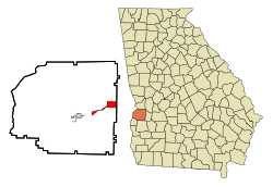
Location in Stewart County and the state of Georgia
Coordinates: 32°5′19″N84°39′50″W / 32.08861°N 84.66389°W / 32.08861; -84.66389
Country United States
State Georgia
County Stewart
Area
[1]
  Total3.25 sq mi (8.40 km2)
  Land3.20 sq mi (8.29 km2)
  Water0.04 sq mi (0.12 km2)
Elevation
607 ft (185 m)
Population
 (2020)
  Total1,370
  Density428.13/sq mi (165.28/km2)
Time zone UTC-5 (Eastern (EST))
  Summer (DST) UTC-4 (EDT)
ZIP code
31825
Area code 229
FIPS code 13-65016 [2]
GNIS feature ID0356496 [3]

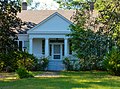
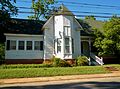
Richland is a city in Stewart County, Georgia, United States. Per the 2020 census, the population was 1,370. [4]

Contents

History

The community took its name from the local Richland Baptist Church, the name of which most likely is a transfer from Richland, South Carolina, the native home of a large share of the first settlers. [5] The Georgia General Assembly incorporated Richland in 1889. [6]

Geography

Richland is located along U.S. Route 280 and Georgia State Route 520 (known as South Georgia Parkway). U.S. Route 280 and Georgia 520 lead northwest 36 miles (58 km) to Columbus. The two highways separate in the city, with U.S. Route 280 leading east 29 miles (47 km) to Americus and Georgia 520 leading southeast 52 miles (84 km) to Albany.

According to the United States Census Bureau, the city has a total area of 4.2 square miles (11 km2), of which 4.2 square miles (11 km2) is land and 0.04 square miles (0.10 km2) (0.48%) is water.

Demographics

Historical population
CensusPop.Note
1890 457
1900 1,014121.9%
1910 1,25023.3%
1920 1,52922.3%
1930 1,5773.1%
1940 1,497−5.1%
1950 1,5714.9%
1960 1,472−6.3%
1970 1,82323.8%
1980 1,802−1.2%
1990 1,668−7.4%
2000 1,7947.6%
2010 1,473−17.9%
2020 1,370−7.0%
U.S. Decennial Census [7]
2010 [8] 2020 [9]
Richland city, Georgia – Racial and Ethnic Composition
(NH = Non-Hispanic)
Note: the US Census treats Hispanic/Latino as an ethnic category. This table excludes Latinos from the racial categories and assigns them to a separate category. Hispanics/Latinos may be of any race.
Race / EthnicityPop 2010 [8] Pop 2020 [9] % 2010% 2020
White alone (NH)40834527.70%25.18%
Black or African American alone (NH)1,01396768.77%70.58%
Native American or Alaska Native alone (NH)320.20%0.15%
Asian alone (NH)840.54%0.29%
Pacific Islander alone (NH)000.00%0.00%
Some Other Race alone (NH)000.00%0.00%
Mixed Race/Multi-Racial (NH)8400.54%2.92%
Hispanic or Latino (any race)33122.24%0.88%
Total1,4731,370100.00%100.00%

At the 2020 census, its population was 1,370.

Notable people

Related Research Articles

<span class="mw-page-title-main">Talbot County, Georgia</span> County in Georgia, United States

Talbot County is a county located in the west central portion of the U.S. state of Georgia. The 2020 census showed a population of 5,733. The county seat and largest city is Talbotton.

<span class="mw-page-title-main">Stewart County, Georgia</span> County in Georgia, United States

Stewart County is a county located in the west central portion of the U.S. state of Georgia. As of the 2020 census, the population was 5,314. The county seat is Lumpkin. The county was created on December 23, 1830.

<span class="mw-page-title-main">Seminole County, Georgia</span> County in Georgia, United States

Seminole County is a county located in the southwestern corner of U.S. state of Georgia. As of the 2020 census, the population was 9,147. The county seat is Donalsonville.

<span class="mw-page-title-main">Richmond County, Georgia</span> Consolidated city-county in Georgia, United States

Richmond County is a county located in the U.S. state of Georgia. As of the 2020 census, the population was 206,607. It is one of the original counties of Georgia, created February 5, 1777. Following an election in 1995, the city of Augusta consolidated governments with Richmond County. The consolidated entity is known as Augusta-Richmond County, or simply Augusta. Exempt are the cities of Hephzibah and Blythe, in southern Richmond County, which voted to remain separate. Richmond County is included in the Augusta-Richmond County, GA-SC metropolitan statistical area.

<span class="mw-page-title-main">Monroe County, Georgia</span> County in Georgia, United States

Monroe County is a county located in the central portion of the U.S. state of Georgia. As of the 2020 census, the population was 27,957. The county seat is Forsyth. The county was created on May 15, 1821. The county was named for James Monroe. Monroe County is included in the Macon, GA metropolitan statistical area.

<span class="mw-page-title-main">Johnson County, Georgia</span> County in Georgia, United States

Johnson County is a county located in the U.S. state of Georgia. As of the 2020 census, the population was 9,189. The county seat is Wrightsville. Johnson County is part of the Dublin, Georgia, micropolitan statistical area.

<span class="mw-page-title-main">Jefferson County, Georgia</span> County in Georgia, United States

Jefferson County is a county located in the U.S. state of Georgia. As of the 2020 census, the population was 15,709. The county seat and largest city is Louisville. The county was created on February 20, 1796, and named for Thomas Jefferson, the main author of the Declaration of Independence who became the third president of the United States.

<span class="mw-page-title-main">Hancock County, Georgia</span> County in Georgia, United States

Hancock County is a county located in the U.S. state of Georgia. As of the 2020 census, the population was 8,735. The county seat is Sparta. The county was created on December 17, 1793, and named for John Hancock, a Founding Father of the American Revolution.

<span class="mw-page-title-main">Dougherty County, Georgia</span> County in Georgia, United States

Dougherty County is located in the southwestern portion of the U.S. state of Georgia. As of the 2020 census, the population was 85,790. The county seat and sole incorporated city is Albany.

<span class="mw-page-title-main">Charlton County, Georgia</span> County in Georgia, United States

Charlton County is the southernmost county of the U.S. state of Georgia, located in the southeastern part of the state. As of the 2020 census, the population was 12,518. The county seat is Folkston.

<span class="mw-page-title-main">Brantley County, Georgia</span> County in Georgia, United States

Brantley County is a county located in the southeastern part of the U.S. state of Georgia. As of the 2020 census, the population was 18,021. The county seat is Nahunta. Brantley County is part of the Brunswick, Georgia metropolitan statistical area.

<span class="mw-page-title-main">Baker County, Georgia</span> County in Georgia, United States

Baker County is a county in Georgia. As of the 2020 census, the population was 2,876. The county seat and only city is Newton. The county was created December 12, 1825 from the eastern portion of Early County by an act of the Georgia General Assembly and is named for Colonel John Baker, a hero of the American Revolutionary War.

<span class="mw-page-title-main">Flovilla, Georgia</span> City in Georgia, United States

Flovilla is a city in Butts County, Georgia, United States. The population was 653 at the 2010 census, and 643 in 2020.

<span class="mw-page-title-main">Broxton, Georgia</span> City in Georgia, United States

Broxton is a city in Coffee County, Georgia, United States. Per the 2020 census, the population was 1,060. It is known for its unique sandstone formation called Broxton Rocks along Rocky Creek 10 miles (16 km) north of town.

<span class="mw-page-title-main">Culloden, Georgia</span> City in Georgia, United States

Culloden is a city in Monroe County, Georgia, United States. The population was 200 in the 2020 census. It is part of the Macon metropolitan statistical area.

<span class="mw-page-title-main">Georgetown, Quitman County, Georgia</span> City in Georgia, United States

Georgetown is a city in Quitman County, Georgia, United States. It is on the Alabama-Georgia state line next to Walter F. George Lake and across the Chattahoochee River from Eufaula, Alabama. Per the 2020 census, the population was 2,235. In 2006, Georgetown and Quitman County voted to consolidate their governments, becoming the smallest such consolidated entity in the Lower 48 states.

<span class="mw-page-title-main">Lumpkin, Georgia</span> City in Georgia, United States

Lumpkin is a city and county seat of Stewart County, Georgia, United States. Per the 2020 census, the population was 891.

<span class="mw-page-title-main">Plains, Georgia</span> City in Georgia, United States

Plains is a city in Sumter County, Georgia, United States. The population was 573 at the 2020 census and it is a part of the Americus Micropolitan Statistical Area. It is best known as the birthplace of Jimmy Carter and his wife Rosalynn, who were the president and first lady of the United States respectively from 1977 to 1981. They lived in Plains both before and after their time in the White House.

<span class="mw-page-title-main">Junction City, Georgia</span> Town in Georgia, United States

Junction City is a town in Talbot County, Georgia, United States. The population was 138 at the 2020 census.

<span class="mw-page-title-main">Crawfordville, Georgia</span> City in Georgia, United States

Crawfordville is a city in Taliaferro County, Georgia, United States. The population was 479 in 2020. The city is the county seat of Taliaferro County.

References

  1. "2020 U.S. Gazetteer Files". United States Census Bureau. Retrieved December 18, 2021.
  2. "U.S. Census website". United States Census Bureau . Retrieved January 31, 2008.
  3. "US Board on Geographic Names". United States Geological Survey. October 25, 2007. Retrieved January 31, 2008.
  4. "Richland city, Georgia". United States Census Bureau . Retrieved April 15, 2022.
  5. Krakow, Kenneth K. (1975). Georgia Place-Names: Their History and Origins (PDF). Macon, GA: Winship Press. p. 188. ISBN   0-915430-00-2.
  6. Candler, Allen Daniel; Evans, Clement Anselm (1906). Georgia: Comprising Sketches of Counties, Towns, Events, Institutions, and Persons. State historical association. p. 195.
  7. "Decennial Census of Population and Housing by Decades". US Census Bureau.
  8. 1 2 "P2 Hispanic or Latino, and Not Hispanic or Latino by Race – 2010: DEC Redistricting Data (PL 94-171) – Richland city, Georgia". United States Census Bureau .
  9. 1 2 "P2 Hispanic or Latino, and Not Hispanic or Latino by Race – 2020: DEC Redistricting Data (PL 94-171) – Richland city, Georgia". United States Census Bureau .