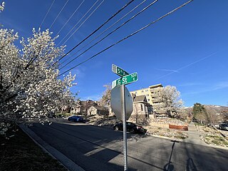
The Avenues is an affluent neighborhood in Salt Lake City, Utah. It is named after the perfectly gridlike, closely laid out roads called Avenues and Streets. First surveyed in the 1850s, the Avenues became Salt Lake City's first neighborhood. Today, the Avenues neighborhood is generally considered younger, more progressive, and somewhat "artsy" when compared to other neighborhoods. Many young professionals choose to live there due to the culture and easy commute to downtown.. It is also one of the most important strongholds of the Utah Democratic Party.

The Fan is a district of Richmond, Virginia, so named because of the "fan" shape of the array of streets that extend west from Belvidere Street, on the eastern edge of Monroe Park, westward to Arthur Ashe Boulevard. However, the streets rapidly resemble a grid after they go through what is now Virginia Commonwealth University. The Fan is one of the easterly points of the city's West End section, and is bordered to the north by Broad Street and to the south by VA 195, although the Fan District Association considers the southern border to be the properties abutting the south side of Main Street. The western side is sometimes called the Upper Fan and the eastern side the Lower Fan, though confusingly the Uptown district is located near VCU in the Lower Fan. Many cafes and locally owned restaurants are located here, as well as historic Monument Avenue, a boulevard formerly featuring statuary of the Civil War's Confederate president and generals. The only current statue is a more modern one of tennis icon Arthur Ashe. Development of the Fan district was strongly influenced by the City Beautiful movement of the late 19th century.

Massachusetts Avenue is a major diagonal transverse road in Washington, D.C., and the Massachusetts Avenue Historic District is a historic district that includes part of it.

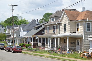
Woodbridge is a historic neighborhood of primarily Victorian homes located in Detroit, Michigan. The district was listed on the National Register of Historic Places in 1980, with later boundary increases in 1997 and 2008. In addition to its historic value, Woodbridge is also notable for being an intact neighborhood of turn-of-the-century homes within walking or biking distance of Detroit's Downtown, Midtown, New Center, and Corktown neighborhoods.

State Route 116 is a primary state highway in the U.S. state of Virginia. The state highway runs 20.66 miles (33.25 km) from SR 122 at Burnt Chimney north to SR 101 in Roanoke. SR 116 connects northwestern Franklin County with the southeastern part of Roanoke. The state highway forms a major street through Downtown Roanoke and the city's north side.

Wasena is a Roanoke, Virginia neighborhood located in south, central Roanoke bisected by U.S. Route 221, immediately to the south of the Roanoke River. It borders the neighborhoods of Raleigh Court on the west, Old Southwest on the north and east and Mountain View via the Wasena Bridge across the Roanoke River on the north, and Franklin-Colonial on the south. As of the 2000 U.S. Census, Wasena has a population of 1,633 residents.

Gainsboro is a Roanoke, Virginia neighborhood located in central Roanoke immediately north of Downtown, across the Norfolk Southern Railway right of way, between Interstate 581 and Orange Avenue. It borders the neighborhoods of Harrison and Gilmer on the west, Washington Park on the north, Williamson Road on the east and Downtown Roanoke on the south. As of the 2000 U.S. Census, Gainsboro has a population of 967 residents.

Raleigh Court is a Roanoke, Virginia neighborhood located in southwest Roanoke along U.S. 11. It borders the neighborhoods of Greater Deyerle on the west, Wasena on the east, Cherry Hill, Mountain View and Norwich on the north and Franklin-Colonial and Grandin Court on the south. Today the neighborhood is accessed from the downtown areas via the Memorial Bridge across the Roanoke River. As of the 2000 U.S. Census, Raleigh Court has a population of 11,200 residents.

Mountain View is a Roanoke, Virginia neighborhood located in central Roanoke north of the Roanoke River. It borders the neighborhoods of Norwich on the west, West End on the east, Hurt Park on the north and Raleigh Court and Wasena on the south.
Riverland/Walnut Hills is a Roanoke, Virginia neighborhood located in southeast Roanoke south of the Roanoke River. It borders the neighborhoods of South Jefferson and South Roanoke on the west, Morningside on the east and Mill Mountain on the south. The neighborhood is divided into the Walnut Hill area at the base of Mill Mountain, and the Riverland area along the Roanoke River, with Virginia State Route 116 running through the entire area. As of the 2000 U.S. Census, Riverland/Walnut Hills has a population of 1,033.

This is a list of the National Register of Historic Places listings in Detroit, Michigan.

Old Southwest is a neighborhood of the independent city of Roanoke, Virginia, United States. Located geographically near the center of the city, Old Southwest was annexed from Roanoke County in 1890 and developed as one of Roanoke's more affluent residential areas. Today the majority of the neighborhood falls within the Southwest Historic District listed on both the Virginia Landmarks Register and the National Register of Historic Places.

The Tree Streets Historic District is a 120-acre (49 ha) historic district in Waynesboro, Virginia. The aptly named district contains portions of Cherry, Chestnut, Locust, Maple, Oak, Pine and Walnut Avenues as well as portions of Eleventh through Sixteenth Streets and part of South Wayne Avenue. It covers the oldest residential neighborhood in Waynesboro and reflects the various stages of development of the city from the 19th century through 1951. It was listed on the National Register of Historic Places in 2002. In 2002, it included 445 buildings deemed to contribute to the historic character of the area, two contributing sites, and seven other contributing structures.

The Sidney Walnut Avenue Historic District is a neighborhood and historic district on the western side of the city of Sidney, Ohio, United States. Located a short distance northwest of the city's downtown, the Walnut Avenue District has been Sidney's premier residential neighborhood since its creation in the late nineteenth century.

Wasena Historic District is a national historic district located in the Wasena neighborhood of Roanoke, Virginia. It encompasses 574 contributing buildings, 1 contributing site, 3 contributing structures, and 3 contributing objects. It is a primarily residential district with single-family dwellings. Also in the district are a few commercial buildings, several industrial buildings, a park along the river and the Wasena Bridge.

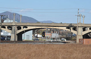
The Roanoke River and Railroad Historic District is a predominantly industrial area on the north side of the Roanoke River in Roanoke, Virginia. The area is bounded by South Jefferson Street on the west and the Roanoke River to the east, and extends north as far as Albemarle Avenue. The district's resources are defined primarily by their relationship to the railroad tracks that bisect this area. The area was developed in the late 19th and early 20th centuries with the completion of the Roanoke & Southern line in 1892 and the Virginian Railway line in 1909, and consists primarily of functional industrial buildings that were built between about 1900 and 1930, an example of which is the Virginia Can Company. Notable exceptions are the Virginian Railway Passenger Station, a Spanish Revival passenger station built 1909-10 and listed on the National Register of Historic Places since 2003, and the Walnut Street and Jefferson Street bridges, completed in 1927 and 1928, respectively. Both bridges were constructed in the Art Deco style and designed with "Egyptian Babylonian" style decorations.

The West End North Historic District encompasses a neighborhood of late 19th and early 20th century residential architecture in western Hartford, Connecticut and eastern West Hartford, Connecticut. Roughly bounded by Prospect, Elizabeth, and Lorraine Streets and Farmington Avenue, the area includes a large number of Colonial Revival and Queen Anne houses, as well as numerous buildings in other period styles, with only a small number of losses. It was listed on the National Register of Historic Places in 1985.

The Belmont Historic District is located in the southeast section of Roanoke, Virginia, US. It consists of an irregularly-shaped 214 acres (87 ha) of primarily residential housing located to the east of the city's downtown and south of the Roanoke Shops.


