Rosemont Historic District (Alexandria, Virginia)

Last updated

Rosemont Historic District
Rosemont Historic District (Alexandria, Virginia) 01.JPG
Alexandria, Virginia.svg
Red pog.svg
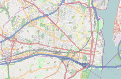
LocationRoughly bounded by Commonwealth Ave., W. Walnut St., Russell Rd., Rucker Pl. and King St., Alexandria, Virginia
Coordinates 38°48′38″N77°3′50″W / 38.81056°N 77.06389°W / 38.81056; -77.06389
Area84 acres (34 ha)
Built1908 (1908)–1941
ArchitectMultiple
Architectural styleColonial Revival, Bungalow/Craftsman
NRHP reference No. 92001275 [1]
VLR No.100-0137
Significant dates
Added to NRHPSeptember 24, 1992
Designated VLRDecember 11, 1991 [2]

The Rosemont Historic District is a historic district in Alexandria, in the U.S. state of Virginia. It was added to the National Register of Historic Places in 1992.

Rosemont is a lushly planted residential area occupying some 84 acres in northwest Alexandria, located adjacent to Alexandria Union Station (ALX). It was developed between 1908 and 1914 by a group of Washington, Alexandria, and Philadelphia investors. The houses were built near the trolley line, allowing residents to work in Washington and live in a suburban neighborhood. Rosemont's more than 450 residences are a prime example of the era's middle-class architecture. House styles range from the American Craftsman, American Foursquare and Arts and Crafts movement to the sedate composition of Colonial Revival homes. The intact original street plan reflects suburban planning ideals of the early 1900s City Beautiful movement. [3]

There are 456 contributing buildings, including 336 houses and apartment buildings, one school, one commercial building, and 118 private garages. One contributing structure and one contributing object were previously listed in the National Register as part of the Boundary Markers of the Original District of Columbia Multiple Property Submission: Southwest # 2 Boundary Marker. The historic district is bounded on the southeast by the Richmond, Fredericksburg and Potomac Railroad line.

During the 1940s, the Rosemont neighborhood used restrictive covenants to exclude Asian-Americans, African-Americans, and any person of the "Hebrew or Jewish Race." [4]
Related Research Articles

<span class="mw-page-title-main">Arlington County, Virginia</span> County in Virginia, United States

Arlington County, or simply Arlington, is a county in the U.S. state of Virginia. The county is located in Northern Virginia on the southwestern bank of the Potomac River directly across from Washington, D.C., the national capital.

<span class="mw-page-title-main">Mount Pleasant (Washington, D.C.)</span> Neighborhood of Washington, D.C.

Mount Pleasant is a neighborhood in Washington, D.C., located in Northwest D.C. The neighborhood is primarily residential, with restaurants and stores centered along a commercial corridor on Mt. Pleasant Street. Mount Pleasant is known for its unique identity and multicultural landscape, home to diverse groups such as the punk rock, the Peace Corps and Hispanic Washingtonian communities.

<span class="mw-page-title-main">History of Washington, D.C.</span>

The history of Washington, D.C., is tied to its role as the capital of the United States. The site of the District of Columbia along the Potomac River was first selected by President George Washington. The city came under attack during the War of 1812 in an episode known as the Burning of Washington. Upon the government's return to the capital, it had to manage the reconstruction of numerous public buildings, including the White House and the United States Capitol. The McMillan Plan of 1901 helped restore and beautify the downtown core area, including establishing the National Mall, along with numerous monuments and museums.

<span class="mw-page-title-main">Massachusetts Avenue (Washington, D.C.)</span> Major road in Washington, D.C., U.S.

Massachusetts Avenue is a major diagonal transverse road in Washington, D.C., and the Massachusetts Avenue Historic District is a historic district that includes part of it.

<span class="mw-page-title-main">Fairlington, Virginia</span> United States historic place

Fairlington is an unincorporated neighborhood in Arlington County, Virginia, located adjacent to Shirlington in the southernmost part of the county on the boundary with the City of Alexandria. The main thoroughfares are Interstate 395, which divides the neighborhood into North and South Fairlington, State Route 7 and State Route 402.

<span class="mw-page-title-main">National Register of Historic Places listings in Virginia</span>

Buildings, sites, districts, and objects in Virginia listed on the National Register of Historic Places:

<span class="mw-page-title-main">Lyon Village, Virginia</span> United States historic place

Lyon Village is a neighborhood and urban village in Arlington County, Virginia, along Langston Boulevard. It adjoins Arlington County's government center, and is approximately one mile west of Rosslyn and less than a mile north of Clarendon, of which it is sometimes considered a sub-neighborhood, as is Cherrydale, the mostly residential district immediately west of Lyon Village.

<span class="mw-page-title-main">Charles M. Goodman</span> American architect (1906–1992)

Charles M. Goodman was an American architect who made a name for his modern designs in suburban Washington, D.C., after World War II. While his work has a regional feel, he ignored the colonial revival look so popular in Virginia. Goodman was quoted in the 1968 survey book Architecture in Virginia as saying that he aimed to "get away from straight historical reproduction."

Henry Wright, was a planner, architect, and major proponent of the garden city, an idea characterized by green belts and created by Sir Ebenezer Howard.

<span class="mw-page-title-main">Fairlawn (Washington, D.C.)</span> Neighborhood in Ward 8, United States

Fairlawn is a working class and middle class residential neighborhood in southeast Washington, D.C., United States. It is bounded by Interstate 295, Pennsylvania Avenue SE, Minnesota Avenue SE, Naylor Road SE, and Good Hope Road SE.

<span class="mw-page-title-main">Boundary markers of the original District of Columbia</span> Markers that marked the District of Columbias original boundary

The boundary markers of the original District of Columbia are the 40 milestones that marked the four lines forming the boundaries between the states of Maryland and Virginia and the square of 100 square miles (259 km2) of federal territory that became the District of Columbia in 1801. Working under the supervision of three commissioners that President George Washington had appointed in 1790 in accordance with the federal Residence Act, a surveying team led by Major Andrew Ellicott placed these markers in 1791 and 1792. Among Ellicott's assistants were his brothers Joseph and Benjamin Ellicott, Isaac Roberdeau, George Fenwick, Isaac Briggs and an African American astronomer, Benjamin Banneker.

<span class="mw-page-title-main">Broadway–Flushing, Queens</span> Neighborhood of Queens in New York City

Broadway–Flushing is a historic district and residential subsection of Flushing, Queens, New York City. The neighborhood comprises approximately 2,300 homes. It is located between 155th and 170th Streets to the west and east respectively, and is bounded on the north by Bayside and 29th Avenues, and on the south by Northern Boulevard and Crocheron Avenue. Broadway–Flushing is listed on the National Register of Historic Places.

<span class="mw-page-title-main">Strivers' Section Historic District</span> Historic district in Washington, D.C., United States

The Strivers' Section Historic District is a historic district located in the Dupont Circle neighborhood of Washington, D.C. Strivers' Section was historically an enclave of upper-middle-class African Americans, often community leaders, in the late 19th and early 20th centuries. It takes its name from a turn-of-the-20th-century writer who described the district as "the Striver's section, a community of Negro aristocracy." The name echoes that of Strivers' Row in Harlem, a New York City historic neighborhood of black professionals. The district is roughly bounded by Swann Street and the Dupont Circle Historic District on the south, Florida Avenue and the Washington Heights Historic District on the north and west, and the Sixteenth Street Historic District on the east.

<span class="mw-page-title-main">DeMun</span> United States historic place

The Hi-Pointe–DeMun Historic District is a historic district that was listed on the National Register of Historic Places in 2005. The district, commonly referred to as “DeMun,” is a neighborhood straddling the city limits of St. Louis, Missouri and Clayton, Missouri. The district is roughly bounded by Clayton Road to the south, Big Bend Boulevard to the west, Northwood Avenue to the north, and Skinker Boulevard to the east, and consists of two subdivisions: DeMun Park and Hi-Pointe.

<span class="mw-page-title-main">Kalorama Triangle Historic District</span> Historic district in Washington, D.C., United States

The Kalorama Triangle Historic District is a mostly residential neighborhood and a historic district in the northwest quadrant of Washington, D.C. The entire Kalorama Triangle neighborhood was listed on the District of Columbia Inventory of Historic Sites (DCIHS) and National Register of Historic Places (NRHP) in 1987. In addition to individually listed landmarks in the neighborhood, the district is home to roughly 350 contributing properties. The neighborhood is roughly bounded by Connecticut Avenue to the west, Columbia Road to the east, and Calvert Street on the north.

Alexandria, Virginia is an independent city in the Commonwealth of Virginia, located along the western bank of the Potomac River. The city of approximately 151,000 is about six miles south of downtown Washington, D.C.

The West Side Residential Historic District is a nationally recognized historic district located in Washington, Iowa, United States. It was listed on the National Register of Historic Places in 2018. At the time it was studied for the State of Iowa it contained 255 resources, which included 184 contributing buildings, one contributing site, one contributing structure, one contributing object, and 68 non-contributing buildings. Some of the numbers could be adjusted up for the National Register nomination as the park required further study. The historic district is a residential neighborhood on the west side of town with houses that were built from the 1850s to the 1960s. The oldest house in the district was constructed in 1856, and eight of the houses were built after 1969, the cut-off year for inclusion as a contributing property. All of the houses are single family dwellings, and most of them are frame construction. Nine of the houses are brick or stucco. They range in height from single-story to two-story structures. The district is noteworthy for its large collection of Victorian styles from the 1880s to the 1900s, but there are also a number of American Foursquare, American Craftsman, and bungalows in the neighborhood as well. The Joseph Keck House and the Frank Stewart House (1894) are individually listed on the National Register of Historic Places.

<span class="mw-page-title-main">Roberts Memorial United Methodist Church</span> United States historic place

Roberts Memorial United Methodist Church is the second oldest Black congregation in Alexandria, Virginia. Founded in 1834 and originally known as Davis Chapel, it has served a mostly Black community for almost two centuries. It is a member of the United Methodist Church.

<span class="mw-page-title-main">Housing in Washington, D.C.</span>

Housing in Washington, D.C., encompasses a variety of shelter types: apartments, single family homes, condominiums, co-ops, and apartments considered public housing. Washington, D.C., is considered one of the most expensive cities in which to live in the United States—in 2019, it was ranked in the top 10 of American cities with the most expensive homes.

The history of Antisemitism in Virginia dates to the establishment of the Colony of Virginia. Jews living in colonial Virginia had more rights than most Jews elsewhere in the world, but they did not begin to have equal rights with Christians until after the American Revolution. During the Civil War, Virginian Jews were often the subject of antisemitic accusations of profiteering and disloyalty to the Confederacy. In the early 20th century, educational institutions such as the University of Virginia used anti-Jewish quotas to reduce their number of Jewish students. Prior to the passage of the 1968 Fair Housing Act, some neighborhoods in Virginia excluded Jews using restrictive covenants. During the 2010s and 2020s, Virginia has seen an increase in reported incidents of antisemitic vandalism and violence.

References

  1. "National Register Information System". National Register of Historic Places . National Park Service. March 13, 2009.
  2. "Virginia Landmarks Register". Virginia Department of Historic Resources. Retrieved May 12, 2013.
  3. "100-0137 Rosemont Historic District". Virginia Department of Historic Resources. Retrieved March 10, 2023.
  4. ""Rethinking Race, Housing, and Community: A History of Restrictive Covenants and Land Use Zoning in Alexandria, Virginia, 1900s-1960s"" (PDF). City of Alexandria . Retrieved August 21, 2023.