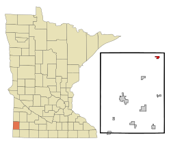
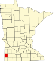
Ruthton, Minnesota

Last updated

Ruthton
Pipestone County Minnesota Incorporated and Unincorporated areas Ruthton Highlighted.svg
Location of Ruthton, Minnesota
Coordinates: 44°10′39″N96°06′12″W / 44.17750°N 96.10333°W / 44.17750; -96.10333
Country United States
State Minnesota
County Pipestone
Government
  TypeMayor Council
  MayorStan Townsend
Area
[1]
  Total0.58 sq mi (1.51 km2)
  Land0.58 sq mi (1.50 km2)
  Water0.01 sq mi (0.01 km2)
Elevation
[2]
1,729 ft (527 m)
Population
 (2020)
  Total226
  Density391.68/sq mi (151.14/km2)
Time zone UTC-6 (Central (CST))
  Summer (DST) UTC-5 (CDT)
ZIP code
56170
Area code 507
FIPS code 27-56482 [3]
GNIS feature ID2396459 [2]

Ruthton is a city in Pipestone County, Minnesota, United States. The population was 241 at the 2010 census. [4]

Contents

The city is the home of Exelon Wind's Cowell Wind Project. [5]

History

Ruthton was platted in 1888, and named for the wife of a member of the town company. [6] A post office has been in operation at Ruthton since 1888. [7] Ruthton was incorporated in 1897. [6]

Geography

According to the United States Census Bureau, the city has a total area of 0.67 square miles (1.74 km2), of which 0.66 square miles (1.71 km2) is land and 0.01 square miles (0.03 km2) is water. [8]

The Redwood River flows through the city as an intermittent stream near its headwaters. [9] [10]

Minnesota State Highway 23 serves as a main route in the community.

Demographics

Historical population
CensusPop.Note
1900 323
1910 290−10.2%
1920 40339.0%
1930 387−4.0%
1940 48024.0%
1950 53411.3%
1960 476−10.9%
1970 405−14.9%
1980 328−19.0%
1990 3280.0%
2000 284−13.4%
2010 241−15.1%
2020 226−6.2%
U.S. Decennial Census [11]

2010 census

As of the census [12] of 2010, there were 241 people, 110 households, and 67 families residing in the city. The population density was 365.2 inhabitants per square mile (141.0/km2). There were 128 housing units at an average density of 193.9 per square mile (74.9/km2). The racial makeup of the city was 99.2% White and 0.8% from two or more races. Hispanic or Latino of any race were 0.8% of the population.

There were 110 households, of which 25.5% had children under the age of 18 living with them, 49.1% were married couples living together, 6.4% had a female householder with no husband present, 5.5% had a male householder with no wife present, and 39.1% were non-families. 30.9% of all households were made up of individuals, and 10.9% had someone living alone who was 65 years of age or older. The average household size was 2.19 and the average family size was 2.76.

The median age in the city was 43.3 years. 22.4% of residents were under the age of 18; 7.1% were between the ages of 18 and 24; 21.9% were from 25 to 44; 34.5% were from 45 to 64; and 14.1% were 65 years of age or older. The gender makeup of the city was 49.8% male and 50.2% female.

2000 census

As of the census [3] of 2000, there were 284 people, 129 households, and 82 families residing in the city. The population density was 419.8 inhabitants per square mile (162.1/km2). There were 145 housing units at an average density of 214.3 per square mile (82.7/km2). The racial makeup of the city was 97.54% White, 1.06% African American, 0.35% Native American, 0.35% Asian, and 0.70% from two or more races.

There were 129 households, out of which 27.9% had children under the age of 18 living with them, 53.5% were married couples living together, 8.5% had a female householder with no husband present, and 35.7% were non-families. 34.1% of all households were made up of individuals, and 18.6% had someone living alone who was 65 years of age or older. The average household size was 2.20 and the average family size was 2.80.

In the city, the population was spread out, with 23.6% under the age of 18, 7.7% from 18 to 24, 26.4% from 25 to 44, 23.9% from 45 to 64, and 18.3% who were 65 years of age or older. The median age was 38 years. For every 100 females, there were 97.2 males. For every 100 females age 18 and over, there were 88.7 males.

The median income for a household in the city was $26,250, and the median income for a family was $33,125. Males had a median income of $25,875 versus $18,125 for females. The per capita income for the city was $13,016. About 10.0% of families and 15.0% of the population were below the poverty line, including 23.7% of those under the age of eighteen and 27.3% of those 65 or over.

Politics

Ruthton is located in Minnesota's 7th congressional district, represented by Collin Peterson, a Democrat. At the state level, Ruthton is located in Senate District 22, represented by Republican Bill Weber, and in House District 22A, represented by Republican Joe Schomacker.

Ruthton murders

Final Harvest: An American Tragedy, by New York Times reporter Andrew H. Malcolm, is about the farm crisis of the 1970s and the murder of two Ruthton bankers by a man who had lost his farm, Jim Jenkins, on September 29, 1983. Jenkins, along with his son, Steve, managed to lure the president of the Buffalo Ridge State Bank in Ruthton, Rudy Blythe Jr., and the bank's loan officer, Toby Thulin, onto a lonely farmhouse road. Jenkins murdered both bankers, then fled to Texas, where he walked into an open field, carefully took his eyeglasses off, put a shotgun into his mouth and pulled the trigger. Steve Jenkins later stood trial in Minnesota on accessory charges. [13]

Notable people

Related Research Articles

<span class="mw-page-title-main">Pipestone County, Minnesota</span> County in Minnesota, United States

Pipestone County is a county in the U.S. state of Minnesota. As of the 2020 census, the population was 9,424. Its county seat is Pipestone.

<span class="mw-page-title-main">Jenkins, Minnesota</span> City in Minnesota, United States

Jenkins is a city in Crow Wing County, Minnesota, United States. The population was 430 at the 2010 census. It is part of the Brainerd Micropolitan Statistical Area.

Jenkins Township is a township in Crow Wing County, Minnesota, United States. The population was 425 at the 2000 census.

<span class="mw-page-title-main">Avoca, Minnesota</span> City in Minnesota, United States

Avoca is a city in Murray County, Minnesota, United States. The population was 111 at the 2020 census.

Eden Township is a township in Pipestone County, Minnesota, United States. The population was 294 at the 2000 census.

<span class="mw-page-title-main">Edgerton, Minnesota</span> City in Minnesota, United States

Edgerton is a city in Pipestone County, Minnesota, United States, located along the Rock River. The population was 1,189 at the 2010 census.

Elmer Township is a township in Pipestone County, Minnesota, United States. The population was 275 at the 2000 census.

Gray Township is a township in Pipestone County, Minnesota, United States. The population was 234 at the 2000 census.

<span class="mw-page-title-main">Hatfield, Minnesota</span> City in Minnesota, United States

Hatfield is a city in Pipestone County, Minnesota, United States. The population was 54 at the 2010 census.

<span class="mw-page-title-main">Holland, Minnesota</span> City in Minnesota, United States

Holland is a city located along the Rock River in Pipestone County in the U.S. state of Minnesota. Located in Pipestone County, it lies approximately eight miles from the city of Pipestone. The population was 187 at the 2010 census, and 215 in 2000.

<span class="mw-page-title-main">Ihlen, Minnesota</span> City in Minnesota, United States

Ihlen is a city in Pipestone County, Minnesota, United States. The population was 61 at the 2020 census.

<span class="mw-page-title-main">Pipestone, Minnesota</span> City in Minnesota, United States

Pipestone is a city in Minnesota, United States, and the county seat of Pipestone County. The population was 4,215 at the 2020 census. The city is also the site of the Pipestone National Monument.

Rock Township is a township in Pipestone County, Minnesota, United States. The population was 184 at the 2000 census.

Sweet Township is a township in Pipestone County, Minnesota, United States. The population was 448 at the 2000 census. The unincorporated community of Airlie is located here, one mile east of the South Dakota border. The Pipestone National Monument is also located here. The township lies just outside the city of Pipestone, adjacent to the city's western and southwestern sides.

<span class="mw-page-title-main">Trosky, Minnesota</span> City in Minnesota, United States

Trosky is a city in Pipestone County, Minnesota, United States. The population was 86 at the 2010 census.

Troy Township is a township in Pipestone County, Minnesota, United States. The population was 318 at the 2000 census.

<span class="mw-page-title-main">Woodstock, Minnesota</span> City in Minnesota, United States

Woodstock is a city in Pipestone County, Minnesota, United States. The population was 124 at the 2010 census.

<span class="mw-page-title-main">Lake Benton, Minnesota</span> City in Minnesota, United States

Lake Benton is a city in Lincoln County, Minnesota, United States. The population was 683 at the 2010 census.

<span class="mw-page-title-main">Minnesota Lake, Minnesota</span> City in Minnesota, United States

Minnesota Lake is a city in Blue Earth and Faribault counties in the State of Minnesota. The population was 661 at the 2020 census. The bulk of the city is in Faribault County; a small part extends into Blue Earth County.

<span class="mw-page-title-main">Jasper, Minnesota</span> City in Minnesota, United States

Jasper is a city in Pipestone and Rock counties in the State of Minnesota. The population was 633 at the 2010 census. Most of the city lies in Pipestone County, with only a small part of the city extending into Rock County.

References

  1. "2020 U.S. Gazetteer Files". United States Census Bureau. Retrieved July 24, 2022.
  2. 1 2 U.S. Geological Survey Geographic Names Information System: Ruthton, Minnesota
  3. 1 2 "U.S. Census website". United States Census Bureau . Retrieved January 31, 2008.
  4. "2010 Census Redistricting Data (Public Law 94-171) Summary File". American FactFinder. United States Census Bureau . Retrieved April 27, 2011.[ dead link ]
  5. "Energy Plants & Facilities - Our Locations - Exelon".
  6. 1 2 Upham, Warren (1920). Minnesota Geographic Names: Their Origin and Historic Significance. Minnesota Historical Society. p.  418.
  7. "Pipestone County". Jim Forte Postal History. Retrieved July 31, 2015.
  8. "US Gazetteer files 2010". United States Census Bureau. Archived from the original on January 25, 2012. Retrieved November 13, 2012.
  9. Waters, Thomas F. (2006). "The Southwest: Rivers of the Coteau des Prairies". The Streams and Rivers of Minnesota. Minneapolis: University of Minnesota Press. pp.  288–303. ISBN   0-8166-0960-8.
  10. Minnesota Atlas & Gazetteer. Yarmouth, Me.: DeLorme. 1994. p. 28. ISBN   0-89933-222-6.
  11. "Census of Population and Housing". Census.gov. Retrieved June 4, 2015.
  12. "U.S. Census website". United States Census Bureau . Retrieved November 13, 2012.
  13. Martin F Nolan (April 17, 1986). "Books: A Midwest Tale". NY Times. Retrieved April 27, 2013.