
The Aztec Ruins National Monument in northwestern New Mexico, US, consists of preserved structures constructed by the Pueblo Indians. The national monument lies on the western bank of the Animas River in Aztec, New Mexico, about 12 miles (19 km) northeast of Farmington. Additional Puebloan structures can be found in Salmon Ruins and Heritage Park, about 9.5 miles (15.3 km) south. Archaeological evidence puts the construction of the ruins in the 12th and 13th centuries. The Puebloan-built ruins were dubbed the "Aztec Ruins" by 19th century American settlers who misattributed their construction to the Aztecs.

This is a list of the buildings, sites, districts, and objects listed on the National Register of Historic Places in American Samoa. There are currently 31 listed sites spread across the three districts of American Samoa. There are no sites listed on the unorganized atoll of Swains Island.

This is a list of the National Register of Historic Places listings in Limestone County, Alabama.

The boundary markers of the original District of Columbia are the 40 milestones that marked the four lines forming the boundaries between the states of Maryland and Virginia and the square of 100 square miles (259 km2) of federal territory that became the District of Columbia in 1801. Working under the supervision of three commissioners that President George Washington had appointed in 1790 in accordance with the federal Residence Act, a surveying team led by Major Andrew Ellicott placed these markers in 1791 and 1792. Among Ellicott's assistants were his brothers Joseph and Benjamin Ellicott, Isaac Roberdeau, George Fenwick, Isaac Briggs and an African American astronomer, Benjamin Banneker.
Van Meter State Park is a public recreation area on the Missouri River in Saline County, Missouri. The state park consists of 1,105 acres (447 ha) of hills, ravines, fresh water marsh, fens, and bottomland and upland forests in an area known as "the Pinnacles." The park has several archaeological sites, a cultural center, and facilities for camping, hiking, and fishing. It is managed by the Missouri Department of Natural Resources.
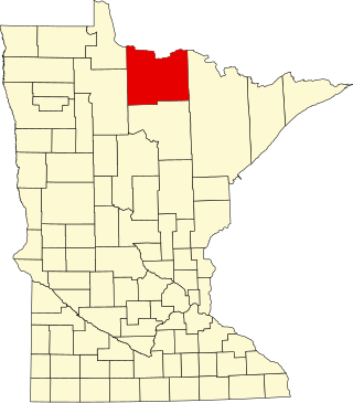
This is a list of the National Register of Historic Places listings in Koochiching County, Minnesota. It is intended to be a complete list of the properties and districts on the National Register of Historic Places in Koochiching County, Minnesota, United States. The locations of National Register properties and districts for which the latitude and longitude coordinates are included below, may be seen in an online map.

This is a list of the National Register of Historic Places listings in southern Westchester County, New York, excluding the cities of New Rochelle and Yonkers, which have separate lists of their own.


