Ryerson | |
|---|---|
| Township of Ryerson | |
 | |
 Ryerson | |
| Coordinates: 45°35′13″N79°30′40″W / 45.58694°N 79.51111°W | |
| Country | Canada |
| Province | Ontario |
| District | Parry Sound |
| Settled | 1870s |
| Incorporated | 1880 |
| Government | |
| • Type | Township |
| • Reeve | George Sterling |
| • Fed. riding | Parry Sound-Muskoka |
| • Prov. riding | Parry Sound—Muskoka |
| Area | |
| • Land | 185.93 km2 (71.79 sq mi) |
| Population (2021) [1] | |
• Total | 745 |
| • Density | 4/km2 (10/sq mi) |
| Time zone | UTC-5 (EST) |
| • Summer (DST) | UTC-4 (EDT) |
| Postal Code | P0A |
| Area codes | 705, 249 |
| Website | www |
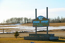
Ryerson is an incorporated township in the Almaguin Highlands region of Parry Sound District in northeastern Ontario, Canada. It had a population of 745 in the 2021 Canadian census. It was named after Egerton Ryerson, the Chief Superintendent of Education for Ontario from 1844 to 1876.

