Saratoga is a town in Carbon County, Wyoming, United States. The population was 1,690 at the 2010 census.

Saratoga is a town in Ward Township, Randolph County, in the U.S. state of Indiana. The population was 254 at the 2010 census.
Northumberland is a town in Saratoga County, New York, United States. Immediately north of Schuylerville and northeast of Saratoga Springs the town is also located on the west bank of the Hudson River.

Victory is a village in Saratoga County, New York, United States. The population was 666 at the 2020 census. The village is located in the northeastern part of the town of Saratoga, southwest of and bordering the village of Schuylerville. Victory is one of the smallest villages in New York.
Mount Pleasant is a town located in eastern Cabarrus County, North Carolina, United States. As of the 2010 census, the town population was 1,652. The town center is located at the crossroads of Mount Pleasant Road and North Carolina Highway 73. NC Highway 49 skirts the town to the north on its way from Charlotte to Asheboro.
Bermuda Run is a town in Davie County, North Carolina, United States. As of the 2020 census, the population of the town was 3,120. It was incorporated in 1999 as a fully gated residential community near country clubs and golf courses like the Bermuda Run Country Club, Oak Valley Golf Club, and Tanglewood Park. In 2000, the town annexed into neighboring Hillsdale, picking up a commercial district. The town rests on the western bank of the Yadkin River along U.S. Route 158 and North Carolina Highway 801. Interstate 40 provides express access to Winston-Salem, the town's nearest urban center. In 2012, Kinderton Village was voluntarily annexed by the town of Bermuda Run. Bermuda Run is considered by the locals to be a mid-high class community and the second-most influential, behind nearby Oak Valley.
Walkertown is a town in Forsyth County, North Carolina, United States and a rural area outside of Winston-Salem. It is part of the Piedmont Triad. The population was 5,695 at the 2020 census.

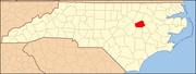
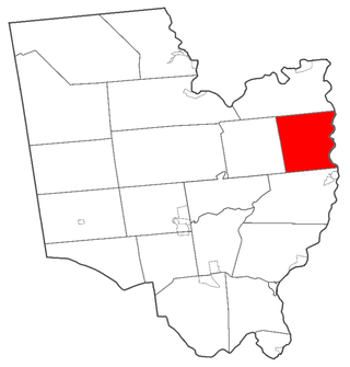
Fountain is a town in Pitt County, North Carolina, United States. The population was 427 at the 2010 census. The town is a part of the Greenville Metropolitan Area located in North Carolina's Inner Banks region.

Columbus is a town and the county seat of Polk County, North Carolina, United States. The population was 999 at the 2010 census.
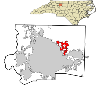
Franklinville is a town in Randolph County, North Carolina, United States. The population was 1,164 at the 2010 census.

Staley is a town in Randolph County, North Carolina, United States. The population was 393 at the 2010 census.
Hoffman is a town in Richmond County, North Carolina, United States. The population was 588 at the 2010 census. It was named for a family of settlers.
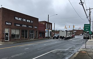
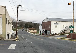
Walnut Cove is a town in Stokes County, North Carolina, United States. The population was 1,536 at the 2020 census.

Colley Township is a township in Sullivan County, Pennsylvania, United States. The population was 626 at the 2020 census. The village of Lopez is located in the township.
Ulmer is a town in Allendale County, South Carolina, United States. The population was 65 at the 2020 census.

Great Falls is a town in Chester County, South Carolina, United States and is located fourteen miles southwest of Lancaster, South Carolina. The population was 1,951 at the 2020 census.
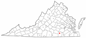
Alberta is a town in Brunswick County, Virginia, United States. The population was 302 at the 2020 census. It is home to the Christanna Campus of Southside Virginia Community College.

Worthington is a town in Marion County, West Virginia, United States. The population was 158 at the 2010 census. Worthington was incorporated in 1893 and named for Colonel George Worthington, an early settler. U.S. Route 19 passes through the town.

Leon is a town in Mason County, West Virginia, United States, situated along the Kanawha River. The population was 137 at the 2020 census. It is part of the Point Pleasant, WV–OH Micropolitan Statistical Area.

Ellenboro is a town in Ritchie County, West Virginia, United States. The population was 222 at the 2020 census. The town is located at the junction of U.S. Route 50 and West Virginia Route 16; the North Bend Rail Trail also passes through the town. The town was named for Ellen Mariah Williamson, the eldest daughter of the family that granted a right of way for the Baltimore and Ohio Railroad to build their line through the town; an earlier name for the community was Shumley. Ellenboro was incorporated in 1903.