Elm City, North Carolina

Last updated

Elm City, North Carolina
Elm City, North Carolina.jpg
Motto: 
"Southern Living"
USA North Carolina location map.svg
Red pog.svg
Elm City, North Carolina
Location within the state of North Carolina
Coordinates: 35°48′15″N77°51′22″W / 35.80417°N 77.85611°W / 35.80417; -77.85611
Country United States
State North Carolina
County Wilson, Nash
Area
[1]
  Total2.16 sq mi (5.59 km2)
  Land2.15 sq mi (5.57 km2)
  Water0.01 sq mi (0.02 km2)
Elevation
[2]
135 ft (41 m)
Population
 (2020)
  Total1,218
  Density566.25/sq mi (218.68/km2)
Time zone UTC-5 (Eastern (EST))
  Summer (DST) UTC-4 (EDT)
ZIP code
27822
Area code 252
FIPS code 37-20980 [3]
GNIS feature ID2406443 [2]
Website elmcitync.com/

Elm City is a town in Nash and Wilson County, United States. The population was 1,298 in 2010. It is a suburb of Wilson, North Carolina.

Contents

Elm City elected its first Black female mayor in its November 2021 municipal elections.

History

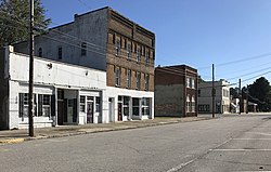
The Elm City Municipal Historic District, W. H. Langley House, and Webb-Barron-Wells House were listed on the National Register of Historic Places in 1986. [4]

In the summer of 1964, the Ku Klux Klan drove away a group of black and white teenage volunteers repainting the local First Presbyterian Church. [5] Subsequently, adult volunteers returned to finish the job, and Governor Terry Sanford dispatched state troopers to protect the team of integrated volunteers. [6] An attempt was later made by two white youths from Rocky Mount to burn down the church but they failed. Today elm city prides itself on integrating all races and walks of life [6]

Geography

According to the United States Census Bureau, the town has a total area of 0.8 square miles (2.1 km2), all land.

Demographics

Historical population
CensusPop.Note
1880 313
1890 48254.0%
1900 56016.2%
1910 5905.4%
1920 72522.9%
1930 90524.8%
1940 9464.5%
1950 839−11.3%
1960 729−13.1%
1970 1,20164.7%
1980 1,56130.0%
1990 1,6244.0%
2000 1,165−28.3%
2010 1,29811.4%
2020 1,218−6.2%
U.S. Decennial Census [7]

2020 census

Elm City racial composition [8]
RaceNumberPercentage
White (non-Hispanic)40032.84%
Black or African American (non-Hispanic)64953.28%
Native American 100.82%
Asian 272.22%
Other/Mixed 383.12%
Hispanic or Latino 947.72%

As of the 2020 United States census, there were 1,218 people, 547 households, and 368 families residing in the town.

2000 census

As of the census [3] of 2000, there were 1,165 people, 474 households, and 328 families residing in the town. The population density was 1,555.6 inhabitants per square mile (600.6/km2). There were 505 housing units at an average density of 674.3 per square mile (260.3/km2). The racial makeup of the town was 43.43% White, 53.91% African American, 0.26% Native American, 1.46% from other races, and 0.94% from two or more races. Hispanic or Latino of any race were 2.58% of the population.

There were 474 households, out of which 30.2% had children under the age of 18 living with them, 45.4% were married couples living together, 17.3% had a female householder with no husband present, and 30.6% were non-families. 27.0% of all households were made up of individuals, and 13.1% had someone living alone who was 65 years of age or older. The average household size was 2.45 and the average family size was 3.01.

In the town, the population was spread out, with 24.2% under the age of 18, 8.5% from 18 to 24, 26.1% from 25 to 44, 25.6% from 45 to 64, and 15.6% who were 65 years of age or older. The median age was 41 years. For every 100 females, there were 88.5 males. For every 100 females age 18 and over, there were 84.0 males.

The median income for a household in the town was $27,188, and the median income for a family was $39,861. Males had a median income of $26,500 versus $20,909 for females. The per capita income for the town was $13,533. About 11.0% of families and 14.7% of the population were below the poverty line, including 12.6% of those under age 18 and 23.1% of those age 65 or over.
Education

Elm City includes two public schools, Elm City Elementary (formerly known as Frederick Douglas School), and Elm City Middle School (formerly known as Elm City School/Elm City High School). It has a good reputation for sports. Jamie Watson, a former NBA athlete, is from Elm City. UNC Basketball alum John Virgil is also from Elm City.

Related Research Articles

<span class="mw-page-title-main">Owens Cross Roads, Alabama</span> Town in Alabama, United States

Owens Cross Roads is a town in Madison County, Alabama, United States, and is included in the Huntsville-Decatur Combined Statistical Area. It was incorporated on October 9, 1967. The population was 2,594 at the 2020 census. It is home to Brazelton Cemetery.

<span class="mw-page-title-main">Liberty, Indiana</span> Town in Indiana, United States

Liberty is a town in and the county seat of Union County, Indiana, United States, located about 5 miles (8.0 km) west of the state's border with Ohio. The population was 2,000 at the 2020 census.

<span class="mw-page-title-main">Wheatland, Iowa</span> City in Iowa, United States

Wheatland is a city in Clinton County, Iowa, United States. The population was 775 at the time of the 2020 census.

<span class="mw-page-title-main">Wellman, Iowa</span> City in Iowa, United States

Wellman is a city in Washington County, Iowa, United States. It is part of the Iowa City, Iowa Metropolitan Statistical Area. The population was 1,524 at the time of the 2020 census.

<span class="mw-page-title-main">Downs, Kansas</span> City in Osborne County, Kansas

Downs is a city in Osborne County, Kansas, United States. As of the 2020 census, the population of the city was 800.

<span class="mw-page-title-main">Laurel, Nebraska</span> City in Nebraska, United States

Laurel is a city in Cedar County, Nebraska located at the merger of Highway 20 and Highway 15 in the northeast corner of the state. Laurel sits roughly 40 miles east of Norfolk, Nebraska, west of Sioux City, Iowa, and south of Yankton, South Dakota. Wayne State College in Wayne, Nebraska is 15 miles south of Laurel. Its population was 975 at the 2020 census.

<span class="mw-page-title-main">North Harmony, New York</span> Town in New York, United States

North Harmony is a town in Chautauqua County, New York, United States. The population was 2,182 at the 2020 census. The town is on the west side of Chautauqua Lake. The shore of the lake is the location of many summer resort communities.

<span class="mw-page-title-main">Pittsfield, New York</span> Town in New York, United States

Pittsfield is a town in Otsego County, New York, United States. The population was 1,366 at the 2010 census.

<span class="mw-page-title-main">Graham, North Carolina</span> City in North Carolina, United States

Graham is a city and the county seat of Alamance County, North Carolina, United States. It is part of the Burlington, North Carolina Metropolitan Statistical Area. As of the 2020 census the population was 17,153.

<span class="mw-page-title-main">Newport, North Carolina</span> Town in North Carolina, United States

Newport is a town in Carteret County, North Carolina, United States. The population was 4,510 at the 2010 census.

<span class="mw-page-title-main">Rural Hall, North Carolina</span> Town in North Carolina, United States

Rural Hall is a town in Forsyth County, North Carolina, United States. It is a part of the Piedmont Triad. The population was 3,360 at the 2020 census. The town has one public park: Covington Memorial Park.

<span class="mw-page-title-main">High Shoals, North Carolina</span> City in North Carolina, United States

High Shoals is a city in Gaston County, North Carolina, United States, named for the high rocky shoal across the Catawba River. The population was 696 at the 2010 census.

<span class="mw-page-title-main">Scotland Neck, North Carolina</span> Town in North Carolina, United States

Scotland Neck is a town in Halifax County, North Carolina, United States. According to the 2010 census, the town population was 2,059. It is part of the Roanoke Rapids, North Carolina Micropolitan Statistical Area.

<span class="mw-page-title-main">Williamston, North Carolina</span> Town in North Carolina, United States

Williamston is a town and the county seat of Martin County, North Carolina, United States. The population was 5,248 at the 2020 census. It is located in North Carolina's Inner Banks region. The closest major city is Greenville, approximately 28 miles (45 km) to the southwest.

<span class="mw-page-title-main">Unionville, North Carolina</span> Town in North Carolina, United States

Unionville is a rural town in Union County, North Carolina, United States. The population was 6,643 at the 2020 census.

<span class="mw-page-title-main">Eastover, South Carolina</span> Town in South Carolina, United States

Eastover is a town in Richland County, South Carolina, United States. The population was 813 at the 2010 census, down from 830 in 2000. It is part of the Columbia, South Carolina, Metropolitan Statistical Area.

<span class="mw-page-title-main">Mount Carmel, Tennessee</span> City in Hawkins County, Tennessee, United States

Mount Carmel is a city in Hawkins County, Tennessee, United States. As of the 2010 census, the population was 5,429, an increase of 634 since the 2000 census. It is part of the Kingsport-Bristol-Bristol, TN-VA Metropolitan Statistical Area, which is a component of the "Tri-Cities" region.

<span class="mw-page-title-main">Elmer City, Washington</span> Town in Washington, United States

Elmer City is a town in Okanogan County, Washington, United States. The population was 239 at the 2020 census.

<span class="mw-page-title-main">Maxton, North Carolina</span> Town in North Carolina, United States

Maxton is a town in Robeson and Scotland counties, North Carolina, United States. The population was 2,426 at the time of the 2010 U.S. Census.

<span class="mw-page-title-main">New Point, Indiana</span> Town in Indiana, United States

New Point is a town in Salt Creek Township, Decatur County, Indiana, United States. The population was 331 at the 2010 census.

References

  1. "ArcGIS REST Services Directory". United States Census Bureau. Retrieved September 20, 2022.
  2. 1 2 U.S. Geological Survey Geographic Names Information System: Elm City, North Carolina
  3. 1 2 "U.S. Census website". United States Census Bureau . Retrieved January 31, 2008.
  4. "National Register Information System". National Register of Historic Places . National Park Service. July 9, 2010.
  5. "Church Group Driven Out by NC Klan". New Journal and Guide. June 27, 1964.
  6. 1 2 "2 Held for Trying to Burn North Carolina Church: Integrated Project is Started at Elm City Despite Threats by Klan". New York Times. July 15, 1964.
  7. "Census of Population and Housing". Census.gov. Retrieved June 4, 2015.
  8. "Explore Census Data". data.census.gov. Retrieved December 24, 2021.