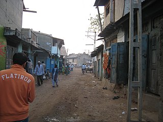
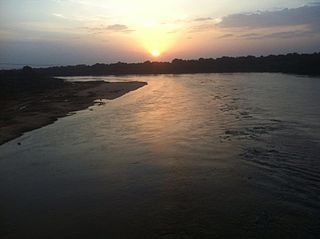
Umreth is a taluka and the administrative center of Anand District in the state of Gujarat, India. It is administered by Umreth Nagarpalika. It is part of the region known as Charotar, located in Anand and Kheda districts.

Ravishankar Vyas, better known as Ravishankar Maharaj, was an Indian independence activist, social worker and Gandhian from Gujarat.

Kheda District is one of the thirty-three districts of Gujarat state in western India. It is part of the region known as Charotar, consisting of Kheda and Anand districts. Its central city Nadiad is the administrative headquarters of the district.
Kutiyana is a city and a municipality in Porbandar district in the Indian state of Gujarat. It is situated on the banks of Bhadar River.
Sillod is a city and a taluka in the Aurangabad district of the Indian state of Maharashtra. Sillod is represented in the Maharashtra Vidhan Sabha through the Sillod Vidhan Sabha constituency. MLA OF SILLOD IS Abdul sattar
Mahemdavad is a town with municipality in the Kheda district in the Indian state of Gujarat. Mahemdavad is situated on the Vatrak River bank. The nearest city is Kheda. It is 30 km from largest city of Gujarat, Ahmedabad.
Nashirabad is a small town in Jalgaon district in the northern Maharashtra state in India. It was named after Nasiruddin Badshah. The earlier name of the town was Solnimbhore. This was due to fact that the town had 16 Hanuman temples and 16 main doors.
Manora is a town in Washim district, Maharashtra state, India. Nearby are other towns such as Waigaul, Poharadevi, and Asola; they are all religious villages. Manora is situated on the bank of the river named as Arunavati River. It is a central town for nearby villages. All major administrative offices are situated in this town. This town is governed by Nagar Panchayat.
Nagaon BK is a small but prosperous village in Amalner Taluka, Jalgaon District, Maharashtra, India.

Telnar or Telnal is a village in Kapadvanj Taluka in Kheda district of Gujarat state, India.
Ratnapimpri is a village in western Indian State of Maharashtra in the Jalgaon District, located on the bank of the River Gopi. It has been situated at the strategic location between two talukas-- Parola and Amalner in Jalgaon district. Administratively, it comes in Parola taluka but the assembly constituency is Covered Under Amalner. It is surrounded by villages named: Bahadarpur, Bhokarbari, Sadavan, and Bhilali. The village consists Sardar, Patil, Bhadane, Borse, Suryawanshi, Dhangar, Wankhede, Bhil communities predominently exists. Ratnapimpri has Two other Sub-villages in it viz. Dabapimpri, and Holpimpri. Although having three villages in one, the administrative activities are being handled by a single Gram-Panchayat, and postal services centered in Holpimpri. Pin Code:425111
Rampur ( ) is a village in Kheda district, Gujarat, India. It is located at 22°39'27"N / 72°46'26"E and 3 km far east of Vaso.
Vachhavad is a village in Mahuva Taluka, Surat District, Gujarat State, India. Vachhavad is 55 km from the district capital, Surat, and 317 km from the state capital Gandhinagar.

Kasor is a village in Sojitra Taluka and Anand District, in Gujarat, India. The village has an entrance from the State Highway 83 in Gujarat. Entrance Gate of Kasor came off the highway just after 2.5 km drive. The 400 K.V.SS Power Station is considered as being in this village.

Laul, also known as Sant Shri Kurmadas Maharaj Village, is a village located in Madha Taluka of Solapur District in the State of Maharashtra, in India. It belongs to the Pune Division. It is located 81 km towards west from District headquarter Solapur. It is situated from Kurduvadi Junction(6 km). The village is located at about 380 km from the state capital, Mumbai. Kurdu (5 km), Ghatane (6 km), Ujani Madha (6 km), Padsali (7 km), Ambad (Te) (7 km) are the nearby Villages to Laul. Laul is surrounded by Paranda Taluka towards North, Mohol Taluka towards East, Barshi Taluka towards East, Indapur Taluka towards west. Pandharpur, Kurduvadi, Solapur, Osmanabad are the nearby Cities to Laul. The village follows the Panchayati raj system. Also has a railway track, which used to travel by few people.
Kanij is a village in Mehmedabad Taluka in Kheda District of Gujarat State, India. It is about 37m above sea level. Kanij is located 15 km towards the north from district headquarters Kheda. The primary language spoken is Gujarati. 15 km from Ahmedabad. 47 km from the state capital Gandhinagar.
Kanjari Boriyavi Junction railway station is a railway station on the Western Railway network in the state of Gujarat, India. It is located in Kanjari, Kheda district of Gujarat, India. Kanjari Boriyavi Junction railway station is 8 km far away from Anand railway station and 11 km far away from Nadiad railway station. Passenger, MEMU and few Express trains halt at Kanjari Boriyavi Junction railway station. Kanjari Boriyavi Junction railway station is also connected to Vadtal by rail.
Mahemadavad Kheda Road railway station is a railway station on the Western Railway network in the state of Gujarat, India. Mahemadavad Kheda Road railway station is 18 km far away from Nadiad railway station. Passenger, MEMU and few Express/Superfast trains halt at Mahemadavad Kheda Road railway station. This railway station's nearest city is Kheda.

Meshwo or Meshwa is a river flowing in north and central parts Gujarat, state of India. Meshwo is the tributary river of the Sabarmati and subtribunary of the Vatrak River. It rises in the Panchara hills of Aravalli range, in the Dungarpur district of Rajasthan and enters in Gujarat at Shamlaji.

The Vatrak is a tributary of the Sabarmati River which flows for 243 kilometers in Gujarat, India. It originates in the hills of Dungarpur, Rajasthan and enters in Gujarat near village Moydi of Meghraj taluka.


