Sheldon, North Dakota

Last updated

Sheldon, North Dakota
Sheldon, North Dakota 06-08-2008.jpg
ND Ransom County Sheldon.svg
Location of Sheldon, North Dakota
Coordinates: 46°35′18″N97°29′40″W / 46.58833°N 97.49444°W / 46.58833; -97.49444
CountryUnited States
State North Dakota
County Ransom
Area
[1]
  Total0.41 sq mi (1.06 km2)
  Land0.41 sq mi (1.06 km2)
  Water0.00 sq mi (0.00 km2)
Elevation
[2]
1,076 ft (328 m)
Population
 (2020)
  Total95
  Density232.27/sq mi (89.79/km2)
Time zone UTC-6 (CST)
  Summer (DST) UTC-5 (CDT)
ZIP code
58068
Area code 701
FIPS code 38-72180
GNIS feature ID1036260 [2]

Sheldon is a city in Ransom County, North Dakota, United States. The population was 95 at the 2020 census. [3] Sheldon was founded in 1882.

Contents

History

The city is named after an early landowner. In 1905, the Masonic Mizpah Lodge Building was built. In 1906, a controversial artesian well was drilled in the community. [4]

Geography

According to the United States Census Bureau, the city has a total area of 0.22 square miles (0.57 km2), all of it land. [5]

The community is located at the junction of County Roads 136 and 3727, southeast of Enderlin.

Demographics

Historical population
CensusPop.Note
1890 258
1900 31823.3%
1910 35812.6%
1920 321−10.3%
1930 3271.9%
1940 281−14.1%
1950 267−5.0%
1960 221−17.2%
1970 192−13.1%
1980 173−9.9%
1990 149−13.9%
2000 135−9.4%
2010 116−14.1%
2020 95−18.1%
2021 (est.)98 [6] 3.2%
U.S. Decennial Census [7]
2020 Census [3]

2010 census

As of the census [8] of 2010, there were 116 people, 50 households, and 34 families residing in the city. The population density was 527.3 inhabitants per square mile (203.6/km2). There were 61 housing units at an average density of 277.3 per square mile (107.1/km2). The racial makeup of the city was 94.8% White, 1.7% Native American, and 3.4% from two or more races.

There were 50 households, of which 28.0% had children under the age of 18 living with them, 64.0% were married couples living together, 4.0% had a female householder with no husband present, and 32.0% were non-families. 28.0% of all households were made up of individuals, and 6% had someone living alone who was 65 years of age or older. The average household size was 2.32 and the average family size was 2.88.

The median age in the city was 42.7 years. 23.3% of residents were under the age of 18; 4.2% were between the ages of 18 and 24; 26.8% were from 25 to 44; 27.6% were from 45 to 64; and 18.1% were 65 years of age or older. The gender makeup of the city was 51.7% male and 48.3% female.

2000 census

As of the census of 2000, there were 135 people, 62 households, and 30 families residing in the city. The population density was 680.8 inhabitants per square mile (262.9/km2). There were 71 housing units at an average density of 358.0 per square mile (138.2/km2). The racial makeup of the city was 94.07% White, 2.96% Native American, 1.48% from other races, and 1.48% from two or more races.

There were 62 households, out of which 24.2% had children under the age of 18 living with them, 37.1% were married couples living together, 6.5% had a female householder with no husband present, and 51.6% were non-families. 48.4% of all households were made up of individuals, and 24.2% had someone living alone who was 65 years of age or older. The average household size was 2.18 and the average family size was 3.27.

In the city, the population was spread out, with 27.4% under the age of 18, 5.9% from 18 to 24, 28.1% from 25 to 44, 20.0% from 45 to 64, and 18.5% who were 65 years of age or older. The median age was 36 years. For every 100 females, there were 125.0 males. For every 100 females age 18 and over, there were 104.2 males.

The median income for a household in the city was $25,625, and the median income for a family was $50,250. Males had a median income of $28,125 versus $21,250 for females. The per capita income for the city was $14,671. There were 6.5% of families and 16.8% of the population living below the poverty line, including 20.5% of under eighteens and 32.1% of those over 64.

Notable people

Related Research Articles

<span class="mw-page-title-main">Sheldon, Illinois</span> Village in Illinois, United States

Sheldon is a village in Sheldon Township, Iroquois County, Illinois, United States. The population was 1,070 at the 2010 census, down from 1,232 at the 2000 census.

<span class="mw-page-title-main">Willey, Iowa</span> City in Iowa, United States

Willey is a city in Carroll County, Iowa, United States. The population was 73 at the time of the 2020 census.

<span class="mw-page-title-main">Maynard, Iowa</span> City in Iowa, United States

Maynard is a city in Fayette County, Iowa, United States. The population was 476 at the time of the 2020 census.

<span class="mw-page-title-main">Webster, Iowa</span> City in Iowa, United States

Webster is a city in Keokuk County, Iowa, United States. The population was 94 at the time of the 2020 census.

<span class="mw-page-title-main">Archer, Iowa</span> City in Iowa, United States

Archer is a city in O'Brien County, Iowa, United States. The population was 117 at the 2020 census.

<span class="mw-page-title-main">Ashton, Iowa</span> City in Iowa, United States

Ashton is a city in Osceola County, Iowa, United States. The population was 436 at the 2020 census.

<span class="mw-page-title-main">Matlock, Iowa</span> City in Iowa, United States

Matlock is a city in Sioux County, Iowa, United States. The population was 74 at the time of the 2020 census.

<span class="mw-page-title-main">Lilydale, Minnesota</span> City in Minnesota, United States

Lilydale is a city in Dakota County, Minnesota, United States. The population was 623 at the 2010 census.

<span class="mw-page-title-main">Warba, Minnesota</span> City in Minnesota, United States

Warba is a city in Itasca County, Minnesota, United States. The population was 181 at the 2010 census.

<span class="mw-page-title-main">Erhard, Minnesota</span> City in Minnesota, United States

Erhard is a city in Otter Tail County, Minnesota, United States. The population was 132 at the 2020 census.

<span class="mw-page-title-main">Richville, Minnesota</span> City in Minnesota, United States

Richville is a city in Otter Tail County, Minnesota, United States. The population was 77 as of the 2020 census.

<span class="mw-page-title-main">Lake Henry, Minnesota</span> City in Minnesota, United States

Lake Henry is a city in Stearns County, Minnesota, United States. The population was 103 at the 2010 census. It is part of the St. Cloud Metropolitan Statistical Area.

<span class="mw-page-title-main">Milo, Missouri</span> Village in Missouri, United States

Milo is a village in Vernon County, Missouri, United States. The population was 90 at the 2010 census.

<span class="mw-page-title-main">Sheldon, Missouri</span> City in Missouri, United States

Sheldon is a city in southern Vernon County, Missouri, United States. The population was 543 at the 2010 census.

<span class="mw-page-title-main">Nehawka, Nebraska</span> Village in Nebraska, United States

Nehawka is a village in southeast Cass County, Nebraska, United States. The population was 173 at the 2020 census.

<span class="mw-page-title-main">Kramer, North Dakota</span> City in North Dakota, United States

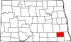
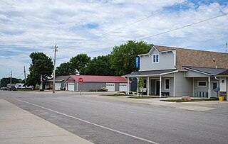
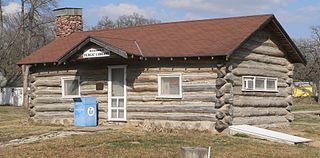
Kramer is a city in Bottineau County, North Dakota, United States. The population was 24 at the 2020 census. Kramer was founded in 1905.

<span class="mw-page-title-main">North River, North Dakota</span> City in North Dakota, United States

North River is a city in Cass County, North Dakota, United States. The population was 55 at the 2020 census. North River was founded in 1973. It is a suburb/bedroom community directly adjacent to the city of Fargo.

<span class="mw-page-title-main">Harrisburg, Oregon</span> City in Oregon, United States

Harrisburg is a city in Linn County, Oregon, United States. The population was 3,567 at the 2010 census.

<span class="mw-page-title-main">Elmhurst Township, Lackawanna County, Pennsylvania</span> Place in Pennsylvania, United States

Elmhurst Township is a township in Lackawanna County, Pennsylvania, United States. The population was 836 at the 2020 census.

<span class="mw-page-title-main">Sheldon, Monroe County, Wisconsin</span> Town in Wisconsin, United States

Sheldon is a town in Monroe County, Wisconsin, United States. The population was 682 at the 2000 census. The unincorporated community of Oil City, Wisconsin is located within the town of Sheldon.

References

  1. "ArcGIS REST Services Directory". United States Census Bureau. Retrieved September 20, 2022.
  2. 1 2 U.S. Geological Survey Geographic Names Information System: Sheldon, North Dakota
  3. 1 2 "Explore Census Data". United States Census Bureau . Retrieved June 27, 2022.
  4. Magazines, Hearst (October 1, 1917). Popular Mechanics. Hearst Magazines.
  5. "US Gazetteer files 2010". United States Census Bureau. Archived from the original on January 25, 2012. Retrieved June 14, 2012.
  6. "City and Town Population Totals: 2020-2021". United States Census Bureau. June 27, 2022. Retrieved June 27, 2022.
  7. United States Census Bureau. "Census of Population and Housing" . Retrieved January 30, 2014.
  8. "U.S. Census website". United States Census Bureau . Retrieved June 14, 2012.