
This is a list of sites in Minnesota which are included in the National Register of Historic Places. There are more than 1,600 properties and historic districts listed on the NRHP; each of Minnesota's 87 counties has at least 2 listings. Twenty-two sites are also National Historic Landmarks.

This is intended to be a complete list of the properties and districts on the National Register of Historic Places in Fairfield County, Connecticut, United States. The locations of National Register properties and districts for which the latitude and longitude coordinates are included below, may be seen in an online map.

This list is of the properties and historic districts that are designated on the National Register of Historic Places or that were formerly so designated, in Hennepin County, Minnesota; there are 169 entries as of November 2018. A significant number of these properties are a result of the establishment of Fort Snelling, the development of water power at Saint Anthony Falls, and the thriving city of Minneapolis that developed around the falls. Many historic sites outside the Minneapolis city limits are associated with pioneers who established missions, farms, and schools in areas that are now suburbs in that metropolitan area.

Shadow Lawn is a historic building in West Long Branch, Monmouth County, New Jersey, United States.

This is a complete list of National Register of Historic Places listings in Ramsey County, Minnesota. It is intended to be a complete list of the properties and districts on the National Register of Historic Places in Ramsey County, Minnesota, United States. The locations of National Register properties and districts for which the latitude and longitude coordinates are included below, may be seen in an online map.

Watrous, also named La Junta, is a National Historic Landmark District near Watrous, New Mexico. It encompasses the historic junction point of the two major branches of the Santa Fe Trail, a major 19th-century frontier settlement route between St. Louis, Missouri and Santa Fe, New Mexico. La Junta, marked this junction point, as well as the first major indications of civilization before westbound travelers reached Santa Fe. The district includes a large area west of the modern community of Watrous, encompassing the confluence of the Mora and Sapello Rivers. Surviving buildings include the houses of early ranchers, as well as a stagecoach mailstop and inn. The district was designated a National Historic Landmark in 1963.

This is a list of the National Register of Historic Places listings in Monterey County, California.

This is a list of the National Register of Historic Places listings in Blue Earth County, Minnesota. It is intended to be a complete list of the properties and districts on the National Register of Historic Places in Blue Earth County, Minnesota, United States. The locations of National Register properties and districts for which the latitude and longitude coordinates are included below, may be seen in an online map.

This is a list of the National Register of Historic Places listings in Crow Wing County, Minnesota. It is intended to be a complete list of the properties and districts on the National Register of Historic Places in Crow Wing County, Minnesota, United States. The locations of National Register properties and districts for which the latitude and longitude coordinates are included below, may be seen in an online map.

This is a list of the National Register of Historic Places listings in Winona County, Minnesota. It is intended to be a complete list of the properties and districts on the National Register of Historic Places in Winona County, Minnesota, United States. The locations of National Register properties and districts for which the latitude and longitude coordinates are included below, may be seen in an online map.

This is a list of the National Register of Historic Places listings in Houston County, Minnesota. It is intended to be a complete list of the properties and districts on the National Register of Historic Places in Houston County, Minnesota, United States. The locations of National Register properties and districts for which the latitude and longitude coordinates are included below, may be seen in an online map.

Joshua's Meadows is a historic home located at Bel Air, Harford County, Maryland, United States. It is a three-part house: the two oldest sections are Flemish bond brick, T-shaped, gable roofed, built about 1750; and the third section is of native fieldstone and dates to 1937. The original house consists of two parts; a main 2 1⁄2-story 20-by-40-foot house and a 1 1⁄2-story 16-by-20-foot kitchen wing.
This is a list of the National Register of Historic Places listings in Tipton County, Tennessee.
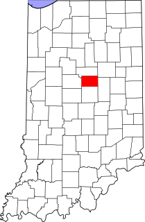
This is a list of the National Register of Historic Places listings in Tipton County, Indiana.

This is a list of the National Register of Historic Places listings in Waseca County, Minnesota. It is intended to be a complete list of the properties and districts on the National Register of Historic Places in Waseca County, Minnesota, United States. The locations of National Register properties and districts for which the latitude and longitude coordinates are included below, may be seen in an online map.

Cedar County Sheriff's House and Jail are historic buildings located in Tipton, Iowa, United States. The facility was known as a “Mom and Pop Jail.” The sheriff's wife, who was Mom, did the cooking and the sheriff, or a deputy, was Pop and provided supervision and administration. It is thought to be the last jail and residence combination still in use when it closed in 2001. The buildings were constructed in brick and were listed on the National Register of Historic Places in 2003 as a part of the Municipal, County and State Corrections Properties MPS.
Morris Frederick Bell was an American architect known primarily for his institutional buildings but also for his domestic and commercial structures. His best known work is the David R. Francis Quadrangle the historic center of the University of Missouri including Jesse Hall. He also designed state correctional schools in Boonville, Chillicothe, and Tipton; and state mental hospitals in Fulton, Higginsville, and Nevada. Bell, a democrat, was also active in civic life. He trained and employed William Lincoln Garver as an assistant. Garver would later go on to have a stand-alone career.

The William Garrett Plantation is a Southern plantation with a historic house located near the town of San Augustine in San Augustine County, Texas. The house was is "Texas frontier architecture" with some elements of Greek Revival and is notable for its "grandiose" scale.

The Divide Sheep Camp, also known as Niland's Cabins, is a ranch site on the Little Snake River in Carbon County, Wyoming, near Baggs. The camp was established in 1909 for summer use by sheepmen of the Niland-Tierney Sheep Company and others in the Little Snake valley. Eventually becoming the Divide Sheep Company the company operated until 1974, leaving the structures intact. The principal elements are a one-story log cabin with a finished attic, measuring about 25 feet (7.6 m) by 40 feet (12 m) built in the early 1920s, a log bunkhouse dating to about 1914, a spring house and a generator shed. The site represents a moderately-well-preserved turn-of-the-century sheep camp.

The Samuel J. Tipton House, near Harris, Kansas, dates from 1857. It was listed on the National Register of Historic Places in 1975.


