Eau Claire County is a county located in the U.S. state of Wisconsin. As of the 2020 census, the population was 105,710. Its county seat is Eau Claire. The county took its name from the Eau Claire River.

Chippewa County is a county located in the U.S. state of Wisconsin. It is named for the historic Chippewa people, also known as the Ojibwe, who long controlled this territory. As of the 2020 census, the population was 66,297. Its county seat is Chippewa Falls. The county was founded in 1845 from Crawford County, then in the Wisconsin Territory, and organized in 1853.

Chippewa Falls is a city located on the Chippewa River in Chippewa County, Wisconsin, United States. The population was 14,731 in the 2020 census. Incorporated as a city in 1869, it is the county seat of Chippewa County.

Stanley is a city in Chippewa and Clark counties in the U.S. state of Wisconsin. The population was 3,608 at the 2010 census. Of this, 3,602 were in Chippewa County, and 6 in Clark County.

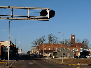
Altoona is a city in Eau Claire County, Wisconsin, United States. The population was 8,292 at the 2020 census with an estimated population in 2022 of 9,149. The city is a railroad terminal on the Union Pacific Railroad.

Eau Claire is a city in Eau Claire and Chippewa counties in the U.S. state of Wisconsin. It is the seat of Eau Claire County. It had a population of 69,421 in 2020, making it the state's eighth-most populous city. It is the principal city of the Eau Claire metropolitan area, locally known as the Chippewa Valley, which had 172,007 residents in 2020.
Carson Park is a historic park located in Eau Claire, Wisconsin. It is located on a 134-acre (54.2 ha) peninsula created on an oxbow lake, Half Moon Lake, which was part of the former course of the Chippewa River. The park contains baseball, football, and softball venues, as well as the Chippewa Valley Museum.

The National Register of Historic Places in the United States is a register including buildings, sites, structures, districts, and objects. The Register automatically includes all National Historic Landmarks as well as all historic areas administered by the U.S. National Park Service. Since its introduction in 1966, more than 97,000 separate listings have been added to the register.

Soo Line 2719 is a 4-6-2 "Pacific" type steam locomotive built by the American Locomotive Company (ALCO) for use on passenger trains operated by the Minneapolis, St. Paul and Sault Ste. Marie Railway. No. 2719 was used to haul the Soo Line's last steam-powered train, a June 21, 1959 round-trip excursion between Minneapolis, Minnesota and Ladysmith, Wisconsin. It was then displayed in Eau Claire, Wisconsin until 1996. It was restored and operated in excursion service from 1998 until 2013 when its boiler certificate expired. Today, the locomotive remains out of service in Duluth, Minnesota were it is currently awaiting an overhaul.
The Wisconsin Bridge and Iron Company (WB&I) was a fabricator and erector of iron and steel bridges and other large structures.

State Trunk Highway 312 is a 7.9-mile (12.7 km) long Wisconsin state highway running along the north side of Eau Claire, from the Town of Union in the west to the Town of Seymour in the east. The entire length of WIS 312 is an expressway with a few grade crossings.

The Soo Line High Bridge, also known as the Arcola High Bridge, is a steel deck arch bridge over the St. Croix River between Stillwater, Minnesota and Somerset, Wisconsin, United States. It was designed by structural engineer C.A.P. Turner and built by the American Bridge Company from 1910 to 1911. The bridge was listed on the National Register of Historic Places in 1977 for its national significance in the themes of engineering and transportation. It was nominated for its exceptional dimensions, beauty, innovative engineering techniques, and importance to transportation between Minnesota and Wisconsin.

This is a list of the National Register of Historic Places listings in Eau Claire County, Wisconsin. It is intended to provide a comprehensive listing of entries in the National Register of Historic Places that are located in Eau Claire County, Wisconsin. The locations of National Register properties for which the latitude and longitude coordinates are included below may be seen in a map.

The Minneapolis, St. Paul and Sault Ste. Marie Railroad (MStP&SSM) was a Class I railroad subsidiary of the Canadian Pacific Railway in the Midwestern United States. Commonly known since its opening in 1884 as the Soo Line after the phonetic spelling of Sault, it was merged with several other major CP subsidiaries on January 1, 1961, to form the Soo Line Railroad.

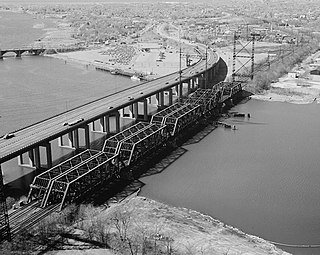
The Housatonic River Railroad Bridge is a historic bridge carrying Metro-North Railroad's New Haven Line trackage across the lower Housatonic River in the U.S. state of Connecticut. The bridge is also used by Amtrak for its Northeast Corridor services. It was listed on the National Register of Historic Places in 1987, which also refers to the bridge as the Devon Bridge. It is also referred to as the Devon Railroad Bridge by the state Department of Environmental Protection.
Phoenix Park is a public space in downtown Eau Claire, Wisconsin, located on a former brownfield site at the confluence of the Chippewa River and the Eau Claire River. It covers approximately 9 acres with approximately 1/2 mile of riverbank frontage. The park serves as the trailhead for the Chippewa River State Trail. The park also offers a walking labyrinth, a natural amphitheater, and is home to Eau Claire's year-round farmer's market. These amenities make Phoenix Park a major gathering spot, especially during the summer months when the park plays hosts to concerts. The park is owned and operated by the City of Eau Claire.
An S bridge is a bridge whose alignment follows a reverse curve, like the letter "S" in plan.

Dells of the Eau Claire County Park is in the north-central Wisconsin Town of Plover, east of the city of Wausau. It is divided in two by the Eau Claire River. The river flows through a rocky gorge to form cascades and waterfalls as it passes over and around weathered boulders, outcrops, and other formations. The depth of the river can vary depending on the time of the year. The park also has areas designated for camping, swimming, hiking, and picnicking.

The James Barber House is located in Eau Claire, Wisconsin.

The Eau Claire station, otherwise known as the Chicago, St. Paul, Minneapolis & Omaha Railroad Depot was a historic railroad station located at 324 Putnam Street in Eau Claire, Wisconsin. The station was built in 1893 for the Chicago, St. Paul, Minneapolis & Omaha Railroad, a subsidiary of the Chicago and North Western Railway. The depot was designed by Charles Sumner Frost in the Richardsonian Romanesque style utilizing Lake Superior brownstone. Passenger service on the line was ceased in 1963.


