Old Wethersfield, also known as Old Wethersfield Historic District, and historically known as Watertown or Pyquag, is a section of the town of Wethersfield, Connecticut, roughly bounded by the borders of the adjacent city of Hartford and town of Rocky Hill, railroad tracks, and I-91. The site of the first permanent European-American settlement in the state of Connecticut, it was added to the National Register of Historic Places in 1970.
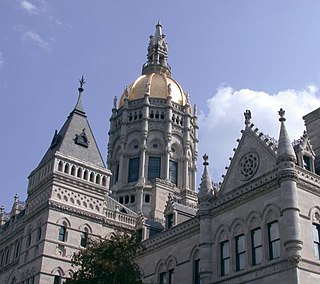
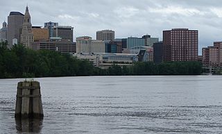
The neighborhoods of Hartford, Connecticut in the United States are varied and historic.

The Downtown North Historic District is a 19-acre (7.7 ha) historic district in Hartford, Connecticut. It is a predominantly residential area located around Main Street and High Street north of I-84 and south of the Amtrak railroad tracks. Its apartment blocks, houses, schools and churches, built up mainly in the late 19th and early 20th centuries as part of an expansion of the city's urban core. It includes the 130-foot (40 m) Keney Tower. The area was listed on the National Register of Historic Places in 2004.

The Dwight Street Historic District is an irregularly shaped 135-acre (55 ha) historic district in New Haven, Connecticut. The district is located immediately west of the center of Downtown New Haven and is generally bounded by Elm Street on the north, Park Street on the east, North Frontage Road on the south, and Sherman Avenue on the west. It contains one of the city's highest concentrations of well-preserved 19th and early 20th-century residential architecture, much of which was developed for the working classes in the city's factories. It was listed on the National Register of Historic Places in 1983. The historic district includes most of the Dwight neighborhood and several blocks of the northeast corner of the West River neighborhood.

The Church of the Good Shepherd and Parish House is an Episcopal church at 155 Wyllys Street in Hartford, Connecticut. It was commissioned by Elizabeth Jarvis Colt, the widow of Samuel Colt and completed in 1867. The church and its associated parish house were designed by Edward Tuckerman Potter, and serve as a memorial to Samuel Colt and members of his family. The church and parish house were added to the National Register of Historic Places in 1975, and became a contributing property to the Coltsville Historic District in 2008.

The Prospect Avenue Historic District encompasses a predominantly residential area in western Hartford and eastern West Hartford, Connecticut. The 300-acre (120 ha) historic district extends along Prospect Avenue from Albany Avenue to Fern Street, including most of the area between those streets and the Park River to the east, and Sycamore Street and Sycamore Lane to the west. The district includes 240 contributing buildings and 48 non-contributing buildings, most of them residences built between 1880 and 1930. The district was listed on the National Register of Historic Places in 1985.

Coltsville Historic District is a National Historic Landmark District in Hartford, Connecticut. The district encompasses the factory, worker housing, and owner residences associated with Samuel Colt (1814-1862), one of the nation's early innovators in precision manufacturing and the production of firearms. It was the site of important contributions to manufacturing technology made by Colt and the industrial enterprise he created. Coltsville is a cohesive and readily identifiable 260-acre (110 ha) area, part of which was originally listed as the Colt Industrial District on the National Register of Historic Places in 1976. It was designated a National Historic Landmark in 2008.
Colt Park is a city park in the southeast Hartford, Connecticut neighborhood of Sheldon/Charter Oak. The 105 acres (42 ha) park was established from the former Armsmear Estate of Samuel Colt and Elizabeth Jarvis Colt which was gifted to the city upon her death in 1905. Today the 106 acres (43 ha) park is home to playgrounds, sports fields, a skating rink and Dillon Stadium. Colt Park was listed on the National Register of Historic Places on June 8, 1976, designated as part of the Colt Industrial District, valued for its association with industrialist Samuel Colt. It is bounded by Wawarme, Wethersfield, Hendricsen, Van Dyke Avenues and Stonington, Maseek and Sequassen Streets.

The James B. Colt House is a historic house at 154 Wethersfield Avenue in Hartford, Connecticut. Built in 1855, it is a high-quality example of Italianate architecture. It was built for James B. Colt, the brother of industrialist Samuel Colt, whose Armsmear estate is just to the north. The house was listed on the National Register of Historic Places in 1975.

The Central Avenue-Center Cemetery Historic District encompasses part of the town center of East Hartford, Connecticut. Although it was founded in the mid-17th century, it is now dominated by architecture of the late 19th and early 20th centuries. The Center Cemetery is the town's oldest surviving property, and includes the grave of William Pitkin, a colonial governor. The district, including portions of Main Street and Central Avenue, was listed on the National Register of Historic Places in 1993.
The Fairfield Avenue Historic District encompasses most of a portion of Fairfield Avenue in southern Hartford, Connecticut. Extending from Trinity College in the north to Cedar Hill Cemetery in the south, the streetscape typifies the city's development between about 1890 and 1930, a period of growth along the road fueled by the rise of streetcars. The district was listed on the National Register of Historic Places in 1984.

The Jefferson-Seymour District is a historic district encompassing a residential area on the south side of Hartford, Connecticut. Covering portions of Cedar, Wadsworth, Seymour and Jefferson Streets, it contains a well-preserved collection of late 19th and early 20th-century middle-class residential architecture, primarily executed in brick. It was listed on the National Register of Historic Places in 1979.

The Laurel and Marshall Streets District is a historic district encompassing a late-19th and early-20th century residential area in the Asylum Hill neighborhood of Hartford, Connecticut. Extending along Laurel and Marshall Streets between Niles and Case Streets, its housing stock represents a significant concentration of middle-class Queen Anne architecture in the city. It was listed on the National Register of Historic Places in 1979.

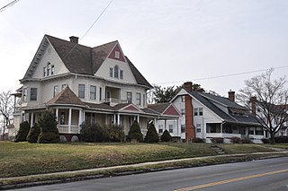
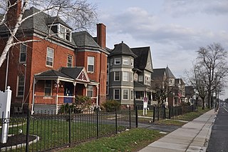
The West End North Historic District encompasses a neighborhood of late 19th and early 20th century residential architecture in western Hartford, Connecticut and eastern West Hartford, Connecticut. Roughly bounded by Prospect, Elizabeth, and Lorraine Streets and Farmington Avenue, the area includes a large number of Colonial Revival and Queen Anne houses, as well as numerous buildings in other period styles, with only a small number of losses. It was listed on the National Register of Historic Places in 1985.
The Parkside Historic District encompasses a fine collection of Queen Anne Victorian houses lining the east side of Wethersfield Avenue north of Wawarme Avenue in southern Hartford, Connecticut. This area was developed in the 1880s and 1890s by Mrs. Elizabeth Jarvis Colt, widow of arms manufacturer Samuel Colt, out of a portion of their extensive estate. Of this development, a row of nine houses now remains; it was listed on the National Register of Historic Places in 1984.
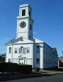
The Rocky Hill Center Historic District encompasses the traditional town center and surrounding residential area of Rocky Hill, Connecticut. It extends along Old Main Street from the Wethersfield line southward to a triangular area bounded by Old Main, Riverview Road, and Glastonbury Avenue. Included in a basically 19th-century streetscape are the town's principal civic and religious buildings, as well as a fine collection of mainly 18th and 19th-century residential architecture. The district was listed on the National Register of Historic Places in 2007.

The Wethersfield Avenue Car Barn, also known locally just as the Trolley Barn, is a historic trolley barn at 331 Wethersfield Avenue in Hartford, Connecticut. Built in 1902, it is the only surviving building used exclusively for the area's extensive electrified street car network in the first half of the 20th century. Now converted to other uses, it was listed on National Register of Historic Places in 1983.