
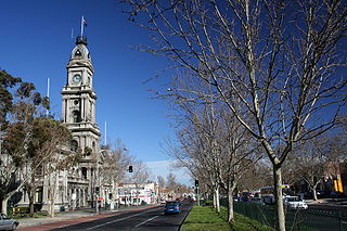
Nepean Highway runs south from St Kilda Junction in Victoria, Australia to Portsea, close to the eastern shore of Port Phillip. It is the primary road route to central Melbourne from Melbourne's southern suburbs.
Hoddle Highway is an urban highway in Melbourne linking CityLink and the Eastern Freeway, itself a sub-section of Hoddle Main Road. Both these names are not widely known to most drivers, as the entire allocation is still best known as by the names of its constituent parts: Hoddle Street, Punt Road and Barkly Street. This article will deal with the entire length of the corridor for sake of completion, as well to avoid confusion between declarations.

The Monash Freeway is a major urban freeway in Victoria, Australia, linking Melbourne's CBD to its south-eastern suburbs and beyond to the Gippsland region. It carries up to 180,000 vehicles per day and is one of Australia's busiest freeways. The entire stretch of the Monash Freeway bears the designation M1.
South Gippsland Freeway is a short freeway linking Dandenong in Melbourne's south-east to other south-eastern destinations, including the Mornington Peninsula and the Gippsland region. The freeway bears the designation M420.

The Mornington Peninsula Freeway is a freeway in Melbourne, Victoria, Australia, that provides a link from south-eastern suburban Melbourne to the Mornington Peninsula. Whilst the entire Freeway is declared by VicRoads as Mornington Peninsula Freeway, the section between EastLink in Carrum Downs and Moorooduc Highway in Moorooduc is locally and commonly known as Peninsula Link. The entire freeway corridor bears the designation M11. This article will deal with the entire length of the corridor for sake of completion, as well to avoid confusion between declarations.

The Frankston Freeway is a short freeway in southern Melbourne initially designed as a bypass of central Frankston and later incorporated a freeway-style upgrade to Wells Road in the 1970s, now acting as a link from suburban Melbourne to Frankston's eastern suburbs.
Moorooduc Highway is a 16 km highway which runs from Frankston to Tuerong and, together with the Mornington Peninsula Freeway, was part of the main route from Melbourne to the Mornington Peninsula until the completion of Peninsula Link in 2013. This name is not widely known to most drivers, as the entire allocation is still best known as by the names of its constituent parts: McMahons Road, Frankston-Flinders Road, and Moorooduc Road. This article will deal with the entire length of the corridor for sake of completion, as well to avoid confusion between declarations.

The Dandenong Valley Highway is an urban highway stretching almost 40 kilometres from Bayswater in Melbourne's eastern suburbs to Frankston in the south. This name covers many consecutive streets and is not widely known to most drivers, as the entire allocation is still best known as by the names of its constituent parts: Stud Road, Foster Street, Dandenong-Frankston Road, Dandenong Road West and Fletcher Road. This article will deal with the entire length of the corridor for sake of completion, as well to avoid confusion between declarations.

The Dingley Arterial Road Project is a partially completed arterial standard road which runs east to west through the southern suburbs of Melbourne, Australia.
The Dandenong Bypass is a highway in the state of Victoria, Australia that runs along the Dingley Freeway reservation from Springvale Road in Keysborough to the South Gippsland Highway in Dandenong South.
Westall Road is a major north to south thoroughfare west of Springvale, Victoria, Australia.
Greensborough Highway is a highway in the north-eastern suburbs of Melbourne, Australia, and is an important route for north-east Melbourne. This name is not widely known to most drivers, as the entire allocation is still best known as by the names of its constituent parts: Lower Heidelberg Road, Rosanna Road, Lower Plenty Road, Greensborough Road and Greensborough Bypass. This article will deal with the entire length of the corridor for sake of completion, as well to avoid confusion between declarations.
Burwood Highway is a major transportation link with Melbourne's eastern suburbs. It begins in the suburb of Kooyong, Melbourne at the junction of the Monash Freeway as Toorak Road between Monash Freeway and Warrigal Road, and finishes in Belgrave, Victoria in the Dandenong Ranges. The highway is considered a major link for people who live in the Dandenong Ranges, as it is the only major feeder roadway in the general area other than Canterbury Road, Ferntree Gully Road, EastLink and Wellington Road.
Springvale Junction is a particularly notorious road intersection in Melbourne. It is situated on the boundary of the suburbs of Mulgrave and Springvale.
Thompson Road is a major urban arterial road in the south-eastern suburbs of Melbourne, Victoria, Australia.
Western Port Highway is a highway in Victoria, Australia, linking the south-eastern fringe of suburban Melbourne to the western coast of Western Port Bay, after which the highway is named, at the Port of Hastings nearly 30 km to the south. It runs from the end of the South Gippsland Freeway at Lynbrook firstly as a dual carriageway and later as an undivided road to Frankston-Flinders Road at Hastings.
The Ringwood Bypass is a short stretch of road extending from EastLink to Maroondah Highway in Melbourne, Australia. It allows the Maroondah Highway to bypass Eastland Shopping Centre, in the eastern Melbourne suburb of Ringwood.
Warrigal Road is a major inner urban road in southeastern Melbourne, Australia. On weekdays, it is heavily trafficked as it runs through many major suburbs along its route, traversing some of Melbourne's eastern and south-eastern suburbs. These suburbs include Chadstone, Oakleigh, and Cheltenham. The Chadstone Shopping Centre can be accessed directly from Warrigal Road at its eastern entrance.

State (Bell/Springvale) Highway, also known as Bell Street/Springvale Road State Highway, is the longest self-contained urban highway in Melbourne, Australia, linking Tullamarine Freeway and Nepean Highway through Melbourne's north-eastern suburbs. These names are not widely known to most drivers, as the entire allocation is still best known as by the names of its constituent parts: Bell Street, Banksia Street, Manningham Road, Williamsons Road, Doncaster Road, Mitcham Road, Springvale Road and Edithvale Road. This article will deal with the entire length of the corridor for sake of completion, as well to avoid confusion between declarations.
Dingley Bypass is an arterial road in southeastern Melbourne, Victoria, Australia that travels along the Dingley Arterial route from Westall Road to Warrigal Road. After the intersection with Warrigal Road, the highway continues further west as South Road, which extends all the way to the bayside Beach Road at Brighton.