
Beckenham is a town in Greater London, England, within the London Borough of Bromley. Prior to 1965, it was part of Kent. It is situated north of Elmers End and Eden Park, east of Penge, south of Lower Sydenham and Bellingham, and west of Bromley and Shortlands, and 8.4 miles (13.5 km) south-east of Charing Cross. Its population at the 2011 Census was 46,844.

Bellingham is an area of south-east London, England, within the London Borough of Lewisham. It lies south of Catford, east of Sydenham and north of Beckenham, and is part of the Catford postal district (SE6).

Catford is a district in south east London, England, and the administrative centre of the London Borough of Lewisham. It is southwest of Lewisham itself, mostly in the Rushey Green and Catford South wards. The population of Catford, including Bellingham, was 44,905 in 2011.

Crofton Park is a mainly residential suburb and electoral ward in the London Borough of Lewisham.

Mottingham is a district of south-east London, England, which straddles the border of both the London Borough of Bromley and the Royal Borough of Greenwich. It is located south west of Eltham, 1.5 miles. It was historically within the county of Kent.

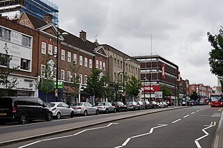
Penge is a suburb of South East London, England, now in the London Borough of Bromley, 3.5 miles (5.6 km) west of Bromley, 3.7 miles (6.0 km) north east of Croydon and 7.1 miles (11.4 km) south east of Charing Cross.

Sydenham is a district of south-east London, England, which is shared between the London boroughs of Lewisham, Bromley and Southwark. Prior to the creation of the County of London in 1889, Sydenham was located in Kent, bordering Surrey. Historically, the area was very affluent, with the Crystal Palace being relocated to Sydenham Hill in 1854. Today, Sydenham is a diverse area, with a population of 28,378 and borders Forest Hill, Dulwich, Crystal Palace, Penge, Beckenham, Catford and Bellingham.

The London Borough of Bromley is a borough in London, England. It borders the county of Kent, of which it formed part until 1965. The borough's population in the 2021 census was 329,991. It is named after Bromley, its principal district. Other districts are Penge, Hayes, West Wickham, Chislehurst, Beckenham and Orpington. The local authority is Bromley London Borough Council.

Lewisham is an area of southeast London, England, six miles south of Charing Cross. It is the principal area of the London Borough of Lewisham, and was within the historic county of Kent until 1889. It is identified in the London Plan as one of 35 major centres in Greater London, with a large shopping centre and street market. Lewisham had a population of 60,573 in 2011.
Bromley is a large town in Greater London, England, within the London Borough of Bromley. It is 9+1⁄2 miles southeast of Charing Cross, and had an estimated population of 88,000 as of 2023.

Lee, also known as Lee Green, is an area of South East London, England, straddling the border of the London Borough of Lewisham and the Royal Borough of Greenwich. It is located northwest of Eltham and southeast of Lewisham. It was in Kent before becoming part of the County of London in 1889, and then Greater London in 1965.

Downham is a district of South East London, England, primarily within the London Borough of Lewisham and some parts in the London Borough of Bromley. It is located north of Bromley and south of Catford.

Grove Park is a district of South East London, England within the London Borough of Lewisham. It is located north east of Bromley and south east of Lewisham.

Eden Park is a suburban area in Greater London, England, within the London Borough of Bromley, Greater London and prior to 1965, in the historic county of Kent. It lies south of Beckenham, west of Park Langley and Shortlands, north of West Wickham and Monks Orchard and east of Elmers End.

Lewisham parks and open spaces are part of the "green lung" of London and include a diverse range of sites, from small urban parks and gardens to one of the most historic natural landscapes in Greater London at Blackheath. While overall control rests with London Borough of Lewisham, management of borough-owned parks and their facilities is contracted out to Glendale Grounds Management.

St Mary Cray is an area of South East London, England, within the London Borough of Bromley. Historically it was a market town in the county of Kent. It is located north of Orpington, and 13 miles (21 km) south-east of Charing Cross.

Lewisham West and Penge was a constituency in Greater London created in 2010 and represented in the House of Commons of the UK Parliament.

Locksbottom is a suburb of south-east London within the London Borough of Bromley, Greater London. Prior to 1965 it was within the historic county of Kent. It is located south of Bromley Common, west of Crofton, north-west of Farnborough, and east of Keston.

Elmers End is an area of south-east London, England, within the London Borough of Bromley, Greater London and formerly part of the historic county of Kent. It is located south of Beckenham, west of Eden Park, north of Monks Orchard and east of Anerley.

Forster Memorial Park, is a public park in London Borough of Lewisham. It takes up the land between Bellingham Road and Whitefoot Lane, Catford – the park and surrounding roads form Southend or Southend Village. The nearest stations are Bellingham and Beckenham Hill.


