Sparkman, Arkansas

Last updated

Sparkman, Arkansas
Dallas County Arkansas Incorporated and Unincorporated areas Sparkman Highlighted 0565900.svg
Location of Sparkman in Dallas County, Arkansas.
Coordinates: 33°55′2″N92°50′56″W / 33.91722°N 92.84889°W / 33.91722; -92.84889
Country United States
State Arkansas
County Dallas
Area
[1]
  Total1.29 sq mi (3.34 km2)
  Land1.29 sq mi (3.34 km2)
  Water0.00 sq mi (0.00 km2)
Elevation
171 ft (52 m)
Population
 (2020)
  Total355
  Density274.98/sq mi (106.19/km2)
Time zone UTC-6 (Central (CST))
  Summer (DST) UTC-5 (CDT)
ZIP code
71763
Area code 870
FIPS code 05-65900
GNIS feature ID0058666

Sparkman is a city in Dallas County, Arkansas, United States. The population was 355 at the 2020 census, down from 427 in 2010.

Contents

History

Sparkman was established between 1911 and 1913 and was named after sawmill owner Lemuel "Pete" Sparkman. In 1915, the Sparkman News was established, Sparkman's first election was held, and electricity was installed. The first school in Sparkman was a two-story building with an enrollment of 132. H.O. Theatt was the first principal, with Miss Ethel Fite and Miss Ella Adams being the first teachers.

A Baptist church was organized in 1914, with Methodist and A.M.E. churches organizing in 1916.

Geography

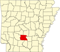
Sparkman is located in western Dallas County at 33°55′2″N92°50′56″W / 33.91722°N 92.84889°W / 33.91722; -92.84889 (33.917201, -92.848763). [2] Arkansas Highway 128 passes through the center of town as Main Street and leads southeast 11 miles (18 km) to Highway 9 at Holly Springs. Arkansas Highway 7 passes through the west side of Sparkman, leading north (with Highway 128) 10 miles (16 km) to Highway 8 at Dalark and south 27 miles (43 km) to Camden.

According to the United States Census Bureau, Sparkman has a total area of 1.3 square miles (3.4 km2), all land.

Climate

The climate in this area is characterized by hot, humid summers and generally mild to cool winters. According to the Köppen Climate Classification system, Sparkman has a humid subtropical climate, abbreviated "Cfa" on climate maps. [3]

Climate data for Sparkman, Arkansas (1991–2020 normals, extremes 1963–2020)
MonthJanFebMarAprMayJunJulAugSepOctNovDecYear
Record high °F (°C)81
(27)
95
(35)
90
(32)
94
(34)
99
(37)
104
(40)
108
(42)
110
(43)
109
(43)
95
(35)
85
(29)
79
(26)
110
(43)
Mean maximum °F (°C)70.4
(21.3)
74.5
(23.6)
81.6
(27.6)
85.4
(29.7)
90.7
(32.6)
94.9
(34.9)
98.9
(37.2)
99.3
(37.4)
95.4
(35.2)
87.1
(30.6)
77.3
(25.2)
70.8
(21.6)
101.0
(38.3)
Mean daily maximum °F (°C)52.2
(11.2)
57.4
(14.1)
65.8
(18.8)
74.4
(23.6)
81.0
(27.2)
88.0
(31.1)
91.8
(33.2)
90.9
(32.7)
85.3
(29.6)
73.9
(23.3)
63.6
(17.6)
54.8
(12.7)
73.3
(22.9)
Daily mean °F (°C)41.4
(5.2)
45.6
(7.6)
53.4
(11.9)
61.6
(16.4)
69.9
(21.1)
77.6
(25.3)
81.3
(27.4)
80.4
(26.9)
74.0
(23.3)
61.8
(16.6)
51.7
(10.9)
44.1
(6.7)
61.9
(16.6)
Mean daily minimum °F (°C)30.6
(−0.8)
33.7
(0.9)
41.0
(5.0)
48.7
(9.3)
58.8
(14.9)
67.1
(19.5)
70.7
(21.5)
69.8
(21.0)
62.6
(17.0)
49.7
(9.8)
39.8
(4.3)
33.5
(0.8)
50.5
(10.3)
Mean minimum °F (°C)15.3
(−9.3)
20.6
(−6.3)
24.8
(−4.0)
33.3
(0.7)
44.2
(6.8)
56.1
(13.4)
63.6
(17.6)
61.0
(16.1)
48.3
(9.1)
32.6
(0.3)
23.6
(−4.7)
19.8
(−6.8)
13.4
(−10.3)
Record low °F (°C)−10
(−23)
10
(−12)
11
(−12)
24
(−4)
32
(0)
41
(5)
52
(11)
48
(9)
34
(1)
22
(−6)
10
(−12)
−4
(−20)
−10
(−23)
Average precipitation inches (mm)4.43
(113)
4.73
(120)
5.64
(143)
5.89
(150)
6.26
(159)
3.94
(100)
3.88
(99)
3.25
(83)
3.56
(90)
4.86
(123)
4.24
(108)
5.51
(140)
56.19
(1,427)
Average snowfall inches (cm)0.8
(2.0)
0.4
(1.0)
0.4
(1.0)
0.0
(0.0)
0.0
(0.0)
0.0
(0.0)
0.0
(0.0)
0.0
(0.0)
0.0
(0.0)
0.0
(0.0)
0.0
(0.0)
0.0
(0.0)
1.6
(4.1)
Average precipitation days (≥ 0.01 in)7.89.18.88.48.57.07.36.35.76.48.08.491.7
Average snowy days (≥ 0.1 in)0.20.30.20.00.00.00.00.00.00.00.00.00.7
Source: NOAA [4] [5]

Demographics

Historical population
CensusPop.Note
1920 561
1930 71126.7%
1940 84018.1%
1950 96414.8%
1960 787−18.4%
1970 663−15.8%
1980 622−6.2%
1990 553−11.1%
2000 5866.0%
2010 427−27.1%
2020 355−16.9%
U.S. Decennial Census [6] [7]

As of the 2010 United States Census, there were 427 people living in the city. The racial makeup of the city was 55.3% White, 38.4% Black and 1.4% from two or more races. 4.9% were Hispanic or Latino of any race.

As of the census [8] of 2000, there were 586 people, 237 households, and 167 families living in the city. The population density was 451.4 inhabitants per square mile (174.3/km2). There were 291 housing units at an average density of 224.2 per square mile (86.6/km2). The racial makeup of the city was 50.85% White, 42.15% Black or African American, 0.34% Native American, 6.48% from other races, and 0.17% from two or more races. 6.83% of the population were Hispanic or Latino of any race.

There were 237 households, out of which 26.6% had children under the age of 18 living with them, 48.1% were married couples living together, 18.1% had a female householder with no husband present, and 29.5% were non-families. 27.0% of all households were made up of individuals, and 11.8% had someone living alone who was 65 years of age or older. The average household size was 2.47 and the average family size was 2.95.

In the city, the population was spread out, with 26.6% under the age of 18, 8.0% from 18 to 24, 23.5% from 25 to 44, 27.1% from 45 to 64, and 14.7% who were 65 years of age or older. The median age was 40 years. For every 100 females, there were 86.6 males. For every 100 females age 18 and over, there were 82.2 males.

The median income for a household in the city was $25,208, and the median income for a family was $32,875. Males had a median income of $26,875 versus $20,795 for females. The per capita income for the city was $12,492. About 14.0% of families and 21.9% of the population were below the poverty line, including 28.4% of those under age 18 and 18.6% of those age 65 or over.

Education

Harmony Grove School District of Ouachita County operates local public schools.

Sparkman Elementary School and Sparkman High School with an enrollment of less than 200 pupils K-12 are in the community. Sparkman athletics teams are known as the Raiders. They compete at the 1A level in girls and boys basketball, baseball, and softball. Sparkman had a football team until they consolidated in 2004. They were very competitive for many years in which they played in state playoff games, sometimes with only 16 players.[ citation needed ]

The community was previously in the Sparkman School District. On July 1, 2004, it consolidated into the Harmony Grove district. [9]

Notable people

Points of interest

Related Research Articles

<span class="mw-page-title-main">Dallas County, Arkansas</span> County in Arkansas, United States

Dallas County is a county located in the U.S. state of Arkansas. As of the 2020 census, the population was 6,482, making it the fourth-least populous county in Arkansas. The county seat is Fordyce. Dallas County is Arkansas's 49th county, formed on January 1, 1845; it was named for George M. Dallas, 11th Vice President of the United States.

<span class="mw-page-title-main">Hamburg, Arkansas</span> City in Arkansas

Hamburg is a city and county seat of Ashley County, Arkansas, United States. The population was 2,857 at the 2010 census. It is best known for being the home town of NBA legend Scottie Pippen.

<span class="mw-page-title-main">Gassville, Arkansas</span> City in Arkansas, United States

Gassville is a city in Baxter County, Arkansas, United States. According to the 2020 census, the city population was 2,171.

<span class="mw-page-title-main">Salesville, Arkansas</span> City in Arkansas, United States

Salesville is a city in Baxter County, Arkansas, United States. The population was 450 in 2010.

<span class="mw-page-title-main">Diamond City, Arkansas</span> City in Arkansas, United States

Diamond City is a city in northeast Boone County, Arkansas, United States. The population was 782 at the 2010 census. It is part of the Harrison Micropolitan Statistical Area.

<span class="mw-page-title-main">Hampton, Arkansas</span> Town in Arkansas, United States

Hampton is a town in Calhoun County, Arkansas, United States. The population was 1,181 according to the 2020 United States Census. The town is the county seat of Calhoun County.

<span class="mw-page-title-main">Eudora, Arkansas</span> City in Arkansas, United States

Eudora is a city in Chicot County, Arkansas, United States. The population was 2,269 at the 2010 census, down from 2,819 in 2000.

<span class="mw-page-title-main">Quitman, Arkansas</span> City in Arkansas, United States

Quitman is a city in Cleburne and Faulkner counties in the U.S. state of Arkansas. Its population was 762 at the 2010 census. The portion of the city in Faulkner County is part of the Central Arkansas region.

<span class="mw-page-title-main">Waldo, Arkansas</span> Town in Arkansas, United States

Waldo is a town in Columbia County, Arkansas, United States. The population was 1,372 at the 2010 census.

<span class="mw-page-title-main">Mountain Pine, Arkansas</span> City in Arkansas, United States

Mountain Pine is a city in Garland County, Arkansas, United States. It is part of the Hot Springs Metropolitan Statistical Area. The population was 770 at the 2010 United States Census. It is located immediately southeast of Lake Ouachita below the Blakely Mountain Dam. The city consists of five defined neighborhoods, Pinewood (north), South Mountain Pine, a business district, Cozy Acres (southwest) and Mountain View/Timberland area.

<span class="mw-page-title-main">Ozan, Arkansas</span> Town in Arkansas, United States

Ozan is a town in Hempstead County, Arkansas, United States. The population was 85 at the 2010 census. It is part of the Hope Micropolitan Statistical Area.

<span class="mw-page-title-main">Batesville, Arkansas</span> City in Arkansas, United States

Batesville is the county seat and largest city of Independence County, Arkansas, United States, 80 miles (183 km) northeast of Little Rock, the state capital. According to the 2010 Census, the population of the city was 10,268. The city serves as a regional manufacturing and distribution hub for the Ozark Mountain region and Northeast Arkansas.

<span class="mw-page-title-main">Calico Rock, Arkansas</span> City in Arkansas, United States

Calico Rock is a city in Izard County, Arkansas, United States. The population was 1,545 at the 2010 census, up from 991 in 2000.

<span class="mw-page-title-main">Newport, Arkansas</span> City in Arkansas, United States

Newport is a city in and the county seat of Jackson County, Arkansas, United States located on the White River, 84 miles (135 km) northeast of Little Rock. The population was 7,879 at the 2010 census.

<span class="mw-page-title-main">Clarksville, Arkansas</span> City in Arkansas, United States

Clarksville is a city in Johnson County, Arkansas, United States. As of the 2010 census the population was 9,178, up from 7,719 in 2000. As of 2018, the estimated population was 9,743. The city is the county seat of Johnson County. It is nestled between the Arkansas River and the foothills of the Ozark Mountains, and Interstate 40 and US Highway 64 intersect within the city limits. Clarksville-Johnson County is widely known for its peaches, scenic byways and abundance of natural outdoor recreational activities.

<span class="mw-page-title-main">Lewisville, Arkansas</span> City in Arkansas, United States

Lewisville is a city in Lafayette County, Arkansas, United States. The population was 1,280 at the 2010 census. It is the county seat of Lafayette County.

<span class="mw-page-title-main">Keo, Arkansas</span> Town in Arkansas, United States

Keo is a town in southwest Lonoke County, Arkansas, United States. The population was 256 at the 2010 census. It is part of the Little Rock–North Little Rock–Conway Metropolitan Statistical Area.

<span class="mw-page-title-main">Keiser, Arkansas</span> City in Arkansas, United States

Keiser is a city in Mississippi County, Arkansas, United States. The population was 751 at the 2020 census.

<span class="mw-page-title-main">Calion, Arkansas</span> City in Arkansas, United States

Calion is a second-class city in Union County, Arkansas, United States. The population was 494 at the 2010 census.

<span class="mw-page-title-main">Smackover, Arkansas</span> City in Arkansas, United States

Smackover is a small city in northern Union County, Arkansas, United States. According to the 2010 census, the population was at 1,865. It had a large oil boom in the 1920s, with production continuing for some time.

References

  1. "2020 U.S. Gazetteer Files". United States Census Bureau. Retrieved October 29, 2021.
  2. "US Gazetteer files: 2010, 2000, and 1990". United States Census Bureau. February 12, 2011. Retrieved April 23, 2011.
  3. Climate Summary for Sparkman, Arkansas
  4. "NOWData – NOAA Online Weather Data". National Oceanic and Atmospheric Administration. Retrieved November 23, 2023.
  5. "Summary of Monthly Normals 1991–2020". National Oceanic and Atmospheric Administration. Retrieved November 23, 2023.
  6. "Census of Population and Housing". Census.gov. Retrieved June 4, 2015.
  7. "Geographic Identifiers: 2010 Demographic Profile Data (G001): Sparkman city, Arkansas". U.S. Census Bureau, American Factfinder. Retrieved October 13, 2015.[ dead link ]
  8. "U.S. Census website". United States Census Bureau . Retrieved January 31, 2008.
  9. "ConsolidationAnnex_from_1983.xls." Arkansas Department of Education. Retrieved on May 23, 2018.
  10. Wells, Rosa Marie (1975). Samuel Woodrow Williams, Catalyst for Black Atlantans, 1946-1970 (Thesis).
  11. "John Taylor, 87, Specialist on Military at Archives, Is Dead - The New York Times". The New York Times .
  12. "The Browns - Country Music Hall of Fame". countrymusichalloffame.org.
  13. "Grand Ole Opry Star And Country Music Hall Of Fame Inductee Jim Ed Brown Has Died - Country Music Hall of Fame". countrymusichalloffame.org.
  14. "Jim Ed Brown (1934 – 2015) - Encyclopedia of Arkansas". encyclopediaofarkansas.net.
  15. "Jim Ed Brown and the Browns - Country Music Hall of Fame". countrymusichalloffame.org. Archived from the original on March 27, 2015. Retrieved August 23, 2015.