
St David's Park is a park in Hobart, Tasmania. It is bounded by Davey Street, Salamanca Place and Sandy Bay Road. St David's Park contains Hobart's original burial ground, and the first Lieutenant Governor, David Collins, is buried there. [1] [2]
St David's Park is a park in Hobart, Tasmania. It is bounded by Davey Street, Salamanca Place and Sandy Bay Road. St David's Park contains Hobart's original burial ground, and the first Lieutenant Governor, David Collins, is buried there. [1] [2]

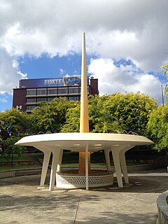
Sullivans Cove is on the River Derwent adjacent to the Hobart City Centre in Tasmania. It was the site of initial European settlement in the area, and the location of the earlier components of the Port of Hobart.

Davey Street a major one way street passing through the outskirts of the Hobart City Centre in Tasmania, Australia. Davey street is named after Thomas Davey, the first Governor of Van Diemen's Land. The street forms a one-way couplet with nearby Macquarie Street connecting traffic from the Southern Outlet in the south with traffic from the Tasman Highway to the east and the Brooker Highway to the north of the city. With annual average daily traffic of 37,200, the road is one of the busier streets in Hobart.
Fern Tree is a rural / residential locality in the local government areas (LGA) of Hobart (64%) and Kingborough (36%) in the Hobart LGA region of Tasmania. The locality is about 9 kilometres (5.6 mi) south-west of the town of Hobart. The 2016 census recorded a population of 726 for the state suburb of Fern Tree.
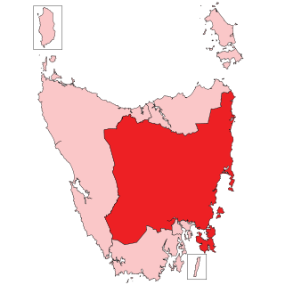
The Division of Lyons is an Australian electoral division in Tasmania.
Macquarie Street a major one way street passing through the outskirts of the Hobart City Centre in Tasmania, Australia. Macquarie street is named after Lachlan Macquarie, who oversaw the planning of Hobart’s inner city grid layout. The street forms a One-way couplet with nearby Davey Street connecting traffic from the Southern Outlet in the south with traffic from the Tasman Highway to the east and the Brooker Highway to the north of the city. With annual average daily traffic of 28,500, the road is one of the busier streets in Hobart.
The Southern Football League is an Australian rules football league based in Tasmania, Australia.
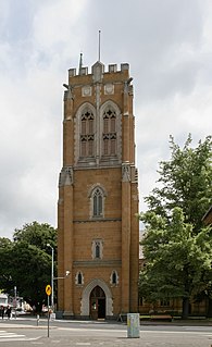
The Cathedral Church of St David in Hobart is the principal Anglican church in Tasmania, Australia. The dean is the Very Reverend Richard Humphrey.
The Anglican Diocese of Tasmania includes the entire Tasmanian archipelago and is an extraprovincial diocese of the Anglican Church of Australia.

The Doone Kennedy Hobart Aquatic Centre is a major, $17 million aquatic sporting facility located upon the Queens Domain, within less than 1 kilometre of the CBD of Hobart, the capital city of Tasmania, Australia. The venue has hosted the Australian Swimming Championships, the Tasmanian Swimming Championships, FINA Swimming World Cup, Pan Pacific Games and the Qantas Skins. Other major events held at the venue throughout its first seven years of operation include the Australian Canoe Polo Championships, Australian Diving Championships, Australian Water Polo Under Age and National League events and the World and Australian Underwater Hockey Championships.

The Hobart Bus Mall is a section of Elizabeth Street which serves as Metro Tasmania's primary bus terminus in Hobart's CBD. It is utilised by thousands of commuters every day, bringing city workers into Hobart from outlying suburbs, and the neighbouring cities of Clarence and Glenorchy, as well as nearby Richmond, Cambridge and Kingborough. The mall is the section of Elizabeth Street, located between Macquarie Street, and Collins Street. There are also several stops located in nearby Franklin Square.

The Tasmanian Museum and Art Gallery (TMAG) is a museum located in Hobart, Tasmania. The museum was established in 1846, by the Royal Society of Tasmania, the oldest Royal Society outside England. The TMAG receives 400,000 visitors annually.

Sloping Island, incorporating the adjacent Sloping Reef, is an island nature reserve, with an area of 117 ha, in Tasmania in south-eastern Australia. It is part of the Sloping Island Group, lying close to the south-eastern coast of Tasmania around the Tasman and Forestier Peninsulas.

Smooth Island, is a privately owned island with an area of 59.31 ha lying close to the south-eastern coast of Tasmania, Australia. The island is part of the Sloping Island Group situated in Norfolk Bay and surrounded by the Tasman and Forestier Peninsulas. The towns Dunalley and Murdunna are nearby. Smooth Island differs from other Tasmanian islands as it has an unencumbered freehold title down to the high-water mark.
Visscher Island is an island, with an area of 3.4 ha, in south-eastern Tasmania, in Australia.

King George Island is an island in south-eastern Australia. It is part of the Sloping Island Group, lying close to the south-eastern coast of Tasmania around the Tasman and Forestier Peninsulas. The island was once inhabited and farmed and contains the ruins of two buildings on its eastern side. A conservation covenant is in place on this island.
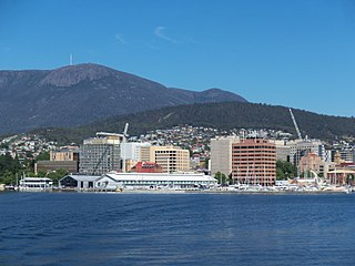
Hobart City Centre is a suburb surrounded by metropolitan Hobart, which comprises the original settlement, the central business district, and other built-up areas. It is the oldest part of Hobart and includes many of the city's important institutions and landmarks, such as Parliament, the Supreme Court, Franklin Square, the Elizabeth Street Mall, the Royal Hobart Hospital, the Theatre Royal, Odeon Theatre, State Library, the NAB Building, the Museum, and the Cenotaph. The city centre is located in the local government areas of the City of Hobart.
Railway Roundabout is a three-lane roundabout in Hobart, Tasmania. It is located on the Brooker Highway, at the top of Liverpool Street. It was originally built for the city's main railway station.
Empire Couriers Park the formally known Warrior Park is the home ground of association football club Olympia FC Warriors who play in the NPL Tasmania. Warrior Park is situated in the Greater Hobart suburb of Warrane.

The Shot Tower at Taroona is a heritage listed historic building between Hobart and Kingston, Tasmania. It was the tallest building in Australia for four years (1870-1875), and the tallest structure in Tasmania until it was superseded by the Mount Wellington broadcast tower in 1960. The Taroona Shot Tower is believed to be the tallest circular sandstone tower in the world.
The College of Health and Medicine is a college of the University of Tasmania that incorporates the School of Medicine, School of Health Sciences, Wicking Centre and Menzies Institute for Medical Research. The College incorporates medicine, pharmacy, psychology, paramedicine, nursing, laboratory medicine, allied health sciences and rural health into its curricula and research.