Hobart is the capital and most populous city of the Australian island state of Tasmania. Home to almost half of all Tasmanians, it is the least-populated Australian state capital city, and second-smallest if territories are taken into account, before Darwin, Northern Territory. Hobart is located in Tasmania's south-east on the estuary of the River Derwent, making it the most southern of Australia's capital cities. Its skyline is dominated by the 1,271-metre (4,170 ft) kunanyi/Mount Wellington, and its harbour forms the second-deepest natural port in the world, with much of the city's waterfront consisting of reclaimed land. The metropolitan area is often referred to as Greater Hobart, to differentiate it from the City of Hobart, one of the five local government areas that cover the city. It has a mild maritime climate.

The River Derwent is a river located in Tasmania, Australia. It is also known by the palawa kani name timtumili minanya. The river rises in the state's Central Highlands at Lake St Clair, and descends more than 700 metres (2,300 ft) over a distance of more than 200 kilometres (120 mi), flowing through Hobart, the state's capital city, before emptying into Storm Bay and flowing into the Tasman Sea. The banks of the Derwent were once covered by forests and occupied by Aboriginal Tasmanians. European settlers farmed the area and during the 20th century many dams were built on its tributaries for the generation of hydro-electricity.

The Mornington Peninsula is a peninsula located south of Melbourne, Victoria, Australia. It is surrounded by Port Phillip to the west, Western Port to the east and Bass Strait to the south, and is connected to the mainland in the north. Geographically, the peninsula begins its protrusion from the mainland in the area between Pearcedale and an area north of Frankston. The area was originally home to the Mayone-bulluk and Boonwurrung-Balluk clans and formed part of the Boonwurrung nation's territory prior to European settlement.

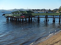
A jetty is a structure that projects from land out into water. A jetty may serve as a breakwater, as a walkway, or both; or, in pairs, as a means of constricting a channel. The term derives from the French word jetée, "thrown", signifying something thrown out.
Somers is a small town on the Mornington Peninsula in Melbourne, Victoria, Australia, 67 km (42 mi) south-east of Melbourne's Central Business District, located within the Shire of Mornington Peninsula local government area. Somers recorded a population of 1,857 at the 2021 census.

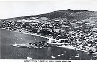
The Wrest Point Hotel Casino is a casino in Tasmania. It was Australia's first legal casino, opening in the suburb of Sandy Bay in Hobart, on 10 February 1973.

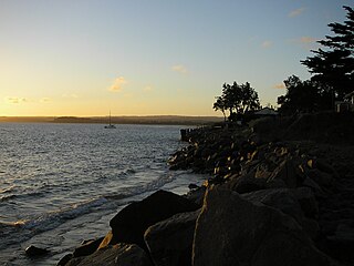
Sandy Bay is a suburb of the city of Hobart, Tasmania, Australia, located immediately south of the central business district, and adjoining the suburb of Battery Point. Sandy Bay is bounded on the east by the Derwent River, and has several beaches along the shore, the main beaches with public access are Nutgrove Beach, Long Beach and Lords Beach.

Orford is a village on the east coast of Tasmania, Australia 73 kilometres north-east of Hobart. It is the home of the joint champions of T20 Cricket in Tasmania. The village is centred on the mouth of the Prosser River, on the southern margin of a substantial coastal inlet called Prosser Bay. Beyond this bay are the waters of the Mercury Passage. At the 2006 census, Orford had a population of 553.

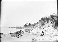
Taroona is a major residential suburb approximately 15 minutes drive from the centre of Hobart, Tasmania on the scenic route between Hobart and Kingston. Although on the edges of the City of Hobart, Taroona is actually part of the municipality of Kingborough. Taroona is bounded on the east by the Derwent River, and has several beaches along the shore, the main beaches with public access are Taroona Beach, Hinsby Beach and Dixons Beach. Past Hinsby Beach, the Alum Cliffs form a section of cliffed coast to the neighbouring suburb of Bonnet Hill.

Walkerville Victoria, Australia, is a tiny village on Waratah Bay in southwest Gippsland, about 190 km southeast of Melbourne. The small town, originally known as Waratah, is separated into Walkerville North and Walkerville South. The Walkerville Promontory View Estate is situated inland 2.3 km north of Walkerville North. At the 2006 census, Walkerville had a population of 262.

Banksmeadow is a suburb of Sydney, in the state of New South Wales, Australia. Banksmeadow is located 11 kilometres south of the Sydney central business district, in the local government area of the Bayside Council. Banksmeadow sits on the northern shore of Botany Bay.

Sandown Bay is a broad open bay which stretches for much of the length of the Isle of Wight's southeastern coast. It extends 8+1⁄2 miles (13.7 km) from Culver Down, near Yaverland in the northeast of the Island, to just south of Shanklin, near the village of Luccombe in the southwest. At Luccombe, the bay is separated from The Undercliff by a large headland from which Upper Ventnor sits atop. The towns of Shanklin, Lake and Sandown are on the bay's coast, while Luccombe and Upper Ventnor feature panoramic views across both Sandown Bay to the East and the Undercliff to the southwest. Due to the bay being relatively sheltered from offshore winds it is often used as temporary anchorage point for boats, including large cargo ships, before continuing east towards Continental Europe, or north towards The Solent.
Sandy Bay Road is a road in Tasmania that connects the southeastern edge of the Hobart CBD with the southeastern suburb of Taroona. It is two-way over its entirety and is 12 kilometres in length. It begins as a continuation of Harrington Street near where it intersects with Davey Street. From there, Sandy Bay Road travels southwards alongside the western edge of St. Davids Park, bypassing Battery Point. It then turns slightly to the west again, before descending a small hill towards the south-east once more, into Sandy Bay proper. Sand Bay Road then continues south-easterly, hugging the western shore of the River Derwent. Passing Wrest Point Hotel Casino it continues to the south-east along Sandy Bay Beach through Lower Sandy Bay. At the point where the Alexandra Battery overlooks Long Beach, Sandy Bay road follows the coast bending in a more southwards direction. The road then begins to climb uphill towards the suburb of Taroona where it becomes the Channel Highway. The road is allocated route code B68.
Seagrove Bay is a bay on the northeast coast of the Isle of Wight, England. It lies to the east of the village of Seaview facing towards Selsey Bill with a 2⁄3 mile (1.1 km) shoreline stretching from Nettlestone Point in the north to Horestone Point in the south. The bay has both the Seaside Award Flag and the Water Quality Award.

Rose Bay Sea Wall is a heritage-listed former Aboriginal land, farms and road reserve and now sea wall, road reserve and esplanade at New South Head Road, Rose Bay, in the Municipality of Woollahra local government area of New South Wales, Australia. It was designed by Herbert E. Ross and built from 1924 to 1926 by Woollahra Municipal Council. It is also known as Rose Bay Sea Wall, Promenade and its setting. It was added to the New South Wales State Heritage Register on 22 August 2014.

Nutgrove Beach is a popular beach destination along the River Derwent in Sandy Bay, Hobart, Tasmania. The north facing beach has views of kunanyi / Mount Wellington, Lords Beach, Wrest Point Hotel Casino, the Tasman Bridge, and the City of Clarence on the eastern shore. Nutgrove Beach neighbours Long Beach and Red Chapel Beach, and is within close proximity to the Sandy Bay Sailing Club and Lower Sandy Bay shops. The beach is dog-friendly and has bathroom facilities.

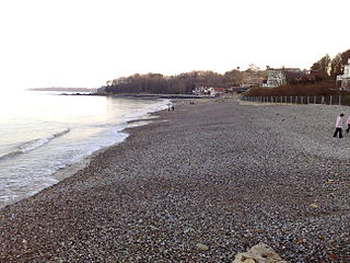
Long Beach is a popular beach destination along the River Derwent in Sandy Bay, Hobart, Tasmania. The east facing beach has views of the City of Clarence on the eastern shore and Blinking Billy Point. Long Beach neighbours Nutgrove Beach and is within close proximity to the Long Beach Reserve Playground, Sandy Bay Sailing Club, Sandy Bay Regatta Association, Hobart Pétanque Club and Lower Sandy Bay shops. Long Beach has a sea pontoon for swimmers and bathroom facilities.
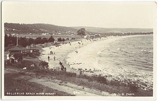
Bellerive Beach is a popular beach destination along the River Derwent in Bellerive, Hobart, Tasmania. The south facing beach neighbours the historic Kangaroo Battery coastal defences and has views of the Derwent estuary, Howrah, Tranmere and Sandy Bay on the western shore. Bellerive Beach has an adjoining parkland with play equipment, barbecues and bathroom facilities and is backed by the Bellerive Oval, a narrow tree-lined reserve and private properties.
Taroona Beach is a popular beach destination along the River Derwent in Taroona, Hobart, Tasmania. The south facing beach looks directly out to Storm Bay and the Tasman Sea, with views of the Derwent estuary, the City of Clarence on the eastern shore, Opossum Bay, South Arm, the Alum Cliffs and northern tip of Bruny Island. Taroona Beach is situated between Hinsby Beach and Crayfish Point, home of the Fisheries and Aquaculture Centre for the Institute for Marine and Antarctic Studies. Taroona Beach contains a boat ramp and is backed by Taroona Park which contains bathroom facilities, a skate park, scout hall, the Taroona Tennis Club, and the Taroona Bowls and Community Club.
Hinsby Beach is a beach along the River Derwent in the Hobart suburb of Taroona, Australia. The south facing beach looks directly out to Storm Bay and the Tasman Sea, with views of the Derwent estuary, the Alum Cliffs, Taroona Shot Tower, the City of Clarence on the eastern shore and Opossum Bay, South Arm. Hinsby Beach is situated between the Alum Cliffs and Taroona Beach. A naturally secluded section of the beach, beyond the rocky south-western outcrop is a zoned naturist beach.