
Randolph County is a county on the central eastern border of the U.S. state of Alabama. As of the 2020 census, the population was 21,967. Its county seat is Wedowee. Its name is in honor of John Randolph, a member of the United States Senate from Virginia. Randolph County was a prohibition or dry county until 2012, when the citizens of Randolph County voted to repeal prohibition.
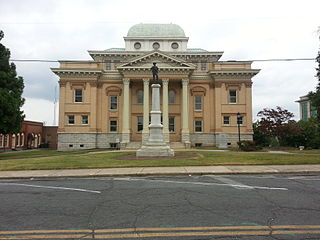
Randolph County is a county located in the U.S. state of North Carolina. As of the 2020 census, the population was 144,171. Its county seat is Asheboro.

West Chatham is a census-designated place (CDP) in the town of Chatham in Barnstable County, Massachusetts, United States. The population was 1,410 at the 2010 census.

Jefferson is a town in and the county seat of Ashe County, North Carolina, United States. The population was 1,622 at the 2020 U.S. census.
East Arcadia is a town in Bladen County, North Carolina, United States. The population was 487 at the 2010 census.

Hildebran is a town in Burke County, North Carolina, United States. The population was 2,023 at the 2010 census. It is part of the Hickory-Lenoir-Morganton Metropolitan Statistical Area.
Mount Pleasant is a town located in eastern Cabarrus County, North Carolina, United States. As of the 2010 census, the town population was 1,652. The town center is located at the crossroads of Mount Pleasant Road and North Carolina Highway 73. NC Highway 49 skirts the town to the north on its way from Charlotte to Asheboro.
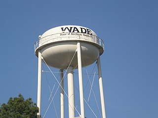
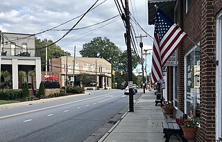
Wade is a town in Cumberland County, North Carolina, United States. The population was 556 at the 2010 census.
Biscoe is a town in Montgomery County, North Carolina, United States. The population was 1,700 at the 2010 census. The town is named after Henry Biscoe, an important customer of the local lumber business.

Columbus is a town and the county seat of Polk County, North Carolina, United States. The population was 999 at the 2010 census.
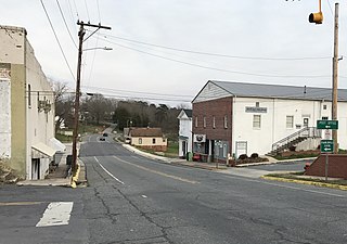
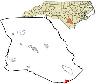
Franklinville is a town in Randolph County, North Carolina, United States. The population was 1,164 at the 2010 census.

Ramseur is a town in Randolph County, North Carolina, United States. The population was 1,692 at the 2010 census.

Randleman is a city in Randolph County, North Carolina, United States. The population was 4,113 at the 2010 census. It is the home of NASCAR's Petty family, the Victory Junction Gang Camp and was the location of the Richard Petty Museum from 2003 to 2014.

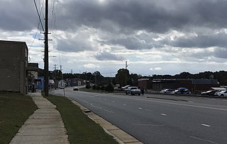
Trinity is a city in Randolph County, North Carolina, United States. The population was 7,006 at the 2020 census. Trinity is part of the Greensboro-High Point Metropolitan Statistical Area of the Piedmont Triad metro region.

Englewood is a city in Montgomery County, Ohio, United States. The population was 13,463 at the 2020 census. A northern suburb of Dayton, it is part of the Dayton metropolitan area.

Holly Hill is a town in Orangeburg County, South Carolina, United States. Prior to 1910 it was located in the northwest portion of Saint James Goose Creek Township. The population was 1,277 at the 2010 census.

Mill Creek is a town in Randolph County, West Virginia, United States, along the Tygart Valley River. The population was 563 at the 2020 census.

Weddington is a suburban town in Union County, North Carolina, United States. The population was 9,459 at the 2010 census. It is a suburb in the Charlotte metropolitan area. The current mayor of Weddington is Jim Bell.
Randolph is a town in Cattaraugus County, New York, United States. The population was 2,470 at the 2020 census. The town was named after Randolph, Vermont.

Randolph is a village in Columbia and Dodge Counties in the U.S. state of Wisconsin. The population was 1,811 at the 2010 census. Of this, 1,339 were in Dodge County, and 472 were in Columbia County. The village is located at the southeast corner of the Town of Randolph in Columbia County, although only a tiny portion of the village lies within the town. Most of the village lies within the Town of Westford in Dodge County. Small portions also lie within the Town of Fox Lake to the north and the Town of Courtland in Columbia County.


