Ramseur, North Carolina

Last updated

Ramseur, North Carolina
Ramseur, North Carolina.jpg
Main Street in Ramseur
NCMap-doton-Ramseur.PNG
Location of Ramseur, North Carolina
Coordinates: 35°44′15″N79°39′16″W / 35.73750°N 79.65444°W / 35.73750; -79.65444
Country United States
State North Carolina
County Randolph
Incorporated1895
Named for Stephen D. Ramseur [1]
Area
[2]
  Total2.25 sq mi (5.81 km2)
  Land2.00 sq mi (5.18 km2)
  Water0.25 sq mi (0.64 km2)
Elevation
[3]
538 ft (164 m)
Population
 (2020)
  Total1,774
  Density887.00/sq mi (342.55/km2)
Time zone UTC-5 (Eastern (EST))
  Summer (DST) UTC-4 (EDT)
ZIP code
27316
Area code 336
FIPS code 37-55040 [4]
GNIS feature ID2407172 [3]
Website www.townoframseur.org

Ramseur is a town in Randolph County, North Carolina, United States. The population was 1,692 at the 2010 census.

Contents

Geography

According to the United States Census Bureau, the town has a total area of 1.7 square miles (4.3 km2), of which 1.6 square miles (4.2 km2) is land and 0.04 square mile (0.1 km2) (1.80%) is water.

Demographics

Historical population
CensusPop.Note
1900 769
1910 1,02232.9%
1920 1,014−0.8%
1930 1,22020.3%
1940 1,2200.0%
1950 1,134−7.0%
1960 1,25810.9%
1970 1,3285.6%
1980 1,162−12.5%
1990 1,1862.1%
2000 1,58833.9%
2010 1,6926.5%
2020 1,7744.8%
U.S. Decennial Census [5]

2020 census

Ramseur racial composition [6]
RaceNumberPercentage
White (non-Hispanic)1,09461.67%
Black or African American (non-Hispanic)23313.13%
Native American 100.56%
Asian 321.8%
Other/Mixed 1086.09%
Hispanic or Latino 29716.74%

As of the 2020 United States census, there were 1,774 people, 638 households, and 415 families residing in the town.

2000 census

At the 2000 census there were 1,588 people, 652 households, and 444 families in the town. The population density was 968.0 inhabitants per square mile (373.7/km2). There were 697 housing units at an average density of 424.9 per square mile (164.1/km2). The racial makeup of the town was 80.67% White, 10.96% African American, 0.25% Native American, 0.69% Asian, 5.04% from other races, and 2.39% from two or more races. Hispanic or Latino of any race were 8.25%. [4]

Of the 652 households 32.1% had children under the age of 18 living with them, 47.7% were married couples living together, 16.6% had a female householder with no husband present, and 31.9% were non-families. 29.0% of households were one person and 16.1% were one person aged 65 or older. The average household size was 2.42 and the average family size was 2.95.

The age distribution was 26.3% under the age of 18, 7.9% from 18 to 24, 27.0% from 25 to 44, 21.1% from 45 to 64, and 17.8% 65 or older. The median age was 36 years. For every 100 females, there were 85.9 males. For every 100 females age 18 and over, there were 78.6 males.

The median household income was $32,961 and the median family income was $42,153. Males had a median income of $28,500 versus $20,848 for females. The per capita income for the town was $15,411. About 10.2% of families and 14.8% of the population were below the poverty line, including 19.2% of those under age 18 and 22.1% of those age 65 or over.

History

Ramseur was named for Stephen Dodson Ramseur, a Confederate major general of the Civil War. [7]

The Deep River-Columbia Manufacturing Company was listed on the National Register of Historic Places in 1978. [8]

In film

Portions of the 1968 film Killers Three were shot in the Ramseur and Coleridge areas, and many locals were cast as extras. [9]

Notable people

Related Research Articles

<span class="mw-page-title-main">Milton, North Carolina</span> Town in North Carolina, United States

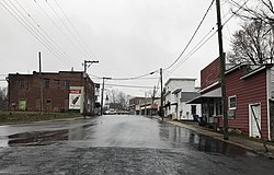
Milton is a town in Caswell County, North Carolina, United States. The population was 166 at the 2010 census. It is adjacent to the Virginia International Raceway, just across the state line in Virginia.

<span class="mw-page-title-main">Mooresboro, North Carolina</span> Town in North Carolina, United States

Mooresboro is a town in Cleveland County, North Carolina, United States. The population was 311 at the 2010 census.

Cerro Gordo is a town in Columbus County, North Carolina, United States. The population was 207 at the 2010 census.

<span class="mw-page-title-main">Chadbourn, North Carolina</span> Town in North Carolina, United States of America

Chadbourn is a town in Columbus County, North Carolina, United States. The population was 1,856 at the 2010 census.

<span class="mw-page-title-main">Conetoe, North Carolina</span> Town in North Carolina, United States

Conetoe is a 246-square-mile (640-square-kilometer) is a town in Edgecombe County, North Carolina, United States. It is part of the Rocky Mount, North Carolina Metropolitan Statistical Area. The population was 294 at the 2010 census.

<span class="mw-page-title-main">Rural Hall, North Carolina</span> Town in North Carolina, United States

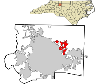
Rural Hall is a town in Forsyth County, North Carolina, United States. It is a part of the Piedmont Triad. The population was 3,360 at the 2020 census. The town has one public park: Covington Memorial Park.

<span class="mw-page-title-main">Walkertown, North Carolina</span> Town in North Carolina, United States

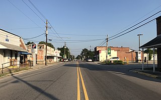
Walkertown is a town in Forsyth County, North Carolina, United States and a rural area outside of Winston-Salem. It is part of the Piedmont Triad. The population was 5,695 at the 2020 census.

<span class="mw-page-title-main">Bunn, North Carolina</span> Town in North Carolina, United States

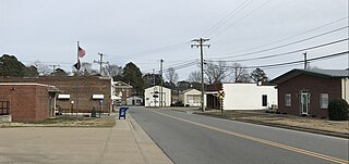
Bunn is a town in Franklin County, North Carolina, United States. The population was 327 at the 2020 census.

<span class="mw-page-title-main">Youngsville, North Carolina</span> Town in North Carolina, United States

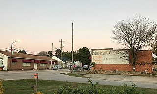
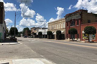
Youngsville is a town in Franklin County, North Carolina, United States. The population was 2,016 at the 2020 census.

<span class="mw-page-title-main">Micro, North Carolina</span> Town in North Carolina, United States

Micro is a town in Johnston County, North Carolina, United States. The population was 458 as of the 2020 census, up from 441 in the 2010 census.

<span class="mw-page-title-main">Bethel, North Carolina</span> Town in North Carolina, United States

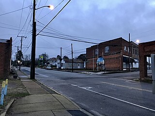
Bethel is a town in Pitt County, North Carolina, United States. The population was 1,577 at the 2010 census. The town is a part of the Greenville Metropolitan Area located in North Carolina's Inner Banks region. Confusingly, there are three other towns in the state named "Bethel." One is between Edenton and Hertford in the "Finger Counties" region in the northeastern corner of the state, another is in the north-central part, in Caswell County and the third is located in the Mountain Region of North Carolina, in Haywood County. There is also a community named Bethel located in Watauga County.

Orrum is a town in Robeson County, North Carolina, United States. The population was 91 at the 2010 census.

<span class="mw-page-title-main">Proctorville, North Carolina</span> Town in North Carolina, United States

Proctorville is a town in Robeson County, North Carolina, United States. The population was 117 at the 2010 census.

<span class="mw-page-title-main">Raynham, North Carolina</span> Town in North Carolina, United States

Raynham is a town in Robeson County, North Carolina, United States. The population was 72 at the 2010 census.

<span class="mw-page-title-main">Rennert, North Carolina</span> Town in North Carolina, United States

Rennert is a town in Robeson County, North Carolina, United States. The population was 383 at the 2010 census.

<span class="mw-page-title-main">Rowland, North Carolina</span> Town in North Carolina, United States

Rowland is a town in Rowland Township, Robeson County, North Carolina, United States. The population was 1,037 at the 2010 census.

<span class="mw-page-title-main">Gibson, North Carolina</span> Town in North Carolina, United States

Gibson is a town in Scotland County, North Carolina, United States. The population was 540 at the 2010 census.

<span class="mw-page-title-main">Wagram, North Carolina</span> Town in North Carolina, United States

Wagram is a town in Scotland County, North Carolina, United States. The population was 840 at the 2010 census. The town was named for the Battle of Wagram, a Napoleonic battle at Deutsch-Wagram in Austria.

<span class="mw-page-title-main">Seven Springs, North Carolina</span> Town in North Carolina, United States

Seven Springs is a town in Wayne County, North Carolina, United States. It lies next to the Neuse River. The 2012 population was estimated at 111. It is included in the Goldsboro, North Carolina Metropolitan Statistical Area.

<span class="mw-page-title-main">Lucama, North Carolina</span> Town in North Carolina, United States

Lucama is a town in Wilson County, North Carolina, United States. The population was 1,108 at the 2010 census.

References

  1. "North Carolina Gazetteer" . Retrieved November 24, 2023.
  2. "ArcGIS REST Services Directory". United States Census Bureau. Retrieved September 20, 2022.
  3. 1 2 U.S. Geological Survey Geographic Names Information System: Ramseur, North Carolina
  4. 1 2 "U.S. Census website". United States Census Bureau . Retrieved January 31, 2008.
  5. "Census of Population and Housing". Census.gov. Retrieved June 4, 2015.
  6. "Explore Census Data". data.census.gov. Retrieved December 20, 2021.
  7. Powell, William S. (1976). The North Carolina Gazetteer: A Dictionary of Tar Heel Places. Chapel Hill: The University of North Carolina Press. p. 402. ISBN   9780807812471.
  8. "National Register Information System". National Register of Historic Places . National Park Service. July 9, 2010.
  9. Elliot, Harvey (June 20, 1968). "Heat, Insects Greet Clark". The Daily Tar Heel. p. 6.