
Huntly is a town in the Waikato district and region of the North Island of New Zealand. It was on State Highway 1, 95 kilometres (59 mi) south of Auckland and 32 kilometres (20 mi) north of Hamilton. It is situated on the North Island Main Trunk (NIMT) railway and straddles the Waikato River. Huntly is within the Waikato District which is in the northern part of the Waikato region local government area.
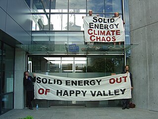
The Save Happy Valley Coalition (SHVC) is an environmental activist movement formed with the express purpose of preventing the Cypress mine, an open cast coal mine on the West Coast of New Zealand, from proceeding.
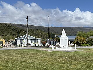
Waimangaroa is a small town located on the West Coast of New Zealand.
Solid Energy was the largest coal mining company in New Zealand and is a state owned enterprise of the New Zealand Government.
The Rapahoe Branch is a branch line railway that forms part of New Zealand's national rail network and is located on the West Coast of the South Island. It has been operational since 1923 and was named the Rapahoe Industrial Line until 2011.
Ohai is a town in the Southland region of New Zealand's South Island, 65 kilometres northwest of Invercargill and 25 kilometres west of Winton.

Powelliphanta augusta or the Mount Augustus snail, previously provisionally known as Powelliphanta "Augustus", is a species of large, carnivorous land snail, a terrestrial pulmonate gastropod mollusc in the family Rhytididae. Naturally occurring only on Mount Augustus near Westport on New Zealand's South Island, their entire habitat was destroyed by coal mining. The world population was taken into captivity, in theory until their habitat was restored and they could be released. The mining company concerned went bankrupt and habitat restoration has been unsuccessful, so the species' future is uncertain.

Millerton is a small settlement in the northwestern South Island of New Zealand in the West Coast region. It is in the Papahaua Ranges, around 33 kilometres by road north of Westport, via SH67 from Westport to Karamea.

The Seddonville Branch, later truncated as the Ngākawau Branch, is a branch line railway in the West Coast region of New Zealand's South Island. Construction began in 1874 and it reached its terminus at the Mokihinui Mine just beyond Seddonville in 1895. In 1981 it was closed past Ngākawau and effectively became an extension of the Stillwater–Westport Line, since formalised as the Stillwater–Ngākawau Line.

Hector and Ngakawau are two lightly populated settlements located at the mouth of the Ngākawau River in the West Coast region of New Zealand. Both settlements are situated on State Highway 67 between Westport and Karamea. Despite a low population, many of the workers at New Zealand's largest open-cut coal mine at Stockton choose to live at these places and shuttles frequently operate between the two places.
Rotowaro was once a small coal mining township approximately 10 km west of Huntly in the Waikato region of New Zealand. The town was built especially for miners houses, but was entirely removed in the 1980s to make way for a large opencast mine.

The Cypress Mine is an extension to the open-cast coal mine the Stockton Mine’s operational area, to the east into the Upper Waimangaroa Mining Permit area, on the West Coast of New Zealand. The mine commenced operation in 2014.

Mining in New Zealand began when the Māori quarried rock such as argillite in times prior to European colonisation. Mining by Europeans began in the latter half of the 19th century.
The Ngakawau Restoration Project is a proposed hydro scheme planned to divert acid mine drainage from coal mines to an ocean outfall to restore water quality of the Ngākawau River, in the northern section of the West Coast of the South Island of New Zealand. The project is a configuration of the Stockton Plateau Hydro Scheme being developed by Hydro Developments (2013) Limited. Project information can be found at https://hydrodevelopments.co.nz
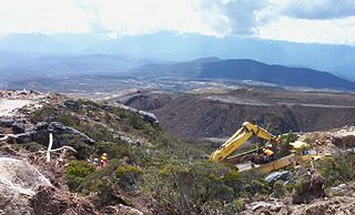
Stockton Mine, on the Stockton Coal Field, is New Zealand's largest opencast mining operation. The entrance to the mine is at the former settlement of Stockton.
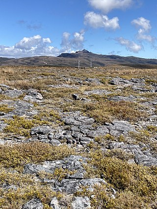
Denniston Plateau is an 18 km long, 600–800 m high coalfield plateau in the Papahaua Range on the West Coast of the South Island of New Zealand. A combination of impermeable rock, high rainfall, and shallow acidic soil has created a unique ecosystem of stunted trees and heath-like vegetation which is home to numerous endemic and undescribed species of plants and invertebrates. The plateau contains rich seams of high-quality coal, which led to the creation and abandonment of the mining towns of Denniston and Millerton, and the current Stockton Mine. Plans to create a new open-cast mine on the southern part of the plateau have become an environmental controversy.
The Escarpment Mine Project is an opencast coal mine at the Mount Rochfort Conservation Area on the Denniston Plateau on the West Coast of New Zealand in the vicinity of the disused Escarpment Mine. Bathurst Resources Limited intended to extract and export between one and four million tonnes of coal a year from open cast mining in an area of 200 hectares of conservation land on the southern Denniston Plateau. The mine would be the second largest opencast coal mine in New Zealand after Solid Energy's Stockton Mine on the Stockton Plateau. Environmental groups such as Forest and Bird and the West Coast Environment Network opposed the project.
The Mt William North Mining Project is a proposed coal mine planned for the West Coast Region of New Zealand.
The Rockies Incline was an inclined tramway on the West Coast of the South Island of New Zealand that for ten years from 1925 to 1935 brought coal from the Westport Main Coal Company’s mine on the Millerton-Stockton plateau down to the Westport to Seddonville railway line near sea level.

Lake Puketirini is a former opencast coal mine, immediately to the west of Huntly and east of the larger, but much shallower Lake Waahi, in the Waikato Region. It is circled by a walkway.
