Tana, Norway

Last updated
Tana Municipality
Tana kommune
Deanu gielda
Tanen herred  (historic name)
Tanaelva River Bridge Tana.jpg
View of the old bridge that spanned the river Tanaelva. A new bridge has replaced it. The river banks on the right side of the photo, are part of the Varanger Peninsula.
Flag of Tana.png
Tana komm.svg
Norway Counties Finnmark Position.svg
Finnmark within Norway
NO 5628 Tana.svg
Tana within Finnmark
Coordinates: 70°11′58″N28°11′09″E / 70.19944°N 28.18583°E / 70.19944; 28.18583
Country Norway
County Finnmark
District Øst-Finnmark
Established1 Jan 1864
  Preceded by Lebesby Municipality
Administrative centre Tana bru
Government
  Mayor (2023)Jon Erland Balto (Sp)
Area
  Total4,051.34 km2 (1,564.23 sq mi)
  Land3,832.65 km2 (1,479.79 sq mi)
  Water218.63 km2 (84.41 sq mi)  5.4%
  Rank#5 in Norway
Population
 (2023)
  Total2,804
  Rank#238 in Norway
  Density0.7/km2 (2/sq mi)
  Change (10 years)
Decrease2.svg −3.3%
Demonym Tanaværing [1]
Official languages
[2]
   Norwegian form Bokmål
   Sámi form Northern Sami
Time zone UTC+01:00 (CET)
  Summer (DST) UTC+02:00 (CEST)
ISO 3166 code NO-5628 [3]
Website Official website

Deatnu (Northern Sami) or Tana (Norwegian) [4] is a municipality in Finnmark county, Norway. The administrative centre of the municipality is the village of Tana bru. Among the other villages in the municipality are Austertana, Bonakas, Polmak, Rustefjelbma, and Skiippagurra. [5]

Contents

The 4,051-square-kilometre (1,564 sq mi) municipality is the 5th largest by area out of the 356 municipalities in Norway. Deanu-Tana is the 238th most populous municipality in Norway with a population of 2,804. The municipality's population density is 0.7 inhabitants per square kilometre (1.8/sq mi) and its population has decreased by 3.3% over the previous 10-year period. [6] [7]

History

View of the local river boats River boats Tana.jpg
View of the local river boats

The municipality of Tana was established on 1 January 1864 when the eastern part of the large municipality of Lebesby was separated to become a new municipality with a population of 1,388. The original municipality included all the land on both sides surrounding the Tanafjorden and the Tana River. [8]

On 1 January 1914, the municipality of Tana was divided into three parts. The southern part (population: 1,426) remained as (a smaller) Tana Municipality. The northern part of the municipality was divided by the Tanafjorden with the western side becoming Gamvik Municipality (population: 1,374) and the eastern side becoming Berlevåg Municipality (population: 784). On 1 January 1964, the neighboring municipality of Polmak (population: 1,072), which had separated from Nesseby Municipality on 1 January 1903, was merged into Tana. [8]

Tana Municipality marks the furthest Soviet advance into Nazi-occupied Norway.

On 1 January 2020, the municipality became part of the newly formed Troms og Finnmark county. Previously, it had been part of the old Finnmark county. [9] On 1 January 2024, the Troms og Finnmark county was divided and the municipality once again became part of Finnmark county. [10]

Name

The municipality (originally the parish) was originally named Tanen, a Norwegianized form of the Northern Sami name for the area, Deanu. The Sami name is identical to the genitive case of Sami word deatnu which means "great river" or "large river", referring to the main river (Tana River) which runs through the municipality. Historically, the name of the municiaplity was spelled Tanen. On 3 November 1917, a royal resolution changed the spelling of the name of the municipality to Tana. [11]

On 1 September 1992, the name of the municipality was changed to "Deatnu-Tana" to symbolize the two official languages in the municipality. [8] [12] Then in 2005, the name was again changed such that either Deatnu or Tana can be used. [13] The Sami language name spelling changes depending on how it is used. It is called Deatnu when it is spelled alone, but it is Deanu gielda when using the Sami language equivalent to "Deanu municipality". [4]

Coat of arms

The coat of arms was granted on 11 May 1984. The official blazon is "Gules, three boats Or in pale" (Norwegian : I rødt tre gule båter). This means the arms have a red field (background) and the charge is three riverboats. The riverboat has a tincture of Or which means it is commonly colored yellow, but if it is made out of metal, then gold is used. The red and yellow colors in the arms were chosen to mimic the Norwegian national arms. The three riverboats were chosen because boats like this have been used in the area for centuries. There are three boats to symbolize the three ethnic groups in the border municipality: the Sámi, Kvens, and Norwegians. The arms were designed by Arvid Sveen. [14] [15] [16]

Economy

In 2013, 29% of the work force was employed in retail, hotels/restaurants and finance; 23% in the healthcare industry and the social sector; 16% in the Secondary sector of the economy; 11% in the primary sector; 9% worked in the education sector; the work force totaled 1,401. [17]

The most important [economic] resources are farmland and [coastal areas, mountains and forests or] [18] utmark; the use of these gives [significant results relating to] agriculture. [19]

The world's northernmost dairy is Tine Tana, and it employs around 30 people. [20]

The Tana Valley is the core area for "the River-Sami Culture" in Finnmark; salmon fishing is central in regard to that culture. [21] According to written sources since the 17th century, fishing has been a major livelihood for the Sami people in the river valley of Tana River. [21]

Churches

The Church of Norway has two parishes (sokn) within the municipality of Tana. It is part of the Indre Finnmark prosti (deanery) in the Diocese of Nord-Hålogaland.

Churches in Deatnu-Tana
Parish (sokn)Church nameLocation of the churchYear built
Tana Austertana Chapel Austertana 1958
Tana Church Rustefjelbma 1964
Polmak Polmak Church Polmak 1853

Government

All municipalities in Norway are responsible for primary education (through 10th grade), outpatient health services, senior citizen services, welfare and other social services, zoning, economic development, and municipal roads and utilities. The municipality is governed by a municipal council of directly elected representatives. The mayor is indirectly elected by a vote of the municipal council. [22] The municipality is under the jurisdiction of the Indre og Østre Finnmark District Court and the Hålogaland Court of Appeal.

Municipal council

The municipal council (Kommunestyre) is made up of 19 representatives that are elected to four year terms. The tables below show the current and historical composition of the council by political party.

Deatnu Tana kommunestyre 20232027 [23]   
Party name (in Norwegian)Number of
representatives
  Labour Party (Arbeiderpartiet)6
  Progress Party (Fremskrittspartiet)2
  Conservative Party (Høyre)3
  Centre Party (Senterpartiet)3
  Liberal Party (Venstre)2
  Sami List in Tana (Deanu Sámelistu–Samelista i Tana)3
Total number of members:19
Deatnu Tana kommunestyre 20192023 [24]   
Party name (in Norwegian)Number of
representatives
  Labour Party (Arbeiderpartiet)8
  Progress Party (Fremskrittspartiet)1
  Conservative Party (Høyre)1
  Centre Party (Senterpartiet)4
  Socialist Left Party (Sosialistisk Venstreparti)1
  Liberal Party (Venstre)2
  Sami List in Tana (Deanu Sámelistu–Samelista i Tana)2
Total number of members:19
Deatnu Tana kommunestyre 20152019 [25]   
Party name (in Norwegian)Number of
representatives
  Labour Party (Arbeiderpartiet)9
  Progress Party (Fremskrittspartiet)2
  Conservative Party (Høyre)1
  Sámi People's Party (Samefolkets Parti)1
  Centre Party (Senterpartiet)2
  Socialist Left Party (Sosialistisk Venstreparti)1
  Liberal Party (Venstre)1
  Árja (Árja)2
Total number of members:19
Deatnu Tana kommunestyre 20112015 [26]   
Party name (in Norwegian)Number of
representatives
  Labour Party (Arbeiderpartiet)9
  Progress Party (Fremskrittspartiet)1
  Conservative Party (Høyre)5
  Sámi People's Party (Samefolkets Parti)2
  Centre Party (Senterpartiet)3
  Socialist Left Party (Sosialistisk Venstreparti)1
  Liberal Party (Venstre)1
  Local List(s) (Lokale lister)1
Total number of members:23
Deatnu Tana kommunestyre 20072011 [25]   
Party name (in Norwegian)Number of
representatives
  Labour Party (Arbeiderpartiet)7
  Progress Party (Fremskrittspartiet)2
  Conservative Party (Høyre)2
  Sámi People's Party (Samefolkets Parti)1
  Centre Party (Senterpartiet)1
  Socialist Left Party (Sosialistisk Venstreparti)1
 Joint list of the Liberal Party and Independent Voters
(Venstre og uavhengige velgeres liste)
3
Total number of members:17
Deatnu-Tana kommunestyre 20032007 [25]   
Party name (in Norwegian)Number of
representatives
  Labour Party (Arbeiderpartiet)7
  Progress Party (Fremskrittspartiet)2
  Conservative Party (Høyre)2
  Sámi People's Party (Samefolkets Parti)1
  Centre Party (Senterpartiet)1
 Joint list of the Liberal Party and Independent Voters
(Venstre og uavhengige velgeres liste)
2
  Tana Common List (Tana fellesliste)2
Total number of members:17
Deatnu-Tana kommunestyre 19992003 [25]   
Party name (in Norwegian)Number of
representatives
  Labour Party (Arbeiderpartiet)9
  Progress Party (Fremskrittspartiet)7
  Conservative Party (Høyre)5
  Christian Democratic Party (Kristelig Folkeparti)1
  Sámi People's Party (Samefolkets Parti)2
  Centre Party (Senterpartiet)2
  Liberal Party (Venstre)1
Total number of members:27
Deatnu-Tana kommunestyre 19951999 [27]   
Party name (in Norwegian)Number of
representatives
  Labour Party (Arbeiderpartiet)10
  Conservative Party (Høyre)7
  Christian Democratic Party (Kristelig Folkeparti)1
  Centre Party (Senterpartiet)4
  Socialist Left Party (Sosialistisk Venstreparti)1
  Liberal Party (Venstre)1
  Sámi Democrat (Samedemokrahtat/Samedemokrate)1
  Sámi List (Sámealbmot listu/Samefolkets liste)2
Total number of members:27
Deatnu-Tana kommunestyre 19911995 [28]   
Party name (in Norwegian)Number of
representatives
  Labour Party (Arbeiderpartiet)8
  Conservative Party (Høyre)7
  Christian Democratic Party (Kristelig Folkeparti)1
  Centre Party (Senterpartiet)4
  Socialist Left Party (Sosialistisk Venstreparti)2
  Liberal Party (Venstre)1
  Sámi Democrat (Samedemokrahtat/Samedemokrate)1
  Sámi List (Sámealbmot listu/Samefolkets liste)3
Total number of members:27
Tana kommunestyre 19871991 [29]   
Party name (in Norwegian)Number of
representatives
  Labour Party (Arbeiderpartiet)10
  Conservative Party (Høyre)4
  Christian Democratic Party (Kristelig Folkeparti)1
  Centre Party (Senterpartiet)1
  Socialist Left Party (Sosialistisk Venstreparti)1
  Liberal Party (Venstre)1
  Tana Cross-Party List (Tana tverrpolitiske liste)3
  Sámi List (Samefolkets liste)3
  Free Voters List (Frie Velgeres list)3
Total number of members:27
Tana kommunestyre 19831987 [30]   
Party name (in Norwegian)Number of
representatives
  Labour Party (Arbeiderpartiet)11
  Conservative Party (Høyre)5
  Christian Democratic Party (Kristelig Folkeparti)1
  Centre Party (Senterpartiet)2
  Socialist Left Party (Sosialistisk Venstreparti)1
  Tana Cross-Party List (Tana tverrpolitiske liste)2
  Sámi List (Samefolkets liste)3
  Free Voters List (Frie Velgeres list)2
Total number of members:27
Tana kommunestyre 19791983 [31]   
Party name (in Norwegian)Number of
representatives
  Labour Party (Arbeiderpartiet)11
  Conservative Party (Høyre)6
  Christian Democratic Party (Kristelig Folkeparti)2
  Centre Party (Senterpartiet)4
  Socialist Left Party (Sosialistisk Venstreparti)1
  Liberal Party (Venstre)1
  Village List (Bygdefolkets enhetsliste)1
  Sámi List (Samefolkets liste)1
Total number of members:27
Tana kommunestyre 19771979 [32]   
Party name (in Norwegian)Number of
representatives
  Labour Party (Arbeiderpartiet)13
  Conservative Party (Høyre)4
  Christian Democratic Party (Kristelig Folkeparti)2
  Centre Party (Senterpartiet)6
  Socialist Left Party (Sosialistisk Venstreparti)2
Total number of members:27
Tana kommunestyre 19711975 [33]   
Party name (in Norwegian)Number of
representatives
  Labour Party (Arbeiderpartiet)15
  Conservative Party (Høyre)5
  Christian Democratic Party (Kristelig Folkeparti)2
  Centre Party (Senterpartiet)3
  Socialist common list
(Venstresosialistiske felleslister)
1
Total number of members:27
Tana kommunestyre 19671971 [34]   
Party name (in Norwegian)Number of
representatives
  Labour Party (Arbeiderpartiet)14
  Conservative Party (Høyre)5
  Christian Democratic Party (Kristelig Folkeparti)1
  Centre Party (Senterpartiet)4
  Socialist People's Party (Sosialistisk Folkeparti)1
  List of workers, fishermen, and small farmholders (Arbeidere, fiskere, småbrukere liste)2
Total number of members:27
Tana kommunestyre 19631967 [35]   
Party name (in Norwegian)Number of
representatives
  Labour Party (Arbeiderpartiet)15
  Conservative Party (Høyre)6
  Communist Party (Kommunistiske Parti)1
  List of workers, fishermen, and small farmholders (Arbeidere, fiskere, småbrukere liste)5
Total number of members:27
Tana herredsstyre 19591963 [36]   
Party name (in Norwegian)Number of
representatives
  Labour Party (Arbeiderpartiet)6
  Conservative Party (Høyre)3
  Communist Party (Kommunistiske Parti)2
  List of workers, fishermen, and small farmholders (Arbeidere, fiskere, småbrukere liste)6
Total number of members:17
Tana herredsstyre 19551959 [37]   
Party name (in Norwegian)Number of
representatives
  Labour Party (Arbeiderpartiet)6
  Conservative Party (Høyre)2
  Communist Party (Kommunistiske Parti)1
  List of workers, fishermen, and small farmholders (Arbeidere, fiskere, småbrukere liste)4
Total number of members:13
Tana herredsstyre 19511955 [38]   
Party name (in Norwegian)Number of
representatives
  Labour Party (Arbeiderpartiet)4
  List of workers, fishermen, and small farmholders (Arbeidere, fiskere, småbrukere liste)3
  Joint List(s) of Non-Socialist Parties (Borgerlige Felleslister)2
  Local List(s) (Lokale lister)3
Total number of members:12
Tana herredsstyre 19471951 [39]   
Party name (in Norwegian)Number of
representatives
  Labour Party (Arbeiderpartiet)4
  List of workers, fishermen, and small farmholders (Arbeidere, fiskere, småbrukere liste)5
  Joint List(s) of Non-Socialist Parties (Borgerlige Felleslister)3
Total number of members:12
Tana herredsstyre 19451947 [40]   
Party name (in Norwegian)Number of
representatives
  Labour Party (Arbeiderpartiet)4
  List of workers, fishermen, and small farmholders (Arbeidere, fiskere, småbrukere liste)5
  Local List(s) (Lokale lister)3
Total number of members:12
Tana herredsstyre 19371941* [41]   
Party name (in Norwegian)Number of
representatives
  Labour Party (Arbeiderpartiet)5
  Liberal Party (Venstre)3
 Joint list of the Conservative Party  (Høyre) and the Free-minded People's Party  (Frisinnede Folkeparti)3
  List of workers, fishermen, and small farmholders (Arbeidere, fiskere, småbrukere liste)1
Total number of members:12
Note: Due to the German occupation of Norway during World War II, no elections were held for new municipal councils until after the war ended in 1945.

Mayors

The mayors (Norwegian : ordfører) of Tana (incomplete list):

Geography

View of the Tanafjorden from the highway Fv 98 Tanafjorden-2012-07-09-12-30-022.jpg
View of the Tanafjorden from the highway Fv 98

Deatnu-Tana is situated along the lower river basin of the Tana River, which borders Finland along most of its course. People live in small settlements along the river, notably Sirma, Polmak, Rustefjelbma, Seida, Skiippagurra, Austertana, and Tana bru. Most inhabitants of Tana are Sami people, and the Sami language and culture are today promoted by the municipality and the schools.

The river Tana has represented a mainstay in the economy, as it is one of Europe's main salmon rivers, and it empties into the Tanafjorden. River transportation is traditionally done by long, narrow river boats, that are still in use, albeit motorized. Lakes in this area include Geassájávri, Nissojávri, and Sundvatnet. At Tana bru, the Tana Bridge (part of European route E6 and European route E75) crosses over the Tana River. The nearest airports are Vadsø Airport (about 70 kilometres or 43 miles away) and Kirkenes Airport (about 130 kilometres or 81 miles away). Kirkenes Airport (but not Vadsø) has direct flights to Oslo.

Wildlife

With the Tana River flowing through wild and spectacular habitat, the municipality of Tana has one of the most spectacular gatherings in Norway. As many as 25,000 goosanders can accumulate along the Tana waterway system. Add to this, thousands of common eider and long-tailed duck, then you have one of the largest concentrations of wildfowl in Norway.

In 2022 one bear was killed because of deaths of sheep from a local farm; An investigation deemed the killing of the bear, legal; The report said there likely had been at least one other bear in the municipality. [44]

Climate

Tana has a subarctic climate (Dfc) with long, cold winters and short cool summers.

Climate data for Rustefjelbma, Tana 1961-90
MonthJanFebMarAprMayJunJulAugSepOctNovDecYear
Mean daily maximum °C (°F)−7.3
(18.9)
−7.0
(19.4)
−3.2
(26.2)
1.3
(34.3)
6.1
(43.0)
12.4
(54.3)
16.3
(61.3)
14.1
(57.4)
9.2
(48.6)
2.9
(37.2)
−2.3
(27.9)
−5.8
(21.6)
3.1
(37.6)
Daily mean °C (°F)−12.2
(10.0)
−11.3
(11.7)
−7.4
(18.7)
−2.0
(28.4)
3.3
(37.9)
8.7
(47.7)
12.3
(54.1)
10.6
(51.1)
6.0
(42.8)
0.2
(32.4)
−6.0
(21.2)
−10.4
(13.3)
−0.7
(30.7)
Mean daily minimum °C (°F)−18.2
(−0.8)
−17.4
(0.7)
−13.6
(7.5)
−7.2
(19.0)
−0.6
(30.9)
4.7
(40.5)
7.5
(45.5)
5.8
(42.4)
1.8
(35.2)
−3.5
(25.7)
−10.8
(12.6)
−16.2
(2.8)
−5.6
(21.9)
Average precipitation mm (inches)39
(1.5)
32
(1.3)
26
(1.0)
24
(0.9)
22
(0.9)
35
(1.4)
54
(2.1)
48
(1.9)
46
(1.8)
49
(1.9)
39
(1.5)
41
(1.6)
455
(17.9)
Average precipitation days (≥ 1 mm)11.28.57.66.75.88.49.59.911.012.310.411.1112.4
Source: Norwegian Meteorological Institute [45]

Notable people

Ella Marie Haetta Isaksen, 2018 Ella Marie Haetta Isaksen, 2018.jpg
Ella Marie Hætta Isaksen, 2018
Marry Somby, 2008 MarrySomby.jpg
Marry Somby, 2008

Writers

Sport

Related Research Articles

<span class="mw-page-title-main">Kvalsund</span> Former municipality in Norway

Kvalsund is a former municipality in the old Finnmark county in Norway. The municipality is now part of Hammerfest Municipality in Troms og Finnmark county. The municipality existed from 1869 until its dissolution in 2020. The administrative centre of the municipality was the village of Kvalsund. Other villages in the municipality include Áisaroaivi, Kokelv, Oldernes, Oldervik, Revsneshamn, Skaidi.

<span class="mw-page-title-main">Nordkapp</span> Municipality in Finnmark, Norway

Nordkapp is a municipality in Finnmark county, Norway. The administrative centre of the municipality is the town of Honningsvåg, where most residents live. Other settlements in Nordkapp include the villages of Gjesvær, Kåfjord, Kamøyvær, Kjelvik, Nordvågen, Repvåg, Skarsvåg, and Valan.

<span class="mw-page-title-main">Porsanger</span> Municipality in Finnmark, Norway

Porsanger is a municipality in Finnmark county, Norway. The administrative centre of the municipality is the village of Lakselv. Other villages in the municipality include Børselv, Brenna, Indre Billefjord, Kistrand, Olderfjord, and Skoganvarre.

<span class="mw-page-title-main">Karasjok</span> Municipality in Finnmark, Norway

is a municipality in Finnmark county, Norway. The administrative centre of the municipality is the village of Karasjok. Other villages include Dorvonjárga, Šuoššjávri, and Váljohka.
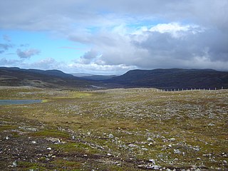
<span class="mw-page-title-main">Lebesby</span> Municipality in Finnmark, Norway

Lebesby is a municipality in Finnmark county, Norway. The administrative centre of the municipality is the village of Kjøllefjord. Other villages in the municipality include Ifjord, Kunes, Lebesby, and Veidnes.

<span class="mw-page-title-main">Gamvik</span> Municipality in Finnmark, Norway

is a municipality in Finnmark county, Norway. The administrative centre of the municipality is the village of Mehamn. The other main villages in Gamvik include Gamvik and Skjånes. Gamvik is known as one of the poorest and most undeveloped municipalities in Norway. The number of inhabitants rose at one moment in 2012, but in 2014, after the fish factory closed, the population declined dramatically with the departure of the eastern European fishermen.

<span class="mw-page-title-main">Berlevåg</span> Municipality in Finnmark, Norway

is a municipality in Finnmark county, Norway. It is located in the traditional district of Øst-Finnmark. The administrative centre of the municipality is the village of Berlevåg.

<span class="mw-page-title-main">Tjeldsund</span> Municipality in Troms, Norway

Tjeldsund is a municipality in Troms county, Norway. The southwestern part of the municipality is part of the traditional district of Ofoten and the rest of the municipality is part of Central Hålogaland. The administrative centre of the municipality is the village of Evenskjer. Other important villages include Fjelldal, Myklebostad, Grovfjord, Renså, Sandstrand, Tovik, and Ramsund. Norges Brannskole is situated in Fjelldal. Marinejegerkommandoen is based south of Ramsund.

<span class="mw-page-title-main">Kvæfjord</span> Municipality in Troms, Norway

Kvæfjord is a municipality in Troms county, Norway. It is part of the traditional region of Central Hålogaland. The administrative centre of the municipality is the village of Borkenes. Other villages include Hundstad, Langvassbukta, and Revsnes.

<span class="mw-page-title-main">Gratangen</span> Municipality in Troms, Norway

Gratangen is a municipality in Troms county, Norway. It is part of the traditional region of Central Hålogaland. The administrative centre of the municipality is the village of Årstein.

<span class="mw-page-title-main">Lavangen</span> Municipality in Troms, Norway

Lavangen (Norwegian) or Loabák (Northern Sami) is a municipality in Troms county, Norway. The administrative centre of the municipality is the village of Tennevoll. Other villages in Lavangen include Fossbakken and Spansdalen and Kjeiprød, Røkenes, Låternes, Tennevoll, Hesjevika, Soløy, and Å.
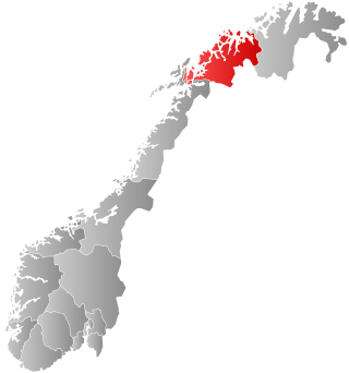
<span class="mw-page-title-main">Bardu</span> Municipality in Troms, Norway

Bardu is a municipality in Troms county, Norway. The administrative centre of the municipality is the village of Setermoen, the largest urban area in the municipality.

<span class="mw-page-title-main">Sørreisa</span> Municipality in Troms, Norway

Sørreisa is a municipality in Troms county, Norway. The administrative centre of the municipality is the village of Sørreisa. Other villages include Grunnreisa, Skøelva, and Smørsgård.
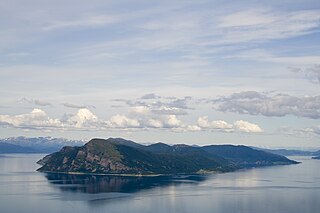
<span class="mw-page-title-main">Dyrøy</span> Municipality in Troms, Norway

Dyrøy is a municipality in Troms county, Norway. The administrative centre of the municipality is the village of Brøstadbotn. Other villages include Dyrøyhamn, Espenes, Holm, and Hundstrand.

<span class="mw-page-title-main">Lyngen</span> Municipality in Troms, Norway

Lyngen is a municipality in Troms county, Norway. The administrative centre of the municipality is the village of Lyngseidet. Other villages include Furuflaten, Lattervika, Nord-Lenangen, and Svensby.

<span class="mw-page-title-main">Storfjord</span> Municipality in Troms, Norway

Storfjord is a municipality in Troms county, Norway. The administrative centre of the municipality is the village of Hatteng. Other villages in Storfjord include Elvevoll, Oteren, and Skibotn.

<span class="mw-page-title-main">Gáivuotna – Kåfjord – Kaivuono</span> Municipality in Troms, Norway

Kåfjord (Norwegian), Gáivuotna[ˈkaːjːvuo̯tna] (Northern Sami), or Kaivuono (Kven) is a municipality in Troms county, Norway. The administrative centre of the municipality is the village of Olderdalen. Other villages include Løkvollen, Manndalen, Birtavarre, Trollvik, Samuelsberg, Nordmannvik, and Djupvik.

<span class="mw-page-title-main">Nordreisa</span> Municipality in Troms, Norway

Nordreisa is a municipality in Troms county, Norway. The administrative centre of the municipality is the village of Storslett. Other villages include Oksfjordhamn, Sørkjosen, and Rotsund.

<span class="mw-page-title-main">Kvænangen</span> Municipality in Troms, Norway

Kvænangen is a municipality in Troms county, Norway. The administrative centre of the municipality is the village of Burfjord. The European route E6 highway goes through the municipality and over the Sørstraumen Bridge, and many people stop at the Kvænangsfjellet pass to view the scenery of the Kvænangen fjord.

<span class="mw-page-title-main">Polmak (municipality)</span> Former municipality in Norway

Polmak is a former municipality in Finnmark county, Norway. The 2,257-square-kilometre (871 sq mi) municipality existed from 1903 until its dissolution in 1964. The administrative centre was the village of Polmak where Polmak Church is located.

References

  1. "Navn på steder og personer: Innbyggjarnamn" (in Norwegian). Språkrådet.
  2. "Forskrift om målvedtak i kommunar og fylkeskommunar" (in Norwegian). Lovdata.no.
  3. Bolstad, Erik; Thorsnæs, Geir, eds. (26 January 2023). "Kommunenummer". Store norske leksikon (in Norwegian). Kunnskapsforlaget.
  4. 1 2 "Stadnamn og rettskriving" (in Norwegian). Kartverket . Retrieved 19 November 2023.
  5. Store norske leksikon. "Deatnu/Tana" (in Norwegian). Archived from the original on 28 March 2014. Retrieved 26 March 2013.
  6. Statistisk sentralbyrå. "Table: 06913: Population 1 January and population changes during the calendar year (M)" (in Norwegian).
  7. Statistisk sentralbyrå. "09280: Area of land and fresh water (km²) (M)" (in Norwegian).
  8. 1 2 3 Jukvam, Dag (1999). "Historisk oversikt over endringer i kommune- og fylkesinndelingen" (PDF) (in Norwegian). Statistisk sentralbyrå.
  9. Mæhlum, Lars, ed. (24 December 2019). "Troms og Finnmark". Store norske leksikon (in Norwegian). Kunnskapsforlaget . Retrieved 26 December 2019.
  10. "Fylkesinndelingen fra 2024" (in Norwegian). Regjeringen.no. 5 July 2022.
  11. "Norsk Lovtidende. 2den Afdeling. 1917. Samling af Love, Resolutioner m.m". Norsk Lovtidend (in Norwegian). Kristiania, Norge: Grøndahl og Søns Boktrykkeri: 1057–1065. 1917.
  12. "Ot.prp. nr. 111 (2001-2002)" (in Norwegian). 5 July 2002.
  13. "Endring av skrivemåten for tospråklige kommuner" (in Norwegian).
  14. "Civic heraldry of Norway - Norske Kommunevåpen". Heraldry of the World. Retrieved 21 January 2023.
  15. "Tana, Finmark (Norway)". Flags of the World. Retrieved 21 January 2023.
  16. "Godkjenning av våpen og flagg". Lovdata.no (in Norwegian). Norges kommunal- og arbeidsdepartementet. 15 July 1984. Retrieved 21 January 2023.
  17. https://www.statsforvalteren.no/siteassets/utgatt/fm-finnmark/dokument-fmfi/kommunal-styring/kommunereformen/endelige-statusbilder/tana-kommune-statusbilde.pdf "2013 ... Primærnæring ... 155 ... Sekundærnæring ... 230 ... Handel, hotell/rest samf, finans ... 419 ... Undervisning ... 132 ... Helse og sosial ... 327 ... 1401"
  18. "Utmark". 26 February 2021.
  19. "Tana". 28 June 2021.
  20. Helga Pedersen. "Samvirke virker". 17 November 2020. Klassekampen. P. 2
  21. 1 2 Aage Solbakk. BUOĐĐU - Utviklingen av garnfisket i Tanavassdraget - Med vekt på perioden 1984-2015. https://deatnu.net/wp-content/uploads/2021/03/Utviklingen-av-garnfisket-i-Tanavassdraget.pdf. Page 3. DeanuInstituhtta. Retrieved 2023-05-22
  22. Hansen, Tore; Vabo, Signy Irene, eds. (20 September 2022). "kommunestyre". Store norske leksikon (in Norwegian). Kunnskapsforlaget . Retrieved 14 October 2022.
  23. "Kommunestyrevalg 2023 - Finnmark Finnmárku". Valg Direktoratet. Retrieved 30 December 2023.
  24. "Tall for Norge: Kommunestyrevalg 2019 - Troms og Finnmark". Valg Direktoratet.
  25. 1 2 3 4 "Table: 04813: Members of the local councils, by party/electoral list at the Municipal Council election (M)" (in Norwegian). Statistics Norway.
  26. "Tall for Norge: Kommunestyrevalg 2011 - Finnmark". Valg Direktoratet. Retrieved 23 October 2019.
  27. "Kommunestyrevalget 1995" (PDF) (in Norwegian). Oslo-Kongsvinger: Statistisk sentralbyrå. 1996. Retrieved 17 March 2020.
  28. "Kommunestyrevalget 1991" (PDF) (in Norwegian). Oslo-Kongsvinger: Statistisk sentralbyrå. 1993. Retrieved 17 March 2020.
  29. "Kommunestyrevalget 1987" (PDF) (in Norwegian). Oslo-Kongsvinger: Statistisk sentralbyrå. 1988. Retrieved 17 March 2020.
  30. "Kommunestyrevalget 1983" (PDF) (in Norwegian). Oslo-Kongsvinger: Statistisk sentralbyrå. 1984. Retrieved 17 March 2020.
  31. "Kommunestyrevalget 1979" (PDF) (in Norwegian). Oslo: Statistisk sentralbyrå. 1979. Retrieved 17 March 2020.
  32. "Kommunevalgene 1975" (PDF) (in Norwegian). Oslo: Statistisk sentralbyrå. 1977. Retrieved 17 March 2020.
  33. "Kommunevalgene 1972" (PDF) (in Norwegian). Oslo: Statistisk sentralbyrå. 1973. Retrieved 17 March 2020.
  34. "Kommunevalgene 1967" (PDF) (in Norwegian). Oslo: Statistisk sentralbyrå. 1967. Retrieved 17 March 2020.
  35. "Kommunevalgene 1963" (PDF) (in Norwegian). Oslo: Statistisk sentralbyrå. 1964. Retrieved 16 March 2020.
  36. "Kommunevalgene og Ordførervalgene 1959" (PDF) (in Norwegian). Oslo: Statistisk sentralbyrå. 1960. Retrieved 17 March 2020.
  37. "Kommunevalgene og Ordførervalgene 1955" (PDF) (in Norwegian). Oslo: Statistisk sentralbyrå. 1957. Retrieved 17 March 2020.
  38. "Kommunevalgene og Ordførervalgene 1951" (PDF) (in Norwegian). Oslo: Statistisk sentralbyrå. 1952. Retrieved 17 March 2020.
  39. "Kommunevalgene og Ordførervalgene 1947" (PDF) (in Norwegian). Oslo: Statistisk sentralbyrå. 1948. Retrieved 17 March 2020.
  40. "Kommunevalgene og Ordførervalgene 1945" (PDF) (in Norwegian). Oslo: Statistisk sentralbyrå. 1947. Retrieved 17 March 2020.
  41. "Kommunevalgene og Ordførervalgene 1937" (PDF) (in Norwegian). Oslo: Statistisk sentralbyrå. 1938. Retrieved 17 March 2020.
  42. Ballovara, Mette (10 October 2019). "Vant med én stemme – Helga Pedersen ny Tana-ordfører". NRK (in Norwegian Bokmål). Retrieved 10 October 2019.
  43. "Ny ordfører i Tana kommune". NRK Troms og Finnmark (in Norwegian). 12 October 2023. Retrieved 29 December 2023.
  44. Østby, Jørn; Ballovara, Mette; Grønnvoll Bjørnback, June; Grønmo, Samuel Frode. "Politiet etterforsker felling av bjørn i Tana". NRK (in Norwegian).
  45. "eKlima Web Portal". Norwegian Meteorological Institute. Archived from the original on 14 June 2004.
  46. IMDb Database retrieved 16 August 2020