
Mbombela Local Municipality is an administrative area in the Ehlanzeni District of Mpumalanga in South Africa. Mbombela is a siSwati name meaning "a lot of people in a small space".

Emalahleni Local Municipality is located in the Nkangala District Municipality of Mpumalanga province, South Africa. eMalahleni is a Nguni name meaning place of coal.
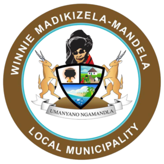
Winnie Madikizela-Mandela Local Municipality is a local municipality in Alfred Nzo District Municipality in the Wild Coast Region of the Eastern Cape Province in South Africa.

Gariep Local Municipality is a defunct local municipality in Joe Gqabi District Municipality, Eastern Cape. The municipality was merged with Maletswai Local Municipality immediately after the August 2016 Local Municipal Elections to form the new Walter Sisulu Local Municipality.

Albert Luthuli Local Municipality is a South African local municipality situated in the Gert Sibande District Municipality, Grass and Wetlands region, of Mpumalanga. It was named after Albert Luthuli. Carolina is the seat of the municipality.

Modimolle Local Municipality was a municipality located in the Waterberg District Municipality of Limpopo province, South Africa. The seat of Modimolle Local Municipality was Modimolle.

Mookgophong Local Municipality was a municipality located in the Waterberg District Municipality of Limpopo province, South Africa. The seat of Mookgophong Local Municipality was Mookgophong.
Greater Tzaneen Local Municipality is located in the Mopani District Municipality of Limpopo province, South Africa. The seat of the municipality is Tzaneen.

Thembisile Hani Local Municipality is located in the Nkangala District Municipality of Mpumalanga province, South Africa. It is a semi-urban local Municipality consisting of 57 villages within which there are 5 (five) established townships.

Kwa Sani Local Municipality was an administrative area in the Harry Gwala of KwaZulu-Natal in South Africa.

Ikwezi Local Municipality was a local municipality in the Sarah Baartman District Municipality of the Eastern Cape in South Africa. Ikwezi is an isiXhosa name that means "morning star". After municipal elections on 3 August 2016 it was merged into the larger Dr Beyers Naudé Local Municipality.

Naledi Local Municipality was a local municipality in the Free State province in South Africa. On 3 August 2016 it was disestablished and merged into the Mangaung Metropolitan Municipality. The name Naledi is a Sesotho word meaning "a star". The principal towns in the area of the disestablished municipality are Dewetsdorp and Wepener.

Hlabisa was an administrative area in the Umkhanyakude District of KwaZulu-Natal in South Africa. Hlabisa is an isiZulu surname of the two nkosis (kings) in the area. The municipality was situated within the vicinity of four Tribal Authorities which are the Mkhwanazi Tribal Authority, the Mdletshe Tribal Authority, and two Hlabisa Tribal Authorities.

Mhlontlo Local Municipality is an administrative area in the OR Tambo District of Eastern Cape in South Africa.

Nxuba Local Municipality was an administrative area in the Amatole District of the Eastern Cape in South Africa. The Fish River, as it is now called, was first named Nxuba River by King Sandile in the 18th century After municipal elections on 3 August 2016 it was merged into the larger Raymond Mhlaba Local Municipality.

Tsolwana Local Municipality was an administrative area in the Chris Hani District of the Eastern Cape in South Africa. Tsolwana is an isiXhosa name which means "something with a sharp ending or a tip", referring the mountains around the whole area. After municipal elections on 3 August 2016 it was merged into the larger Enoch Mgijima Local Municipality.

Lukhanji Local Municipality was an administrative area in the Chris Hani District of the Eastern Cape in South Africa. Lukhanji is a Xhosa name for the mountain that runs from the eastern side of Queenstown to the western side. After municipal elections on 3 August 2016 it was merged into the larger Enoch Mgijima Local Municipality.

Umtshezi Local Municipality was an administrative area in the Uthukela District of KwaZulu-Natal in South Africa. uMtshezi is an isiZulu name word for Bushman or San. The name uMtshezi refers to the Bushman River. After municipal elections on 3 August 2016 it was merged into the larger Inkosi Langalibalele Local Municipality.

Ntambanana Local Municipality was a local municipality within the uThungulu District of KwaZulu-Natal in South Africa. In 2016 the municipality was dissolved and its territory divided between Mthonjaneni Local Municipality, uMhlathuze Local Municipality and uMfolozi Local Municipality.

Imbabazane Local Municipality was an administrative area in the Uthukela District of KwaZulu-Natal in South Africa. Imbabazane is the name of an African tree. After municipal elections on 3 August 2016 it was merged into the larger Inkosi Langalibalele Local Municipality.


