Thurston, Ohio

Last updated
Thurston, Ohio
Thurston, High from Maple.jpg
Houses on High Street
OHMap-doton-Thurston.png
Location of Thurston, Ohio
Map of Fairfield County Ohio Highlighting Thurston Village.png
Location of Thurston in Fairfield County
Coordinates: 39°50′38″N82°32′44″W / 39.84389°N 82.54556°W / 39.84389; -82.54556
Country United States
State Ohio
County Fairfield
Area
[1]
  Total0.40 sq mi (1.05 km2)
  Land0.40 sq mi (1.05 km2)
  Water0.00 sq mi (0.00 km2)
Elevation
[2]
883 ft (269 m)
Population
 (2020)
  Total603
  Density1,492.57/sq mi (575.62/km2)
Time zone UTC-5 (Eastern (EST))
  Summer (DST) UTC-4 (EDT)
ZIP code
43157
Area code 740
FIPS code 39-76764 [3]
GNIS feature ID1047053 [2]

Thurston is a village in Fairfield County, Ohio, United States. The population was 603 at the 2020 census.

Contents

History

Thurston was originally called Bush City, and under the latter name was laid out in 1881. [4] A post office called Thurston has been in operation since 1881. [5]

Geography

Thurston is located at 39°50′38″N82°32′44″W / 39.84389°N 82.54556°W / 39.84389; -82.54556 (39.843864, -82.545551). [6]

According to the United States Census Bureau, the village has a total area of 0.26 square miles (0.67 km2), all land. [7]

Demographics

Historical population
CensusPop.Note
1920 394
1930 4309.1%
1940 424−1.4%
1950 4547.1%
1960 429−5.5%
1970 428−0.2%
1980 52723.1%
1990 5392.3%
2000 5553.0%
2010 6048.8%
2020 603−0.2%
U.S. Decennial Census [8]

2010 census

As of the census [9] of 2010, there were 604 people, 219 households, and 152 families living in the village. The population density was 2,323.1 inhabitants per square mile (897.0/km2). There were 238 housing units at an average density of 915.4 per square mile (353.4/km2). The racial makeup of the village was 95.4% White, 0.3% Native American, 0.2% Asian, 0.3% from other races, and 3.8% from two or more races. Hispanic or Latino of any race were 1.3% of the population.

There were 219 households, of which 43.4% had children under the age of 18 living with them, 48.4% were married couples living together, 12.8% had a female householder with no husband present, 8.2% had a male householder with no wife present, and 30.6% were non-families. 21.9% of all households were made up of individuals, and 8.7% had someone living alone who was 65 years of age or older. The average household size was 2.76 and the average family size was 3.18.

The median age in the village was 34.6 years. 29.1% of residents were under the age of 18; 8.5% were between the ages of 18 and 24; 28.2% were from 25 to 44; 22.5% were from 45 to 64; and 11.8% were 65 years of age or older. The gender makeup of the village was 48.0% male and 52.0% female.

2000 census

As of the census [3] of 2000, there were 555 people, 203 households, and 145 families living in the village. The population density was 2,145.3 inhabitants per square mile (828.3/km2). There were 209 housing units at an average density of 807.9 per square mile (311.9/km2). The racial makeup of the village was 96.04% White, 0.18% African American, 1.62% Native American, 0.36% Asian, and 1.80% from two or more races. Hispanic or Latino of any race were 0.18% of the population.

There were 203 households, out of which 36.5% had children under the age of 18 living with them, 51.2% were married couples living together, 13.8% had a female householder with no husband present, and 28.1% were non-families. 23.2% of all households were made up of individuals, and 9.4% had someone living alone who was 65 years of age or older. The average household size was 2.73 and the average family size was 3.12.

In the village, the population was spread out, with 29.7% under the age of 18, 9.0% from 18 to 24, 28.8% from 25 to 44, 20.9% from 45 to 64, and 11.5% who were 65 years of age or older. The median age was 34 years. For every 100 females there were 96.1 males. For every 100 females age 18 and over, there were 97.0 males.

The median income for a household in the village was $29,911, and the median income for a family was $30,000. Males had a median income of $23,438 versus $24,375 for females. The per capita income for the village was $14,381. About 9.3% of families and 9.9% of the population were below the poverty line, including 9.1% of those under age 18 and 11.8% of those age 65 or over.

Related Research Articles

<span class="mw-page-title-main">Fairfield County, Ohio</span> County in Ohio, US

Fairfield County is a county located in the U.S. state of Ohio. As of the 2020 census, the population was 158,921. Its county seat and largest city is Lancaster. Its name is a reference to the Fairfield area of the original Lancaster.

<span class="mw-page-title-main">Marsing, Idaho</span> City in Owhyee County, Idaho, United States

Marsing is a city in Owyhee County, Idaho, United States. The population was 1,031 at the time of the 2010 census. It is part of the Boise metropolitan area.

<span class="mw-page-title-main">Hamel, Illinois</span> Village in Illinois, United States

Hamel is a village in Madison County, Illinois, United States. The population was 929 at the 2020 census, up from 816 in 2010. It is a part of the Illinois Metro East portion of the Greater St. Louis metropolitan area.

<span class="mw-page-title-main">Yetter, Iowa</span> City in Iowa, United States

Yetter is a city in Calhoun County, Iowa, United States. The population was 19 at the time of the 2020 census.

<span class="mw-page-title-main">Rosalie, Nebraska</span> Village in Thurston County, Nebraska, United States

Rosalie is a village in Thurston County, Nebraska, United States, within the boundaries of the Omaha Indian Reservation. The population was 160 at the 2010 census.

<span class="mw-page-title-main">Thurston, Nebraska</span> Village in Thurston County, Nebraska, United States

Thurston is a village in Thurston County, Nebraska, United States. The population was 132 at the 2010 census.

<span class="mw-page-title-main">Baltimore, Ohio</span> Village in Ohio, United States

Baltimore is a village in Fairfield County, Ohio, United States. The population was 2,981 at the 2020 census.

<span class="mw-page-title-main">Bremen, Ohio</span> Village in Ohio, United States

Bremen is a village in Fairfield County, Ohio, United States. The population was 1,479 at the 2020 census.

<span class="mw-page-title-main">Lithopolis, Ohio</span> Village in Ohio, United States

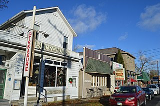
Lithopolis is a village in Fairfield and Franklin counties in the U.S. state of Ohio. The population was 2,134 at the 2020 census.

<span class="mw-page-title-main">Millersport, Ohio</span> Village in Ohio, United States

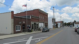
Millersport is a village in Fairfield County, Ohio, United States. The population was 978 at the 2020 census. Millersport is most notable as the home of the Sweet Corn Festival, which is held in Millersport annually during the first week of September.

<span class="mw-page-title-main">Pleasantville, Ohio</span> Village in Ohio, United States

Pleasantville is a village in Fairfield County, Ohio, United States. The population was 934 at the 2020 census.

<span class="mw-page-title-main">Stoutsville, Ohio</span> Village in Ohio, United States

Stoutsville is a village in Fairfield County, Ohio, United States. The population was 579 at the 2020 census.

<span class="mw-page-title-main">Sugar Grove, Ohio</span> Village in Ohio, United States

Sugar Grove is a village in Fairfield County, Ohio, United States. The population was 429 at the 2020 census.

<span class="mw-page-title-main">West Rushville, Ohio</span> Village in Ohio, United States

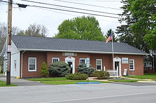
West Rushville is a village in Fairfield County, Ohio, United States. The population was 166 at the 2020 census.

<span class="mw-page-title-main">North Fairfield, Ohio</span> Village in Ohio, United States

North Fairfield is a village in Huron County, Ohio, United States. The population was 560 at the 2010 census.

<span class="mw-page-title-main">Tarlton, Ohio</span> Village in Ohio, United States

Tarlton is a village in Fairfield and Pickaway counties in the U.S. state of Ohio. The population was 254 at the 2020 census.

<span class="mw-page-title-main">East Butler, Pennsylvania</span> Borough in Pennsylvania, United States

East Butler is a borough in Butler County, Pennsylvania, United States. The population was 732 at the 2010 census.

<span class="mw-page-title-main">Washington Township, Butler County, Pennsylvania</span> Township in Pennsylvania, United States

Washington Township is a township in Butler County, Pennsylvania, United States. The population was 1,287 at the 2020 census.

<span class="mw-page-title-main">Reeseville, Wisconsin</span> Village in Wisconsin, United States

Reeseville is a village in Dodge County, Wisconsin, United States. The population was 763 at the 2020 census.

<span class="mw-page-title-main">Buckeye Lake, Ohio</span> Village in Ohio, United States

Buckeye Lake is a village in Fairfield and Licking counties in the U.S. state of Ohio. The population was 2,520 at the 2020 census. It is named for Buckeye Lake, a large lake along which the village is built.

References

  1. "ArcGIS REST Services Directory". United States Census Bureau. Retrieved September 20, 2022.
  2. 1 2 "US Board on Geographic Names". United States Geological Survey. 2007-10-25. Retrieved 2008-01-31.
  3. 1 2 "U.S. Census website". United States Census Bureau . Retrieved 2008-01-31.
  4. Miller, Charles Christian (1912). History of Fairfield County, Ohio, and representative citizens. Chicago, Richmond-Arnold Pub. Co. p. 200.
  5. "Fairfield County". Jim Forte Postal History. Retrieved 17 December 2015.
  6. "US Gazetteer files: 2010, 2000, and 1990". United States Census Bureau. 2011-02-12. Retrieved 2011-04-23.
  7. "US Gazetteer files 2010". United States Census Bureau. Archived from the original on 2012-01-25. Retrieved 2013-01-06.
  8. "Census of Population and Housing". Census.gov. Retrieved June 4, 2015.
  9. "U.S. Census website". United States Census Bureau . Retrieved 2013-01-06.