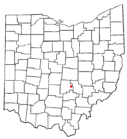
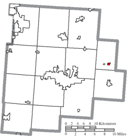
Rushville, Ohio

Last updated

Rushville, Ohio
Downtown Rushville Ohio.jpg
Downtown Rushville Ohio
OHMap-doton-Rushville.png
Location of Rushville, Ohio
Map of Fairfield County Ohio Highlighting Rushville Village.png
Location of Rushville in Fairfield County
Coordinates: 39°45′54″N82°25′53″W / 39.76500°N 82.43139°W / 39.76500; -82.43139
Country United States
State Ohio
County Fairfield
Area
[1]
  Total0.24 sq mi (0.62 km2)
  Land0.24 sq mi (0.62 km2)
  Water0.00 sq mi (0.00 km2)
Elevation
[2]
1,050 ft (320 m)
Population
 (2020)
  Total304
  Density1,266.67/sq mi (488.25/km2)
Time zone UTC-5 (Eastern (EST))
  Summer (DST) UTC-4 (EDT)
ZIP codes
43150
Area code 740
FIPS code 39-69204 [3]
GNIS feature ID1065259 [2]

Rushville is a village in Fairfield County, Ohio, United States. The population was 304 at the 2020 census. Much of the village is listed on the National Register of Historic Places as the Rushville Historic District.

Contents

History

Rushville takes its name from Little Rush Creek, which runs between the villages of Rushville and West Rushville. [4] The town was founded in 1808 by Joseph Turner and became a prosperous stop along the old Zane's Trace road constructed in 1797 by Colonel Ebenezer Zane. [5] Rushville was known as a stop on the Underground Railroad in the years prior to the Civil War. Several fugitive slaves who died in Rushville while seeking freedom in Canada are buried in the nearby Pleasant Hill Cemetery. [6]

Geography

Rushville is located at 39°45′54″N82°25′53″W / 39.76500°N 82.43139°W / 39.76500; -82.43139 (39.764882, -82.431393). [7]

According to the United States Census Bureau, the village has a total area of 0.24 square miles (0.62 km2), all land. [8]

Demographics

Historical population
CensusPop.Note
1870 221
1880 2272.7%
1890 29128.2%
1900 257−11.7%
1910 246−4.3%
1920 209−15.0%
1930 201−3.8%
1940 22813.4%
1950 25210.5%
1960 28312.3%
1970 2892.1%
1980 2993.5%
1990 229−23.4%
2000 26817.0%
2010 30212.7%
2020 3040.7%
U.S. Decennial Census [9]

2010 census

As of the census [10] of 2010, there were 302 people, 107 households, and 81 families living in the village. The population density was 1,258.3 inhabitants per square mile (485.8/km2). There were 120 housing units at an average density of 500.0 per square mile (193.1/km2). The racial makeup of the village was 96.0% White, 0.7% Asian, and 3.3% from two or more races.

There were 107 households, of which 44.9% had children under the age of 18 living with them, 52.3% were married couples living together, 14.0% had a female householder with no husband present, 9.3% had a male householder with no wife present, and 24.3% were non-families. 16.8% of all households were made up of individuals, and 4.7% had someone living alone who was 65 years of age or older. The average household size was 2.82 and the average family size was 3.12.

The median age in the village was 32.3 years. 30.5% of residents were under the age of 18; 9.5% were between the ages of 18 and 24; 31.9% were from 25 to 44; 22.9% were from 45 to 64; and 5.3% were 65 years of age or older. The gender makeup of the village was 47.4% male and 52.6% female.

2000 census

As of the census [3] of 2000, there were 268 people, 90 households, and 74 families living in the village. The population density was 1,183.4 inhabitants per square mile (456.9/km2). There were 103 housing units at an average density of 454.8 per square mile (175.6/km2). The racial makeup of the village was 97.01% White, 0.75% Native American, and 2.24% from two or more races.

There were 90 households, out of which 52.2% had children under the age of 18 living with them, 61.1% were married couples living together, 12.2% had a female householder with no husband present, and 16.7% were non-families. 14.4% of all households were made up of individuals, and 5.6% had someone living alone who was 65 years of age or older. The average household size was 2.98 and the average family size was 3.25.

In the village, the population was spread out, with 34.7% under the age of 18, 8.6% from 18 to 24, 33.6% from 25 to 44, 19.8% from 45 to 64, and 3.4% who were 65 years of age or older. The median age was 31 years. For every 100 females there were 98.5 males. For every 100 females age 18 and over, there were 96.6 males.

The median income for a household in the village was $33,750, and the median income for a family was $45,875. Males had a median income of $31,563 versus $25,417 for females. The per capita income for the village was $13,864. About 12.7% of families and 14.7% of the population were below the poverty line, including 16.5% of those under the age of eighteen and 66.7% of those 65 or over.

Notable person

Related Research Articles

<span class="mw-page-title-main">Rushville, Illinois</span> City in Illinois, United States

Rushville is a city in Schuyler County, Illinois, United States. The population was 3,005 at the 2020 census. It is the county seat of Schuyler County. It was first settled by Euro-Americans in 1823.

<span class="mw-page-title-main">Waterloo, Indiana</span> Town in Indiana, United States

Waterloo is a town in Grant and Smithfield townships, DeKalb County, Indiana, United States. The population was 2,242 at the 2010 census.

<span class="mw-page-title-main">Henderson, Iowa</span> City in Iowa, United States

Henderson is a city in Mills County, Iowa, United States. The population was 144 at the time of the 2020 census.

<span class="mw-page-title-main">Emmett, Michigan</span> Village in Michigan, United States

Emmett is a village in St. Clair County of the U.S. state of Michigan. The population was 269 at the 2010 census. The village is located within Emmett Township.

<span class="mw-page-title-main">Funkley, Minnesota</span> City in Minnesota, United States

Funkley is a city in Beltrami County, Minnesota, United States. The population was 18 at the 2020 census, making the city the second-least populous incorporated place in Minnesota. It shared that distinction with Tenney until the latter dissolved in 2011.

<span class="mw-page-title-main">Rushville, Missouri</span> Village in Missouri, United States

Rushville is a village in western Buchanan County, Missouri, United States. The population was 303 at the 2010 census. It is part of the St. Joseph, MO–KS Metropolitan Statistical Area.

<span class="mw-page-title-main">Innsbrook, Missouri</span> Village in Missouri, United States

Innsbrook is a village in Warren County, Missouri, United States. The population was 552 at the 2010 census. The village of Innsbrook is comprised almost entirely by Innsbrook Resort—a private, gated community. The village was founded in 1998.

<span class="mw-page-title-main">Rushville, Nebraska</span> City in Nebraska, United States

Rushville is a city in Sheridan County in the state of Nebraska, in the remote Sandhills Region. Its population was 890 at the 2010 census. It is the county seat of Sheridan County.

Gorham is a town in Ontario County, New York, United States. The population was 4,130 at the 2020 census. The town is named after Nathaniel Gorham.

Bermuda Run is a town in Davie County, North Carolina, United States. The population was 1,725 at the 2010 census. It was incorporated in 1999 as a fully gated residential community near country clubs and golf courses like the Bermuda Run Country Club, Oak Valley Golf Club, and Tanglewood Park. In 2000, the town annexed into neighboring Hillsdale, picking up a commercial district. The town rests on the western bank of the Yadkin River along U.S. Route 158 and North Carolina Highway 801. Interstate 40 provides express access to Winston-Salem, the town's nearest urban center. In 2012, Kinderton Village was voluntarily annexed by the town of Bermuda Run.

<span class="mw-page-title-main">McVille, North Dakota</span> City in North Dakota, United States

McVille is a city in Nelson County, North Dakota, United States. The population was 392 at the 2020 census. McVille was founded in 1906.

<span class="mw-page-title-main">West Rushville, Ohio</span> Village in Ohio, United States

West Rushville is a village in Fairfield County, Ohio, United States. The population was 166 at the 2020 census.

<span class="mw-page-title-main">Brice, Ohio</span> Village in Ohio, United States

Brice is a village in Franklin County, Ohio, United States, on the southeast side of the Columbus metropolitan area. The population was 93 at the 2020 census. The village theme is "An Early American Village".

<span class="mw-page-title-main">Sheffield, Ohio</span> Village in Ohio, United States

Sheffield is a village in Lorain County, Ohio, United States, along the Black River. The population was 4,135 at the 2020 census. It is part of the Cleveland metropolitan area.

<span class="mw-page-title-main">Castanea Township, Clinton County, Pennsylvania</span> Township in Pennsylvania, United States

Castanea Township is a township in Clinton County, Pennsylvania, United States. The population was 1,095 at the 2020 census.

Norris is a town in Pickens County, South Carolina, United States. The population was 813 at the 2010 census. It is part of the Greenville–Mauldin–Easley Metropolitan Statistical Area.

<span class="mw-page-title-main">Harrison, South Dakota</span> Census-designated place in South Dakota, United States

Harrison is an unincorporated community and census-designated place (CDP) in Douglas County, South Dakota, United States. The population was 55 at the 2020 census.

<span class="mw-page-title-main">North Bay, Wisconsin</span> Village in Wisconsin, United States

North Bay is a village in Racine County, Wisconsin, United States. The population was 209 at the 2020 census.

<span class="mw-page-title-main">Gratiot, Ohio</span> Village in Ohio, United States

Gratiot is a village in Licking and Muskingum counties in the U.S. state of Ohio. The population was 221 at the 2010 census.

<span class="mw-page-title-main">Patch Grove, Wisconsin</span> Village in Wisconsin, United States

Patch Grove is a village in Grant County, Wisconsin, United States. The population was 198 at the 2010 census. The village is located within the Town of Patch Grove.

References

  1. "ArcGIS REST Services Directory". United States Census Bureau. Retrieved September 20, 2022.
  2. 1 2 "US Board on Geographic Names". United States Geological Survey. October 25, 2007. Retrieved January 31, 2008.
  3. 1 2 "U.S. Census website". United States Census Bureau . Retrieved January 31, 2008.
  4. Overman, William Daniel (1958). Ohio Town Names. Akron, OH: Atlantic Press. p. 121.
  5. Graham, Albert Adams (1883). History of Fairfield and Perry Counties, Ohio. Chicago: W.H. Beers & Co. p. 248.
  6. "Memorial marker installed for runaway slaves in Rushville cemetery". Lancaster Eagle Gazette. Retrieved October 5, 2022.
  7. "US Gazetteer files: 2010, 2000, and 1990". United States Census Bureau. February 12, 2011. Retrieved April 23, 2011.
  8. "US Gazetteer files 2010". United States Census Bureau. Archived from the original on January 25, 2012. Retrieved January 6, 2013.
  9. "Census of Population and Housing". Census.gov. Retrieved June 4, 2015.
  10. "U.S. Census website". United States Census Bureau . Retrieved January 6, 2013.
  11. "Benjamin Hanby and His Anti-Slavery Song | Westerville Public Library".