Severe Tropical Storm Mekkhala,[nb 1] known in the Philippines as Severe Tropical Storm Amang,was an early-season tropical cyclone that made landfall over the Philippines in mid-January 2015. Mekkhala killed three people in the Bicol Region and caused light crop damage. Notably,the storm disturbed Pope Francis’visit to the country after the victims of Typhoon Haiyan on November 8,2013. Although the storm also caused an airplane crash in Tacloban,nobody was hurt in the incident.
The system developed on January13 between the Philippines and Guam. Moving west-northwest for its duration,Mekkhala passed north of Yap State on January14 while slowly intensifying due to moderate wind shear. Conditions became more favorable on January16,when the storm quickly strengthened to peak winds of at least 110km/h (70mph);a ragged eye prompted the American-based Joint Typhoon Warning Center (JTWC) to upgrade it to a typhoon. The storm weakened slightly and made landfall on the Philippine island of Samar on January17. Mekkhala weakened further over land,dissipating on January21 east of Luzon.
Meteorological history
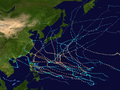
Map plotting the storm's track and intensity,according to the Saffir–Simpson scale
Tropical Storm Mekkhala was first noted as a tropical disturbance on January 11, while it was located within a marginal environment for further development, about 205km (125mi) to the south-southwest of Chuuk State in the Federated States of Micronesia.[2] At this time the system's low level circulation centre was broad and ill-defined, with a large band of deep atmospheric convection flaring along the centre's northern edge.[2] Over the next day the system moved westwards into a more favourable environment, with atmospheric convection wrapping into a slowly-consolidating low-level circulation center.[3] The Japan Meteorological Agency subsequently started to monitor the system as a tropical depression early on January 13.[nb 2][5] Later that day the United States Joint Typhoon Warning Center initiated advisories on the system and classified it as Tropical Depression 01W, despite tropical storm force winds of 65km/h (40mph) occurring on the northern side of the system.[nb 3][7][8]
Although deep convection was displaced to the northwest of an exposed LLCC early on January 14, the JMA still upgraded the system to a tropical storm and named it Mekkhala, under moderate vertical wind shear offset by excellent poleward outflow.[9][10] In post-season analysis, the agency upgraded the storm at 12:00 UTC on the previous day.[11] Late on January 14, the PAGASA named the storm Amang right after it entered the Philippine Area of Responsibility.[12]
Severe Tropical Storm Mekkhala making landfall over the Samar
Tracking west-northwestward and then westward along the southern periphery of a subtropical ridge, Mekkhala was upgraded to a tropical storm by the JTWC early on January 15, due to its slightly improved structure.[13] Mekkhala quickly intensified on the next day due to improved conditions; the wind shear became in-phase with the storm's motion while the robust divergent outflow persisted.[14] Therefore, the JMA upgraded the system to a severe tropical storm at 06:00UTC on January16,[11] and later that day the JTWC upgraded it to a typhoon, when a central dense overcast has significantly deepened and totally obscured the LLCC.[14] Later, a microwave imagery revealed that Mekkhala formed a ragged eyewall structure.[15] The system reached peak intensity at 00:00UTC on January 17 with ten-minute maximum sustained winds of 110km/h (70mph),[11] although operationally the JMA estimated typhoon-force winds of 130km/h (80mph).[16]
After slightly weakening, Mekkhala tracked northwestward and made landfall over Dolores, Eastern Samar of the Philippines at around 15:00 Philippine Standard Time (07:00UTC), where Typhoon Hagupit also made landfall the month before.[17] Both the JMA and the JTWC downgraded Mekkhala to a tropical storm on January17, due to land interaction weakening the storm significantly.[18][19][20] Mekkhala weakened further while crossing the Bicol Region on January 18, leading the JTWC to downgrade it to a tropical depression when it turned northward and emerged into the Philippine Sea.[21] Late on the same day, the JMA downgraded Mekkhala to a tropical depression, and shortly after the JTWC issued the final warning as strong wind shear exposed the LLCC.[22] The tropical depression drifted northeastward and maintained its exposed low-level circulation east of Luzon, until the system was completely absorbed by a stationary front early on January 21.[23][24]
Impact
Animation of issued PSWS for Tropical Storm Mekkhala (Amang) when crossing and skirting the Philippines.The site of the Papal Mass in Tacloban on January 17
During January 14, Mekkhala passed about 95km (60mi) to the north of Yap State and less than 45km (30mi) to the south of the atoll Ulithi.[25] A peak wind gust of 58km/h (36mph) was recorded in Yap State, along with a rainfall total of around 13mm (0.5in).[25] On Ulithi a rainfall total of 100mm (4in) was recorded, while there were no reports of any deaths or significant damage on either Ulithi or in Yap State.[25]
Severe Tropical Storm Mekkhala, also known as Tropical Storm Amang, killed three people in the Bicol Region of the Philippines. Damage in the region amounted to ₱318.7million (US$7.13million), stemming mostly from agriculture.[26] In addition, the storm caused agricultural damage of ₱30.3million (US$678,000) in Samar.[27] The crop damage and a subsequent drought caused rice shortages in the country, prompting the government to import the grain in May 2015.[28] Throughout the country, 48homes were destroyed while a further 490sustained damage.[27] Infrastructural losses reached ₱49.7million (US$1.11million); repairs to roadways was quick and completed by January21.[26] A volunteer from the Bicol Region, who worked for a Catholic Relief Services station in Salcedo, Eastern Samar, was hit by a soundbox due to a collapsed scaffolding caused by heavy winds during a papal Mass held in Daniel Z. Romualdez Airport in Tacloban, Leyte.[29]
To comfort Tacloban people who suffered from the devastation caused by Typhoon Haiyan in 2013, and Typhoon Hagupit a month prior, Pope Francisvisited the storm-ravaged city on January 17. However, the schedule was significantly impacted by Severe Tropical Storm Mekkhala and thousands of pilgrims and the Pope wore their raincoats during the rain-soaked Mass in the airport.[30] Only minutes after Pope Francis’ aircraft left the airport, a private jet was veered off the runway by strong winds of Mekkhala and eventually crashed. The 15passengers on the plane were all safe, including officials from the Cabinet of the Philippines.[31]
↑Tropical Storm Mekkhala (RSMC Tropical Cyclone Best Track). Japan Meteorological Agency. February 17, 2015. Archived from the original on December 19, 2014. Retrieved July 9, 2016.
This page is based on this Wikipedia article Text is available under the CC BY-SA 4.0 license; additional terms may apply. Images, videos and audio are available under their respective licenses.


