Umtshezi Local Municipality

Last updated
Umtshezi
Umtshezi CoA.png
Map of KwaZulu-Natal with Umtshezi highlighted.svg
Location in KwaZulu-Natal
Country South Africa
Province KwaZulu-Natal
District uThukela
Seat Estcourt
Wards 9
Government
[1]
  Type Municipal council
  MayorBongani Dlamini (African National Congress)
Area
  Total1,972 km2 (761 sq mi)
Population
 (2011) [2]
  Total83,153
  Density42/km2 (110/sq mi)
Racial makeup (2011)
[2]
   Black African 90.2%
   Coloured 1.4%
   Indian/Asian 5.8%
   White 2.3%
First languages (2011)
[2]
   Zulu 84.7%
   English 10.7%
   Southern Ndebele 1.2%
   Afrikaans 1.1%
  Other2.3%
Time zone UTC+2 (SAST)
Municipal codeKZN234

Umtshezi Local Municipality was an administrative area in the Uthukela District of KwaZulu-Natal in South Africa. uMtshezi is an isiZulu name word for Bushman or San. The name uMtshezi refers to the Bushman River. [3] After municipal elections on 3 August 2016 it was merged into the larger Inkosi Langalibalele Local Municipality.

Contents

Main places

The 2001 census divided the municipality into the following main places: [4]

PlaceCodeArea (km2)Population
Estcourt 51601 14.4713,958
Khwezi 51602 14.452,978
Kwanobamba 51603 0.992,702
Weenen 51605 2.241,157
Wembezi 51606 18.2917,497
Remainder of the municipality 51604 2,079.5121,630

Politics

The municipal council consisted of seventeen members elected by mixed-member proportional representation. Nine councillors were elected by first-past-the-post voting in nine wards, while the remaining eight were chosen from party lists so that the total number of party representatives was proportional to the number of votes received. In the election of 18 May 2011 no party obtained a majority; the African National Congress won eight seats, the Inkatha Freedom Party five, and the National Freedom Party three. The following table shows the results of the election. [5] [6]

PartyVotesSeats
WardListTotal %WardListTotal
ANC 10,94511,02721,97246.2628
IFP 6,1966,19112,38726.1235
NFP 4,6334,6109,24319.4123
Democratic Alliance 1,8311,8013,6327.6011
Minority Front 1591382970.6000
Total23,76423,76747,531100.09817
Spoilt votes385341726

The ANC and the NFP formed a coalition to govern the majority. Subsequently, the ANC won a by-election in a ward previously held by the IFP, giving the ANC a majority of nine seats. [7]

Related Research Articles

2006 South African municipal elections

Municipal elections were held in South Africa on 1 March 2006, to elect members to the local governing councils in the municipalities of South Africa. The municipalities form the local government of South Africa and are subdivisions of the provinces, thus making them responsible for local service delivery, such as electricity, water and fire services.

KwaDukuza Local Municipality Local municipality in KwaZulu-Natal, South Africa

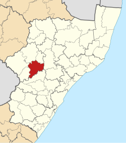
KwaDukuza Local Municipality is one of four municipalities under iLembe District Municipality, KwaZulu-Natal, South Africa.

2011 South African municipal elections South African municipal elections held on 18 August 2011

Municipal elections were held in South Africa on 18 May 2011, electing new councils for all municipalities in the country. Municipal elections are held every five years, and the previous municipal elections were held in 2006. The first municipal elections following the reorganisation of municipalities took place in December 2000.

Bela-Bela Local Municipality Local municipality in Limpopo, South Africa

Bela-Bela Local Municipality is located in the Waterberg District Municipality of Limpopo province, South Africa. The seat of Bela-Bela Local Municipality is Bela-Bela.

Thabazimbi Local Municipality Local municipality in Limpopo, South Africa

Thabazimbi Local Municipality is an administrative area in the Waterberg District of Limpopo in South Africa. The seat of Thabazimbi Local Municipality is Thabazimbi.

The Big Five False Bay Local Municipality Local municipality in KwaZulu-Natal, South Africa

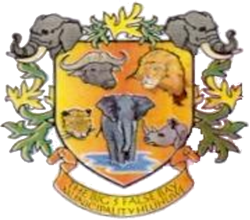
The Big Five False Bay was an administrative area in the Umkhanyakude District of KwaZulu-Natal in South Africa.

Endumeni Local Municipality Local municipality in KwaZulu-Natal, South Africa

Endumeni Local Municipality is an administrative area in the Umzinyathi District of KwaZulu-Natal in South Africa. Endumeni is an isiZulu name meaning "a place of thunderstorm". The municipality shares its name with the Endumeni hill.

Kwa Sani Local Municipality Former local municipality in KwaZulu-Natal, South Africa

Kwa Sani Local Municipality was an administrative area in the Harry Gwala of KwaZulu-Natal in South Africa.

Indaka Local Municipality Local municipality in KwaZulu-Natal, South Africa

Indaka Local Municipality was an administrative area in the Uthukela District of KwaZulu-Natal in South Africa. The municipality is named after the Indaka River that runs through the municipal area.

uMdoni Local Municipality Local municipality in KwaZulu-Natal, South Africa

uMdoni Local Municipality is an administrative area in the Ugu District of KwaZulu-Natal in South Africa. Umdoni is an isiZulu name for the indigenous tree, Mdoni.

eDumbe Local Municipality Local municipality in KwaZulu-Natal, South Africa

eDumbe Local Municipality is an administrative area in the Zululand District of KwaZulu-Natal in South Africa. The municipality is named after the Dumbe mountain.

Hlabisa Local Municipality Local municipality in KwaZulu-Natal, South Africa

Hlabisa was an administrative area in the Umkhanyakude District of KwaZulu-Natal in South Africa. Hlabisa is an isiZulu surname of the two nkosis (kings) in the area. The municipality was situated within the vicinity of four Tribal Authorities which are the Mkhwanazi Tribal Authority, the Mdletshe Tribal Authority, and two Hlabisa Tribal Authorities.

uMuziwabantu Local Municipality Local municipality in KwaZulu-Natal, South Africa

uMuziwabantu Local Municipality is an administrative area in the Ugu District of KwaZulu-Natal in South Africa.

Umzumbe Local Municipality Local municipality in KwaZulu-Natal, South Africa

Umzumbe Local Municipality is an administrative area in the Ugu District of KwaZulu-Natal in South Africa.

Richmond Local Municipality Local municipality in KwaZulu-Natal, South Africa

Richmond Local Municipality is an administrative area in the UMgungundlovu District of KwaZulu-Natal in South Africa.

Ntambanana Local Municipality Local municipality in KwaZulu-Natal, South Africa

Ntambanana Local Municipality was a local municipality within the uThungulu District of KwaZulu-Natal in South Africa. In 2016 the municipality was dissolved and its territory divided between Mthonjaneni Local Municipality, uMhlathuze Local Municipality and uMfolozi Local Municipality.

Ingwe Local Municipality Former local municipality in KwaZulu-Natal, South Africa

Ingwe Local Municipality was an administrative area in the Harry Gwala District of KwaZulu-Natal in South Africa. Ingwe is an isiZulu name word that means leopard. The municipality was given the name because there were leopards in this area many years ago.

Mkhambathini Local Municipality Local municipality in KwaZulu-Natal, South Africa

Mkhambathini Local Municipality is an administrative area in the UMgungundlovu District of KwaZulu-Natal in South Africa. Mkhabathini is the isiZulu name derived from the Zulu word eMkhambathini meaning the place of acacia trees.

Imbabazane Local Municipality Local municipality in KwaZulu-Natal, South Africa

Imbabazane Local Municipality was an administrative area in the Uthukela District of KwaZulu-Natal in South Africa. Imbabazane is the name of an African tree. After municipal elections on 3 August 2016 it was merged into the larger Inkosi Langalibalele Local Municipality.

The 2016 South African municipal elections were held on 3 August 2016, to elect councils for all district, metropolitan and local municipalities in each of the country's nine provinces. It was the fifth municipal election held in South Africa since the end of apartheid in 1994; municipal elections are held every five years.

References

  1. "Contact list: Executive Mayors". Government Communication & Information System. Archived from the original on 14 July 2010. Retrieved 22 February 2012.
  2. 1 2 3 "Statistics by place". Statistics South Africa. Retrieved 27 September 2015.
  3. South African Languages - Place names
  4. Lookup Tables - Statistics South Africa
  5. "Results Summary – All Ballots: Umtshezi" (PDF). Independent Electoral Commission. Retrieved 3 December 2013.
  6. "Seat Calculation Detail: Umtshezi" (PDF). Independent Electoral Commission. Retrieved 3 December 2013.
  7. Hans, Bongani (11 November 2011). "ANC promises to keep coalition despite victory". The Mercury. Retrieved 4 December 2013.

Coordinates: 29°00′17″S29°52′19″E / 29.00472°S 29.87194°E / -29.00472; 29.87194