Verwood, Saskatchewan

Last updated
Verwood
Canada Saskatchewan location map.svg
Red pog.svg
Verwood
Coordinates: 49°31′00″N105°37′00″W / 49.51667°N 105.616667°W / 49.51667; -105.616667
Country Canada
Province Saskatchewan
Region South Central
Rural Municipality Excel No. 71
Post office established1913-05-01
Restructured (Unincorporated community)December 31, 1954
Government
  Governing bodyExcel No. 71]
   MLA Dave Marit
   MP Jeremy Patzer
Time zone CST
Postal code
S0N
Area code(s) 306
Highways Highway 13
Highway 36
Railways Great Western Railway
[1] [2] [3] [4]

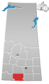
Verwood is an unincorporated community in Excel Rural Municipality No. 71, Saskatchewan, Canada. The community previously held the status of a village until December 31, 1954.

Contents

History

When a name was being decided for the village, it was decided to use the name of the first resident that would die. The first person who died was six year old Vera Ann Wood. Vera died from an accident in which her dress caught on fire as she was putting straw into the stove to make her father a cup of tea. She originally survived the incident, but later died from her injuries. In addition to having the village named after her, her death also led to the creation of the Verwood Cemetery on the north side of Hwy 13.

Prior to December 31, 1954, Verwood was incorporated as a village, and was restructured as an unincorporated community under the jurisdiction of the Rural municipality of Excel on that date. [5]

See also

Related Research Articles

Laura, Saskatchewan Hamlet in Saskatchewan, Canada

Laura is a hamlet in Montrose Rural Municipality 315, Saskatchewan, Canada. It previously held the status of village until December 31, 1954 and again at an unknown date but was restructured back to hamlet status on December 28, 1978. The hamlet is located southwest of Saskatoon along Highway 7 and Canadian National Railway Saskatoon-Rosetown stub. Prior to the Great Depression, Laura was a bustling active pioneer farming community.

Cedoux Unincorporated community in Saskatchewan, Canada

Cedoux is an unincorporated community in the Rural Municipality of Wellington No. 97 in the province of Saskatchewan, Canada. It is held village status prior to July 21, 1913. Cedoux is located on Highway 35, approximately 25 km (16 mi) north of the City of Weyburn and approximately 91 km (57 mi) southeast of Regina.

Girvin, Saskatchewan Hamlet in Saskatchewan, Canada

Girvin is a former village of 20 people in Saskatchewan, Canada. It is located midway between Regina and Saskatoon on Highway 11 between the towns of Davidson and Craik. The village was formally dissolved in 2005; its remaining population is now counted as part of the rural municipality of Arm River.

Bounty, Saskatchewan Unincorporated community in Saskatchewan, Canada

Bounty is an unincorporated community in Fertile Valley No. 285 Saskatchewan, Canada. The population was 5 at the 2001 Census. It previously held the status of village until November 25, 1997. The community is located on Range Road 104 and Township Road 300, about 21 km (13 mi) west of Outlook. At one time Bounty was said to have nobody living in the community.

Xena, Saskatchewan Locality in Saskatchewan, Canada

Xena, Saskatchewan was a village in Saskatchewan. The last building was demolished in the 1970s. It is now an unincorporated area in the rural municipality of Morris No. 312, in the Canadian province of Saskatchewan. Xena is located on Highway 2 in central Saskatchewan.

Vidora Unincorporated community in Saskatchewan, Canada

Vidora is an unincorporated community within the Rural Municipality of Reno No. 51, Saskatchewan, Canada. The community once had a population of 200 people in 1940 and has since declined to 1 resident. It previously held the status of a village until it was dissolved as an unincorporated community on January 1, 1952. The community is located between Robsart and Consul on highway 21 & highway 13 known as the Red Coat Trail. Very little remains of the former village, only one home that is also used as a post office still stands as of 2008. There are many cement foundations and sidewalks still found scattered around the town site, including the remnants of the old bank vault to the former Municipality Office that was moved to Consul.

Senate, Saskatchewan Unincorporated community in Saskatchewan, Canada

Senate is an unincorporated community within the Rural Municipality of Reno No. 51, Saskatchewan, Canada. The village had a population of 63 around 1940 and has since declined to 0 residents. The town-site is located along Hwy 21 & the historic Red Coat Trail, about 20 km east of the Alberta-Saskatchewan border and is about 200 km southwest of the city of Swift Current.

Mantario Special service area in Saskatchewan, Canada

Mantario is a special service area in the Rural Municipality of Chesterfield No. 261 in the Canadian province of Saskatchewan.It held village status prior to June 30, 2007. The population was 5 people in 2011. The community is located 70 km southwest of the Town of Kindersley on Highway 44.

Penzance, Saskatchewan Special service area in Saskatchewan, Canada

Penzance is a special service area in the Rural Municipality of Sarnia No. 221, in the Canadian province of Saskatchewan. It held village status prior to January 31, 2008. The population was 41 people in 2001. The community is located 88 km north of the City of Moose Jaw on Highway 2. Penzance was named after the original Penzance, in Cornwall, England.

Scotsguard Unincorporated community in Saskatchewan, Canada

Scotsguard is an unincorporated community within the Rural Municipality of Bone Creek No. 108, Saskatchewan, Canada. The community is located on Highway 13, also known as the historic Red Coat Trail, about 10 km northeast of the town of Shaunavon.

Instow, Saskatchewan Unincorporated community in Saskatchewan, Canada

Instow is an unincorporated community within the Rural Municipality of Bone Creek No. 108, Saskatchewan, Canada. The community is located on Highway 13 also known as the historic Red Coat Trail, about 10 km northeast of the town of Shaunavon.

Shackleton, Saskatchewan Special service area in Saskatchewan, Canada

Shackleton is a special service area in the Rural Municipality of Miry Creek No. 229, Saskatchewan, Canada. It previously held the status of village until December 31, 2013. The community is located 81 km (50 mi) northwest of the City of Swift Current on Highway 32.

Hatton, Saskatchewan Unincorporated community in Saskatchewan, Canada

Hatton, also known as Forres, is an unincorporated community in Maple Creek Rural Municipality No. 111, Saskatchewan, Canada. The community is located on Highway 635 10 km north of the Trans Canada Highway, and 20 km northwest of Maple Creek. Not much is left of the once prosperous town of 800 citizens, but an old pioneer cemetery and schoolhouse that is now a private residence.

Rural Municipality of Excel No. 71 Rural municipality in Saskatchewan, Canada

The Rural Municipality of Excel No. 71 is a rural municipality (RM) in the Canadian province of Saskatchewan within Census Division No. 3 and SARM Division No. 2. It is located in the south-central portion of the province.

Lemsford, Saskatchewan Unincorporated hamlet in Saskatchewan, Canada

Lemsford is an unincorporated hamlet in Clinworth Rural Municipality No. 230, Saskatchewan, Canada. It previously held the status of village until January 1, 1951. The hamlet is located 42 km east of the Town of Leader at the intersection of Highway 32 and Highway 649, the hamlet is also serviced by the Great Western Railway.

Madison, Saskatchewan Unincorporated community in Saskatchewan, Canada

Madison is an unincorporated community in Newcombe Rural Municipality No. 260, Saskatchewan, Canada. The community had a population of 10 in 2001. It previously held the status of village until February 1, 1998. The hamlet is located 20 km west of the Town of Eston on highway 44 along the Canadian National Railway subdivision.

Portreeve, Saskatchewan Unincorporated community in Saskatchewan, Canada

Portreeve is an unincorporated in the Rural Municipality of Clinworth No. 230, Saskatchewan, Canada. It previously held the status of village until December 31, 1972. The hamlet is located approximately 114 km (71 mi) northwest of the City of Swift Current on Highway 32.

Tyvan, Saskatchewan Unincorporated community in Saskatchewan, Canada

Tyvan is an unincorporated community in the Rural Municipality of Wellington No. 97, Saskatchewan, Canada. It is located on Highway 33, approximately 79 km southeast of the City of Regina. It previously held the status of a village until July 1, 1936.

Willows, Saskatchewan

Willows is an unincorporated community in Lake of the Rivers Rural Municipality No. 72, Saskatchewan, Canada. It previously held the status of a village until January 1, 1950. The name is a contraction of William Gibson Lowes, owner of the first store.

References

  1. National Archives, Archivia Net. "Post Offices and Postmasters". Archived from the original on October 6, 2006. Retrieved 2014-08-21.
  2. Government of Saskatchewan, MRD Home. "Municipal Directory System". Archived from the original on January 15, 2016. Retrieved 2014-08-21.
  3. Canadian Textiles Institute. (2005). "CTI Determine your provincial constituency". Archived from the original on 2007-09-11.
  4. Commissioner of Canada Elections, Chief Electoral Officer of Canada (2005). "Elections Canada On-line". Archived from the original on April 21, 2007.
  5. "Restructured Villages". Saskatchewan Ministry of Municipal Affairs. Archived from the original on March 25, 2008. Retrieved 2008-02-10.