Walkerville, Montana

Last updated
Walkerville, Montana
Lexington Mine Walkerville.JPG
Lexington Mine in Walkerville
Silver Bow County Montana Incorporated and Unincorporated areas Walkerville Highlighted.svg
Location of Walkerville in Silver Bow County, Montana
USA Montana location map.svg
Red pog.svg
Walkerville
Usa edcp location map.svg
Red pog.svg
Walkerville
Coordinates: 46°1′48″N112°32′18″W / 46.03000°N 112.53833°W / 46.03000; -112.53833
Country Flag of the United States.svg  United States
State Flag of Montana.svg  Montana
County Silver Bow
Area
[1]
  Total2.23 sq mi (5.77 km2)
  Land2.23 sq mi (5.77 km2)
  Water0.00 sq mi (0.00 km2)
Elevation
6,309 ft (1,923 m)
Population
 (2020)
  Total639
  Density286.93/sq mi (110.81/km2)
Time zone UTC-7 (Mountain (MST))
  Summer (DST) UTC-6 (MDT)
ZIP code
59701
Area code 406
FIPS code 30-77650
GNIS feature ID0792762

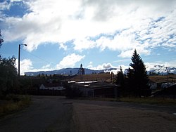
Walkerville is a town in Silver Bow County, Montana, United States, that is an enclave of the consolidated city-county of Butte. The population was 639 at the 2020 census. [2] Walkerville is a suburb of Butte, and the only other incorporated community in the county, as well as the only part of the county that is not part of Butte.

Contents

Part of Walkerville is included in the Butte-Anaconda Historic District. Walkerville represents some of the earliest mines in the district and preserves the early mining camp flavor present in the 1890s to 1910s.

History

Walkerville is a suburb of Butte, Montana and is home to some of the earliest mining sites in the area. These sites attracted many investors to Walkerville in the late 1800s. Walkerville is named for four of those investors: brothers Joseph, Samuel, Matthew and David Walker of Salt Lake City; [3] they had purchased the lucrative Alice mine upon recommendation by their agent (and later Copper King) Marcus Daly. [4] :46

There were many different types of materials mined depending on the location of a given site. Copper and silver were two of the most commonly mined materials. In 1893, silver prices dropped, but the town's economy continued to thrive due to its copper production. [5] The town incorporated in 1890, and by the early 1900s almost 2,500 people lived there, mostly Cornish and Irish immigrants who came to work in the mines. [6] Walkerville's economic success continued until 1918 when the end of World War I caused copper prices to drop.

In 1955, the Anaconda Company decided to begin open-pit mining operations, which transformed Walkerville. Residents opposed open-pit mining on the grounds that it took away jobs. But extracting metals was cheaper with the open pit method, and as copper prices dropped after World War II, the old Alice Mine transformed into the Alice Pit. Blasting in the pit, located in the middle of Walkerville, angered residents who complained of noise, flying rocks, and cracking basements. The Anaconda Company offered to buy property at fair market prices and sold homes back to residents for one dollar on the stipulation that the home be moved. Many residents moved away. When the blasting and digging rendered Sibyl, Rose, and Pearl streets impassable, they were condemned and fenced off. Mayor Jimmy Shea responded by demanding that the Company formally petition the city council to discontinue and vacate the streets. With this leverage, the city council demanded the Company pay to repair city utilities, build a new road, repair damaged streets, build safety fences, keep the pit one hundred feet from homes, and build a new ballpark. Eventually, the Company acquiesced to most of these demands. Even so, Walkerville's fight with the Company became more bitter as the pit continued to expand. In 1961, the City of Walkerville sued Anaconda for damaging city property. The Alice Pit never reopened. [6]

By 2015, nearly all of the town's many mines are abandoned. Some of these sites have become very dangerous and plans are being made to restore or remove them. [7]

Geography

Berkeley Pit is 2 miles (3.2 km) to the south. The town is on the U.S. Continental Divide.

According to the United States Census Bureau, the town has a total area of 2.23 square miles (5.78 km2), all land. [8]

Neighborhoods

Butchertown was named for Rollo Butcher, Walkerville's first permanent resident. [3]

Demographics

Historical population
CensusPop.Note
1880 444
1890 1,743292.6%
1900 2,62150.4%
1910 2,491−5.0%
1920 2,391−4.0%
1930 2,052−14.2%
1940 1,880−8.4%
1950 1,631−13.2%
1960 1,453−10.9%
1970 1,097−24.5%
1980 887−19.1%
1990 605−31.8%
2000 71418.0%
2010 675−5.5%
2020 639−5.3%
U.S. Decennial Census [11] [2]

2010 census

As of the census [12] of 2010, there were 675 people, 304 households, and 175 families residing in the town. The population density was 302.7 inhabitants per square mile (116.9/km2). There were 344 housing units at an average density of 154.3 per square mile (59.6/km2). The racial makeup of the town was 93.2% White, 0.1% African American, 3.3% Native American, 0.6% Asian, 0.3% Pacific Islander, 0.3% from other races, and 2.2% from two or more races. Hispanic or Latino of any race were 3.9% of the population.

There were 304 households, of which 27.6% had children under the age of 18 living with them, 41.4% were married couples living together, 10.2% had a female householder with no husband present, 5.9% had a male householder with no wife present, and 42.4% were non-families. 35.2% of all households were made up of individuals, and 13.2% had someone living alone who was 65 years of age or older. The average household size was 2.22 and the average family size was 2.90.

The median age in the town was 44.2 years. 22.4% of residents were under the age of 18; 8.6% were between the ages of 18 and 24; 20.3% were from 25 to 44; 33.8% were from 45 to 64; and 15% were 65 years of age or older. The gender makeup of the town was 48.6% male and 51.4% female.

2000 census

As of the census of 2000, there were 714 people, 297 households, and 195 families residing in the town. The population density was 325.1 inhabitants per square mile (125.5/km2). There were 343 housing units at an average density of 156.2 per square mile (60.3/km2). The racial makeup of the town was 94.26% White, 0.14% African American, 4.06% Native American, 0.28% Asian, 0.70% from other races, and 0.56% from two or more races. Hispanic or Latino of any race were 3.22% of the population.

There were 297 households, out of which 31.3% had children under the age of 18 living with them, 49.5% were married couples living together, 11.1% had a female householder with no husband present, and 34.3% were non-families. 30.6% of all households were made up of individuals, and 11.4% had someone living alone who was 65 years of age or older. The average household size was 2.40 and the average family size was 3.00.

In the town, the population was spread out, with 25.5% under the age of 18, 8.7% from 18 to 24, 27.3% from 25 to 44, 25.5% from 45 to 64, and 13.0% who were 65 years of age or older. The median age was 37 years. For every 100 females there were 97.8 males. For every 100 females age 18 and over, there were 102.3 males.

The median income for a household in the town was $28,009, and the median income for a family was $29,861. Males had a median income of $27,404 versus $19,063 for females. The per capita income for the town was $14,156. About 9.9% of families and 12.1% of the population were below the poverty line, including 18.8% of those under age 18 and 5.0% of those age 65 or over.

Media

The FM radio station KMTZ is licensed in Walkerville. [13] It plays adult hits.

See also

Related Research Articles

<span class="mw-page-title-main">Greenlee County, Arizona</span> County in Arizona, United States

Greenlee County is a county in the southeastern part of the U.S. state of Arizona. As of the 2020 census, the population was 9,563, making it Arizona's least populous county. The county seat is Clifton.

<span class="mw-page-title-main">Silver Bow County, Montana</span> County in Montana, United States

Silver Bow County is a county in the U.S. state of Montana. As of the 2020 census, the population was 35,133. Its county seat is Butte. In 1977, the city and county governments consolidated to form the single entity of Butte-Silver Bow. Additionally, the town of Walkerville is a separate municipality from Butte and is within the county.

<span class="mw-page-title-main">Deer Lodge County, Montana</span> County in Montana, United States

Deer Lodge County is a county in the U.S. state of Montana. As of the 2020 census, the population was 9,421. It forms a consolidated city-county government with its county seat of Anaconda. The county was established in 1865.

<span class="mw-page-title-main">Hayden, Arizona</span> Town in Gila and Pinal Counties, Arizona

Hayden is a town in Gila and Pinal counties in Arizona, United States. According to the 2010 census, the population of the town was 662.

<span class="mw-page-title-main">Miami, Arizona</span> Town in Gila County, Arizona

Miami is a town in Gila County, Arizona, United States. Miami is a classic Western copper boom-town. Miami's old downtown has been partly renovated, and the Bullion Plaza Museum features the cultural, mining and ranching history of the Miami area.

<span class="mw-page-title-main">Morenci, Arizona</span> CDP in Greenlee County, Arizona

Morenci is a census-designated place (CDP) and company town in Greenlee County, Arizona, United States, and was founded by the Detroit Copper Mining Company of Arizona. The population was 2,000 at the 2000 census and 1,489 at the 2010 census. The biggest employer in Morenci and the owner of the town is Freeport-McMoRan, the owner of the Morenci Mine, the largest copper mining operation in North America, and one of the largest copper mines in the world. The town was a site of the Arizona Copper Mine Strike of 1983. The large open-pit mine is north of the town.

<span class="mw-page-title-main">Ajo, Arizona</span> Community in Pima County, Arizona

Ajo is an unincorporated community in Pima County, Arizona, United States. It is the closest community to Organ Pipe Cactus National Monument. The population was 3,304 at the 2010 census. Ajo is located on State Route 85 just 43 miles (69 km) from the Mexican border.

<span class="mw-page-title-main">Kearny, Arizona</span> Town in Pinal County, Arizona

Kearny is a town in Pinal County, Arizona, United States. The town was named after General Stephen Watts Kearny, who passed through the area on November 7, 1846, while leading 100 dragoons to California. According to the 2010 census, the population of the town is 1,950. The economic base of Kearny and nearby towns is the Ray mine and Hayden Smelter, both owned and operated by ASARCO.

<span class="mw-page-title-main">Dillon, Montana</span> City in Beaverhead County, Montana, United States

Dillon is a city in and the county seat of Beaverhead County, Montana, United States. The population was 3,880 at the 2020 census. The city was named for Sidney Dillon (1812–1892), president of Union Pacific Railroad.

<span class="mw-page-title-main">Bearcreek, Montana</span> Incorporated town in Montana, United States

Bearcreek is an incorporated town in Carbon County, Montana, United States. It is part of the Billings, Montana Metropolitan Statistical Area. The population was 91 at the 2020 census. Bearcreek uses the Mayor/Council form of government.

<span class="mw-page-title-main">Neihart, Montana</span> Town in Montana, United States

Neihart is a town in Cascade County, Montana, United States. It is located in the center of Little Belt Mountains. The population was 43 at the 2020 census. It is part of the Great Falls, Montana, Metropolitan Statistical Area.

<span class="mw-page-title-main">Boulder, Montana</span> Town in Montana, United States

Boulder is a town in and the county seat of Jefferson County, Montana, United States. It is on the north bank of the Boulder River between Butte and Helena, slightly east of the Continental Divide, at the intersection of Interstate 15 and Montana Highway 69. The population was 1,201 at the 2020 census. It is part of the Helena Micropolitan Statistical Area, which includes all of Lewis and Clark and Jefferson counties; its population is 83,058 according to the 2020 Census.

<span class="mw-page-title-main">Whitehall, Montana</span> Town in Montana, United States

Whitehall is a town in Jefferson County, Montana, United States. The population was 1,006 at the 2020 census. It is part of the Helena Micropolitan Statistical Area.

<span class="mw-page-title-main">Deer Lodge, Montana</span> City in Powell County, Montana, United States

Deer Lodge is a city in and the county seat of Powell County, Montana, United States. The population was 2,938 at the 2020 census.

<span class="mw-page-title-main">Colstrip, Montana</span> City in Montana, United States

Colstrip is a city in Rosebud County, Montana, United States. The population was 2,096 at the 2020 census.

<span class="mw-page-title-main">Warrior Run, Pennsylvania</span> Borough in Pennsylvania, United States

Warrior Run is a borough in Luzerne County, Pennsylvania, United States. The population was 528 at the time of the 2020 census.

<span class="mw-page-title-main">Delbarton, West Virginia</span> Town in West Virginia, United States

Delbarton is a town in Mingo County, West Virginia, United States. The population was 522 at the 2020 census.

<span class="mw-page-title-main">Encampment, Wyoming</span> Town in Wyoming, United States

Encampment is a town in southern Carbon County, Wyoming, United States. The population was 450 at the 2010 census.

<span class="mw-page-title-main">Marcus Daly</span> American businessman (1841–1900)

Marcus Daly was an Irish-born American businessman known as one of the four "Copper Kings" of Butte, Montana, United States.

<span class="mw-page-title-main">Butte, Montana</span> County seat of Silver Bow County, Montana

Butte is a consolidated city-county and the county seat of Silver Bow County, Montana, United States. In 1977, the city and county governments consolidated to form the sole entity of Butte-Silver Bow. The city covers 718 square miles (1,860 km2), and, according to the 2020 census, has a population of 34,494, making it Montana's fifth-largest city. It is served by Bert Mooney Airport with airport code BTM.

References

  1. "ArcGIS REST Services Directory". United States Census Bureau. Retrieved September 5, 2022.
  2. 1 2 "U.S. Census website". United States Census Bureau . Retrieved November 2, 2021.
  3. 1 2 The Montana National Register Sign Program. "Walkerville, Butte". Historic Montana. Montana Historical Society . Retrieved 25 April 2020.
  4. Glasscock, C.B. (2002). The War of the Copper Kings. Riverbend Publishing. ISBN   1-931832-21-8.
  5. "Walkerville, Montana | Southwest Montana Tourism Information".
  6. 1 2 Leech, Brian (Summer 2012). "Protest, Power, and the Pit: Fighting Open-Pit Mining in Butte, Montana". Montana The Magazine of Western History. 62 (2): 26-38. Retrieved 2 January 2024.
  7. "Archived copy" (PDF). Archived from the original (PDF) on 2015-03-05. Retrieved 2015-06-09.{{cite web}}: CS1 maint: archived copy as title (link)
  8. "US Gazetteer files 2010". United States Census Bureau . Retrieved 2012-12-18.
  9. 1 2 3 4 5 6 7 "Butte in 75, No. 47: Walkerville City Hall". The Montana Standard . Lee Enterprises . Retrieved 25 April 2020.
  10. Google (25 April 2020). "Butchertown, Walkerville" (Map). Google Maps . Google. Retrieved 25 April 2020.
  11. United States Census Bureau. "Census of Population and Housing" . Retrieved May 31, 2014.
  12. "U.S. Census website". United States Census Bureau . Retrieved 2012-12-18.
  13. "KMTZ". FCC. Retrieved 24 December 2023.