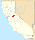
Wallace, California

Last updated
Wallace
Calaveras County California Incorporated and Unincorporated areas Wallace Highlighted.svg
Location in Calaveras County and the state of California
Usa edcp location map.svg
Red pog.svg
Wallace
Location in the United States
Coordinates: 38°11′39″N120°58′41″W / 38.19417°N 120.97806°W / 38.19417; -120.97806 Coordinates: 38°11′39″N120°58′41″W / 38.19417°N 120.97806°W / 38.19417; -120.97806
Country Flag of the United States.svg  United States
State Flag of California.svg  California
County Calaveras
Area
[1]
  Total4.413 sq mi (11.429 km2)
  Land4.333 sq mi (11.223 km2)
  Water0.080 sq mi (0.206 km2)  1.8%
Elevation
194 ft (59 m)
Population
 (2010)
  Total403
  Density91/sq mi (35/km2)
Time zone UTC-8 (Pacific (PST))
  Summer (DST) UTC-7 (PDT)
ZIP code
95254
Area code(s) 209
FIPS code 06-83304
GNIS feature IDs 1660118, 2409523

Wallace is a census-designated place (CDP) at the far west edge of Calaveras County, California, United States on State Route 12. The population was 403 at the 2010 census, up from 220 at the 2000 census.

Contents

Name

On the 1883 map of the town site is the name of the surveyor, John Herbert Wallace. It has been widely assumed that he is the one the town is named after. However, according to historian Sal Manna in the July 2006 issue of Las Calaveras, the quarterly magazine of the Calaveras County Historical Society, the town is named for John Herbert Wallace's father, John Wallace, who was a well-known engineer and surveyor in the area. He had been elected San Joaquin County surveyor. John Wallace was also an elder brother of Alfred Russel Wallace, a leading 19th century British naturalist who independently developed a theory of natural selection around the same time as Charles Darwin. John Wallace had originally come to California for the California Gold Rush, but was unsuccessful as a miner.

Geography

According to the United States Census Bureau, the CDP has a total area of 4.4 square miles (11 km2), of which, 98.2% is land and 1.8% is water.

History

The town's post office was established in 1883, closed in 1945, and re-established in 1951. [2]

Demographics

2010

The 2010 United States Census [3] reported that Wallace had a population of 403. The population density was 91.3 inhabitants per square mile (35.3/km2). The racial makeup of Wallace was 347 (86.1%) White, 3 (0.7%) African American, 4 (1.0%) Native American, 10 (2.5%) Asian, 2 (0.5%) Pacific Islander, 22 (5.5%) from other races, and 15 (3.7%) from two or more races. Hispanic or Latino of any race were 32 persons (7.9%).

The Census reported that 403 people (100% of the population) lived in households, 0 (0%) lived in non-institutionalized group quarters, and 0 (0%) were institutionalized.

There were 154 households, out of which 39 (25.3%) had children under the age of 18 living in them, 106 (68.8%) were opposite-sex married couples living together, 9 (5.8%) had a female householder with no husband present, 3 (1.9%) had a male householder with no wife present. There were 10 (6.5%) unmarried opposite-sex partnerships, and 1 (0.6%) same-sex married couples or partnerships. 24 households (15.6%) were made up of individuals, and 12 (7.8%) had someone living alone who was 65 years of age or older. The average household size was 2.62. There were 118 families (76.6% of all households); the average family size was 2.92.

The population was spread out, with 81 people (20.1%) under the age of 18, 27 people (6.7%) aged 18 to 24, 80 people (19.9%) aged 25 to 44, 134 people (33.3%) aged 45 to 64, and 81 people (20.1%) who were 65 years of age or older. The median age was 47.8 years. For every 100 females, there were 89.2 males. For every 100 females age 18 and over, there were 97.5 males.

There were 176 housing units at an average density of 39.9 per square mile (15.4/km2), of which 154 were occupied, of which 131 (85.1%) were owner-occupied, and 23 (14.9%) were occupied by renters. The homeowner vacancy rate was 4.3%; the rental vacancy rate was 8.0%. 328 people (81.4% of the population) lived in owner-occupied housing units and 75 people (18.6%) lived in rental housing units.

2000

As of the census [4] of 2000, there were 220 people, 87 households, and 68 families residing in the CDP. The population density was 51.9 inhabitants per square mile (20.0/km2). There were 96 housing units at an average density of 22.6 per square mile (8.7/km2). The racial makeup of the CDP was 90.00% White, 1.36% Black or African American, 0.45% Native American, 2.27% Asian, 0.91% from other races, and 5.00% from two or more races. 4.09% of the population were Hispanic or Latino of any race.

There were 87 households, out of which 27.6% had children under the age of 18 living with them, 64.4% were married couples living together, 6.9% had a female householder with no husband present, and 21.8% were non-families. 11.5% of all households were made up of individuals, and 4.6% had someone living alone who was 65 years of age or older. The average household size was 2.53 and the average family size was 2.74.

In the CDP, the population was spread out, with 22.3% under the age of 18, 4.1% from 18 to 24, 22.3% from 25 to 44, 36.8% from 45 to 64, and 14.5% who were 65 years of age or older. The median age was 46 years. For every 100 females, there were 111.5 males. For every 100 females age 18 and over, there were 94.3 males.

The median income for a household in the CDP was $66,607, and the median income for a family was $70,568. Males had a median income of $51,058 versus $22,308 for females. The per capita income for the CDP was $26,895. None of the population or families were below the poverty line.

Politics

In the state legislature, Wallace is in the 8th Senate District , represented by Republican Andreas Borgeas, [5] and the 5th Assembly District , represented by Republican Frank Bigelow. [6] Federally, Wallace is in California's 4th congressional district , represented by Republican Tom McClintock. [7]

Related Research Articles

Fairview, California CDP in California, United States

Fairview is a census-designated place (CDP) in Alameda County, California, United States. It borders on the city of Hayward and the census-designated place of Castro Valley. The population was 11,341 at the 2020 census.

<span class="mw-page-title-main">Sunol, California</span> Census-designated place in California, United States

Sunol is an unincorporated area and census-designated place in Alameda County, California. Located in the Sunol Valley of the East Bay, the population was 913 at the 2010 census. It is best known as the location of the Sunol Water Temple and for its historic tourist railroad system, the Niles Canyon Railway.

Bear Valley, Alpine County, California Census-designated place in California, United States

Bear Valley is a census-designated place in Alpine County, California, best known as the location of the Bear Valley ski area. The population was 121 at the 2010 census, down from 133 at the 2000 census.

Avery, California Census-designated place in California, United States

Avery is a census-designated place (CDP) in Calaveras County, California, United States. The population was 646 at the 2010 census, down from 672 at the 2000 census. Avery is located on State Route 4 and is home to the oldest continually operating hotel in the county, the Avery Hotel Restaurant & Saloon. Built in 1853, it was known as the "Half Way House," being located between Murphys, Arnold, and Calaveras Big Trees State Park.

Dorrington, California Census-designated place in California, United States

Dorrington is a census-designated place (CDP) in Calaveras County, California, United States. The population was 609 at the 2010 census, down from 727 at the 2000 census. Originally known as Cold Spring Ranch until 1902, the town sits on State Route 4 and historically was a stopping point along the toll road between Murphys and Ebbetts Pass, often serving as a resort for visitors to what is now Calaveras Big Trees State Park. Dorrington is also home to the second largest Sugar Pine in the world, measuring 32 feet in circumference and 220 feet tall. Dorrington is named for Dora Connell (Meyers), wife of John (Jack) Connell of Camp Connell.

Forest Meadows, California Census-designated place in California, United States

Forest Meadows is a census-designated place (CDP) in Calaveras County, California, United States. The population was 1,249 at the 2010 census, up from 1,197 at the 2000 census.

Rail Road Flat, California Census-designated place in California, United States

Rail Road Flat is a census-designated place (CDP) in Calaveras County, California, United States. The population was 475 at the 2010 census, down from 549 at the 2000 census.

<span class="mw-page-title-main">Vallecito, California</span> Census-designated place in California, United States

Vallecito is a census-designated place (CDP) in Calaveras County, California, United States. The population was 442 at the 2010 census, up from 427 at the 2000 census. The town is registered as California Historical Landmark #273. Nearby is Moaning Cavern, the largest cave chamber in California, which the Miwok Indians used as a burial ground.

<span class="mw-page-title-main">West Point, California</span> Census-designated place in California, United States

West Point is a census-designated place (CDP) in Calaveras County, California, in the United States. As of the 2010 United States Census, West Point's population was 674, down from 746 as of the 2000 census. The town is registered as California Historical Landmark #268. There is an annual West Point Lumberjack Days festival in the community.

Mountain View, Contra Costa County, California Census designated place in California, United States

Mountain View is a census designated place (CDP) in Contra Costa County, California, United States. The population was 2,372 at the 2010 census.

<span class="mw-page-title-main">Riverdale, California</span> Census-designated place in California, United States

Riverdale is a census-designated place (CDP) in Fresno County, California, United States. The population was 3,153 at the 2010 census, up from 2,416 at the 2000 census. Riverdale is located 23 miles (37 km) south of Fresno, at an elevation of 223 ft (68 m).

<span class="mw-page-title-main">West Bishop, California</span> Census-designated place in California, United States

West Bishop is a census-designated place (CDP) in Inyo County, California, United States. The population was 2,607 at the 2010 census, down from 2,807 at the 2000 census.

East San Gabriel, California Census-designated place in California, United States

East San Gabriel is a census-designated place (CDP) in Los Angeles County, California, United States. The population was 14,874 at the 2010 census, up from 14,512 at the 2000 census.

North El Monte, California Census-designated place in California, United States

North El Monte is a census-designated place (CDP) in the San Gabriel Valley, in Los Angeles County, California, United States. The population was 3,723 at the 2010 census, up from 3,703 at the 2000 census.

<span class="mw-page-title-main">West Rancho Dominguez, California</span> Unincorporated community in California, United States

West Rancho Dominguez, formerly known as West Compton, is an unincorporated census-designated place (CDP) located in southern Los Angeles County, California. Per the 2020 census, the population was 24,347. The community lies to the west of the city of Compton. The ZIP Codes encompassing the CDP area are 90220 & 90248.

<span class="mw-page-title-main">Tamalpais-Homestead Valley, California</span> Census-designated place in California, United States

Tamalpais-Homestead Valley is a census-designated place (CDP) in Marin County, California, United States. The population was 11,492 at the 2020 census.

<span class="mw-page-title-main">Keddie, California</span> Census-designated place in California, United States

Keddie is a census-designated place in Plumas County, California, United States. The population was 66 at the 2010 census.

Lakeview, California Census-designated place in California, United States

Lakeview is a census-designated place (CDP) in Riverside County, California, United States. The population was 2,104 at the 2010 census, up from 1,619 at the 2000 census. The community is named for nearby Mystic Lake.

<span class="mw-page-title-main">Traver, California</span> Census-designated place in California, United States

Traver is a census-designated place (CDP) in Tulare County, California, United States. The population was 713 at the 2010 census, down from 732 at the 2000 census.

<span class="mw-page-title-main">Rancho Calaveras, California</span> Census-designated place in California, United States

Rancho Calaveras is a census-designated place (CDP) in Calaveras County, California, United States. The population was 5,325 at the 2010 census, up from 4,182 at the 2000 census.

References

  1. "2010 Census U.S. Gazetteer Files – Places – California". United States Census Bureau.
  2. Durham, David L. (1998). California's Geographic Names: A Gazetteer of Historic and Modern Names of the State. Clovis, Calif.: Word Dancer Press. p. 843. ISBN   1-884995-14-4.
  3. "2010 Census Interactive Population Search: CA - Wallace CDP". U.S. Census Bureau. Archived from the original on July 15, 2014. Retrieved July 12, 2014.
  4. "U.S. Census website". United States Census Bureau . Retrieved 2008-01-31.
  5. "Senators". State of California. Retrieved March 21, 2013.
  6. "Members Assembly". State of California. Retrieved March 21, 2013.
  7. "California's 4th Congressional District - Representatives & District Map". Civic Impulse, LLC. Retrieved March 2, 2013.