Water Eaton, Oxfordshire

Last updated

Water Eaton
WaterEaton ManorHouse closeup.jpg
Water Eaton Manor House
Oxfordshire UK location map.svg
Red pog.svg
Water Eaton
Location within Oxfordshire
OS grid reference SP5112
Civil parish
District
Shire county
Region
Country England
Sovereign state United Kingdom
Post town Oxford
Postcode district OX2 8HE
Dialling code 01865
Police Thames Valley
Fire Oxfordshire
Ambulance South Central
UK Parliament
List of places
UK
England
Oxfordshire
51°48′14″N1°15′43″W / 51.804°N 1.262°W / 51.804; -1.262 (Water Eaton)

Water Eaton is a hamlet in the civil parish of Gosford and Water Eaton, in the Cherwell district, in the county of Oxfordshire, England. It is between Oxford and Kidlington.

Contents

Water-Eaton was formerly in the parish of Kidlington, [2] in 1866 Water Eaton became a separate civil parish, on 1 April 1932 the parish was abolished and merged with Gosford to form "Gosford and Water Eaton". [3] In 1931 the parish had a population of 127. [4]

Manor

Eaton is a common English place-name. In this case it appears as Eatun in Anglo-Saxon charters from 864, 904 and 929, Etone in the Domesday Book of 1086 and Water Eton in a Charter Roll from 1268. Eaton is derived from Old English and in this case means tūn ("farm") by a river. [5] The prefix "Water" seems tautological, but it distinguishes Water Eaton from Woodeaton just over 1 mile (1.6 km) to the east. Water Eaton manor house was built for Sir Edward Frere in 1586 but reduced in size at a later date. The Gothic Revival architect GF Bodley restored the house in 1890 and made it his home. [6] It is now a Grade II* listed building. [7]

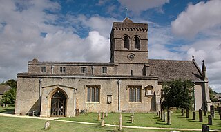
A Perpendicular Gothic Church of England chapel was built northeast of the manor house in 1610 and restored in 1884. [8] The chapel is a Grade I listed building. [9] East of the manor house are two detached 17th-century "pavilions" [10] [11] or guest houses and a square 17th-century dovecote. [12] At the end of the First English Civil War in June 1646 the Articles of Surrender for the siege of Oxford were finally agreed in Water Eaton. They were signed on 20 June in the Audit House of Christ Church, Oxford.

St Frideswide's Farm

St Frideswide's Farmhouse is a 16th-century Tudor stone house, and towards the end of that century was a home of the Lenthall family. [13] The house was extended in the 17th or 18th and 20th centuries. [13] It is now a Grade II* listed building. [14]

Transport

Water Eaton park and ride site in 2008 Park and ride bus station - geograph.org.uk - 792636.jpg
Water Eaton park and ride site in 2008

In 1850 the Buckinghamshire Railway between Bletchley and Oxford was opened through the parish. In 1905 Oxford Road Halt was opened 1 mile (1.6 km) west of the manor house. The halt was short-lived, being closed down in 1926. In 1940 a grain silo and rail siding were built on the south side of the former halt. The silo has been disused since the 1980s but remained a landmark visible over a wide area. [15] [16] The silo was demolished in October 2013. [17] In the 2000s Oxfordshire County Council opened a Park and ride site just south of the grain silo. In October 2015 Chiltern Railways opened Oxford Parkway station next to the park and ride and near the site of the former halt. [18]

Related Research Articles

<span class="mw-page-title-main">Garsington</span> Human settlement in England

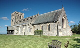
Garsington is a village and civil parish about 8 kilometres (5 mi) southeast of Oxford in Oxfordshire. "A History of the County of Oxfordshire" provides a detailed history of the parish from 1082. The 2011 census recorded the parish's population as 1,689. The village is known for the artistic colony and flamboyant social life of the Bloomsbury Group at Garsington Manor when it was the home from 1914 to 1928 of Philip and Ottoline Morrell, and for the Garsington Opera which was staged there from 1989 to 2010.
<span class="mw-page-title-main">Kidlington</span> Suburb of Oxfordshire, England

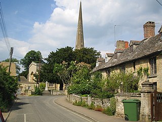
Kidlington is a suburb and civil parish in the Cherwell district of Oxfordshire, England. It is in-between the River Cherwell and Oxford Canal, 5 miles (8 km) north of Oxford and 8 miles (13 km) south-west of Bicester. It remains officially a village despite its size.

<span class="mw-page-title-main">Adderbury</span> Human settlement in England

Adderbury is a winding linear village and rural civil parish about 3 miles (5 km) south of Banbury in northern Oxfordshire, England. The settlement has five sections: the new Milton Road housing Development and West Adderbury, towards the southwest; East Adderbury to the centre, with a village green and a manor house; the new housing Development on the Aynho Road; the northeast, which is known as Twyford, named after a small outlying settlement by a forked section of the River Cherwell.

<span class="mw-page-title-main">Bampton, Oxfordshire</span> Human settlement in England

Bampton, also called Bampton-in-the-Bush, is a settlement and civil parish in the Thames Valley about 4+12 miles (7 km) southwest of Witney in Oxfordshire. The parish includes the hamlet of Weald. The 2011 Census recorded the parish's population as 2,564. Bampton is variously referred to as both a town and a village. The Domesday Book recorded that it was a market town by 1086. It continued as such until the 1890s. It has both a town hall and a village hall.
<span class="mw-page-title-main">Bletchingdon</span> Human settlement in England

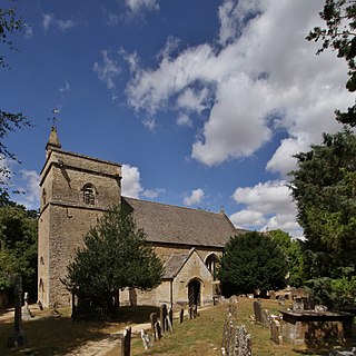
Bletchingdon is a village and civil parish 2 miles (3 km) north of Kidlington and 6 miles (10 km) southwest of Bicester in Oxfordshire, England. Bletchingdon parish includes the hamlet of Enslow just over 1 mile (1.6 km) west of the village. The 2011 Census recorded the parish's population as 910.

<span class="mw-page-title-main">Bucknell, Oxfordshire</span> Village in Oxfordshire, England

Bucknell is a village and civil parish 2+12 miles (4 km) northwest of Bicester in Oxfordshire, England. The 2011 Census recorded the parish's population as 260.

<span class="mw-page-title-main">Binsey, Oxfordshire</span> Village in Oxfordshire, England

Binsey is a small village on the west side of Oxford, in Oxfordshire, England. It lies on the banks of the River Thames about 1.5 miles (2.4 km) northwest of the centre of Oxford, on the opposite side of the river from Port Meadow and about 1 mile (1.6 km) southwest of the ruins of Godstow Abbey.

<span class="mw-page-title-main">Hampton Poyle</span> Human settlement in England

Hampton Poyle is a village in the civil parish of Hampton Gay and Poyle, in the Cherwell district, in the county of Oxfordshire, England. It is the Cherwell in valley, about 1 mile (1.6 km) northeast of Kidlington and about 5 miles (8 km) north of the centre of Oxford.

<span class="mw-page-title-main">Yarnton</span> Human settlement in England

Yarnton is a village and civil parish in Oxfordshire about 1 mile (1.6 km) southwest of Kidlington and 4 miles (6 km) northwest of Oxford. The 2011 Census recorded the parish's population as 2,545.
<span class="mw-page-title-main">Wardington</span> Human settlement in England

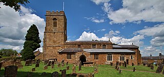
Wardington is a village and civil parish in Oxfordshire, about 4 miles (6.4 km) northeast of Banbury. The village consists of two parts: Wardington and Upper Wardington. The village is on a stream that rises in Upper Wardington and flows north to join the River Cherwell.
<span class="mw-page-title-main">Kirtlington</span> Human settlement in England

Kirtlington is a village and civil parish in Oxfordshire about 6+12 miles (10.5 km) west of Bicester. The parish includes the hamlet of Northbrook. The 2011 Census recorded the parish's population as 988.

<span class="mw-page-title-main">Woodeaton</span> Human settlement in England

Woodeaton or Wood Eaton is a village and civil parish about 4 miles (6.4 km) northeast of Oxford, England. It also has a special needs school called Woodeaton Manor School.

<span class="mw-page-title-main">Gosford, Oxfordshire</span> Human settlement in England

Gosford is a village immediately southeast of Kidlington, in the Cherwell district, Oxfordshire, England. It is in the civil parish of Gosford and Water Eaton. The 2011 Census recorded Gosford and Water Eaton's parish population as 1,373.

<span class="mw-page-title-main">Cornwell, Oxfordshire</span> Human settlement in England

Cornwell is a small village and civil parish about 2.5 miles (4 km) west of Chipping Norton in the West Oxfordshire district of Oxfordshire, near the county border with Gloucestershire. The 2001 Census recorded the parish's population as 66.

<span class="mw-page-title-main">Swyncombe</span> Human settlement in England

Swyncombe is a hamlet and large civil parish in the high Chilterns, within the Area of Outstanding Natural Beauty about 4+12 miles (7 km) east of Wallingford, Oxfordshire, England. Swyncombe hamlet consists almost entirely of its Church of England parish church of Saint Botolph, the former rectory and Swyncombe House. The population of the parish is in the hamlets of Cookley Green and Russell's Water, and the scattered hamlet of Park Corner. The 2011 Census recorded the parish's population as 250. It is partially forested and is the fifth largest of 87 civil parishes in the District.

<span class="mw-page-title-main">Chesterton, Oxfordshire</span> Human settlement in England

Chesterton is a village and civil parish on Gagle Brook, a tributary of the Langford Brook in north Oxfordshire. The village is about 1+12 miles (2.4 km) southwest of the market town of Bicester. The village has sometimes been called Great Chesterton to distinguish it from the hamlet of Little Chesterton, about 34 mile (1.2 km) to the south in the same parish. The 2011 Census recorded the parish population as 850.

<span class="mw-page-title-main">Toot Baldon</span> Human settlement in England

Toot Baldon is a village and civil parish about 5 miles (8 km) southeast of Oxford in Oxfordshire. Since 2012 it has been part of the Baldons joint parish council area, sharing a parish council with the adjacent civil parish of Marsh Baldon. The 2011 Census recorded its population as 148.

<span class="mw-page-title-main">Sibford Ferris</span> Human settlement in England

Sibford Ferris is a village and civil parish about 6.5 miles (10.5 km) west of Banbury in Oxfordshire. It is on the south side of the Sib valley opposite its larger sister village, Sibford Gower. The 2011 Census recorded the parish's population as 476.

<span class="mw-page-title-main">Westwell, Oxfordshire</span> Human settlement in England

Westwell is a small village and civil parish about 2 miles (3 km) southwest of the market town of Burford in Oxfordshire. It is the westernmost village in the county, close to the border with Gloucestershire.

<span class="mw-page-title-main">Hampton Gay</span> Human settlement in England

Hampton Gay is a village in the civil parish of Hampton Gay and Poyle, in the Cherwell district, in the county of Oxfordshire, England. It is in the Cherwell Valley about 1.5 miles (2.4 km) north of Kidlington. In 1931 the parish had a population of 28. On 1 April 1932 the parish was abolished to form "Hampton Gay and Poyle".

References

  1. "Home". gosfordandwatereaton-pc.gov.uk.
  2. "History of Water Eaton, in Cherwell and Oxfordshire". A Vision of Britain through Time . Retrieved 30 November 2023.
  3. "Relationships and changes Water Eaton CP/Hmlt through time". A Vision of Britain through Time. Retrieved 30 November 2023.
  4. "Population statistics Water Eaton CP/Hmlt through time". A Vision of Britain through Time. Retrieved 30 November 2023.
  5. Ekwall 1960, Eaton.
  6. Sherwood & Pevsner 1974, pp. 825–826.
  7. Historic England. "Manor House (Grade II*) (1046562)". National Heritage List for England . Retrieved 26 June 2019.
  8. Sherwood & Pevsner 1974, p. 826.
  9. Historic England. "Chapel at Water Eaton Manor House (Grade I) (1046563)". National Heritage List for England . Retrieved 26 June 2019.
  10. Historic England. "North pavilion and attached walls approximately 40 metres north east of the manorhouse (Grade II) (1046565)". National Heritage List for England . Retrieved 26 June 2019.
  11. Historic England. "South pavilion and attached walls approximately 40 metres east of the manorhouse (Grade II) (1369721)". National Heritage List for England . Retrieved 26 June 2019.
  12. Historic England. "Dovecote approximately 80 metres east of the manorhouse (Grade II) (1046566)". National Heritage List for England . Retrieved 26 June 2019.
  13. 1 2 Crossley & Elrington 1990, pp. 179–213.
  14. Historic England. "St Frideswides Farmhouse (Grade II*) (1286525)". National Heritage List for England . Retrieved 18 December 2011.
  15. Derelict Places: Water Eaton Grain Silo - August 2008
  16. Geograph SP5011: Disused grain silo at Water Eaton
  17. "Water Eaton silo demolished for Oxford Parkway Station". BBC. 30 October 2013. Retrieved 31 October 2013.
  18. Keown, Callum (25 October 2015). "Keen passengers board the first trains to leave Oxford Parkway". Oxford Mail . Newsquest . Retrieved 26 June 2019.

Bibliography