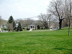
Branford Center is a neighborhood and census-designated place (CDP) in the town of Branford, Connecticut, United States. The CDP encompasses the traditional town center area and the area known as Branford Point. The population of the CDP was 5,819 at the 2010 census.

The Colchester Village Historic District encompasses most of the historic village center of Colchester, Connecticut. It is located at the junction of Route 16, Route 85, and Norwich Avenue. Roughly, the district extends to the northwest along Broadway Street as far as Jaffe Terrace; east along Norwich Avenue to just short of Pleasant Street; south along South Main Street to just north of Hall Hill Road; west along Linwood Avenue to just east of Kmick Lane. The historic district was listed on the National Register of Historic Places (NRHP) in 1994.

The Amherst Village Historic District encompasses the historic village center of Amherst, New Hampshire. Centered on the town's common, which was established about 1755, Amherst Village is one of the best examples of a late-18th to early-19th century New England village center. It is roughly bounded on the north by Foundry Street and on the south by Amherst Street, although it extends along some roads beyond both. The western boundary is roughly Davis Lane, the eastern is Mack Hill Road, Old Manchester Road, and Court House Road. The district includes the Congregational Church, built c. 1771-74, and is predominantly residential, with a large number of Georgian, Federal, and Greek Revival houses. Other notable non-residential buildings include the Farmer's Bank, a Federal-style brick building built in 1806, and the Amherst Brick School, a brick Greek Revival structure that has served as the School Administrative Unit 39 offices since 1997.
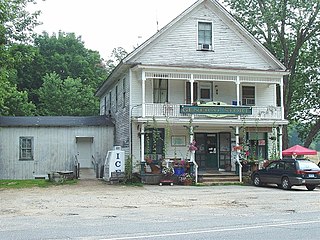
The Mansfield Center Historic District encompasses the historic early village center of Mansfield, Connecticut. First settled about 1692, it is one of the oldest settlements in Tolland County, and retains a strong sense of 18th century colonial layout. It extends along Storrs Street extending from Chaffeeville Road in the north to Centre Street in the south, and was listed on the National Register of Historic Places in 1972.

The Old Saybrook South Green is a 20-acre (8.1 ha) historic district that encompasses the historic town green and nearby streets in Old Saybrook, Connecticut. Established in the 1630s, most of the buildings arrayed around the green were built between 1760 and 1900, and reflect the prosperity of the town, which was a major port and shipbuilding center. The district was listed on the National Register of Historic Places in 1976.

The Glastonbury Historic District encompasses a streetscape dating to the 17th century, along Main St. from Hebron Ave. to Talcott Rd. in Glastonbury, Connecticut. In addition to a significant number of 17th and 18th-century houses, it shows the architectural development of the town over time, with buildings spanning three centuries in construction dates. It was listed on the National Register of Historic Places in 1984.

The Suffield Historic District is a historic district encompassing the Main Street area of the town center of Suffield, Connecticut, USA. It was listed on the National Register of Historic Places in 1979 and is part of a larger local historic district. It runs along North and South Main Street from Muddy Brook to north of Mapleton Avenue, and includes a diversity of 18th through early 20th-century architecture.

The Town Center Historic District encompasses the historic village center of South Hampton, New Hampshire. Centered around the Barnard Green, the town common, on New Hampshire Route 107A, it includes architectural reminders of the town's growth and change over time. The district was listed on the National Register of Historic Places in 1983.
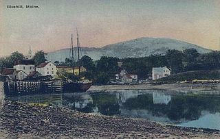
The Blue Hill Historic District encompasses the historic village center of the town of Blue Hill, Maine. The village, established in 1762, is a well-preserved collection of buildings, many of them built before 1840. Most of the older buildings are residential in character; the modest collection of commercial and civic buildings were mostly built between 1880 and 1940. The district was listed on the National Register of Historic Places in 1980.

Roxbury Center is the central village of Roxbury, Connecticut. Centered at the junction of Connecticut Routes 67 and 317, it has been the center of town civic life since the mid-18th century. The village was listed on the National Register of Historic Places in 1983.
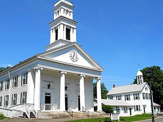
The Plymouth Center Historic District encompasses historic early village center of Plymouth, Connecticut. Stretching along Main, North and South Streets from their junction, it flourished in the 19th century with small-scale industries, but declined late in the century with the separation of Thomaston and the more significant industrial development at Terryville. The district features colonial, Federal, and Greek Revival architecture and was added to the National Register of Historic Places in 1999, with a slight enlargement the following year.

The Woodbury Historic District No. 1 encompasses the linear town center of Woodbury, Connecticut. Extending along two miles of Main Street, from Flanders Road in the north to Old Sherman Hill Road in the south, the district represents an architectural cross section of the town history, from the late 17th century to the present. It was added to the National Register of Historic Places on March 11, 1971.

The Putney Village Historic District encompasses most of the main village and town center of Putney, Vermont. Settled in the 1760s, the village saw its major growth in the late 18th and early 19th century, and includes a cohesive collection with Federal and Greek Revival buildings, with a more modest number of important later additions, including the Italianate town hall. The district was listed on the National Register of Historic Places in 1986.

The Danby Village Historic District encompasses much of the town center of Danby, Vermont. It is centered on a stretch of Main Street, roughly between Depot Street and Brook Road. The village has a cohesive collection of mid-19th century architecture, mostly residential, with a modest number of later additions. The district was listed on the National Register of Historic Places in 1983.
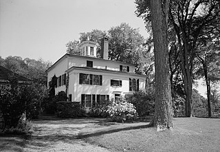
The Topsham Historic District encompasses the historic village center of Topsham, Maine. Extending along parts of Elm, Green, and Pleasant Streets, the area has a fine collection of 19th and early 20th-century architecture, with the majority built before 1850. It is almost entirely residential, with only a few non-residential uses, including a church. The district was listed on the National Register of Historic Places in 1978.
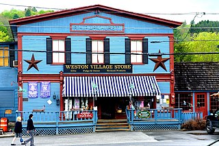
The Weston Village Historic District encompasses the town center and principal village of Weston, Vermont. Centered on Farrar Park, which serves as the town green, it includes a diversity of architectural styles from the late 18th century to about 1935, and includes residential, civic, commercial, industrial and religious buildings. It was listed on the National Register of Historic Places in 1985.

The Palisado Avenue Historic District encompasses a predominantly residential streetscape in northeastern Windsor, Connecticut. Extending along Palisado Avenue between the Farmington River and Bissell Ferry Road, it is a basically 18th-century street view, populated mainly with houses from the 18th to the 20th centuries. The district was listed on the National Register of Historic Places in 1987.

The Westbrook Town Center Historic District encompasses the historic town center of Westbrook, Connecticut. Roughly linear in shape, the district extends along the Boston Post Road, with its focal center at the junction with Essex Road. The area has been a center of civic activity since the early 18th century, even though Westbrook was not incorporated until 1840, and has residential, commercial, civic, and religious architecture covering three centuries. The district was listed on the National Register of Historic Places in 2017.

The Naugatuck Center Historic District encompasses the historic civic and business center of Naugatuck, Connecticut. Centered around the town green, the district includes churches, schools and municipal buildings, many from the late 19th or early 20th centuries, as well as a diversity of residential architecture. The district was listed on the National Register of Historic Places in 1999.

The Southbury Historic District No. 1 encompasses a well-preserved 19th-century village landscape along Main Street North in Southbury, Connecticut. This area includes the historic town center of Southbury, and is part of a larger streetscape extending into neighboring Woodbury, where it continues in the Woodbury Historic District No. 2. The district was listed on the National Register of Historic Places in 1971.
